
What Is Wayfinding: A Practical Guide to Indoor Navigation
What is wayfinding? It's the process of helping people understand where they are, decide where they need to go, choose a route, and recognise when they've arrived, and in the UK that matters because 92% of disabled people surveyed had experienced at least one transport barrier and 68% had more than one access need (NCAT transport barriers report). It's an accessibility and journey-completion issue, not just a signage issue, and that difference becomes obvious the moment someone reaches the right building but still can't find the lift, platform, toilet, or accessible exit.
A visitor can walk into a station, airport, campus, or retail venue and still be stranded by a missing map, an unclear platform change, or a route that stops making sense halfway through. That's why wayfinding needs to be treated as a connected system, not a wall of arrows.
What Wayfinding Actually Means in Practice
A person can reach the right venue and still fail to complete the trip. They may find the building, but not the entrance they can use, the platform they need, or the corridor that leads to the lift.
A working definition that operations teams can use
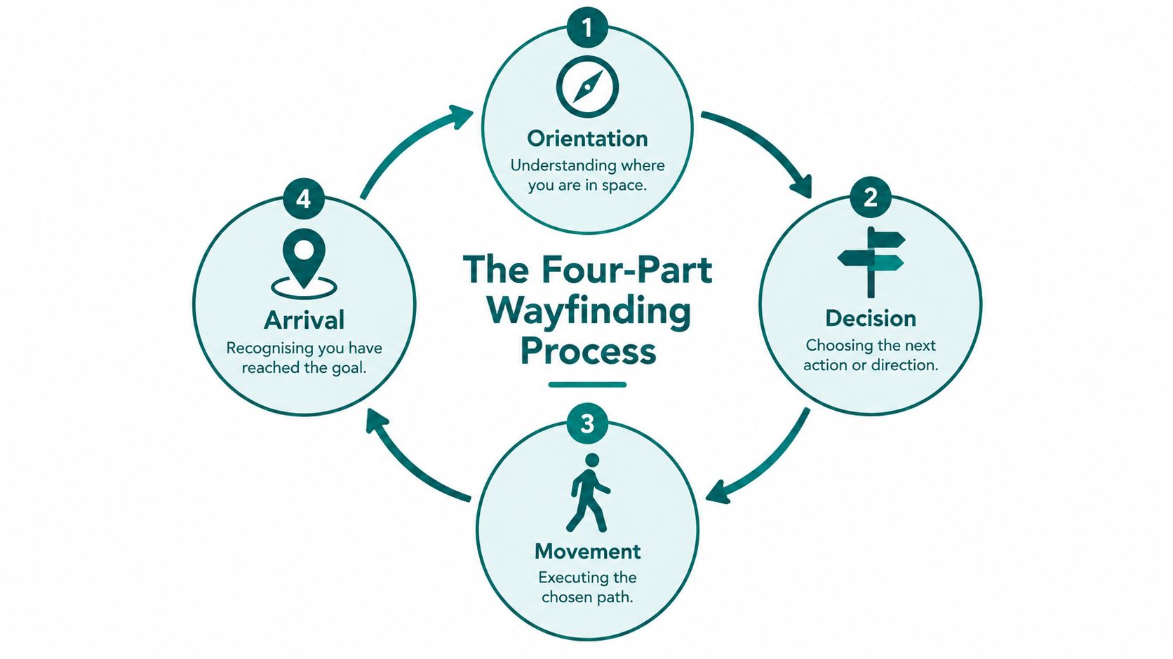
Wayfinding has four parts, orientation, decision, movement, and arrival. First, a traveller understands where they are. Then they choose the next action, follow the route, and confirm they have reached the destination they needed.
That matters because barriers rarely sit in one place. UK evidence on transport access shows disabled travellers face problems across journeys, with unclear environments, missing assistance, and physical obstructions affecting movement from start to finish. If a venue only fixes signs, it may help people orient themselves while still leaving decision points, platforms, and exits unusable.
Practical rule: if a route can be described but not completed, it is not working as wayfinding.
How it differs from signage, mapping, and navigation
Signage is one part of wayfinding. Maps help people orient themselves. Navigation is the act of moving through space. Wayfinding is the wider discipline that connects those pieces to the environment, and it has to work across entrances, routes, facilities, and exits.
That broader view explains why the question what is wayfinding is often answered too narrowly. A venue can have polished signs and still fail if the route changes, a lift is out of service, or the user cannot interpret the instructions in time. For a plain-language companion definition, Waymap's location services overview is a useful reference point.
The point for leaders is simple. Wayfinding is not decoration, and it is not just orientation. It is the operational layer that helps people finish the journey.
Indoor, Outdoor and Underground Environments Explained
Wayfinding behaves differently depending on the environment. A solution that works in a bright lobby can fail on a street, and a system that works outdoors can collapse underground where visibility and signal conditions change.
Indoor spaces depend on decision points
Indoors, people rely on corridors, junctions, vertical circulation, and visible cues around doors, lifts, and stairs. The risk is not only getting lost, it's arriving at the wrong side of a building and then having to backtrack through a complex layout. That's why indoor wayfinding needs strong route continuity, clear landmarks, and reliable confirmation at each turn.
Outdoor routes depend on the streetscape
Outside, the route itself becomes the problem. Pavement condition, street furniture, roadworks, and dropped kerbs can all affect whether someone can reach the destination in the first place. UK streetscape research found that navigation was time-consuming and challenging, and highlighted pavement conditions, street furniture, previous barrier experiences, local-authority action, and roadworks as especially impactful factors (NCAT streetscape insights).
Underground environments remove the easy cues
Underground, the usual outdoor cues disappear. Stations, tunnels, and basements demand route clarity because visibility is limited and conventional satellite positioning becomes unreliable. A venue that feels simple at street level can become confusing the moment the traveller goes below ground.
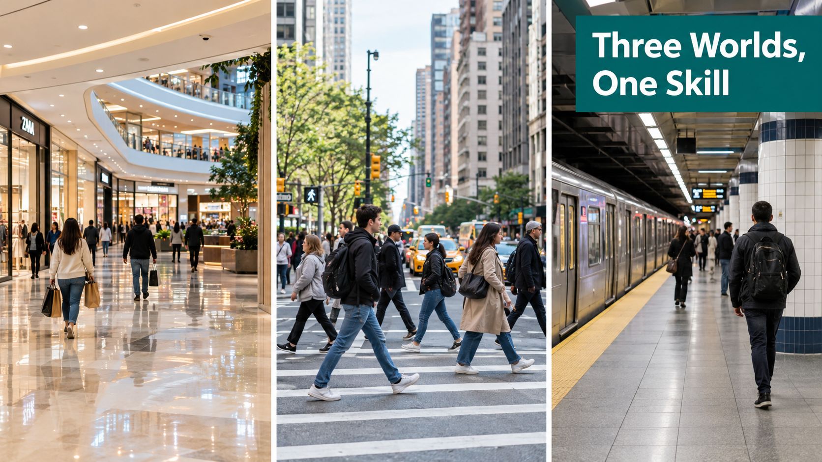
A three-part wayfinding strategy often helps teams think clearly about scope:
- Indoor: focus on corridors, floors, lifts, and entrances.
- Outdoor: focus on landmarks, pavement continuity, crossings, and temporary obstructions.
- Underground: focus on enclosed routes, platforms, transfers, and confirmation points.
The image below captures that split in a way teams can discuss internally.
If you want the practical distinction between indoor and outdoor positioning, Waymap's GPS-in-buildings explainer is a useful companion to this section.
How Wayfinding Technologies Compare for Venues
Most venue teams don't start by asking for “wayfinding.” They ask whether they can fix the problem with signs, a map, a kiosk, or an app, and whether the solution will keep working when the layout changes.
What operators are really comparing
Static signage is dependable for fixed information, but it can't adapt quickly. Printed maps are useful for overview, but they age as soon as a route changes. Kiosk directories help at a single point, though they still depend on people reaching the kiosk and interpreting it on the spot.
Digital options introduce more flexibility, but each comes with a different burden. Bluetooth beacons and Wi-Fi fingerprinting usually require hardware, installation planning, and ongoing maintenance. GPS is useful outdoors, but it won't solve every indoor or underground journey. QR codes and mobile apps can help with access, but they still rely on the user knowing where to start and trusting that the data is current.
| Technology | Typical accuracy | Infrastructure required | Maintenance burden |
|---|---|---|---|
| Static signage | Fixed, location-based | Physical installation | Low once installed, but hard to update |
| Printed maps | Overview-level | Printing and placement | Moderate, because updates become reprints |
| Kiosk directories | Point-of-use guidance | Screen or kiosk hardware | Moderate to high in busy venues |
| Bluetooth beacons | Route-level, environment-dependent | Installed beacon network | High, because hardware must be maintained |
| Wi-Fi fingerprinting | Variable | Network infrastructure and calibration | High, because layouts and signals change |
| GPS | Good outdoors, weak indoors | None on site, but dependent on signal | Low on site, but limited in enclosed spaces |
| QR code route pages | Depends on content quality | Printed or displayed codes | Low to moderate, because content must stay current |
| Mobile apps | Varies by data source | App and content management | Moderate, because routes and venue data need upkeep |
The question venue managers usually ask next is blunt: is there something that doesn't need installed hardware? That matters because hardware rollouts are expensive to plan, difficult to maintain, and awkward in high-footfall spaces where layouts change often. If you want a broader market view of indoor positioning approaches, Waymap's indoor tracking overview gives more context.
Why hardware-free matters in practice
A venue with frequent tenant churn, temporary closures, or changing event layouts can't treat navigation as a one-time install. It needs a system that can be updated as fast as the space changes.
That's why traditional tools and hardware-dependent systems often solve only part of the problem. They help a person see information, but they don't always help that person complete the journey after the environment shifts.
Accessibility Benefits and the Operational Case
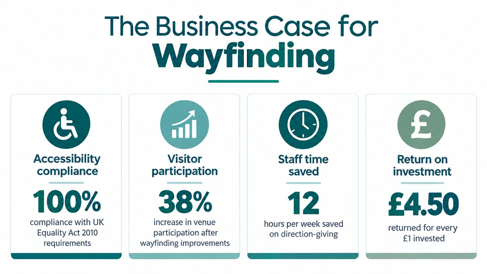
Wayfinding matters because it affects both compliance and participation. UK accessibility law and guidance require more than decorative signs, they require usable information, and rail operators are expected to state access conditions clearly at decision points.
Why accessibility is an operational issue
The Equality Act 2010 creates a legal context in which accessible journeys matter, while BS 8300 and the Office of Rail and Road's station guidance reinforce the need for clear, route-specific information. The ORR requires Category A stations to state that there is step-free access to all platforms or the relevant platform, and Category B stations to explain access conditions clearly, including platform-specific differences where possible (Office of Rail and Road guidance).
That matters because people don't just need a destination name. They need to know whether the route is usable for them, and whether the accessible entrance, platform, or exit is the one they should choose. The UK Government's inclusive mobility guidance also says transport environments should provide a continuous chain of directional information and information in forms disabled people can use (Inclusive mobility guidance).
Why participation drops when wayfinding fails
The participation gap is the other half of the business case. The Motability Foundation reported that disabled people in the UK took 38% fewer trips than non-disabled people, and that gap had remained unchanged for more than a decade (Motability Foundation transport accessibility gap report). It also found that 1 in 5 disabled people were unable to travel because appropriate transport options were unavailable.
That is not just a transport statistic. It tells venue leaders that unclear, incomplete, or unreliable journey information suppresses attendance, confidence, and independence.
A helpful companion for estates teams is DME Superstore's stair alternative guide, because it shows how access decisions often start with alternatives to stairs rather than with stairs themselves.
Practical takeaway: if a person has to ask staff at every transition, your wayfinding system is carrying an operational burden your signage budget can't hide.
The business case also reaches beyond rail. Retail, campus, hospital, and stadium teams all feel the same friction, unclear routes increase staff interruptions, and changing layouts make static systems harder to rely on. For a more implementation-focused accessibility reference, Waymap's accessibility best practices page is a useful internal read.
How GPS-Free Sensor Fusion Changes What Wayfinding Can Do
The most important shift in modern wayfinding is not a new sign style, it's the move from fixed infrastructure to sensor-based guidance. That changes what venues can support, especially where layout changes, staff turnover, or signal limitations make hardware-heavy systems brittle.
Why sensor fusion is different
Waymap uses the smartphone's motion sensors, along with detailed venue maps, to provide step-accurate guidance without GPS, Wi-Fi, Bluetooth beacons, or installed hardware. The core idea is dead reckoning from device-native sensors, combined with a map layer that can be updated without a site visit.
That changes the operating model. A venue doesn't need to install beacons across every corridor or maintain a network that can fail when tenants move walls or events reconfigure the space. It can update the navigation layer as the venue changes, which is especially relevant in stadiums, transport hubs, campuses, and retail environments.
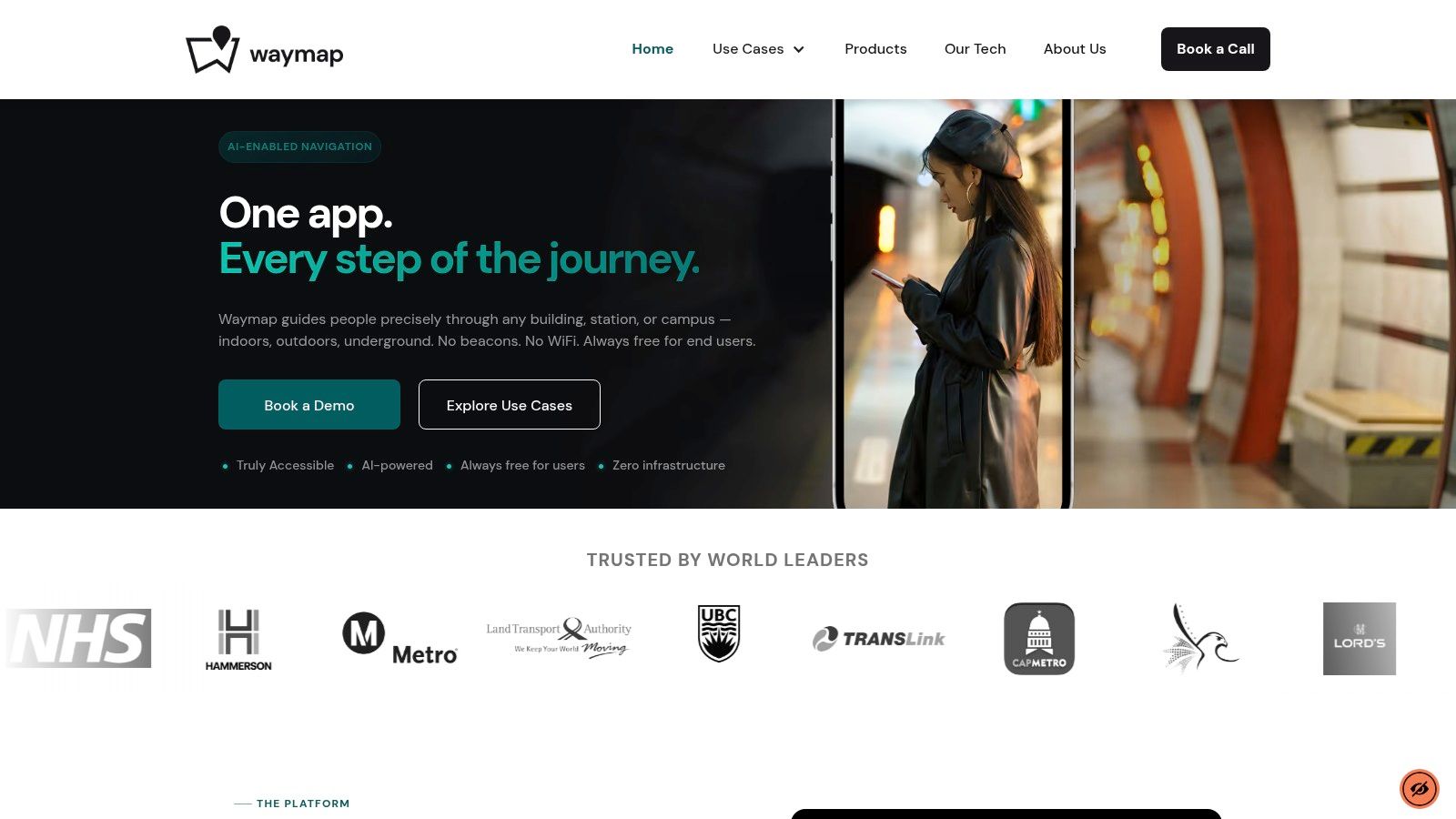
The screenshot below shows the software layer in use.
Why Lord's matters as a named deployment
Waymap went live at Lord's Cricket Ground in 2025 as the first stadium in the world to implement the technology. That deployment is significant because stadiums combine dense footfall, changing event conditions, and complex arrival patterns, which is exactly the sort of environment where static or hardware-dependent systems become harder to maintain.
In a venue like that, the user problem isn't abstract. People need to get to the exact gate, entrance, stand, or point of interest without adding extra stress to the journey.
The idea is simple once you strip away the jargon. If wayfinding is a journey-completion problem, then the best system is the one that keeps working when the environment changes under the traveller's feet.
Here's a short demonstration of the kind of experience this approach is built to support.
For teams evaluating the underlying approach, Waymap's sensor fusion algorithm page explains the technical direction in more depth.
Design Principles That Make Wayfinding Actually Work
Wayfinding works when the environment tells the same story in the same place, again and again. If signs conflict with routes, or routes change without updated information, people lose confidence fast.
Use physical parameters, not just design opinions
UK inclusive mobility guidance gives useful benchmarks. Pedestrian routes should generally provide a minimum clear width of 2,300 mm, increasing to 3,000 mm on sub-surface station platforms. Timetables and information displays should normally sit between 900 mm and 1,800 mm above floor level, important information should be no higher than 1,700 mm, and 300 lux is identified as a lighting benchmark in relevant access contexts (Inclusive mobility guide).
Those numbers matter because wayfinding fails when people can't approach, see, or read the information at the point they need it.
Don't confuse more signs with better guidance
A common mistake is to add more signs when the problem is really inconsistency. More information can increase cognitive load, especially for blind and low-vision travellers, people with cognitive impairments, and infrequent users. A clean route with timely confirmation often performs better than a dense field of arrows.
A useful design pattern reference for teams that need to think about information hierarchy is the UI design pattern guide from DOM Studio, because route screens, kiosks, and mobile guidance all depend on the same clarity principles.
A simple operator checklist
- Keep information continuous: directions should carry people from entrance to destination, not stop at the first junction.
- Use multisensory cues: don't depend on vision alone where the environment needs to support more than one access need.
- Confirm decision points: tell users they've taken the correct turn, not just where the next turn is.
- Update quickly: if entrances, closures, or facilities change, the guidance has to change with them.
- Match message detail to context: the instruction should be short enough to act on immediately.
A route that looks clear on a plan can still fail in motion if the traveller has no confirmation after each decision.
Common Questions About Modern Wayfinding
What is wayfinding in simple terms? Wayfinding is the system that helps people understand where they are, choose where to go, follow the route, and know they've arrived. In practice, it combines signs, maps, landmarks, routes, and accessible information into one journey-support system.
How accurate can step-by-step wayfinding be for blind and low-vision users? It can be precise enough to support exact doors, platforms, and destination points when the guidance is built around perceivable environmental cues and reliable route data. UK evidence shows that instructions designed around visually impaired users reduced workload, reduced minor deviations, and improved completion speed compared with more map-literate instruction styles (UK Government transport accessibility research).
How does sensor-fusion wayfinding compare with beacon systems on cost and maintenance? Sensor-fusion wayfinding avoids the ongoing burden of installed hardware, which makes it easier to maintain in changing venues. Beacon systems can work, but they depend on physical devices that need installation, calibration, and upkeep, especially where layouts change often.
Which UK regulations and standards matter most for accessible wayfinding? The Equality Act 2010, BS 8300, ORR station access wording, and inclusive mobility guidance all shape how accessible information should be presented and maintained. Together, they point toward clear, route-specific, and usable guidance rather than generic destination labels.
Which venues benefit most from a dynamic, hardware-free wayfinding layer? Large venues with frequent change benefit most, especially transport hubs, stadiums, campuses, airports, and retail centres. Those environments need route information that can be updated quickly without relying on new infrastructure every time the layout changes.
If you're assessing wayfinding for a station, stadium, campus, or retail venue, Waymap gives teams a way to turn journey-completion into an operational system rather than a signage project. Visit Waymap to see how GPS-free, hardware-free navigation can support accessibility, confidence, and day-to-day venue operations.
