
What Is Location Services: Your 2026 Guide

Location services are a feature in software that uses data from GPS, cellular, Wi-Fi, and other sensors to determine and share the geographical position of a device. In the UK, cellular network location is generally accurate to around 150 metres, while GPS can deliver higher outdoor accuracy but fails indoors and underground.
If you've ever tried to find the right platform in a large station, the correct entrance in a hospital, or a gate in a multi-level airport, you've already run into the practical limits of location services. Outdoors, people tend to think they operate reliably. Indoors, that confidence often disappears fast.
For venue operators, transport teams, estates managers, and accessibility leads, the question isn't just what is location services. It's whether the technology still works when roofs block satellite signals, layouts change, and visitors need directions to an exact door instead of a broad area on a map.
By Tom Pey, Founder of Waymap and blind accessibility technologist.
What Are Location Services and Why Do They Matter?
A traveller lands at a busy airport, opens an app, and gets directions to the terminal. That same person then enters a covered concourse, drops below ground to a rail link, and suddenly the blue dot becomes uncertain. That's the difference between the idea of location services and the operational reality.
Location services are digital functions that determine where a device is and use that information to support navigation, search, tracking, alerts, and contextual content. They sit behind much more than maps. They also support travel planning apps, delivery tracking, asset visibility, fitness tools, social features, and venue guidance.

Why location services are now infrastructure
In the UK, the government's Geospatial Strategy 2020 to 2025 formally recognises location services as a critical asset and says they have enabled "location-hungry" business models that are transforming cities and connecting communities. That matters because it moves location services out of the category of consumer convenience and into the category of operational infrastructure.
For a venue manager, that shift is practical. If visitors can't orient themselves, staff absorb the cost. Front-of-house teams answer repeat direction questions. Accessibility teams manage avoidable complaints. Printed signage becomes a constant maintenance task when routes change.
Practical rule: If a service only works in the car park or on the pavement outside, it isn't a complete wayfinding system for a real venue.
Where the common definition falls short
Most explainers stop at GPS. That isn't enough. Real location systems combine several inputs, and the environment determines whether those inputs are useful.
A transport hub, shopping centre, university campus, or hospital needs position data that can survive these conditions:
- Indoor transitions: Moving from open sky into covered buildings
- Underground spaces: Stations, tunnels, lower concourses, basements
- Complex layouts: Multiple floors, interchanges, and restricted routes
- Frequent change: Temporary closures, retail refits, event-day crowd management
If you want a useful primer on the mechanics behind guidance systems, our article on how a navigation system works gives the broader technical backdrop.
How Do Location Services Pinpoint Your Position?
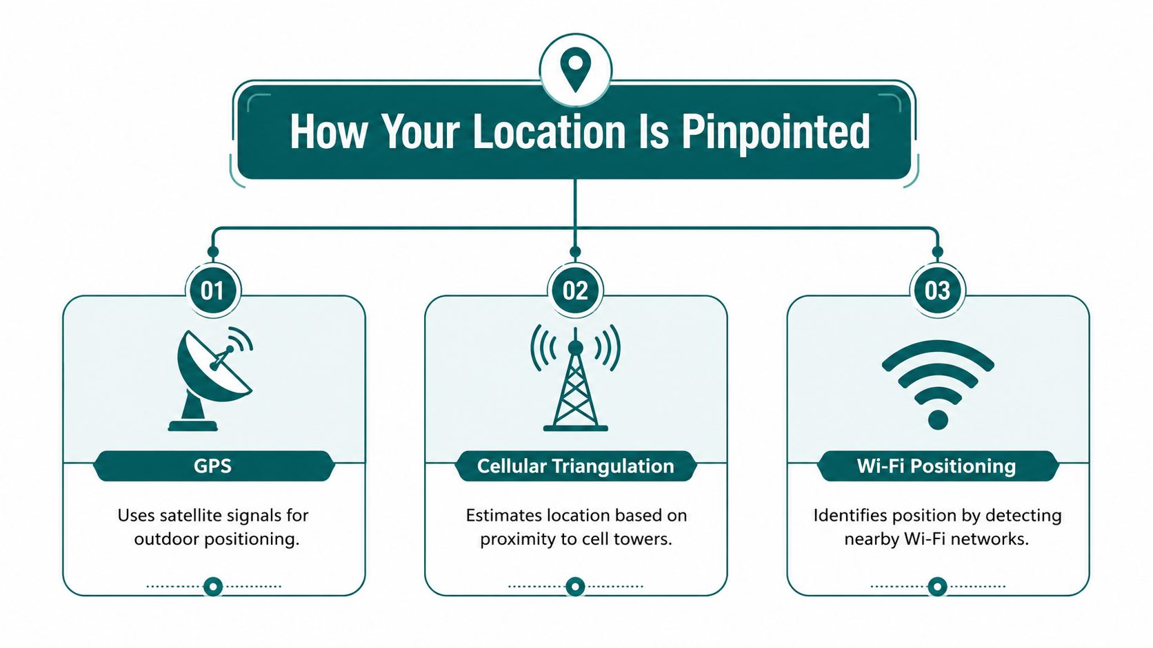
Most location services don't rely on a single method. They combine several sources and choose the best one available at that moment. That's why a phone may feel precise in one setting and vague in another.
GPS, cellular, Wi-Fi, and Bluetooth in plain English
GPS uses satellite signals to estimate where a device is. It's strong outdoors because the phone has a clearer view of the sky. In open environments, GPS is often the signal people mean when they talk about location.
Cellular positioning estimates location using the mobile network. A device's connection to nearby towers gives the system a rough idea of where it is. This can work in more places than GPS, but it usually offers much broader positioning.
Wi-Fi positioning uses nearby wireless networks as reference points. In dense urban areas or inside large venues, this can help establish a user's position when satellite coverage is weak.
Bluetooth beacons are installed hardware points that broadcast signals to nearby devices. They can support indoor wayfinding, but they depend on venue installation, calibration, and ongoing upkeep.
If you're comparing these methods with the broader mapping layer behind them, Understanding geospatial data is a useful companion read because it explains how location information becomes usable digital context.
How systems decide which signal to trust
In UK mobile networks, Location Services architecture described in an Ofcom submission can deploy GPS, GSM cell ID, and enhanced cell ID simultaneously. The system then selects the result that best matches the application's needs for accuracy and response time, and it can fall back to network-based positioning when GPS is blocked inside a building.
That fallback matters more than many operators realise. A service that can change method dynamically is more resilient than one that depends on a single input.
Here's the practical hierarchy many teams work with:
| Method | Best environment | Main strength | Main weakness |
|---|---|---|---|
| GPS | Outdoors | Strong open-sky positioning | Poor indoors and underground |
| Cellular | Wide-area coverage | Broad availability | Lower precision |
| Wi-Fi | Equipped buildings | Useful in dense built spaces | Depends on local network conditions |
| Bluetooth beacons | Managed venues | Can support indoor guidance | Requires installed hardware and maintenance |
Why sensor fusion changes the picture
The strongest systems don't just switch between external signals. They also combine them with the phone's own sensors. Accelerometers, gyroscopes, and magnetometers help estimate movement and heading between signal updates.
Sensor fusion becomes important as it merges multiple imperfect signals into a more stable position estimate. Our explainer on sensor fusion algorithms looks at why this matters when a single source becomes unreliable.
A location service isn't one technology. It's a decision engine choosing between signals that each fail in different ways.
What Determines the Accuracy of Location Services?
Accuracy depends less on brand or app name than on environment, signal quality, and the method being used. The wrong question is "Which technology is best?" The right question is "Which technology is reliable in this setting?"
Coverage and precision are not the same thing
In the UK, cellular network location capability is generally available with an accuracy of approximately 150 metres, according to the LexisNexis UK legal glossary for location-based services. That's useful for broad area awareness. It isn't enough to tell someone which side of a transport concourse they need, which doorway is correct, or whether they've reached the right platform entrance.
GPS usually performs better outdoors, but that doesn't make it universally more useful. A highly accurate signal that disappears under a roof is less operationally dependable than a less precise method that keeps working.
What weakens a location signal
A phone's position estimate is affected by several factors at once:
- Building materials: Concrete, steel, and roofing can block or distort signals
- Vertical complexity: Multi-level venues confuse systems built for flat map views
- Device movement: Fast turns, pauses, escalators, and lifts complicate position updates
- Magnetic interference: Internal sensors can drift in challenging environments
For practitioners, many procurement mistakes often occur at this juncture. Buyers compare headline accuracy claims without asking how those claims hold up inside a live venue.
Why continuous guidance needs more than GPS
A user doesn't need a location estimate once. They need it continuously. That's especially true in stations, hospitals, campuses, and shopping centres where direction changes matter every few seconds.
This is why modern navigation products use internal phone sensors alongside map intelligence. Heading, step detection, and movement patterns can improve continuity where external signals become unreliable. Our article on magnetometer accuracy explores one part of that challenge in more depth.
The real test of accuracy isn't whether the dot looks good on a map. It's whether a person can act on the instruction with confidence.
Who Controls Your Location Data?
The short answer is that users should control their location data, and organisations must build services around that principle. In the UK, this isn't just good practice. It's a legal requirement.
Consent isn't optional for value-added services
Under the UK's Privacy and Electronic Communications Regulations, processing location data for a value-added service requires explicit user consent. Users must also be given a free and easy way to withdraw that consent each time they use the service, as set out in the ICO's guidance on location data under PECR.
That has a direct design consequence. A navigation app can't rely on vague, bundled permission language and call it compliant. Consent must be specific, active, and easy to reverse.
What organisations need to get right
Venue operators often think of permission prompts as a mobile app issue. They aren't only that. They are part of governance, procurement, accessibility delivery, and public trust.
A compliant approach usually includes:
- Clear explanation: Tell users what location data is used for and why
- Separate opt-in: Don't bury location processing inside general terms
- Easy withdrawal: Let people stop sharing location without friction
- Visible accountability: Make responsibilities clear between venue, operator, and app provider
For teams reviewing the privacy implications of digital signals beyond obvious map functions, our piece on IP address and GDPR considerations is a useful parallel reference.
Children need stricter handling
Location permissions become more sensitive when children are involved. In the UK, geolocation features for children are treated with additional care under the Children's Code, and passive location services involving children have separate consent expectations under the industry code of practice for those services.
That matters in public venues. Transport operators, retail centres, and leisure destinations can't assume one privacy model fits every user.
Good location design gives people a genuine choice. If consent is difficult to refuse or hard to withdraw, trust drops quickly.
Why Do Standard Location Services Fail Indoors and Underground?
The standard consumer model of location services assumes an environment with available signals, stable connectivity, and direct line of sight to the systems doing the positioning. Real buildings don't cooperate.

The physical problem
GPS is a satellite-based technology. Roofs, concrete, steel, and underground structures interrupt or block the signal. That's why a phone that appears highly accurate on the street can become uncertain inside a shopping centre, airport terminal, or station mezzanine.
Cellular and Wi-Fi can help, but they have their own limits. Cellular often lacks the precision needed for exact indoor guidance. Wi-Fi positioning depends on the local network environment, which may not have been designed for navigation at all.
The operational problem
When GPS fails, many venues look at beacon or Wi-Fi-based indoor positioning. On paper, that sounds reasonable. In practice, it introduces operational friction that decision-makers know well.
For an NHS estates manager, installed hardware can be difficult to justify when capital spend is restricted and layouts change during refurbishments. For a transport operator, maintaining hardware across high-footfall environments creates a long-term burden. Batteries fail, assets move, maintenance windows are limited, and maps need constant updating.
This is the invisible infrastructure gap. Indoor navigation needs reliable positional awareness, but the environment either blocks the obvious signal or makes hardware-heavy alternatives expensive to sustain.
The accessibility consequences
This isn't a niche edge case. According to the HPE overview of location-based services, 68% of UK transit users report navigation difficulties in stations such as the London Underground, and 79% of UK accessibility audits cite a lack of reliable indoor wayfinding as a top failure point. For blind and low-vision users, the problem is more severe because visual cues and distant signage aren't dependable substitutes.
That changes the conversation from convenience to inclusion. If a venue's wayfinding model assumes people can see overhead signs, interpret maps quickly, and recover from a wrong turn without support, many visitors are left behind.
A good critique of indoor positioning myths is our article on why the blue dot often fails people indoors.
Standard location services were built around signal availability. Indoor wayfinding is built around signal absence.
How Can Venues Provide Reliable Indoor Navigation for Everyone?
The answer is to stop treating indoor navigation as a smaller version of outdoor GPS. It isn't. The venue needs a method designed for signal-poor environments and day-to-day operational realities.
What works better in practice
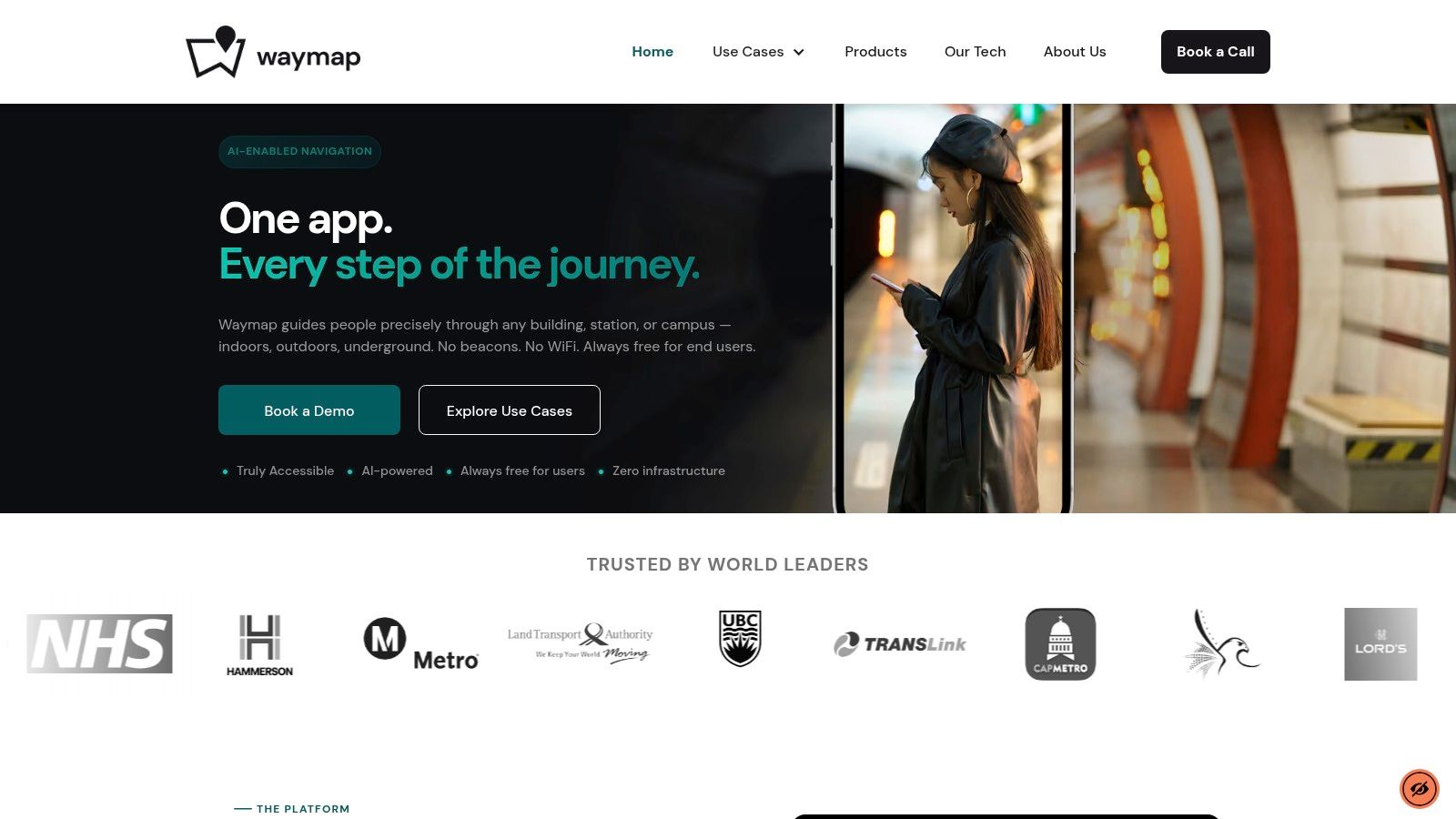
The strongest indoor approach is infrastructure-free navigation. Instead of relying on beacons, installed hardware, or GPS, it uses the smartphone's native motion sensors and detailed map data to calculate movement through the environment.
At Waymap, that's done through dead reckoning using device-native sensors, with sub-3-metre accuracy in infrastructure-free environments and no pre-mapping requirement for venues with high staff turnover or frequent layout changes. Those details matter because they answer the main objections operators raise. They don't want another hardware estate to maintain, and they don't want accessibility improvements tied up in long installation programmes.
Why this matters for compliance and operations
Indoor navigation isn't only about helping a visitor get from A to B. It supports broader duties under frameworks such as the Equality Act 2010, and it aligns with standards-led thinking around inclusive environments including BS 8300, PAS 78, and BS EN 17210.
For venue teams, the gains are practical:
- Accessibility delivery: People can move around independently with more confidence
- Operational flexibility: Route changes and point-of-interest updates can be managed digitally
- Lower maintenance burden: No beacon battery replacement or hardware servicing programme
- Better visitor support: Fewer basic wayfinding interruptions for frontline staff
A named example matters here. WMATA is relevant because large transit environments expose every weakness in conventional indoor positioning. Multi-level layouts, heavy footfall, and constant route decisions make broad, unstable positioning far less useful than precise guidance.
Later in the user journey, seeing the experience matters as much as reading about it:
What doesn't hold up over time
What usually fails isn't the demo. It's the maintenance model.
A system that depends on dense installed infrastructure can become brittle when:
| Challenge | What happens in practice |
|---|---|
| Venue layout changes | Wayfinding data and hardware placement fall out of sync |
| High staff turnover | Local knowledge about maintaining the system disappears |
| Budget pressure | Repairs and updates are deferred |
| Accessibility audits tighten | Broad positioning no longer meets user needs |
That is why infrastructure-free guidance has become a more serious option for airports, retail centres, hospitals, campuses, and transit agencies. It addresses the technical failure of GPS indoors and the operational failure of hardware-heavy alternatives at the same time.
Frequently Asked Questions About Location Services
What is location services in simple terms?
Location services are tools in software that identify where a device is and use that position to provide functions such as navigation, tracking, search, or alerts. They can use GPS, cellular, Wi-Fi, Bluetooth, and device sensors depending on the environment.
Is GPS the same as location services?
No. GPS is one method inside the broader category of location services. A location service may use GPS outdoors, then rely on other signals or sensors when GPS becomes weak or unavailable.
Do location services need the internet?
Not always. Some location functions depend on network access for maps, updates, or cloud processing, but position calculation can also use on-device sensors and stored map data.
Why do location services stop working indoors?
They often stop working indoors because buildings block or distort the signals that standard systems depend on, especially satellite signals. That's why indoor and underground navigation requires a different technical approach from ordinary outdoor map apps.
Are location services a privacy risk?
They can be if organisations collect or process location data without clear controls. In the UK, value-added location services require explicit opt-in consent and an easy way for users to withdraw it.
Why does what is location services matter to venue managers?
It matters because the answer affects accessibility, visitor flow, staffing pressure, and compliance. If the system only gives rough outdoor positioning, it won't solve wayfinding inside a real venue.
If you're assessing how to provide reliable navigation across indoor, outdoor, and underground spaces without adding hardware, Waymap shows what that can look like in practice. Our platform was built first for blind and low-vision users and now helps venues, operators, and public bodies deliver precise, infrastructure-free guidance where standard location services fall short.
