
Why the blue dots on your map fail indoors

We all know the little blue dot on our mapping apps. It seems like a simple, trusty guide, but it's constantly making an educated guess about your location. That fundamental uncertainty is precisely why it so often fails indoors, where accuracy is non-negotiable. For the professionals who manage large, complex venues, understanding this limitation is the first step toward a more reliable navigation strategy.
Why is the blue dot a guess, not a fact?
That dot on a visitor’s screen is not a statement of fact; it’s the output of an algorithm making its best guess. A smartphone fuses data from multiple sources—GPS, Wi-Fi, and cellular networks—to estimate a user's location.
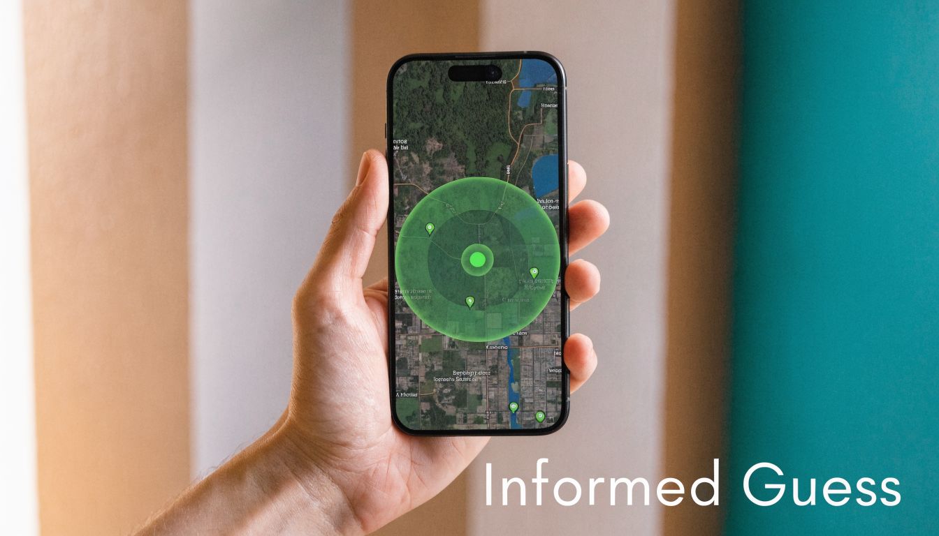
The large, faint circle that often pulses around the dot is a visual representation of the system’s uncertainty. Outdoors, with a clear view of GPS satellites, the circle is small and tight, indicating high confidence. Indoors, however, that confidence collapses.
When does signal quality falter?
Inside a hospital, an underground transport hub, or a shopping centre built from concrete and steel, GPS signals are blocked. The system loses its primary data source, and the uncertainty circle expands dramatically. The location estimate can be off by tens of metres, rendering it useless for precise guidance.
This navigational guesswork isn't just an inconvenience; for a venue operator, it's an operational liability. It exposes the gap between consumer-grade location apps and the professional precision required for complex public spaces.
Before any positioning technology can function, it needs an accurate map of the environment. As resources like Room Sketch 3D for accurate planning demonstrate, creating a dependable digital base layer is a meticulous process. If the map itself is flawed, even the most advanced system is set up to fail. For any application where accuracy is critical—from guiding a patient to a clinic to helping a traveller find their departure gate—a "best guess" is not a solution.
How do phones calculate your position?
The blue dot is the end result of a rapid, complex calculation. Your device constantly fuses data from multiple sources in a process known as signal fusion to estimate its location.
Outdoors, in a signal-rich environment, the system relies almost entirely on the Global Positioning System (GPS). With a clear line of sight to at least four satellites, a phone can pinpoint its location with reasonable accuracy. The blue dot remains stable and relatively correct.
The moment a user steps inside, they enter a signal-poor environment. GPS signals are extremely weak and cannot penetrate solid materials like concrete, steel, or coated glass. The system loses its primary tool and is forced to find alternatives.
Why do indoor signals fail?
Without GPS, a phone begins a frantic search for other clues, using technologies that were never designed for precise indoor positioning.
Wi-Fi Networks: The phone scans for nearby Wi-Fi hotspots, checks their signal strength, and cross-references this against large, crowd-sourced databases that map router locations. A dense cluster of known networks can provide a rough position, but it is often inconsistent.
Cellular Towers: In a similar process, the phone measures signal strength from multiple mobile towers. Triangulating its distance from them provides an estimate, but the margin for error is often 50 metres or more.
Bluetooth Beacons: Some venues attempt to solve this by installing low-energy Bluetooth beacons. These broadcast their location and can offer more precision, but they require significant capital investment in hardware, ongoing maintenance, and rely on the user having a specific app. This creates a fragmented and unreliable experience.
This search for any available signal is why the blue dot becomes so erratic indoors. The constant jumping, sudden lurches across the map, and frustrating lag directly reflect the system’s deep uncertainty. We explore these challenges in our guide to indoor positioning systems.
The system's behaviour is not a bug; it is a feature of its design. The blue dot's unreliability indoors is a direct consequence of its dependence on signals that were never intended for metre-level indoor precision.
Once you understand the technical limitations, it becomes clear why GPS-based systems are fundamentally unsuited for navigating complex indoor spaces like hospitals, airports, or large office buildings. Relying on them for critical guidance is simply using the wrong tool for the job.
What is the business cost of a failing blue dot?
For a venue operator, a failing blue dot is more than a technical glitch; it's a business problem with financial consequences. Inside a building, where signals are unreliable, a visitor's frustration quickly becomes a drain on operations, a source of negative customer experience, and a failure in accessibility.
Consider the daily impact: a patient, already anxious, arrives late for a hospital appointment because their map cannot distinguish between corridors. A traveller at a major airport like Heathrow misses their flight because their phone insists they are on the wrong floor. These are not isolated incidents; they are daily occurrences with a direct cost.
What is the real-world impact of imprecision?
Every time a visitor gets lost, a staff member must stop their work to provide directions. Multiplied across thousands of daily interactions, this represents a significant hidden cost in lost productivity. Furthermore, a confusing visit often translates to a negative online review and reduced likelihood of return, affecting everything from retail sales to patient satisfaction scores.
The problem is even more acute for visitors with disabilities. A recent UK Civil Aviation Authority review of 25 major airports, including Heathrow with its 80 million annual passengers, revealed that 22% of disabled travellers experience significant stress navigating the terminal. Similarly, a Sports Grounds Safety Authority report found only 29% of UK stadiums were fully accessible for fans with low vision—a key reason many disabled people avoid attending live events.
When a visitor with a visual impairment can’t trust their navigation tool, they lose their independence. For an operations manager, this isn't just poor customer service—it's a failure to provide the equitable, accessible environment required by law and social responsibility.
Why can't static signage solve this?
Installing more signs or staffing more information desks are traditional fixes that are expensive to maintain and difficult to update. They cannot offer the personalised, A-to-B guidance that users now expect, and they are useless for communicating temporary closures or route changes. In a dynamic, modern venue, static signage is an outdated strategy.
The shortcomings of standard mapping apps indoors, detailed in our analysis of Google Maps' indoor capabilities, highlight a clear market gap. The unreliability of the blue dot creates a compelling business case for a better system.
What is needed is a solution that delivers consistent, metre-level accuracy indoors, without depending on the very signals that cause other apps to fail. This is not about adding more signs; it is about providing visitors with reliable guidance that enhances their autonomy and frees up staff to perform their primary duties.
What is the true cost of navigational inaccuracy?
The familiar blue dot on a map may seem helpful, but inside a large venue, its unreliability creates tangible costs that affect daily operations and brand reputation. When a visitor trusts the dot on their screen and that trust is broken, the resulting confusion triggers a domino effect with serious consequences.
How does this drain your resources?
The most immediate impact is the strain on staff. Every time a visitor gets lost searching for a shop, clinic, or departure gate, an employee must stop their work to give directions. These constant interruptions are a major drain on productivity, pulling teams away from their core responsibilities.
This friction also affects the bottom line. In a large retail centre, shoppers who cannot find a specific store are more likely to abandon their search and leave. Complex layouts without clear guidance can lead to a 10% reduction in dwell time, directly impacting sales. Over time, this lost revenue accumulates.
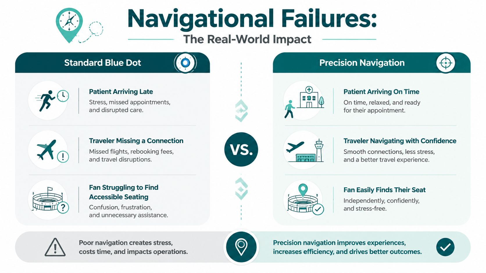
The contrast between navigational failure and precision guidance is stark. Poor navigation leads to stress and operational inefficiency, while a precision system resolves these issues, improving visitor experience and operational effectiveness.
Why is this more than an inconvenience?
Beyond financial costs lies a significant human impact. In the UK, 16.1% of the population—9.8 million people—live with a disability, including 2.1 million with sight loss. For these individuals, an unreliable map is a barrier to participation in public life.
The UK government's own research found that 41% of disabled adults avoid public transport due to fear of getting lost, citing poor signage and a lack of audio directions as key problems. Perspective matters, a concept explored in this article on the Pale Blue Dot photograph.
When a person with a visual impairment can’t trust their navigation tool, their independence and dignity are undermined. This transforms the problem from an operational headache into a failure to meet accessibility mandates and a significant social responsibility issue.
Waymap provides step-by-step audio guidance accurate to within one metre, operating flawlessly indoors without GPS or beacons. This level of precision helps venues meet their accessibility obligations, turning a potential weakness into a strength that improves the experience for every visitor.
How do conventional and precision navigation compare?
| Feature | Conventional 'Blue Dot' Apps | Waymap Precision Navigation |
|---|---|---|
| Core Technology | Relies on GPS, Wi-Fi, and mobile data, which are often weak or unavailable indoors. | Uses advanced motion sensing and mapping algorithms; requires no GPS, Wi-Fi, or beacons. |
| Indoor Accuracy | Often inaccurate by 10-30 metres, leading to a "best guess" location that causes confusion. | Accurate to within one metre, providing step-by-step, turn-by-turn guidance. |
| Accessibility | Limited features for visually impaired users; reliant on visual maps and inconsistent audio cues. | Designed for accessibility with detailed audio instructions, step-free routing, and vibration feedback. |
| User Experience | Creates stress, frustration, and dependence on staff for directions. | Fosters independence, confidence, and a stress-free journey for all visitors. |
| Operational Impact | Diverts staff to provide directions, leading to lost productivity and potential revenue loss. | Reduces the burden on staff, allowing them to focus on core duties and improving operational efficiency. |
The difference is not merely a better dot on a map; it's a fundamentally more reliable and inclusive system. The true cost of navigational inaccuracy is measured in lost productivity, missed revenue, and eroded accessibility. Investing in a robust, inclusive technology that moves beyond the blue dot is a sound business decision.
How can you achieve hardware-free precision?
The unreliability of the blue dot indoors is not a problem that can be solved with stronger signals or better Wi-Fi. It is a fundamental flaw in a system designed for open skies, not the signal-blocking reality of indoor spaces. Achieving true precision requires a different approach—one that stops searching for external signals and starts using the powerful sensors already in every smartphone.
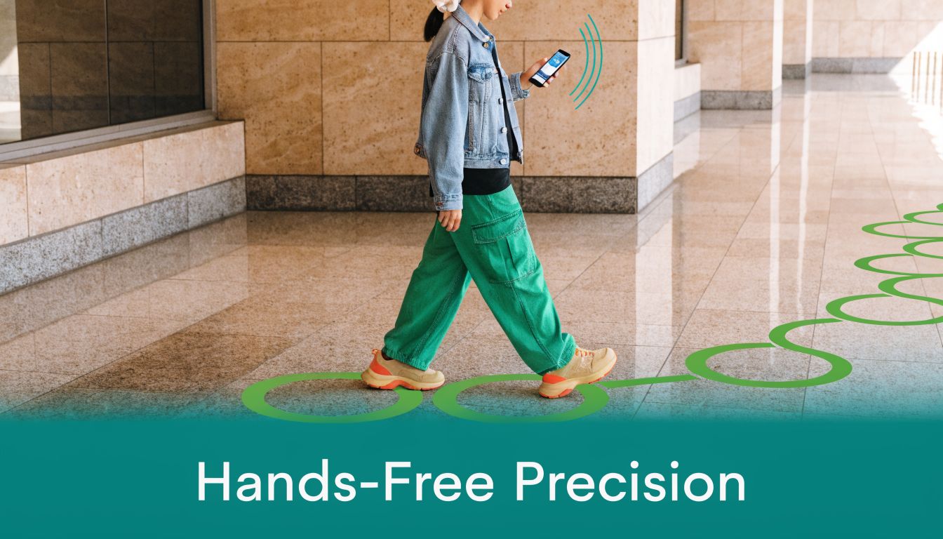
This is Waymap's domain. Our system bypasses GPS, Wi-Fi, and cellular data entirely. Instead, our proprietary algorithm fuses data from a smartphone's native motion sensors—the accelerometer and gyroscope—with our pre-mapped venue information. This process creates a unique ‘personal motion signature’ for each user.
By learning an individual’s gait—their stride length and pace—Waymap delivers step-accurate, hands-free audio directions. The result is navigation with up to 1-metre accuracy, a level of precision that signal-based systems cannot achieve indoors.
What does "zero hardware" mean for venue operators?
For venue management, the efficiency is a key advantage. Waymap requires zero hardware installation. There are no Bluetooth beacons to purchase, install, and maintain. No expensive Wi-Fi upgrades are necessary. This hardware-free model dramatically reduces the cost and complexity of deployment and eliminates ongoing maintenance overhead.
Updating maps is equally straightforward. If a corridor closes or a store relocates, the change is made instantly on our digital map, and every user receives the updated information without any on-site intervention. This operational agility is critical for dynamic environments like transport hubs and retail centres.
This precision directly enhances accessibility and visitor experience. A 2025 Scope survey found that one in five disabled shoppers avoids a venue due to poor wayfinding, while a Public Health England study showed only 34% of UK malls offer audio navigation. With our technology, venues can transform their accessibility credentials. Our pilot at Westfield London demonstrated this, reporting 92% user satisfaction.
This isn't about making a better blue dot. It's about replacing an unreliable guess with a verifiable fact, using the motion sensors already present in every modern smartphone.
In a major train station, a blue dot system might struggle to identify the correct platform. Waymap, however, can guide a user with audio instructions directly to a specific carriage door. This level of detail—navigating to a point, not a general area—is the difference between frustrating guesswork and genuine confidence. By creating a system independent of external signals, we deliver reliability where it matters most. For a deeper analysis of the technical landscape, explore our guide to mapping and navigation technologies.
Your questions about moving beyond the blue dot
For facilities directors, heads of accessibility, and operations leads, the frustrations of relying on the blue dots for indoor navigation are clear. It is time to move beyond guesswork and implement the efficient and truly inclusive solutions that modern venues and their visitors require. Here are direct answers to the questions we hear most from decision-makers.
What is 'the blue dot' on my phone's map, really?
The blue dot represents your phone's best guess of its location, not a factual position. It synthesizes signals from GPS, local Wi-Fi networks, and cellular towers to triangulate its position. The pale blue circle often pulsing around the dot indicates the margin of error; a larger circle signifies lower confidence and accuracy.
Why does the blue dot fail so badly indoors?
GPS signals, the foundation of outdoor mapping, cannot penetrate solid materials like concrete, steel, or insulated glass. The moment a user enters a building, their phone loses its most reliable signal source. Indoors, the phone is left to guess its location based on weaker, less reliable Wi-Fi and cellular signals, which were never designed for precision. This causes the dot to lag, jump, or get stuck, with errors of tens of metres that make it useless for detailed guidance.
How does Waymap work without GPS or beacons?
Waymap uses a different methodology. Our proprietary algorithm harnesses the smartphone’s built-in motion sensors—the accelerometer and gyroscope. By combining this motion data with our highly detailed digital maps of a venue and learning an individual's walking patterns, the system delivers turn-by-turn audio directions with 1-metre accuracy. Because it requires no external signals or hardware like beacons, it functions reliably everywhere, including signal-dead zones like underground stations.
Is Waymap only for visually impaired users?
No. Waymap was engineered from the ground up to meet the exacting standards of blind and visually impaired users, but that precision and reliability benefit everyone. For venues, it provides a single, universal wayfinding solution that dramatically improves the experience for all visitors, delivers valuable operational insights, and meets accessibility mandates without requiring multiple, costly systems. Every person using Waymap also helps to maintain and improve the map, contributing to a more accessible space for all.
By designing for the most challenging use case—a person who cannot see their environment—we create a system that is more robust, reliable, and useful for every single person who enters your venue. It transforms accessibility from a compliance task into a powerful operational advantage.
The fundamental problem with the blue dots is their reliance on an infrastructure never designed for complex indoor environments. By shifting to a system that uses the powerful technology already in every visitor's pocket, you solve this problem and unlock a new level of operational efficiency and user satisfaction.
Discover how Waymap can deliver hardware-free, step-accurate navigation for your venue. Request a demo today.