
Orientation and Mobility: A Practical Guide for 2026
Orientation and mobility (O&M) is the set of skills that lets a blind or low-vision person know where they are and move safely and efficiently through an environment.
You've reached the station, but the entrance you expected is closed and the departure board points you towards a different platform. For the traveller, the immediate problem is confirming where to go next. For the operator, it's making sure the alternative route works, and that passengers can discover it without guessing.
Independent navigation depends on both learned skills and a dependable environment. At Waymap, we treat the journey as a sequence of decisions, with a recovery option when conditions change, rather than a line drawn between two addresses.
What Orientation and Mobility Means in Practice
At an unfamiliar station, a traveller may know the exit they need but still have to work out which way they are facing and which passage leads there. Reaching the exit involves a series of decisions, from finding a useful landmark to checking that the chosen route remains clear.
Orientation means understanding your position and direction in relation to the surroundings. Mobility is moving through those surroundings using techniques and tools suited to your needs. Knowing an exit's name does not, on its own, show how to reach it.
O&M specialists teach these skills through individual lessons. Training can include long-cane and sighted-guide techniques, route planning, interpreting environmental cues, and recovering after a wrong turn. The aim is to make informed decisions when the environment differs from what was expected.
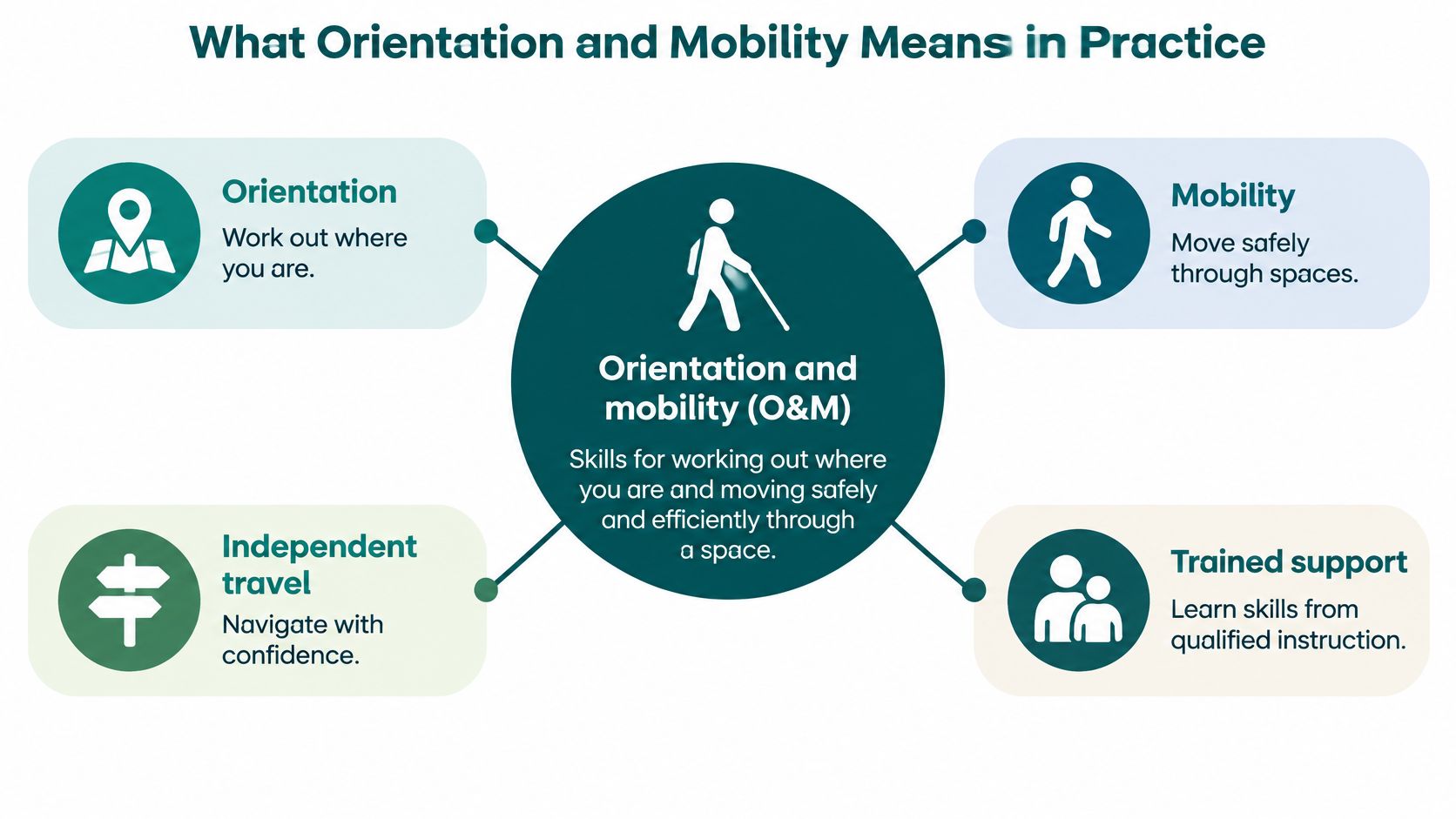
The components of orientation and mobility
| Component | What it covers | Everyday example |
|---|---|---|
| Orientation | Knowing where you are and where you need to go | Confirming the platform number on a station map before boarding |
| Mobility | Moving safely and efficiently through a space | Using a long cane to detect a kerb edge before a crossing |
| Environmental information | Cues from sound, surface, light and layout | Interpreting traffic flow alongside crossing cues |
| Travel tools | Aids that support orientation and mobility | Long cane, guide dog, or phone navigation as a complement to training |
Body position and directional understanding help a traveller make sense of these cues. Body awareness from MedAmerica Rehab Center provides useful background vocabulary, while specialist O&M instruction addresses how to apply skills during travel.
O&M supports independent travel, but it cannot remove every barrier in a building or replace the judgement needed when conditions change. Waymap was founded by Dr Tom Pey, and its navigation work is built first for blind and low-vision users.
“Thank you for providing independence and less reliance on people.”
Evelyn V., Waymap website
This is one person's account; individual experiences and support needs differ.
Where Journeys Break Down for Blind and Low-Vision Travellers
A local walk can be the essential connection between home, public transport and everyday services. A pavement obstruction or an ambiguous crossing therefore affects more than the walking portion of a journey.
RNIB's 2021 Seeing Streets Differently report, based on responses from 302 blind people and 153 partially sighted people, estimated that around 340,000 people were registered blind or partially sighted nationally and approximately 2 million lived with sight loss affecting daily life. In that survey, 73% relied on walking journeys for independent travel, while 78% said walking was their only or main form of outdoor physical exercise.
RNIB identified practical environmental requirements: detecting and avoiding moving vehicles, dependable kerbs and crossings, and uncluttered pavements. A navigation instruction can identify the route, but it can't remove a delivery trolley from it or restore a missing kerb cue.
Reported barriers on UK journeys
The groups below differ. NCAT surveyed disabled travellers across impairments, while RNIB's findings concern blind and partially sighted people; the percentages shouldn't be treated as directly comparable measures.
| Barrier | Reported share | Source |
|---|---|---|
| Encountered barriers while travelling | 92% of surveyed disabled people | NCAT transport barriers report |
| Unreliable or missing step-free access on trains, trams and underground | 43% of users of those modes | NCAT transport barriers report |
| Confusing signs or inaccessible station layouts | 27% of respondents | NCAT transport barriers report |
| Audio or visual information problems on air and boat journeys | 16% of air and boat users | NCAT transport barriers report |
| Vehicle information unavailable or inaccessible | 23% of disabled people | NCAT accessibility data report |
| Train-platform gap | 82% of blind and partially sighted respondents | RNIB's February 2025 survey |
| Rail assistance reliably met | 44% of blind and partially sighted respondents | RNIB's February 2025 survey |
The assistance figure measures reliable provision, not the proportion encountering a barrier. Its operational significance is straightforward: a route that depends on a staff handover needs that handover to happen.
Fix the physical route as well as the directions
For estates teams, pavement maintenance belongs in accessibility planning. Where tree roots may be affecting a path, guidance on how to assess root damage on commercial properties from Prestonwood Commercial Services offers a maintenance starting point, not a UK accessibility standard.
Our guidance for blind and low-vision navigation takes the same practical starting point: identify the obstacle the traveller encounters.
NCAT's accessibility data report also puts the wider consequence at 38% fewer transport journeys by disabled people than non-disabled people, a gap broadly unchanged for more than a decade. An unresolved obstruction or unusable interchange can mean an appointment, visit or opportunity that someone cannot reach.
Which Support Methods Solve Which Navigation Problems
Choose support according to the problem, not the technology category. Someone learning an unfamiliar crossing needs a different intervention from a passenger trying to locate a hospital department after arriving at reception.
O&M instruction provides the foundation for using other forms of support. Staff, physical cues and digital guidance then contribute different information, with different dependencies.
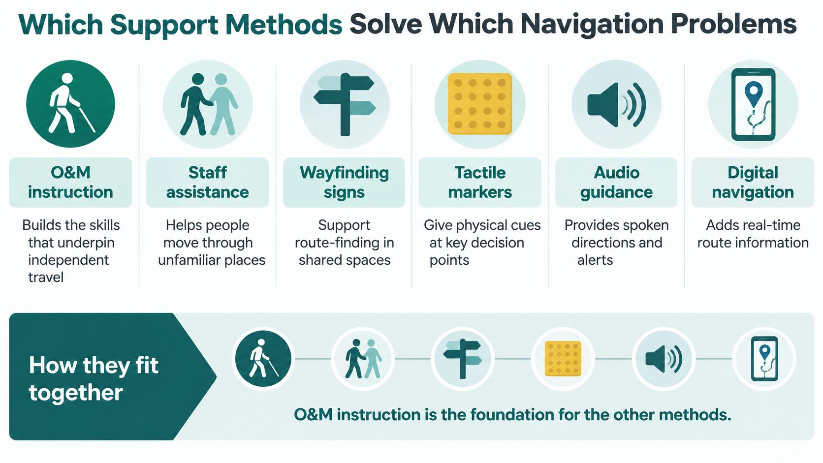
Navigation support methods compared
| Approach | What it provides | Where it falls short |
|---|---|---|
| O&M instruction (long cane, sighted guide) | Skills to detect, plan and recover from error | Requires lessons and does not update the venue itself |
| Staff assistance | Human help on the day | Depends on staff availability and timing |
| Tactile and physical features | Fixed cues along the route | Only where installed; cannot report a closure |
| Phone navigation with GPS | Outdoor route guidance | Weak or absent indoors and underground |
| Infrastructure beacons | Indoor positioning | Installation and maintenance on fixed hardware |
| Waymap (complements O&M and staff help) | Step-by-step audio and on-screen guidance indoors, outdoors and underground | Should not be used as the primary navigation solution for a disabled person |
The blunt limitations matter. Installing tactile features doesn't create a channel for reporting a lift failure. Adding an app doesn't create staff capacity, and booking assistance doesn't teach a traveller how to interpret the surrounding street.
What the hospital example tells us
At the Royal Hospital for Children and Young People (RHCYP), Dr Olivia Swann identified Waymap as the only viable option because it could operate without GPS, Wi-Fi or cellular signal. The relevant constraint was navigating a large hospital site without depending on those signals, alongside the support hospital staff provide.
The technical distinction is specific. Waymap Core uses AI-powered SmartStep motion-based positioning, with smartphone inertial sensors measuring movement, direction and elevation for dead-reckoning. Our algorithms estimate step length and direction of travel, while the venue's navigation model supplies the route context.
That removes a positioning dependency on installed beacons. It doesn't remove the need for accurate route information, a usable phone or appropriate travel skills.
Selection rule: Choose the method that fills the missing function, then check what happens when that method is unavailable.
For a campus journey, that might mean instruction for the street approach, fixed cues at the entrance and human help for an unexpected access problem. Our guide to support for visually impaired travellers provides further context for combining support rather than treating each method as a replacement for the others.
How to Map a Journey as a Chain of Decision Points
A journey is a chain of decision points, not a single origin-to-destination line. A passenger needs to identify the right entrance, select a usable vertical connection and reach the correct boarding location, not merely arrive near the station.
The NCAT transport barriers report documents the physical access and information failures reported in the barrier table. For route designers, the practical implication is to test whether people can understand and complete each transition, including when normal operations change.
Build the route around observable decisions
List every decision point. Include the entrance, lift or stair, interchange, platform or stop, exit and final destination. Give each a precise name so staff and passengers aren't using different descriptions of the same place.
Record the cue a traveller can use at each point. A tactile feature, audible landmark, accessible sign or clearly identified staff position should help confirm location rather than merely suggest a direction.
Separate permanent layout from operational status. A corridor's position belongs in the base map; a lift closure belongs in an updateable service record. Keeping them separate makes temporary changes easier to publish and withdraw correctly.
Give each decision a usable fallback. An alternative entrance isn't enough if the connecting route includes inaccessible steps, so inspect the whole diversion rather than its starting point.
Confirm a decision point on site with someone who uses the route. Ask what tells them they have arrived and what could make that cue ambiguous. Then extend that review across the chain with blind and partially sighted users.
Test the full journey at busy times and during a known disruption. Check whether announcements arrive before a turn, signs remain discoverable and staff can explain the same alternative route.
Test the destination, not just the doorway
The RHCYP deployment began with Dr Olivia Swann identifying wayfinding as a drain on clinical time and a source of distress for families. A pre-deployment internal NHS Lothian survey of 100 families found that 4 in 10 needed help finding their way around the hospital.
That makes the endpoint important. Reaching the hospital entrance isn't the same as arriving at the right department, and reaching the department isn't enough if the visitor cannot identify reception.
Use navigation instructions tied to decision points to specify when a message should be delivered and what it should confirm. Pair audio and visual information where appropriate, and verify that both describe the current route.
A route is operationally accessible only when its required connections work together, at the time someone needs to travel.
What to Do When the Route Changes
Stop somewhere appropriate, clear of the immediate flow of people, before trying to resolve a wrong turn or unexpected closure. Continuing while uncertain can take you further from the last location you recognised.
More than three quarters of blind and partially sighted respondents felt nervous travelling to unfamiliar places, according to RNIB's account of its inclusive journeys findings. Recovery therefore needs to be part of the travel plan, not an improvised test of confidence.
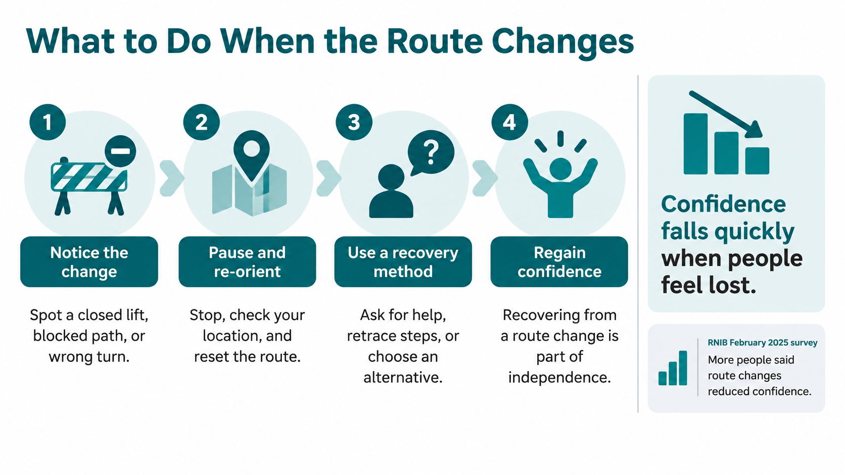
Use a recovery sequence you can rehearse
Pause and recall the last confirmed point. Identify the entrance, lift lobby or junction you last recognised. Don't assume that the most recent instruction proves your current position.
Confirm location using an identifiable fixed cue. This might be a platform number, a known tactile feature or an accessible sign, interpreted using your established travel techniques.
Contact assistance when the location or onward route remains unclear. Ask a specific question, such as which entrance serves the working lift, rather than requesting directions to the destination without explaining the access requirement.
Check what the station's accessibility information says about the alternative. Ask staff to confirm the complete onward connection, including any transfer between platforms or stations.
Re-plan from the confirmed location. Use a fallback you understand rather than attempting to rejoin the original route by guesswork. If retracing your steps isn't appropriate, wait for suitable assistance.
Report the discrepancy once you're able to do so. Give the location, the obstruction and the instruction that no longer matched conditions, so the operator can correct it.
Use the station's published assistance arrangements
The Office of Rail and Road's Accessible Travel Policy guidance requires stations to have an A, B or C accessibility classification described in public-facing operator information. It also requires operators, where reasonably practicable, to indicate at an accessible height how passengers can speak to a human operator.
Where an accessible station cannot be used, that guidance requires operators to explain how they will provide an appropriate alternative accessible service without extra charge, to the nearest or most convenient accessible station. Ask what arrangement applies to your journey rather than assuming a suggested diversion meets your needs.
For operators, real-time transit information should support these decisions before passengers reach the obstruction. For travellers, an O&M specialist can help rehearse recovery techniques so that asking, checking and restarting become familiar parts of independent travel.
How Accessibility Teams Keep Routes Current
Capital approval cycles can make new physical hardware difficult to fund. Maintaining that hardware across busy stations, campuses and stadiums then creates an ongoing operational task, especially where layouts and crowd arrangements change.
A software-held route model avoids adding fixed positioning hardware, but it doesn't maintain itself. Someone still needs authority to change the route record, verify the diversion and tell passengers what has happened.
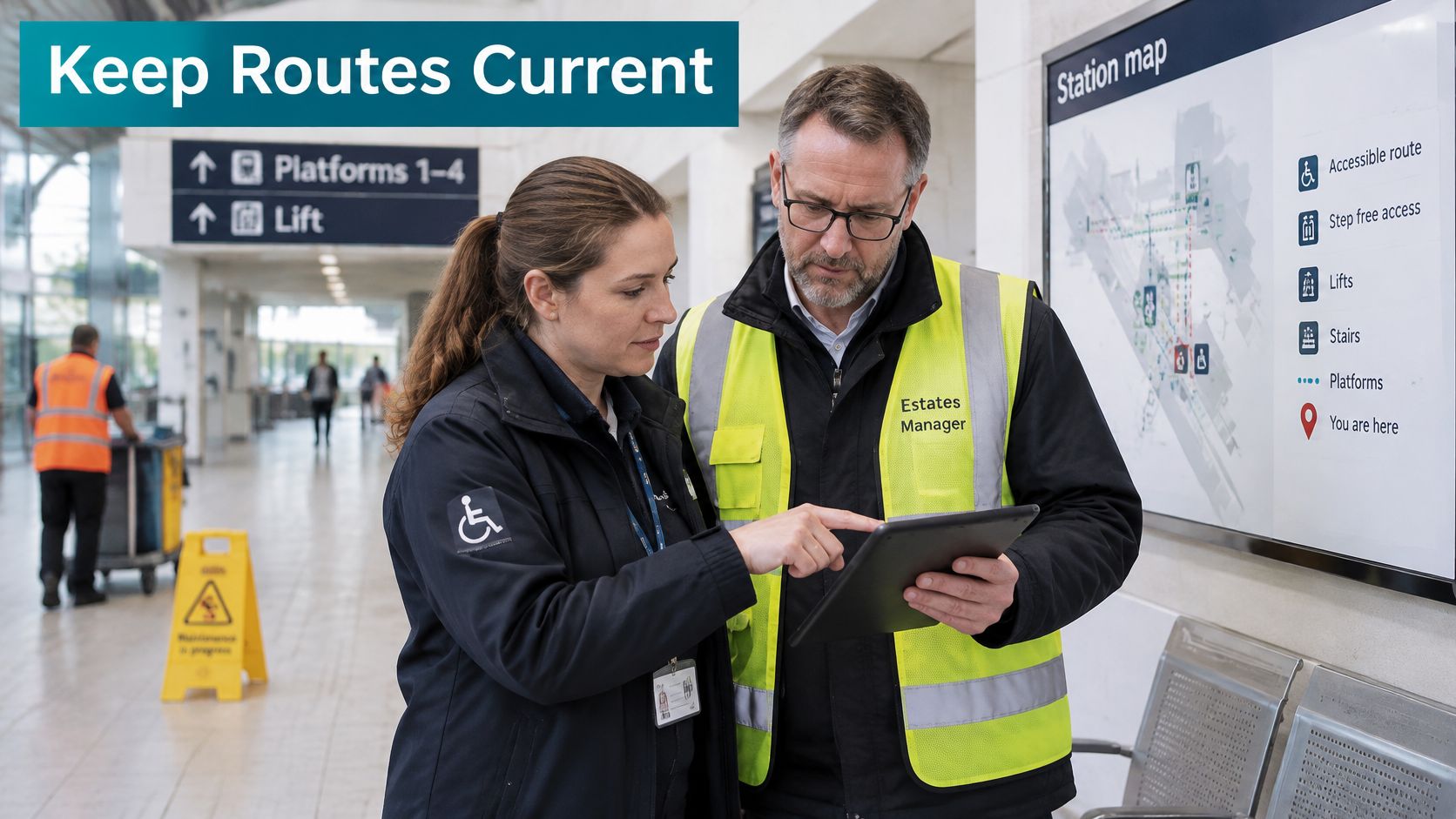
Give route updates operational ownership
| Practice | What the responsible team must do |
|---|---|
| Map exact decision points | Maintain identifiable entrances, junctions, vertical connections and destinations |
| Assign named owners | Specify who approves changes and who covers absence or out-of-hours incidents |
| Test with users | Include blind and partially sighted people in checking instructions and diversions |
| Publish current conditions | Update passenger-facing information when access changes and remove expired notices |
Treat an accessibility update like an operational instruction, not a communications campaign. A lift failure needs a checked alternative, an owner and a clear point at which normal routing can resume.
Connect the information duty to the delivery method
Section 181A of the Equality Act 2010 allows regulations requiring local-service operators to provide information about service identity, direction, stopping places, diversions and connecting services. It also allows requirements governing when and how information is announced and displayed.
That provision doesn't prescribe infrastructure-free navigation or establish that an app alone achieves compliance. It does make practical journey information central to accessible travel. A delivery method that doesn't depend on additional fixed positioning hardware can help operators address that need, provided their information remains accurate.
Separate deployment objectives from demonstrated outcomes
Our work for the West Midlands Combined Authority at Birmingham New Street had distinct objectives: improve independent navigation for passengers with visual impairments and mobility challenges, improve passenger flow and reduce congestion, and demonstrate a scalable model for major UK rail stations.
Testing showed strong user satisfaction across diverse groups. Users with visual impairments gave particularly positive responses about increased confidence navigating independently. Those findings support the navigation case; they shouldn't be presented as a quantified congestion reduction.
Our mapping process combines venue plans with movement patterns to create a precise navigation model. For event teams, route planning for changing show layouts raises the same ownership question as a station diversion: who confirms that the published route still matches the space people will encounter?
Choose Your Next Step for Independent Navigation
Choose a journey you need to make, then identify where decisions or recovery may be needed. An O&M specialist or local sight-loss service can help you practise unfamiliar parts. Prepare a route card in your preferred accessible format, with the destination's exact entrance, recognisable cues, assistance contacts and an alternative if a key connection is unavailable.
Before travelling, check the operator's accessibility information, particularly where platform access matters. For questions about eye-care roles, choosing eye care with Style Site Optical explains the distinction between optometrists and ophthalmologists.
For operators, start with a bounded pilot
- Appoint an accountable owner. Assign responsibility for route information to someone who can coordinate estates, operations and accessibility staff.
- Choose a complete journey. Test an entrance-to-destination route that includes difficult connections, not only the easiest corridor.
- Measure completed arrivals. Record whether participants reach the correct entrance, platform or facility, where they hesitate and whether they can recover when conditions change.
- Make expansion conditional. Resolve failures before extending the approach across the estate.
Bring a decision-point list to a scoping discussion with the accessibility team. Use the pilot to assess whether the route, its information and the update process work for users. Installation alone does not show that a route is dependable.
Frequently Asked Questions About Orientation and Mobility
What is orientation and mobility?
Orientation and mobility is the combination of understanding your location and using learned techniques to travel through an environment. It includes interpreting surroundings, planning movement and responding when the expected route changes.
Who teaches orientation and mobility?
Trained O&M specialists provide individual instruction. A local sight-loss service can help you find an appropriate starting point and discuss the journeys you want to practise.
Is orientation and mobility the same as long cane training?
No, long cane training is part of a wider set of travel skills. Instruction can also include sighted guide techniques, environmental cues, public transport and problem-solving.
How important is walking for independent travel with sight loss?
Walking can be the essential link between home, transport and local services. Operators should assess the approach to their entrance as well as movement inside the building.
Can a navigation app replace orientation and mobility training?
No, an app cannot replace the judgement and techniques developed through instruction. Digital directions should complement appropriate travel tools, environmental information and human support.
What should a traveller do when a lift is closed?
Pause at a suitable location and establish where you are before selecting an alternative. Confirm that the replacement route meets your access needs, including its onward connections.
What is a station accessibility classification?
It is the operator's published description of a station's access category. Read the accompanying detail for the platforms and route you need rather than treating the category alone as sufficient.
How do venues keep orientation and mobility routes accurate?
Venues need accountable route owners, user testing and a process for publishing operational changes. They should also withdraw outdated diversions when normal access resumes.
Waymap offers smartphone-based audio and on-screen navigation to support journeys through indoor, outdoor and underground spaces, alongside O&M skills and human assistance. Visit Waymap to discuss a pilot with your accessibility and operations teams, using your entrances, decision points and recovery routes as the agenda.
