
Blind Low Vision Navigation and Accessibility Guide
If you're trying to help someone move through a station, hospital, campus, or shopping centre with blind low vision, the failure usually isn't a lack of goodwill. It's the gap between what the place assumes a person can see and what the person can actually rely on in motion. That gap is why accessible wayfinding has to be treated as core infrastructure, not a specialist add-on.
The scale is larger than many operators realise. In England, around 1.9 million people, roughly 3% of the population, were estimated to be living with sight loss in 2024, while 268,500 people were registered as blind or partially sighted on 31 March 2023, including 20,330 new registrations in 2022 to 2023 (RNIB reporting on sight loss in England). Registration matters for support, but it doesn't capture everyone who needs easier navigation. For venues, that means the actual audience for accessible guidance is broader than the official register suggests.
Understanding Blind and Low Vision Definitions
Blindness and low vision are not the same thing, and designing as if they are leads to weak systems. Low vision covers a wide range of functional barriers, including reduced contrast sensitivity, glare intolerance, peripheral field loss, and difficulty processing complex visual environments. A person may read some print, recognise shapes at close range, or use magnification, yet still struggle to follow static signs, spot obstacles, or maintain orientation in a crowded venue.
Why the distinction changes navigation design
The practical distinction is important because wayfinding failures often happen before a person reaches an obvious barrier. Someone with low vision may cope with a platform sign in one lighting condition and lose it completely in another. Another person may manage short indoor trips but find a long interchange exhausting because visual scanning never settles into a predictable pattern.
That's why the built environment has to support a continuum of sight loss, not just total blindness. RNIB notes that more than 2 million people in the UK live with sight loss, while around 320,000 are formally registered as Sight Impaired or Severely Sight Impaired (RNIB key information and statistics). The functional need is larger than the administrative category. A venue that only thinks in terms of registration will under-design the journey.
Practical rule: if a person needs to stop, scan, turn back, or ask twice, the environment is already too dependent on vision.
Age, mobility, and the navigation problem
Age makes the issue sharper. In England, 155,960 people aged 75 and over were registered locally as blind or partially sighted in the year ending 2023, equivalent to 3,031 per 100,000, while 29,215 people aged 65 to 74 were registered at a rate of 533 per 100,000 (UK Government vision-profile statistics). That gap shows how strongly the need for accessible information, transport, and venue navigation rises with age.
For operators, the implication is direct. If your audience includes older adults, the question is not whether blind low vision users will arrive. It is whether your environment can be used without guesswork, strain, or repeated dependence on staff.
Navigating Built Environments with Sight Loss
A station concourse, hospital corridor, or retail atrium can look orderly to a sighted planner and still feel unstable to a blind low vision traveller. The trouble is usually not one dramatic obstacle. It's the accumulation of small failures, poor lighting, inconsistent floor finish, a misplaced display stand, a confusing change in level, or a platform edge that isn't easy to read at speed.
In transport settings, the failure points become operational. RNIB's 2025 survey of 1,197 blind and partially sighted people found that more than one in three couldn't make the train journeys they wanted or needed to make, while 82% struggled with the gap between the train and the platform edge. Fewer than half said they could make all the bus journeys they wanted or needed to make (RNIB on getting around). Those figures point to a journey problem, not just a boarding problem.
Where assistance breaks down
Booked help can reduce anxiety, but it isn't a complete solution. In the same RNIB survey, assistance staff reliably met only 44% of reported needs. That matters because navigation often falls apart in the moments when a passenger needs a platform change, a different entrance, or a route adjustment that staff can't predict in advance (RNIB reports and insight). A good process helps, but it can't eliminate lateness, handover failures, or missed meet points.
A passenger shouldn't have to choose between waiting for help and risking a wrong turn.
For underground, signal-poor, or high-traffic places, the practical answer is continuous guidance that works without human availability. That guidance has to name the exact entrance, lift, platform, or exit, and it has to stay usable when a route changes. In hospitals, the same logic applies to clinics, wards, and departments that move or rename spaces over time. The strongest systems reduce dependence on a single person remembering the right door.
What works better than static instructions
Static signage still matters, but it fails whenever a person can't see it, reaches it too late, or arrives after a temporary layout change. Digital wayfinding gives the person a repeatable route, spoken in real time, and that repeatability is what turns a confusing site into a usable one. For a practical hospital example, see the Waymap guidance on wayfinding in hospitals.
Meeting UK Accessibility Standards and Regulations
A person can face a legal access barrier long before they reach a doorway. In the UK, the Equality Act 2010 places service providers and public authorities under three separate reasonable-adjustment duties when a disabled person is put at a substantial disadvantage, changing a provision, criterion or practice, addressing a physical feature, and providing an auxiliary aid or service (Equality Act 2010, Part 2). Where the problem is information, the Act also covers giving that information in an accessible format.
That matters because accessible communication is part of service delivery, not a courtesy add-on. The explanatory notes make the operational side clearer, since reasonable steps can include changing how things are done, modifying the built environment, or providing auxiliary aids and services such as specialist software or a different service (Equality Act 2010 explanatory notes). For teams responsible for real sites, that is the point where policy has to become a working journey, not a paper standard.
What the law expects in real venues
The law also recognises that some physical features were installed to assist access. The Equality Act 2010 (Disability) Regulations 2010 say a provider is not required to remove or alter a feature that was installed to assist access and meets the relevant design standard (Equality Act 2010 regulations). For a UK-specific breakdown of the standards, see the Waymap guide to UK accessibility standards.
That distinction matters because not every access problem is solved by rebuilding the building. The central question is whether the current journey leaves a disabled person at a substantial disadvantage in practice. If it does, the adjustment may be a different route, an accessible information format, or an auxiliary aid that supports independent movement. A useful companion reference for service teams is the UX design fundamentals, because poor information architecture creates the same friction as poor physical layout.
Design and compliance are linked. If users cannot understand the route, the adjustment has already failed in practice.
For venue teams, the hard part is operational. Major physical changes are slow, expensive, and hard to repeat every time a layout shifts. Digital guidance is often the more workable adjustment in spaces that change often, especially where the legal duty is about access to information and a usable journey, not a fixed architectural finish.
Comparing Assistive Technology and Wayfinding Tools
The assistive-tech market is full of tools that solve part of the problem. White canes and screen readers help with immediate interaction, but they don't describe the route ahead. Bluetooth beacon systems can improve indoor positioning, but they depend on installed hardware, ongoing maintenance, and layout stability. Infrastructure-free navigation apps take a different approach, using the phone the traveller already carries.
Wayfinding Technology Comparison for Venues
| Technology Type | Infrastructure Requirement | Maintenance Burden | User Experience |
|---|---|---|---|
| White cane and other mobility aids | None | Low | Reliable for close-range mobility, but limited for route planning |
| Beacon-based indoor positioning | Installed beacons and supporting hardware | High | Can work well where hardware is maintained, but breaks when layouts change or devices fail |
| Static signage | Physical signs only | Medium | Familiar for many users, but dependent on vision, lighting, and consistency |
| Infrastructure-free digital wayfinding | Smartphone sensors and mapped routes | Low on-site hardware burden | Audio-first guidance that can support independent movement across changing environments |
A practical comparison point is maintenance. Beacon systems add devices to check, replace, power, document, and remap. That burden grows in venues with heavy footfall, changing tenant fit-outs, temporary works, or repeated event layouts. If you manage estates, you already know that physical layers age unevenly. Digital guidance avoids turning every route change into a hardware project.
For teams deciding between visible labels and dynamic guidance, the custom engraved asset labels resource is useful for understanding permanent identification needs. But permanent labels still don't solve every navigation problem, especially when a route changes on short notice or a user needs spoken guidance while moving.
What operators should prioritise
A stronger decision rule is simple. If the environment changes often, hardware-dependent wayfinding will cost more to sustain. If the user needs hands-free guidance in motion, static overlays won't be enough. That is why software-defined wayfinding has become more attractive to operators who need a repeatable experience without a hardware estate to preserve.
For a deeper comparison of the market, the Waymap article on indoor navigation technology is a useful reference point.
Designing Inclusive Spaces for Visual Impairments
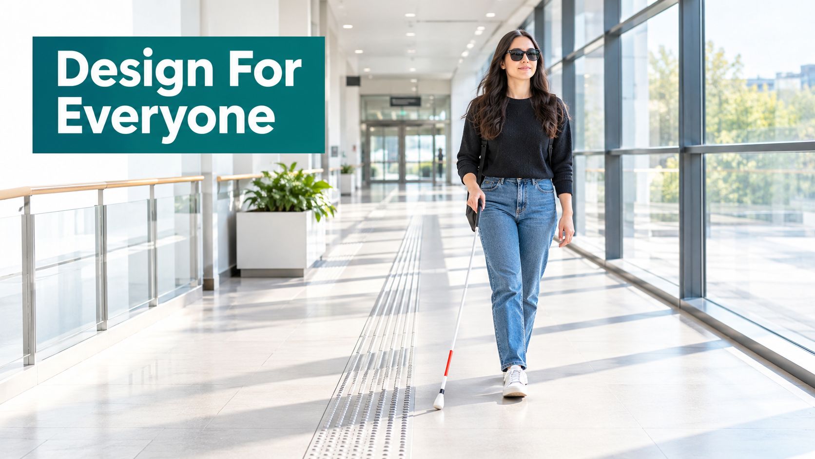
A usable space starts with legibility. High-contrast edges, consistent surface cues, predictable lighting, and tactile paving all help blind low vision users build confidence as they move. Acoustic landmarks matter too, because a space that sounds distinct is easier to orient in than one where every corridor, foyer, and atrium blends into the same echo.
Physical cues that reduce friction
The most effective spaces usually do a few things consistently. They make entrances obvious. They keep obstacle placement disciplined. They avoid unnecessary visual clutter around decision points like lifts, ticket gates, or reception desks. In practice, that means fewer surprises between a doorway and a destination.
The role of digital guidance is to fill the gaps that physical cues can't cover. It can offer dynamic, multilingual, updateable instructions when a space is rearranged for maintenance or an event. It also gives a person a route that doesn't disappear when signage is moved or a temporary barrier is added.
A useful planning resource here is How can I display my artwork? from The Print Warehouse Ltd, because many venues need to balance signage, displays, and clear circulation space without cluttering the journey. That trade-off is real in galleries, retail, and hospitality settings where visibility and navigation can compete for the same wall and floor space.
Digital layers that complement the building
The strongest design approach is not physical or digital. It is both. Physical cues make a building legible at a glance, while digital guidance gives people a route that stays current when the environment changes. For estates teams, that means accessibility no longer depends on one costly retrofit. It depends on a maintained system of cues, information, and guidance.
The Waymap piece on inclusive design principles expands on that relationship in a venue context.
Delivering Infrastructure-Free Precision Navigation
Wayfinding works best when it doesn't ask the venue to install extra hardware just to stay accurate. Waymap uses dead reckoning with device-native motion sensors, so the route guidance follows the person's movement through indoor, outdoor, and underground spaces without relying on GPS, Wi-Fi, or Bluetooth. For operators, that removes the maintenance burden that comes with keeping a hardware layer alive across a changing estate.
Why infrastructure-free navigation holds up better
The value is practical. If a station reconfigures a corridor, a museum changes a gallery route, or a stadium updates an entrance pattern, a hardware-based system can fall out of sync quickly. A software-defined system can adapt without replacing beacons or re-running a physical install. That matters most in places with constant change, heavy footfall, or limited tolerance for service disruption.
Waymap's approach also adapts to how people walk. It learns stride and movement patterns to produce heads-up, audio-first guidance that stays step-accurate and supports precise doors, platforms, and points of interest. That's a different proposition from a map overlay, because the user doesn't need to stop, interpret, and confirm a screen before moving on.
Operational advantage: less hardware in the building means fewer points of failure for the accessibility team to manage.
Where this matters in the real world
That approach is especially relevant in large, complex places such as transit hubs and stadiums, where a traveller may need continuous guidance underground or in signal-poor areas. For Waymap's deployments at places like WMATA and Lord's Cricket Ground, the key value is not novelty, it is reliability in environments where staff help, visual signage, or fixed beacons don't always cover the full route.
The Waymap article on infrastructure-free wayfinding benefits covers this maintenance trade-off in more detail. For accessibility leads, the takeaway is simple. If the experience has to work for blind low vision users across changing space, the navigation layer needs to move with the environment, not lag behind it.
Frequently Asked Questions About Sight Loss Navigation
What does blind low vision mean in practical terms?
Blind low vision means a person has reduced visual ability that affects daily navigation, but the level of impairment can vary widely. Some people still use residual sight with magnification or higher contrast, while others rely mainly on touch, sound, and other non-visual cues.
Do blind low vision users need the same navigation support as blind users?
Often, yes, because the barriers overlap in daily travel. Low vision can still make signs, platform edges, route changes, and obstacles hard to read, so audio-first and hands-free guidance remains useful.
Is a registered blind or partially sighted list enough to plan accessibility?
No, because registration does not capture everyone with functional sight loss. RNIB's broader prevalence estimate for England is around 1.9 million people, while the formal register is much smaller (RNIB sight-loss reporting).
What is the legal duty under the Equality Act 2010 for sight loss access?
The duty is to make reasonable adjustments when a disabled person is substantially disadvantaged. That can include changes to practice, physical features, accessible information, and auxiliary aids. The explanatory notes set out how that duty works in practice (Equality Act 2010).
Can digital wayfinding count as an accessibility adjustment?
Yes, if it removes barriers created by the environment or by the way information is delivered. Accessible communication and auxiliary services both fit within that framework, so digital wayfinding can be part of a practical adjustment rather than a separate add-on.
Does infrastructure-free navigation work where GPS does not?
Yes, because it uses device-native motion sensors rather than GPS alone. That makes it suitable for indoor and underground navigation where satellite signals are weak or unavailable.
What should venue managers fix first for blind low vision access?
They should fix the journey, not just the sign. Clear entrances, obstacle discipline, accessible information, and a route that still works when the environment changes matter more than isolated compliance gestures.
Waymap provides precision navigation for blind low vision users across indoor, outdoor, and underground spaces, with hands-free audio guidance that does not depend on GPS, Wi-Fi, or installed hardware. If you manage a station, campus, hospital, stadium, or large venue, visit Waymap to see how infrastructure-free wayfinding can support accessibility and operational resilience.
