
London Underground Navigation: Step-Free Routes Explained
London Underground navigation starts from a blunt fact. In 2016/17 the Underground carried 1.37 billion passenger journeys, more than 2.5 times the post-war low of 498 million journeys in 1982, as Transport for London's history of the Underground records. That history also puts today's network at 272 stations on 11 lines, grown from the Metropolitan Railway opening on 10 January 1863 between Paddington and Farringdon, with six intermediate stations.
A coloured line doesn't name the entrance, the interchange walk, or whether the platform is reachable without stairs. Passages were added across more than 160 years, so two stops on the same line can work completely differently.
What Makes a London Underground Journey Hard to Navigate
The Tube map is a diagram of lines, not a plan of the building. Entrances, interchanges, platform layouts and step-free routes were added as the network grew, so the nearest street door is often the wrong door.
Answer three questions before you travel.
- Which entrance connects to my line? A door on the far side of the station can add a long internal walk, or stairs you can't use.
- Which route is step-free? A station label isn't the same thing as a platform you can board from.
- What is the exact platform-level path? Line, direction, lift and the gap to the train all sit after the gateline.
Work through those checks stage by stage, at platform level, rather than trusting a station flag. The same decision-point logic is set out in our note on public transportation directions.
How to Navigate a Tube Journey Stage by Stage
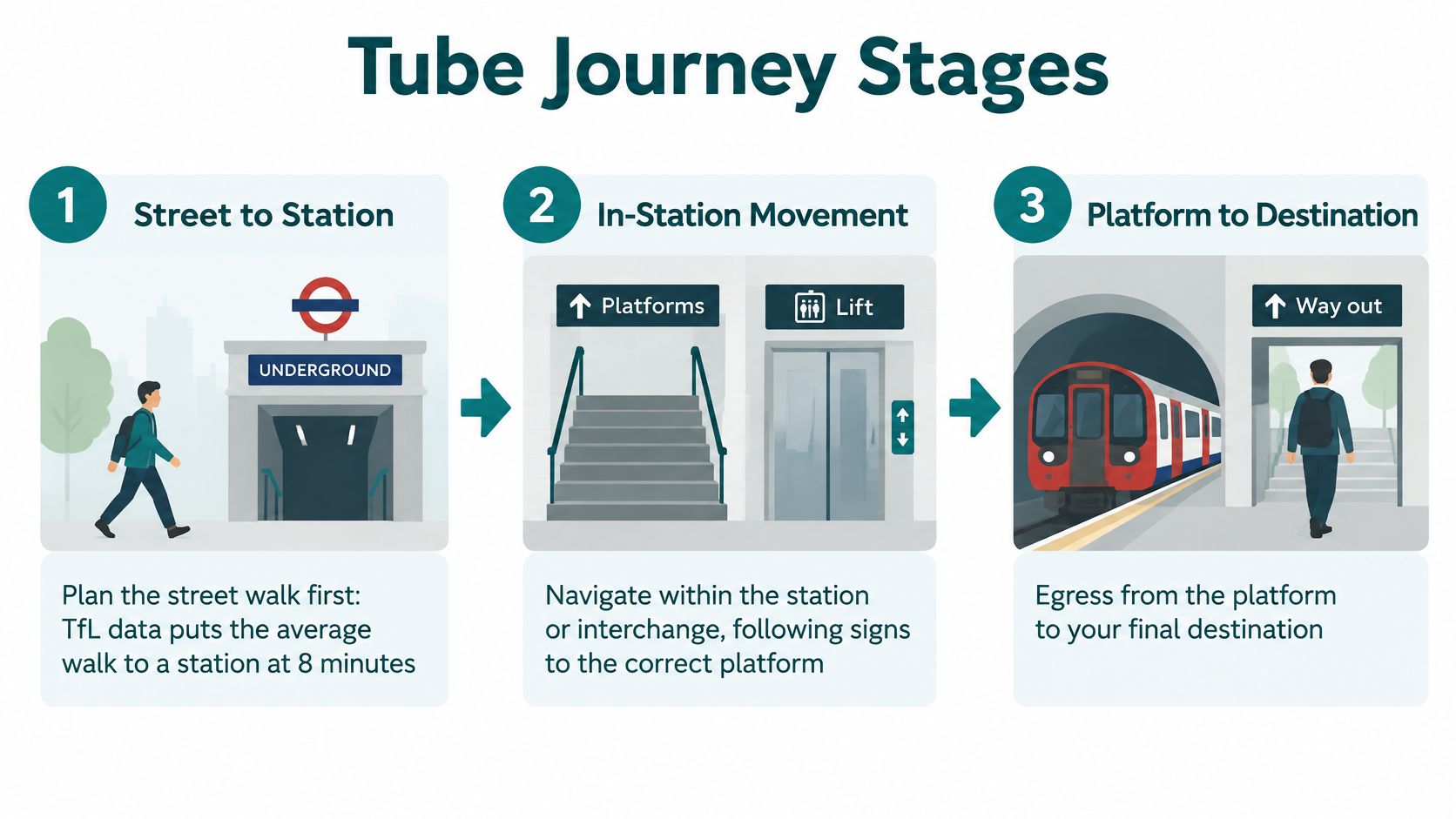
Split the trip into street-to-station access, in-station movement or interchange, and platform-to-destination egress. TfL's open data publishes walking times for adjacent Tube, Overground and DLR stations, and Journey Planner can show an interchange as its own stage. A Victoria to Central line transfer is a five-minute walk. The same benchmark puts the average walk to a London Underground station at 5 minutes 30 seconds, and the average walk from the station to the final destination at 5 minutes 27 seconds. Hide those legs inside the rail time and the ETA is wrong, especially when stairs are involved.
Street walk and the right entrance
- Plan the street walk first. Add both walking averages before you look at train minutes. Starting the clock at the gateline is how people miss connections.
- Use the entrance tied to your line, not the nearest door. The closest entrance can drop you on the wrong side of the paid area, or onto stairs when you needed a lift.
Say the day ends around Notting Hill and you explore Portobello Market and pastel streets. The station that looks closest can still be the wrong door for the line, or for a step-free path. Pick the entrance, then the street route to that entrance.
Inside the station and back out
- Count the interchange as walking. That five-minute Victoria to Central transfer isn't a free connection. Leave it out and a tight change fails for anyone with limited mobility or reduced sight.
- Confirm line and direction at the first choice after the gateline. Don't carry a map colour in your head past the barriers.
- Separate stairs, escalators and lifts on each leg, and note where the lift sits.
- Re-check if the platform or interchange changes. A revised route isn't the one you memorised at home.
- Plan the egress. Name the exit nearest the destination and whether that exit is step-free. Dropping the walk away from the station is how the last five minutes disappear.
| Stage | What to check | Figure or example | Common slip |
|---|---|---|---|
| Street to station | Entrance connected to your line | Average walk to station: 5 minutes 30 seconds | Taking the nearest door |
| In-station movement | Interchange walk, line and direction | Victoria to Central line transfer: five minutes (TfL Journey Planner) | Leaving out interchange time |
| Platform to destination | Exit nearest your destination and whether it is step-free | Average walk from station: 5 minutes 27 seconds | Forgetting egress time |
Practical rule: If you can't say the route from street to platform in one breath, entrance and lift included, it isn't planned.
Those checks match what useful navigation instructions should do: one action at each choice, not a single pin on the station name.
Step-Free Thresholds for Platform Access
A station can be labelled step-free and still leave a boarding gap you can't cross alone. Match the platform's measurements to TfL's bands before you commit to the route.
| TfL category | Step height | Platform gap | What to expect |
|---|---|---|---|
| Suitable for most customers, including wheelchair users | 0 to 50 mm | 0 to 85 mm | Cross without assistance |
| Step-free to platform | 51 to 120 mm | 86 to 180 mm | Check for a manual ramp or boarding help |
| Beyond step-free to platform limits | Above 120 mm | Above 180 mm | Manual ramp or other assistance may be needed |
| Step-free from street to train | Smaller step | Smaller gap | Most passengers cross unaided |
| Step-free from street to platform | No stairs on the route | A large step or gap may remain | A boarding ramp may still be needed |
TfL Go's step-free information sets the band suitable for most customers, including wheelchair users, at steps of 0–50 millimetres and gaps of 0–85 millimetres. The separate step-free to platform band covers steps of 51–120 millimetres and gaps of 86–180 millimetres. Beyond those ranges, a manual ramp or other assistance may be needed. TfL Go can filter to step-free stations, plan routes step-free to the platform, show lift status and identify accessible toilets.
Street to platform is not street to train
TfL's wheelchair access guidance splits two outcomes that maps often collapse. Step-free from street to platform means you can reach the platform without stairs, but a large step or gap may remain and you may need a boarding ramp. Step-free from street to train means a smaller step or gap that most passengers, including wheelchair users, can cross without assistance. Journey tools then add platform-level detail on steps, gaps, manual ramps and level boarding points.
Read the table against the specific platform, not the station name. If the gap sits in the 86–180 millimetre band, plan for a ramp and for someone to deploy it. If it sits above that band, don't treat the stop as independently boardable.
A green step-free icon on a station list answers the stairs question. It doesn't answer the boarding question.
For how those platform checks show up on real metro trips, see our public transport examples.
Signs That Confirm Your Line and Platform
After the gateline, wayfinding is a trail, not a single map at the entrance. TfL's London Underground signs manual says passengers follow signs to the correct platform, and that signing must be clear and unambiguous at decision-making points. Signs should face the direction of passenger movement where possible, with consistent text size and formatting.
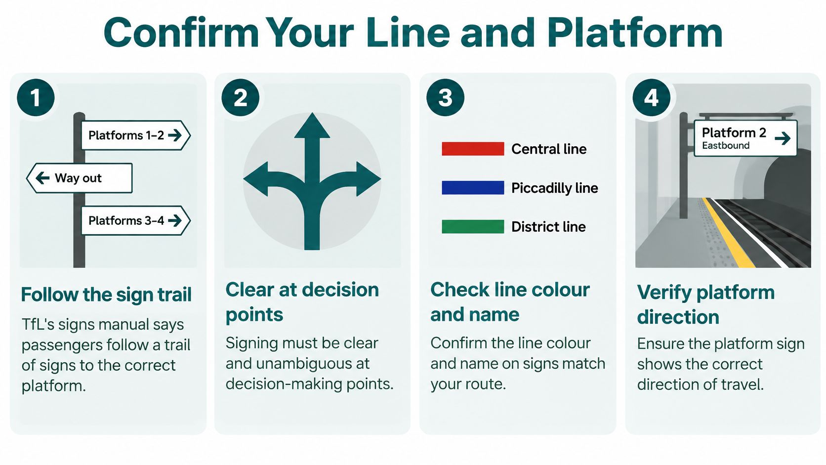
Use this checklist at every choice.
- Match the line name and colour strip on the sign to the journey in your hand. Memory of the map colour is the usual miss, especially where two lines share a passage.
- Read the platform description for direction or destination, not only the line name. The right line in the wrong direction is still the wrong train.
- On an island platform, read the line diagram before you walk in. The manual says those diagrams should be visible as you enter. Going in first and checking second wastes the length of the platform.
- At an interchange, follow the signs for the new line before you leave the platform you arrived on. The first sign in a sequence is a prompt, not the whole instruction.
On open platforms, confirmation signs identify the line through the name and colour strip, together with a platform description. That repetition is the design. Each sign confirms a choice you are about to make.
The same rule shows up off the Tube. Teams planning signage for ward relocations have to face signs the way people walk, or the trail breaks at the first junction. Underground passages fail the same way when a sign faces the opposite flow.
How Do You Find a Step-Free Route When a Lift Is Out
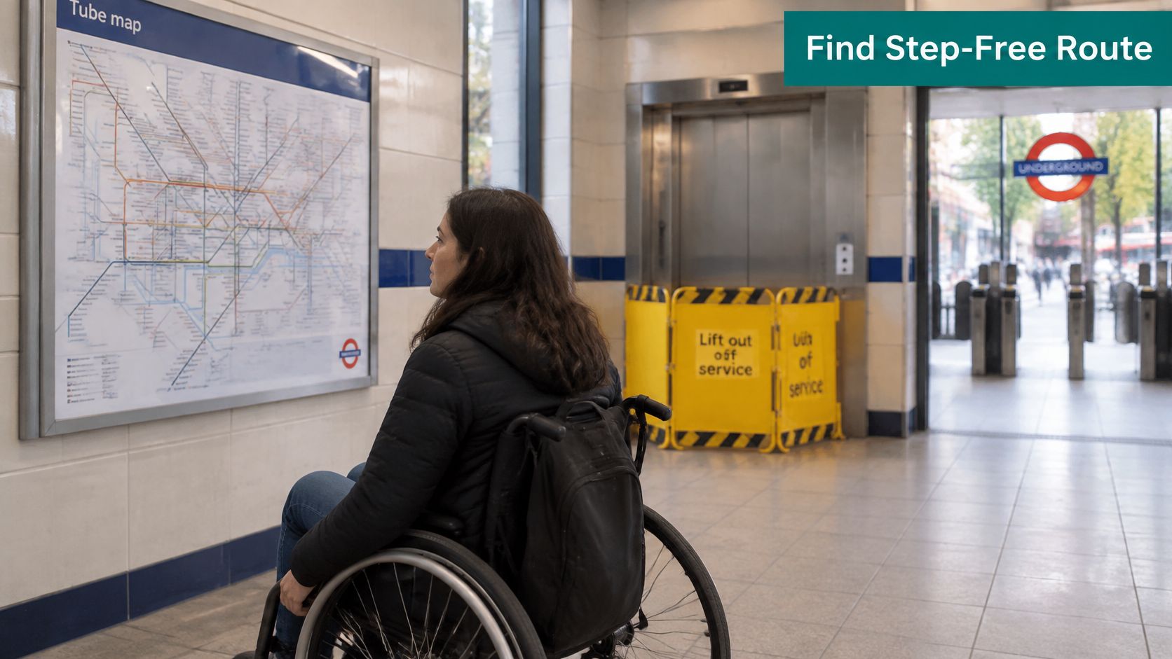
The failure many passengers hit first is treating a step-free station as if every platform, interchange and entrance were step-free today. A closed lift breaks that assumption in the ticket hall, not on the diagram you saved last week.
TfL's accessible travel policy puts step-free Underground stations at 94 of 272, about one third. That is up from 91 of 272 in 2022, when TfL's step-free press release called the share one third of the network. The policy also says station navigation is reviewed at the busiest stations and busiest times, with temporary differences passed on by staff or signs, particularly at event stations.
A constrained route, not the shortest one
- Filter by lift availability and platform access before you compare minutes. A quicker line with a dead lift isn't a candidate.
- Validate the whole chain from street to platform, including the interchange walk and the boarding position. One working lift at the entrance doesn't prove the interchange lift.
- Name a fallback before you leave. Another entrance, another interchange, or staff advice. Decide it while you still have a signal and a choice of stations.
TfL's March 2026 Commissioner's Report says staff can advise on lift and escalator availability, step-free routes, disruptions and alternatives. It also reported that 66 of 121 Underground stations beneath the surface had 4G or 5G coverage by early 2026, just over half. Live status can vanish once you're below ground. An independent analysis of TfL disruption data in that report found 567 lift-disruption records across 201 stations in an 80-day period. Lifts were unavailable for an average of 22 units at any moment, and 45 outages lasted more than a week. A static flag can't tell you which entrance works this morning.
The same report says TfL was testing a single navigation app after three accessibility trials. End-to-end station navigation is still unfinished. User research in the accessible travel policy found just over half of surveyed vision-impaired young people felt confident using the Underground, so almost half could not make full use of it. 59% of respondents ranked interchanges with other Tube lines among their top three step-free priorities. Lift-finding and wasted walking show up in that consultation as major wayfinding problems.
The clip below shows how quickly an out-of-service lift forces a new path through the station.
Three slips keep recurring. People assume a step-free station makes every platform step-free. Directions go stale during a crowd surge and nobody restates the change. Instructions omit platform distance, stair count or which lift to use. For how status should reach you before you're in the passage, see our note on real-time transit information.
Confirm Your Route Before You Leave Home
Run four checks, then stop planning and travel.
- Walk the stages on paper. Street time, entrance, interchange minutes, exit. If a leg has no number, you don't have a plan.
- Read the platform category, not only the station label. The boarding gap is the check that strands people.
- Check live lift and line status while you still have a connection.
- Pick a fallback station before you set off. I would rather lose five minutes on a second station than find the only lift failed at the gateline.
The Equality Act 2010 requires service providers, including transport operators, to make reasonable adjustments for disabled passengers. A station flagged step-free that fails at the platform doesn't meet that duty in practice. The passenger is the person left on the wrong side of the stairs. Operators also carry the cost of keeping physical hardware working in high-footfall stations where layouts change. Beacons and fixed kit need power, maintenance and re-surveys. That capital cycle is why many networks still can't offer a reliable in-station path when a lift drops out.
Waymap guides through stations and streets using only the smartphone's motion sensors fused with detailed maps. There is no reliance on GPS, Wi-Fi or installed hardware, and no pre-installed beacons to maintain. It works in underground stations without an internet connection. Transport information in the app draws on Transport for London, the Metropolitan Transportation Authority, other transport agencies and OpenStreetMap. Disruption alerts for Tube and subway lines can arrive by push notification or email, which is the check you want before the signal disappears.
On the UK rail side, the October 2024 launch at Birmingham New Street Station was the first major infrastructure-free navigation deployment on the network. The West Midlands deployment set out to support independent travel for passengers with visual impairments and mobility challenges, ease flow at a crowded station, and test a model other major stations could copy. Accuracy in indoor testing there beat GPS-based navigation, which is what you'd expect once the phone is below street level.
Static signs can't update when a lift fails. A map on the phone can, if it doesn't need the station's own hardware to keep working.
Tom Pey, founder of Waymap, is a blind accessibility technologist who built the product from that daily constraint. If you are comparing tools that don't depend on station Wi-Fi, our rundown of the best free navigation app options is the place to start.
Frequently Asked Questions About London Underground Navigation
How do I navigate the London Underground step-free?
Plan the route stage by stage, check the platform category, and confirm live lift status before you travel. The entrance, the interchange and the boarding gap each need their own yes.
Can TfL Go show whether a platform is step-free?
Yes. TfL Go can filter to step-free stations, plan routes step-free to the platform, show lift status and identify accessible toilets. Use the millimetre bands, not the station icon alone.
What separates step-free to platform from step-free to train?
Step-free to platform means no stairs, but a large step or gap may still need a ramp. Step-free to train means a smaller gap that most passengers cross unaided.
Does Waymap work in underground stations without a signal?
Yes. It runs on the phone's own motion sensors and maps, and it works underground without an internet connection. Line disruption alerts can still be set before you go below ground.
Who can I ask for help inside a station?
Staff at the ticket hall or platform can advise on lift and escalator availability, step-free routes, disruptions and alternatives. Ask for the working entrance and the boarding position, not only whether the station is step-free.
Waymap gives step-by-step guidance from the street to the platform using the phone's motion sensors and detailed maps, including where GPS and station Wi-Fi drop out. If you plan accessible Tube journeys and need a path you can re-check when a lift fails, visit Waymap and try a door-to-platform route before your next trip.
