
Inertial Navigation System Guide: How INS Works
You're inside a large hospital, phone in hand, trying to reach a clinic on another floor. Google Maps still shows the blue dot outside on the pavement, or it spins without producing useful guidance. For a wheelchair user, a blind person, or anyone carrying luggage, “you're here” is not enough. The useful question is which corridor, lift, ramp, or entrance comes next.
An inertial navigation system, or INS, offers a way to estimate movement without waiting for an external positioning signal. It uses sensors already found in a smartphone, including an accelerometer, gyroscope, and magnetometer, then combines their readings with software that models steps, direction, and location. The approach is especially relevant where GPS, Wi-Fi, and installed beacons are unavailable or unreliable. For context, see this explanation of why GPS doesn't work reliably indoors.
Why Indoor Navigation Breaks and What Steps In
Satellite navigation depends on signals travelling from orbit to a receiver on the ground. Concrete, steel, underground structures, and some modern glass materials can weaken or block those signals. Inside a complex hospital, railway station, stadium, or shopping centre, the phone may retain an outdoor position for a while, then stop updating as the user moves deeper into the building.
That creates a practical problem, not just a technical one. A map can identify the building, but it may not know whether someone has entered the correct door, reached a concourse, passed a ticket barrier, or turned into the corridor leading to the accessible lift.
An INS takes a different approach. It doesn't ask an external transmitter where the phone is. It observes how the phone moves and calculates a new position from the previous one.
The phone becomes the reference point
The accelerometer detects changes in movement. The gyroscope detects rotation, such as turning into a corridor. The magnetometer can provide a heading reference, although metal structures and electrical equipment can disturb magnetic readings. Software fuses these inputs into an estimate of walking direction and distance.
This process is called dead reckoning. A person starts from a known point, detects a step, estimates its length, updates the heading, and repeats the calculation. The system knows where the journey began and how the phone has moved since then, but it must manage accumulating uncertainty because it doesn't receive a fresh absolute position from satellites.
That distinction matters. An inertial navigation system isn't a magic replacement for every positioning technology. It's a local motion estimator, and its usefulness depends on sensor quality, movement modelling, calibration, map information, and correction methods. The rest of the engineering challenge is keeping a small error from becoming a large one during a long indoor journey.
The Core Sensors and Math Behind an Inertial Navigation System
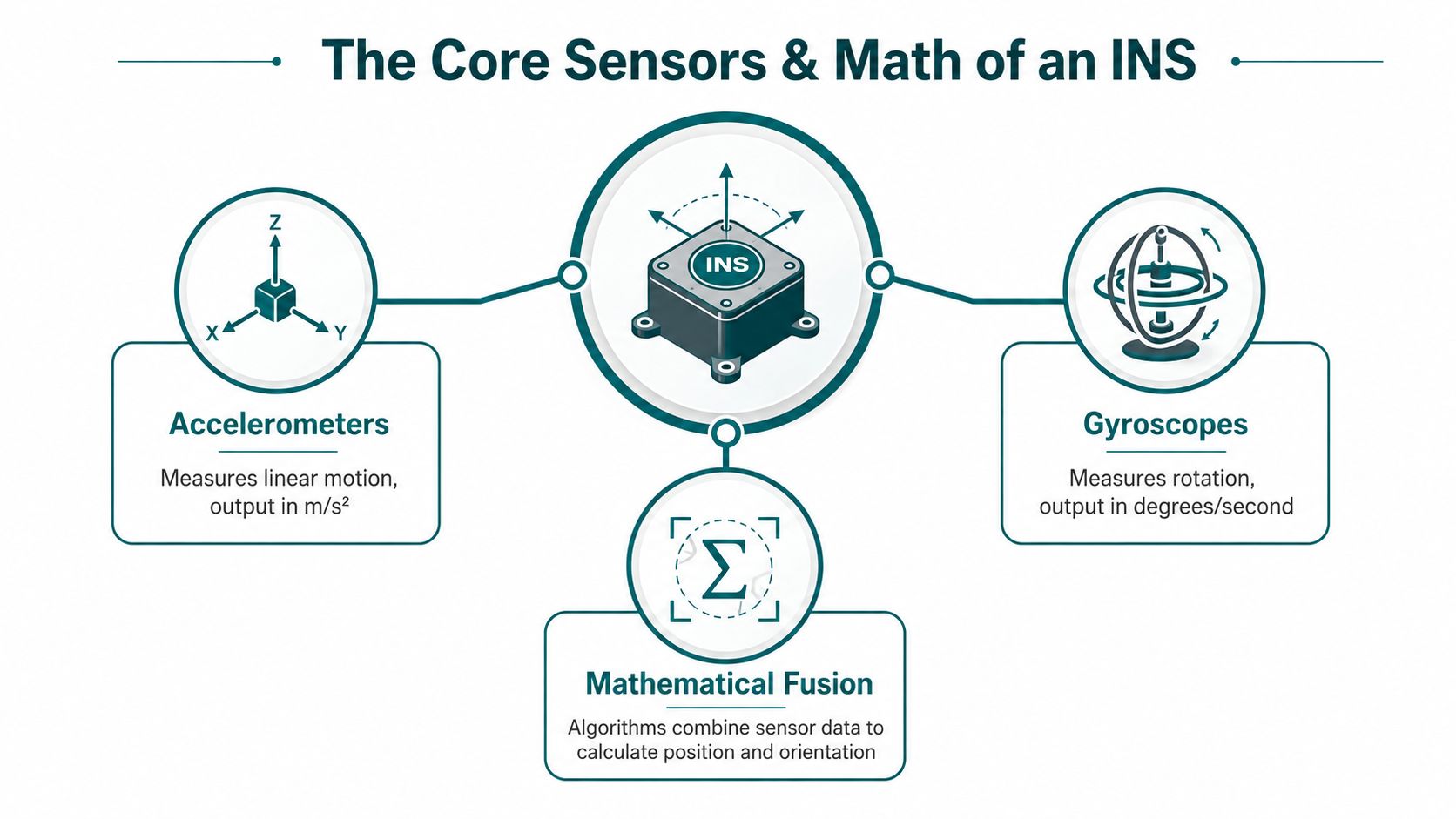
An INS begins with measurements, not a map pin. Three sensor families provide the basic observations.
- Accelerometers measure linear acceleration, including changes caused by walking and gravity.
- Gyroscopes measure rotation, helping the system identify turns and changes in orientation.
- Magnetometers sense the direction of the Earth's magnetic field and can contribute to a heading relative to magnetic north.
A phone doesn't just read one sensor and announce a location. It combines imperfect observations in a repeated calculation.
Dead reckoning in practical steps
Consider a pedestrian walking from a hospital entrance.
- Detect movement. The accelerometer signal rises and falls as the person's body moves. A step detector identifies a regular walking event rather than treating every vibration as forward travel.
- Estimate distance. The software estimates step length using factors such as cadence, acceleration pattern, and the person's movement style. A short step and a long step shouldn't produce the same position update.
- Estimate heading. Gyroscope readings reveal rotation during a turn. The magnetometer can provide an additional directional reference, but the system must account for magnetic interference.
- Update position. Each step becomes a vector. The new position equals the previous position plus that vector, with direction and distance both estimated from the sensor stream.
Engineers describe this through coordinate frames. The body frame is fixed to the phone, the local frame describes movement relative to the surrounding floor or Earth, and the global frame represents the wider map reference. A strapdown INS keeps the sensors attached to the moving body and uses mathematical transformations to convert measurements between those frames.
The calculation is often expressed conceptually as:
new position = previous position + estimated movement vector
In a full strapdown formulation, the system integrates angular rate to update orientation, transforms measured acceleration into the local frame, removes gravity, and integrates motion to estimate velocity and position. That sounds abstract, but the plain-language meaning is simple. The phone is always estimating where it is relative to where it started, rather than measuring an absolute location directly.
Waymap describes this sensor-fusion problem in practical terms through its explanation of how sensor fusion algorithms support navigation. The hard part isn't collecting readings. It's deciding which readings deserve confidence at each moment.
How Drift Happens and How Engineers Fight It
An INS drifts because integration magnifies small errors. A slight gyroscope bias can gradually rotate the estimated heading away from the true heading. An accelerometer bias can make the system believe each step is a little longer or shorter than it was. Consumer MEMS sensors also contain noise, and pedestrian movement introduces irregular patterns that don't match a clean laboratory walk.
Shuffling, sidestepping, pausing, standing still, holding a phone at different angles, and swinging an arm can all confuse a model built around ordinary forward walking. The Cambridge review reports that a simple MEMS inertial navigation system can accumulate more than 150 metres of average position error after 60 seconds, while adding magnetometer fusion reduces the average error to around 5 metres over the same interval (Cambridge technical review). The same review concludes that MEMS INS hardware can't maintain sub-metre accuracy for longer than about one minute without aiding.
Three correction tools
Engineers reduce drift by giving the calculation opportunities to correct itself.
- Zero-velocity updates, or ZUPT: When the system detects that a foot or device has become stationary, it can reset the estimated velocity towards zero. This limits the error that would otherwise carry into the next step.
- Kalman filtering: A Kalman filter combines noisy measurements with a motion model. It weighs competing estimates and updates its belief as new sensor readings arrive.
- Map matching: A digital map supplies constraints. If the estimated path crosses a wall or ignores a permitted turn, the system can favour a route that fits the known corridors, doors, stairs, and lifts.
A tuned system can perform much better than raw integration. Roke reports sub-4% drift over 2 km and hour-long indoor missions in its pedestrian research (Roke RENS pedestrian navigation). That result describes a tuned research system and shouldn't be treated as a universal promise for every phone or building.
| Error Source | Typical Effect | Mitigation |
|---|---|---|
| Gyroscope bias | Heading gradually rotates away from the true direction | Gyroscope calibration, sensor fusion, and map constraints |
| Accelerometer bias | Estimated step distance becomes too long or too short | Step modelling and periodic motion corrections |
| MEMS sensor noise | Position and orientation estimates fluctuate | Kalman filtering and smoothing |
| Shuffling or sidestepping | Step detector misclassifies movement | Personalised motion models and confidence checks |
| Standing still | Software may interpret noise as movement | Zero-velocity detection and map matching |
The correction loop is the important design feature. ZUPT supplies motion resets, the filter combines them with sensor data, and the map matcher rejects physically implausible paths. For magnetic heading limitations, Waymap's discussion of magnetometer accuracy in navigation explains why a reliable system shouldn't depend on one sensor alone.
Inertial Navigation System vs GPS and Beacons
The three technologies answer different positioning problems.
GPS works well outdoors because a receiver can calculate its position from satellite signals. It offers a useful absolute reference while the user is in open air, but concrete, steel, underground structures, and enclosed interiors can make that reference unavailable. GPS also doesn't understand the difference between a building entrance and the correct internal door.
Bluetooth Low Energy beacons place fixed radio transmitters around a venue. A phone estimates proximity or location from the signals, which can work well when the beacons are correctly positioned and maintained. The trade-off is operational. Every installed device becomes an asset that needs a known location, power management, inspection, and replacement when the venue changes.
Ultra-wideband can provide highly precise ranging, but it also depends on dedicated anchors and a designed coverage area. An INS computes movement locally from the phone's sensors, so it doesn't need a signal from a satellite, beacon, or Wi-Fi access point during the journey.
| Technology | Typical Accuracy | Infrastructure Needed | Signal Dependence | Best Use Case |
|---|---|---|---|---|
| GPS | Useful outdoor positioning | Satellite visibility and a receiver | Depends on satellite signals | Outdoor journeys and open approaches to venues |
| Bluetooth beacons | Local indoor positioning | Installed, mapped, and maintained beacons | Depends on beacon radio signals | Fixed venues with an infrastructure budget |
| UWB | Highly precise local ranging | Dedicated anchors and compatible devices | Depends on anchor signals | Controlled sites requiring precise ranging |
| Smartphone INS | Relative movement estimation | Phone sensors, software, and map data | Doesn't need an external positioning signal during movement | Indoor, underground, and rapidly changing environments |
This isn't a contest where one system wins everywhere. Operators should use GPS where outdoor coverage is dependable, beacons where fixed infrastructure is acceptable, and INS where installation speed, privacy, or signal independence matters. The practical issues behind indoor navigation beacons include not only accuracy, but also who maintains the hardware when a corridor, shopfront, platform, or entrance changes.
Smartphone INS Constraints and What They Mean for Pedestrians
A smartphone INS is not equivalent to a navigation unit built around a high-grade inertial sensor. The phone has small MEMS components designed for a broad range of everyday functions, and the operating conditions are uncontrolled.
A person may carry the phone in a pocket, hold it in front of the body, rotate it while listening to an instruction, or place it on a surface before continuing. Each posture changes the relationship between the sensor axes and the person's direction of travel. A device that is perfectly aligned at the start can be angled differently a few steps later.
Why pedestrian motion is unusually difficult
A vehicle follows a constrained path. A pedestrian can turn in place, walk sideways, pause at a door, move around a queue, or change pace to avoid another person. The software must separate intentional movement from phone handling and environmental vibration.
That's why the Cambridge review's result is important for deployment decisions. It reports that a simple MEMS-based INS can accumulate more than 150 metres of average position error after 60 seconds, while magnetometer fusion brings the average error to around 5 metres over the same period (Cambridge research on MEMS INS performance). Even with that improvement, the review says MEMS hardware alone can't maintain sub-metre accuracy for longer than about one minute without aiding.
The phone still provides useful raw material. Modern handsets expose accelerometer, gyroscope, magnetometer, and barometer data to software, allowing a navigation application to combine step detection, orientation estimation, floor changes, and map constraints. The resulting experience depends less on a single sensor reading than on how well the application interprets the whole movement pattern.
Engineering reality: A phone can estimate a pedestrian's movement without GPS, but unaided integration shouldn't be confused with reliable, door-level wayfinding over an unlimited distance.
For pedestrian navigation, the software must learn or estimate stride characteristics, recognise turns, detect pauses, and apply corrections when the path reaches a known corridor or decision point. Waymap's explanation of the mobile phone's position and sensor-based movement illustrates why the handset's placement and movement pattern matter as much as the sensor specification.
Performance Metrics and Deployment Decisions for Venues
Procurement teams need more than the phrase “high accuracy”. They need to know whether a user will receive the correct instruction at a lift, platform, ward entrance, ticket gate, or shopfront.
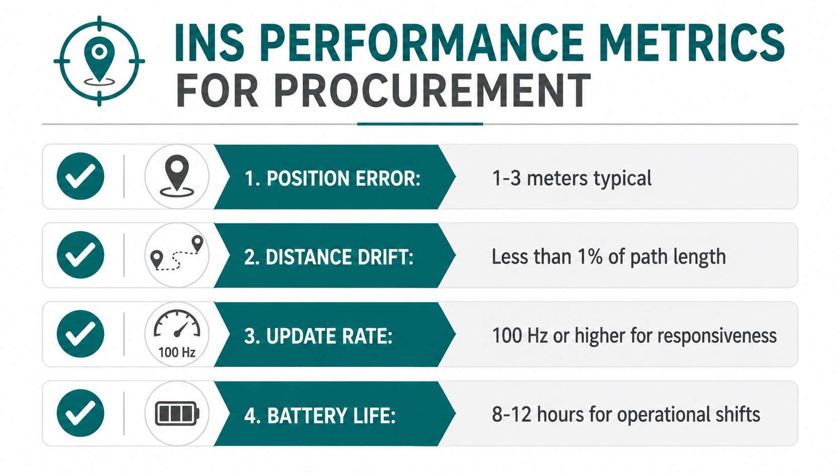
Four measures make the discussion concrete:
- Position error: The distance between the estimated location and the person's real location.
- Distance drift: The accumulated error expressed relative to the path travelled.
- Heading accuracy: How closely the estimated direction matches the person's actual direction.
- Time to first fix: How quickly the system establishes a usable position after the user enters or resumes a journey.
The Cambridge review reports INS drift of 2% to 6% of distance over multi-floor walks (Cambridge review of inertial navigation). Roke reports sub-4% drift over 2 km and hour-long indoor missions (Roke RENS performance information). These figures belong to their respective research contexts, so a venue operator should validate performance on its own routes, phone types, floor layouts, and user movements.
Match the metric to the decision
An NHS estates team may ask whether a visually impaired visitor can follow guidance through a complex hospital without adding permanent hardware to every corridor. A transport operator may focus on whether a passenger can move from a station entrance to the correct platform and whether the system remains useful around gates, stairs, and underground passages.
Accessibility regulators and venue leaders may also consider duties under the Equality Act 2010, the Americans with Disabilities Act, BS 8300, PAS 78, the UN Convention on the Rights of Persons with Disabilities, or BS EN 17210, depending on jurisdiction and project scope. These frameworks don't prescribe one navigation technology. They do make inclusive access a design and service consideration rather than an optional interface feature.
The central trade-off is straightforward. Infrastructure-free INS shifts expenditure away from installing and maintaining physical transmitters and towards mapping, software, testing, calibration, and operational monitoring. The right choice depends on whether the venue can maintain hardware, how often its layout changes, and how exact the guidance must be at the final destination.
How Waymap Applies Inertial Navigation in Real Venues
Waymap applies smartphone sensor fusion to pedestrian wayfinding rather than to vehicle or aircraft control. Its SmartStep capability uses the phone's accelerometer, gyroscope, magnetometer, and barometer to estimate steps, direction, heading, and position without relying on GPS, Wi-Fi, or installed hardware.
The operational question is where that approach helps a person move through a complicated place.
- Lord's Cricket Ground: Bowl seating, stairways, entrances, and changing sightlines can make a visual route difficult to interpret. Turn-by-turn guidance can connect a visitor to a specific seating area or point of interest without requiring the user to identify each landmark independently.
- WMATA Washington Metro: A journey may include the station entrance, fare gates, concourses, stairs, lifts, and platform access. Infrastructure-free positioning can support visually impaired riders through these connected spaces without placing a beacon on every pillar or decision point.
- SBS Transit: A bus journey can include outdoor walking, a bus stop, metal shelters, and an indoor destination. A sensor-based approach can maintain a consistent movement model across the transition between street-level and enclosed environments.
- Westfield London: A large retail centre can involve multiple floors, entrances, car parks, escalators, lifts, and changing shop locations. A digital wayfinding layer can be updated as points of interest change, instead of depending on a fixed network of physical transmitters.
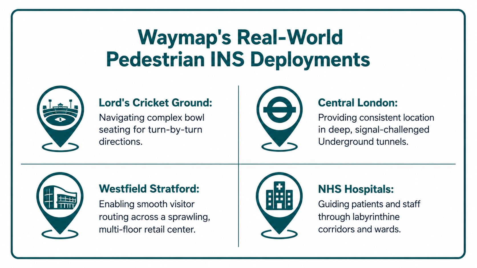
These examples show why pedestrian INS needs more than a sensor specification. A venue must represent doors, platforms, barriers, lifts, stairs, ramps, accessible routes, and points where a person must make a decision. The application then has to translate that model into clear audio or visual instructions that match how a person moves.
Waymap's approach is particularly relevant where physical infrastructure would be difficult to deploy across a high-footfall environment or where frequent layout changes would make installed hardware burdensome. It was founded by Dr Tom Pey, a blind accessibility technologist, and its product is designed around hands-free, step-based guidance for indoor, outdoor, and underground journeys.
Frequently Asked Questions About Inertial Navigation Systems
Does a smartphone INS work without internet?
A smartphone INS can work without an active GPS, Wi-Fi, or beacon signal during movement. It uses the phone's motion sensors and stored map information, although an application may still need connectivity for setup, map updates, or other online services.
How accurate is an unaided pedestrian INS?
An unaided pedestrian INS accumulates error over time and distance. The Cambridge review found more than 150 metres of average error after 60 seconds for a simple MEMS system, while magnetometer fusion reduced the average error to around 5 metres over the same interval (Cambridge findings on MEMS inertial navigation).
What's the difference between an INS and an IMU?
An IMU is the sensor package, while an INS is the navigation system built around those measurements. An IMU generally supplies acceleration and rotation data; an INS processes those readings to estimate orientation, velocity, and position.
Does an INS work underground or in lifts?
An INS can estimate movement underground and during lift travel because it doesn't require satellite visibility. Floor changes, pauses, turns, and unusual movement still require careful modelling and map constraints.
Is INS cheaper than Bluetooth beacons?
INS can reduce the need for installed hardware, but it shifts the work towards software, mapping, testing, and maintenance. Beacons may suit a stable venue with an infrastructure budget, while INS may suit a site where installation or hardware upkeep is difficult.
Is an INS safe for blind users in emergencies?
An INS should support emergency wayfinding, not replace venue emergency procedures or human assistance. Blind and partially sighted users need clearly tested routes, accessible alerts, reliable map data, and a fallback process when conditions change.
Waymap provides infrastructure-free pedestrian navigation using smartphone motion sensors, map data, and step-aware guidance for indoor, outdoor, and underground venues. If your organisation is evaluating an inertial navigation system for hospitals, transport networks, campuses, stadiums, or shopping centres, visit Waymap to discuss a route-based deployment.
