
Indoor Position System: How It Works and Where It Helps
You've arrived at a busy railway station and need to reach the correct platform, take a lift, then find the right carriage. For a blind passenger, signs, crowds, changing announcements and gaps in static maps can turn that route into a series of unanswered questions. An indoor position system can help by locating a person inside the station and providing step-by-step directions to specific places.
For operators, the challenge isn't finding a technology that reports a precise position. It's keeping directions usable from the entrance to the passenger's actual destination, including when routes change or equipment is out of service. The difference between a convincing demonstration and a dependable service lies in how well the system supports the whole journey.
What Is an Indoor Position System
An indoor position system estimates where a person or device is inside a building and uses that location to support navigation. Unlike outdoor GPS, which depends on signals from satellites, indoor positioning can use smartphone motion sensors, Bluetooth beacons, Wi-Fi signals, magnetic patterns or a combination of methods. Satellite signals often weaken or become unreliable inside enclosed spaces, where walls, roofs and the structure of a building obstruct reception.
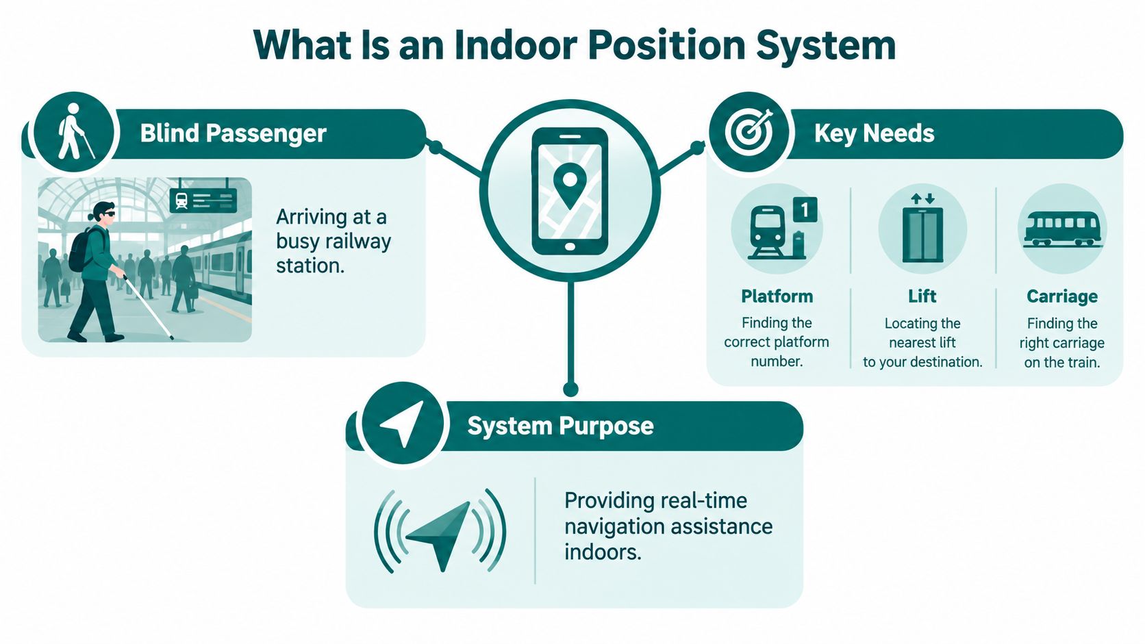
A standard map app can show a building outline or a venue's points of interest. An indoor navigation system adds a user's changing position and a route through the mapped environment. Depending on the technology and map detail, directions can lead to a platform, lift, ticket counter, toilet, entrance or specific door rather than stopping at a building's approximate location.
That distinction matters for accessibility. A route may need to avoid stairs, identify a lift, explain a change in direction and continue to the point where help is available. The UK Parliament's evidence on accessible indoor navigation identified railway stations as a major use case and described potential benefits for people with vision impairments, cognitive impairments and print disabilities. It also connected predictable wayfinding with easier access to public transport and employment. The parliamentary evidence on indoor navigation and accessibility
A useful test: Does the system guide someone to the destination they need, or does it only show where they are?
The same parliamentary submission cited Deloitte's estimate that approximately 25% of journeys made with assistance from a navigation application would involve indoor journeys by 2022, and reported that the indoor-navigation market was estimated at nearly £30.5 billion in 2022. Those figures are historical estimates, but the policy point remains relevant: indoor navigation matters where satellite positioning can't reliably support access.
Core Technologies Behind Indoor Positioning
Indoor positioning systems use different methods to estimate location, and each comes with practical trade-offs. Some require installed equipment; others rely on a smartphone's sensors and a digital map. Many systems combine inputs because no single signal provides dependable guidance in every building.
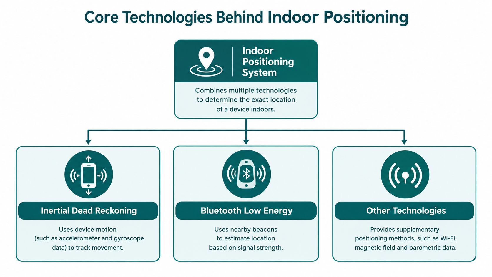
How the main methods estimate location
- Inertial dead reckoning: A smartphone's accelerometer and gyroscope detect movement and changes in direction. Like counting steps while keeping track of which way you're facing, this estimates how a person moves from a known starting point. It can work without installed venue hardware, but small errors can accumulate over a long route. Waymap's overview of inertial measurement units describes the sensors used to measure motion.
- Bluetooth Low Energy: Installed beacons broadcast signals that nearby phones can detect. The system uses those signals to estimate location. Beacons can support detailed positioning, but venue teams must install, monitor and maintain the hardware.
- Wi-Fi positioning: A system can use signals from access points already in a building, but coverage and reliability depend on the network layout, signal conditions and the devices being used.
- Ultra-wideband: UWB uses short-range radio signals and dedicated hardware for precise ranging. Its suitability depends on the required coverage and the cost and complexity of installing supporting equipment.
- Magnetic fingerprinting: A system records local magnetic patterns and uses them to recognise areas of a building, much like identifying a room by its distinctive signature. It can complement other positioning inputs, but those fingerprints need to be collected and maintained.
- Visual markers: A camera can recognise a known image or landmark. This can help establish position at a particular point, but a marker-based approach depends on the user reaching a recognisable view.
The University of Glasgow reported that combining smartphone inertial sensors, pedestrian dead reckoning, magnetic fingerprinting, crowd-sensing and particle filtering increased positioning accuracy from 80.49% to 96.32% in its research. The Glasgow study on combined indoor-positioning methods illustrates why system designers combine methods: one can help correct the weaknesses of another. For a separate example of how location technologies are discussed in security contexts, see this overview of GPS tracking for event security.
The design decision isn't whether a technology can work. It's whether its coverage, upkeep and behaviour suit the building and the journey people need to make.
How Accurate Are Indoor Positioning Systems
A system can pin a user to within half a metre in a test corridor and still lose them at the first crowded concourse. Published accuracy figures describe what happened under specific conditions, and the gap between those conditions and a live venue is where deployments succeed or fail.
A Cambridge pedestrian-localisation study tracked users through an 8,725-square-metre building spanning three floors, holding position within 0.5 metres for 75% of the time and within 0.73 metres for 95% of the time. Bluetooth Low Energy research at the University of Leeds reported an average error of approximately 0.6 metres across a 3-metre line-of-sight test range, and in a static trial its beacon tracker collected 78,440 samples with reported accuracy above 99% in that scenario. The University of Leeds Bluetooth Low Energy study
These results are genuine, and they are also conditional. A 3-metre line-of-sight range says little about behaviour behind a structural column, and a static test says little about guiding someone through a moving crowd, around temporary barriers, up a lift and to the correct door. When I assess vendor claims, I ask three questions: what was measured, where was it measured, and does the test route look anything like the journeys people make? An accuracy figure quoted without its test setup is closer to a marketing line than a specification.
Comparing the evidence by method
| Technology | Reported accuracy | Environment | Source |
|---|---|---|---|
| Pedestrian localisation | Within 0.5 metres for 75% of the time; within 0.73 metres for 95% | 8,725-square-metre building spanning three floors | Cambridge pedestrian-localisation study |
| Bluetooth Low Energy beacon tracker | Average error of approximately 0.6 metres over a 3-metre range; above 99% in the reported static test | Line-of-sight experiments and a static scenario | University of Leeds research |
| Smartphone inertial sensors | Median error within 5 metres | Inertial measurements alone | University of Edinburgh study |
The Edinburgh result shows why inertial positioning alone drifts: errors in heading, stride length and phone orientation accumulate over distance, so a 5-metre median error is an average across a test, and individual users will see worse. Waymap's discussion of indoor positioning accuracy examines why figures like these need to be read alongside their test conditions.
Accuracy on commissioning day is also a snapshot. Radio environments shift as layouts change, crowd densities rise and hardware ages. Operators who keep guidance reliable treat positioning quality as something maintained: monitored against real journeys, re-surveyed when the building changes and re-tested on the routes that matter.
Why Accuracy Alone Does Not Guarantee an Accessible Journey
A system can locate someone precisely and still fail to get them where they need to go. Positioning accuracy says where the device appears to be; accessible journey completion depends on whether the route reflects the environment and the person's access needs.
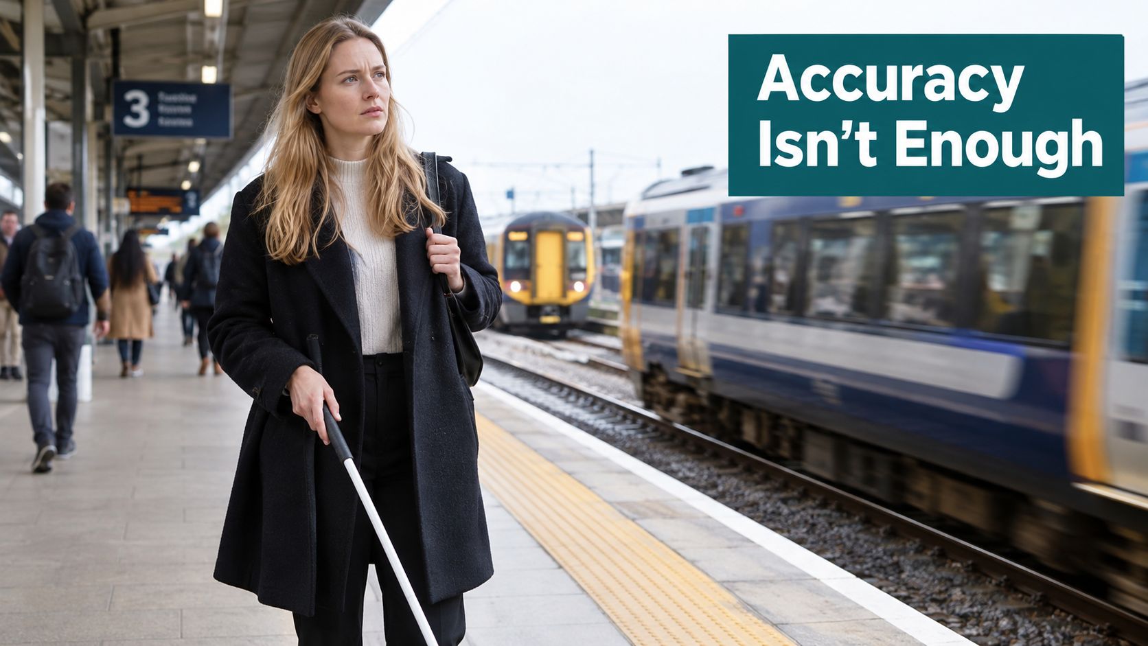
An RNIB survey of 1,197 blind and partially sighted people found that more than one in three couldn't make the train journeys they wanted or needed to make. It also found that 82% struggled with the gap between train and platform edge, while only 44% were reliably met by assistance staff. Reported difficulties included finding a carriage (77%), finding a suitable seat (79%), locating toilets (57%) and understanding poor-quality announcements (55%). The RNIB survey on getting around
Those problems aren't solved by a location pin alone. If a digital map omits a lift outage, accessible entrance, platform gap, temporary closure or assistance point, the route may be technically well-positioned but practically unusable. The same applies when a system gives an instruction too early or fails to continue after a change in level.
Measure the whole route
For a station or large venue, evaluate whether someone can complete a journey across its real decision points:
- Entry and access: Can the person reach the entrance and use an appropriate route into the building?
- Vertical movement: Does the map identify step-free paths and usable lifts?
- Key destinations: Can the system guide people to platforms, carriages, toilets, seating and service counters?
- Operational changes: Are closures, diversions and temporary obstructions reflected in the route?
- Arrival and handover: Does guidance continue to the destination or point where assistance is available?
For venue organisers planning inclusive visits, practical details such as access at an Abingdon live music venue can help show how much the visitor experience depends on more than locating the building. Our guide to navigation for blind and low-vision users explores why directions need to support the complete journey, not just report position.
Measure the task, not just the signal: Test whether people can independently reach the destination they set out to find.
Infrastructure-Free Versus Infrastructure-Dependent Systems
The main deployment choice is whether positioning relies on installed hardware or on the user's smartphone sensors and a mapped environment. Neither approach is automatically right for every venue. The better fit depends on how much infrastructure the operator can maintain and how often the physical environment changes.
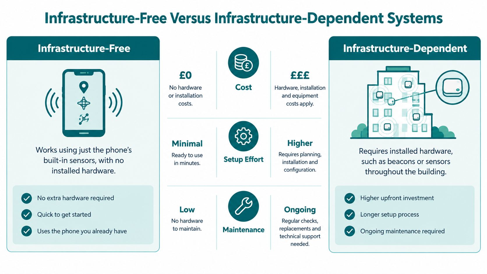
Infrastructure-dependent systems use equipment such as Bluetooth beacons, sensors or other fixed anchors. This can be a sensible choice where the operator needs to control a defined area and can assign responsibility for installation and ongoing checks. The trade-off is operational: hardware needs to be tracked, tested and maintained, and gaps in coverage can become apparent when equipment fails or a building changes.
Infrastructure-free systems use smartphone sensors and digital maps instead of requiring installed positioning hardware throughout the building. They can reduce physical maintenance and make route updates less dependent on visiting each location. Their performance still needs validation: map quality, sensor behaviour, route design and user needs all affect whether guidance works in practice.
| Decision point | Infrastructure-free approach | Infrastructure-dependent approach |
|---|---|---|
| Physical hardware | Uses phone sensors and maps, without installed positioning hardware | Requires beacons, sensors or other fixed equipment |
| Upkeep | Route and map information still need an owner and an update process | Teams must maintain both route information and the deployed hardware |
| Changing layouts | Digital route updates can avoid a hardware visit, but the map must still be corrected | Changed layouts may require hardware checks as well as map updates |
| Best fit | Venues seeking to avoid hardware across large or changing environments | Sites where fixed equipment is appropriate and ongoing maintenance is resourced |
The regulatory context makes maintenance a service issue, not only a technical one. There's no single UK standard governing indoor navigation; public bodies must meet the Public Sector Bodies (Websites and Mobile Applications) Accessibility Regulations 2018, while the Equality Act 2010 requires reasonable adjustments. UK rail assistance demand rose to more than 1.6 million bookings in 2024–25, an 18% annual increase, but only 78% of passengers received all the help they'd booked. The UK regulatory and standards context for indoor navigation
For operators weighing options, navigation without GPS is a useful starting point for understanding infrastructure-free approaches. The decision should include ownership of maps, updates and fallback procedures, not only a comparison of installation costs.
Real-World Applications Across Transport, Campuses, and Venues
The value of an indoor position system changes with the setting. A passenger may need to reach a platform or lift; a student may need a particular room; a visitor at a stadium may need an entrance, seat or accessible facility. In each case, the system needs a usable map and directions that match the environment.
Railway stations are a clear use case because a journey can pass through entrances, ticketing areas, barriers, lifts and platforms before reaching a particular carriage. Yet access barriers affect travel behaviour: analysis of the 2024 National Travel Survey found that 62% of disabled people used trains less than once a year or never, compared with 33% of non-disabled people. The same analysis reported that disabled adults made 29% fewer journeys overall than non-disabled adults. NatCen's analysis of disabled people's transport behaviour
At universities, indoor navigation can help people find teaching rooms, reception desks, libraries and facilities in buildings whose layouts may be unfamiliar to new students and visitors. Shopping centres and stadiums present a different challenge: multiple levels, busy concourses, entrances and services can make it difficult to turn a general venue map into a route to a precise destination.
Match the system to the venue
- Transport operators need routes that connect stations and interchanges with platforms, lifts and accessible exits. A position estimate that stops at the concourse won't answer whether a passenger can reach the place they need.
- Universities need clear destinations and routes through buildings, particularly where people are unfamiliar with the campus or a room has moved.
- Retail and visitor venues need routes to shops, seating, toilets and service points, with a process for updating information when temporary layouts change.
- Stadiums and event sites need directions that reflect entrances, seating areas and facilities, while keeping maps aligned with operational changes.
Named organisations and venues are useful in a deployment review only when the actual implementation and its outcomes can be verified. That's why a decision-maker should ask each vendor for a relevant deployment reference, its scope and the specific operational constraint it addressed, rather than assuming a familiar venue name proves a system's suitability. Visitors planning to find their way around Edinburgh can also see how a city-level map helps orient a journey, while indoor navigation must continue into the building itself.
Regulatory Drivers and the Case for Accessible Navigation
UK service providers have a legal duty under the Equality Act 2010 to make reasonable changes when disabled customers would otherwise face a substantial disadvantage. Government guidance groups reasonable adjustments into changes to how services are delivered, modifications to the physical environment, and auxiliary aids or services, such as accessible information, specialist software or additional staff support. Disabled customers can't be charged for reasonable adjustments. The government's disability guidance for service providers
For public bodies, the Public Sector Bodies (Websites and Mobile Applications) Accessibility Regulations 2018 also apply to digital services. The practical implication for a venue is that a digital route should be accessible and dependable, not merely available. Parliamentary evidence on accessible indoor navigation also noted that the updated British Standard for accessible and inclusive built environments recognised audio navigation as a wayfinding method. Waymap's overview of UK accessibility standards
Decide who owns route accuracy
No single technology satisfies every accessibility need, and digital guidance doesn't replace reasonable physical adjustments or staff support. It can, however, provide information through an alternative format and help people move through complex environments. Operators still need to decide who updates maps when a lift is out of service, a temporary barrier appears, a route closes or crowd management changes access.
Governance question: Who can approve a route change, and how will people using the system know the route is current?
That question belongs in procurement and operations planning. A system with strong positioning but no clear process for checking route information can direct users along a route that no longer exists. A lower-maintenance approach may ease hardware work, but it still needs an accountable map owner, accessibility testing with disabled passengers and a fallback when a route can't be followed.
Regulatory responsibility therefore doesn't end with purchasing a navigation product. Operators should assess whether routes reflect step-free access, usable facilities, accessible information and the way the venue runs. Technology supports access when its information stays aligned with the physical environment and when staff know what to do if conditions change.
Frequently Asked Questions About Indoor Positioning
How does an indoor position system work without GPS?
An indoor position system estimates location using signals or movement data available inside a building, where satellite reception can be unreliable. Depending on the design, it may use smartphone motion sensors, Bluetooth beacons, Wi-Fi, magnetic patterns or a combination of inputs.
Does indoor positioning work on any smartphone?
Not every indoor positioning method works on every smartphone. Sensor-based approaches depend on compatible device sensors, while beacon, Wi-Fi, camera or UWB features may depend on hardware, permissions and the system design. Ask a provider to identify supported devices and test the actual phones your visitors use.
How accurate is indoor positioning in practice?
Accuracy depends on the technology, building and test conditions. Published UK research includes sub-metre results in particular trials, while an Edinburgh study reported a median error within five metres using inertial measurements alone. Neither result guarantees the same performance on every route, so test critical destinations in the venue.
How much does an indoor positioning system cost to deploy?
Deployment cost depends on the chosen technology, map preparation, installation, integration and ongoing maintenance. A system that needs installed hardware has physical equipment and upkeep to budget for; an infrastructure-free approach avoids that hardware but still requires accurate maps, route governance and testing. Ask suppliers to explain total ownership costs and responsibilities, not just the initial price.
How does indoor navigation help disabled passengers?
Indoor navigation can provide accessible directions to destinations such as platforms, lifts, toilets and exits, helping people manage complex routes. The need is substantial: the National Centre for Accessible Transport reports that 92% of disabled people face at least one barrier on at least one mode of transport, and 68% have more than one access need. It also reports that disabled people make 38% fewer transport journeys than non-disabled people, while 79% travel less often because of barriers. The National Centre for Accessible Transport report on barriers
Does indoor positioning need an internet connection?
Internet access requirements depend on the product and how it handles maps, location processing and updates. Ask whether navigation can continue when connectivity is unavailable, which features require a connection, and how venue teams publish route changes.
How is indoor positioning different from outdoor GPS navigation?
Outdoor GPS navigation estimates position using satellite signals, while indoor positioning uses methods suited to buildings and enclosed spaces. Many journeys connect both environments, so operators should check whether guidance continues across the transition into a station or venue.
Waymap provides audio navigation using smartphone motion sensors and detailed maps, guiding people indoors, outdoors and underground without relying on GPS, Wi-Fi or installed beacons. To assess whether an infrastructure-free approach fits your venue and accessibility requirements, visit Waymap.
