
Georeferencing a Map: A Guide for Venues & Transit
A visitor is standing outside the wrong entrance, a passenger has reached the station concourse but can't find the accessible platform route, or a facilities team has published a polished venue map that knows nothing about the position of its doors. In each case, the visible problem looks like wayfinding. The underlying problem is often simpler and more fundamental: the map has never been tied properly to the place it represents.
Georeferencing a map gives a digital image or drawing a real-world position. For venues, campuses and transport networks, that spatial foundation affects route accuracy, accessibility information, asset updates and the cost of maintaining navigation over time. A static floor plan can show corridors, platforms and rooms. A georeferenced map lets software relate those features to coordinates, movement and other spatial data.
What Is Georeferencing and Why Does It Matter
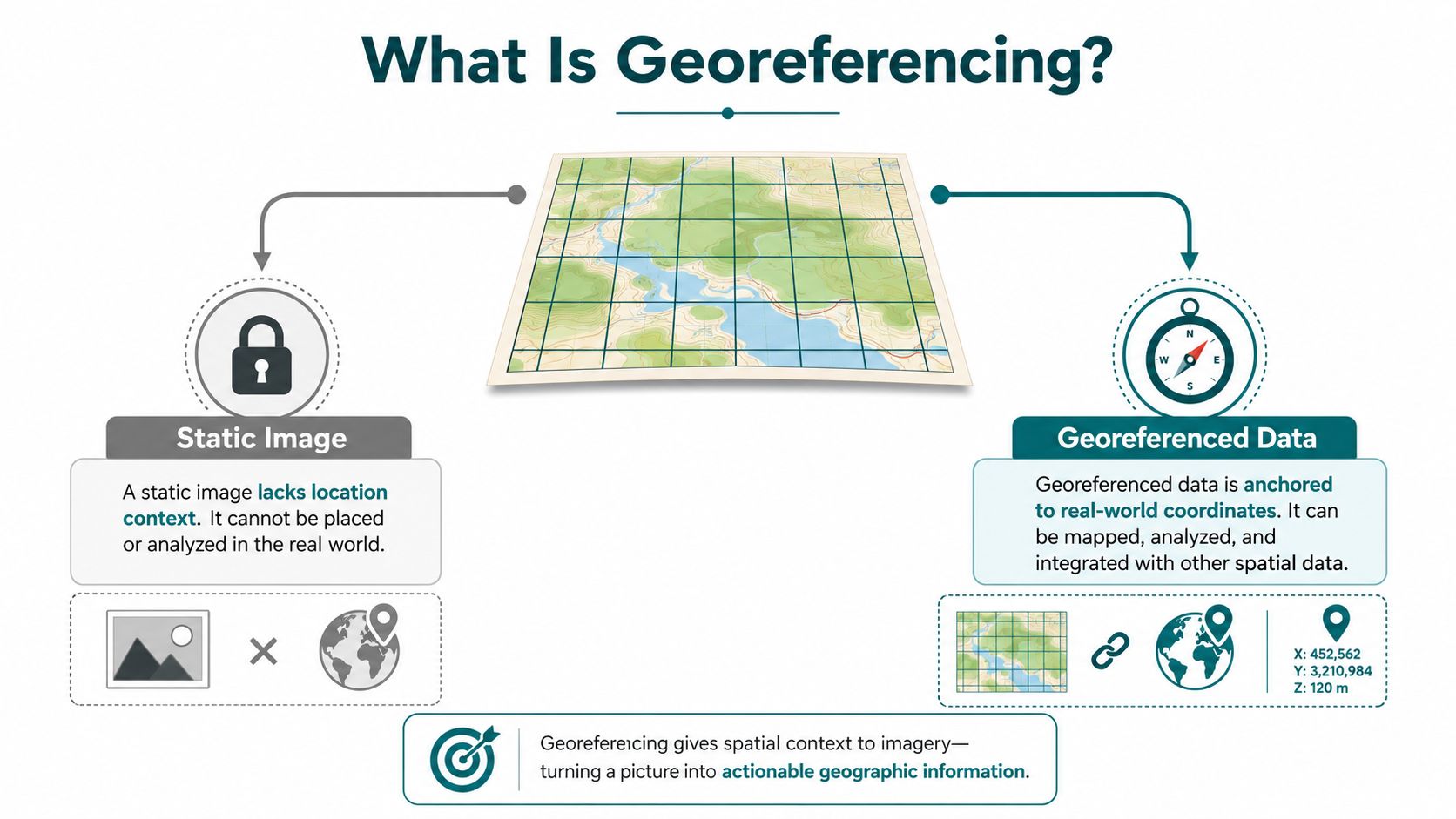
Georeferencing means registering a raster map, scanned plan or other image within a geographic framework so that every relevant position on the image corresponds to a position in the world. A scan of a station plan may show a ticket hall and platforms, but without georeferencing it remains a picture. It has no dependable relationship with a user's location, a door, a lift or a platform entrance.
The distinction resembles the difference between a photograph of a building and an architectural blueprint linked to a surveyed site. The photograph can be useful for recognition, but it can't answer whether a person is standing at the north entrance or approaching the accessible route from a particular corridor. A spatially aware map can support that relationship because its pixels and features are anchored to coordinates.
Why the coordinate framework matters
In Great Britain, Ordnance Survey's modern georeferencing framework is built on the British National Grid and OSGB36, a single national datum. Its accumulated error is only about 20 metres over the length of Great Britain, and OS identifies it as the coordinate reference system used on all OS maps. The framework was created through a national retriangulation campaign that ran from 1935 to 1962, replacing earlier principal-triangulation data with one national datum and reference system. Ordnance Survey's guide to coordinate systems in Great Britain explains how the system provides a consistent basis for positioning across the country.
The OS framework uses a Transverse Mercator approach and divides Great Britain into 100 km squares, identified with two letters, then into smaller grid squares. That structure matters because a venue map, an external approach route and a wider transport map can be managed within a shared spatial reference instead of being treated as unrelated graphics.
Location services are another part of the wider digital foundation, particularly when a map must respond to a device's position. Waymap's explanation of how location services work provides useful context for teams assessing the relationship between map data and navigation.
What this enables operationally
A correctly referenced map can support:
- Route calculation, by placing doors, paths, platforms and points of interest in a common spatial model.
- Layer management, so operators can combine maps with entrances, lifts, closures, boundaries or asset data.
- Position-aware guidance, where a device can compare a user's estimated position with the mapped environment.
- Controlled updates, because a changed doorway or platform can be amended as a spatial feature rather than redrawn as an isolated image.
Georeferencing doesn't make an inaccurate source plan accurate. It gives the plan a geographic relationship. The quality of that relationship determines whether later navigation, accessibility and operational decisions rest on solid ground.
How Do You Georeference a Map Correctly
A reliable georeferencing workflow prepares the source, selects the target coordinate reference system, places control points, then calculates and tests the transformation. Software menus differ, but these decisions determine whether the resulting layer can support infrastructure-free navigation, accessibility checks and future operational updates.
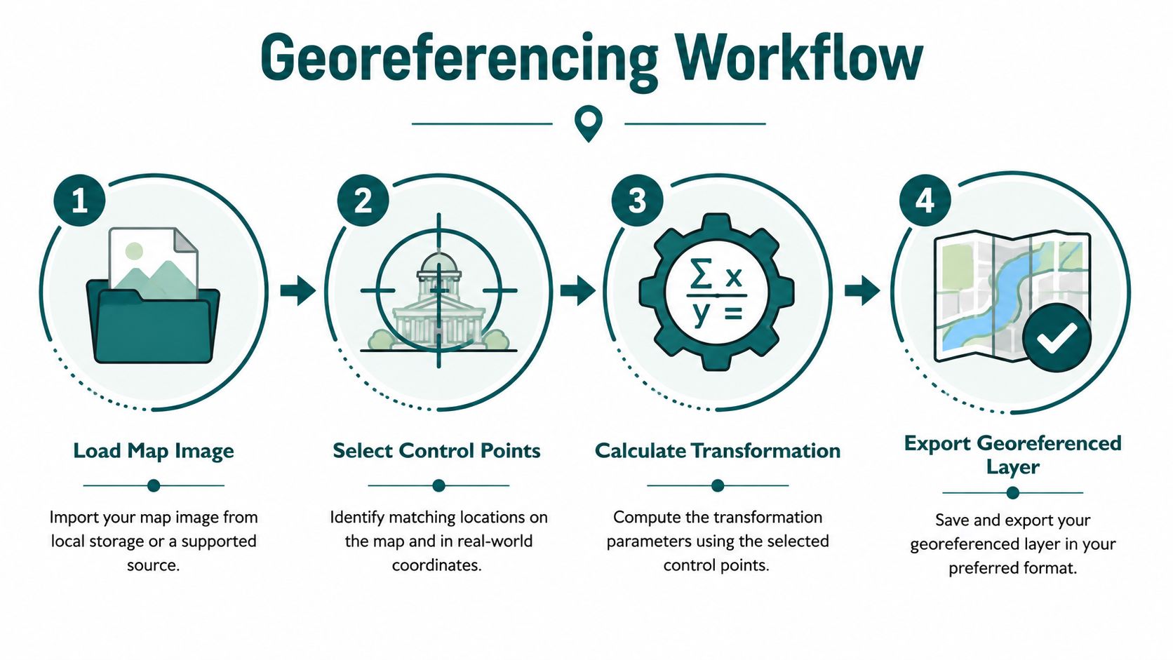
1. Prepare the source map
Begin with the best available scan or raster export. Keep the original file, record its provenance, and document the map's scale, date, orientation and intended extent. A historic sheet, current external site plan and indoor floor plan can require different treatment. A clean-looking scan does not guarantee reliable geometry. Paper stretches, folds shift lines, and local drawings may follow conventions that do not match a national projection.
Historic Ordnance Survey sheets often use known map locations as control points. The Living with Machines project used the four corners of each sheet because National Library of Scotland metadata supplied predicted corner locations for every map. That method works when the neatline is clear and its expected positions are known. How the Living with Machines project georeferenced historic OS maps explains why raster images need to be registered within a geographic framework.
2. Select the target CRS
For many UK projects, the practical target is the British National Grid, EPSG:27700. Choose the reference system used by surrounding authoritative data and the operational area. A venue with an outdoor campus, station entrance and underground interchange may need more than an image overlay. Define the spatial model before placing control points, especially if the map will support routes to accessible entrances, lifts or platforms.
Ordnance Survey describes ground control points as real-world coordinates matched to pixel coordinates. Its georeferencing specification lists points in the order bottom-left, bottom-right, top-right and top-left, and includes a Transverse Mercator projection definition. The OS technical specification for georeferencing helps teams exchange world files and other georeferencing metadata without leaving the coordinate framework implicit.
3. Place control points that can be found twice
A control point must be identifiable in both the source map and the reference layer. Suitable candidates include building corners, road junctions, bridge ends and other stable, sharply defined features. Avoid tree canopies, vague wall edges and symbols whose centre depends on individual interpretation.
The National Library of Scotland recommends at least three control points, while additional points can produce a better fit. National Library of Scotland georeferencer guidance for placing and editing control points explains how points can be moved or deleted before saving the result. Distribute points across the whole map rather than clustering them near one entrance. A cluster can create a convincing local fit while the opposite side of the sheet shifts.
Practical rule: A point is valuable only when another operator can identify the same location without guessing.
4. Calculate the transformation and inspect the error
The transformation resamples source pixels onto the target projection grid. Review residual error for individual points, not only the overall visual overlay. A map can align at one corner and still fail at another.
Use RMSE, or root mean square error, as one part of the quality check. Ordnance Survey provides source-scale benchmarks showing why one universal tolerance is unsafe. OS mapping at 1:1250 typically has around 0.5 m RMSE absolute accuracy, while 1:2500 resurveyed mapping has about 1.1 m absolute accuracy. OS accuracy guidance distinguishes absolute accuracy from relative accuracy, which concerns distances between nearby features.
The final test is operational. Overlay the result against dependable reference features, inspect the edges, and check locations that affect users, including the accessible entrance, lift landing, platform threshold and reception desk. If the source cannot support the required precision, record that limitation rather than presenting the layer as exact. This protects route quality, accessibility compliance under the Equality Act 2010 and the budget from corrections after deployment.
For complex built environments, spatial capture can supplement conventional plans. Waymap's material on 3D LiDAR scanning is relevant when an operator needs a richer representation of changing indoor and outdoor spaces.
What Are the Common Georeferencing Mistakes to Avoid
A map can appear correctly positioned on screen and still send people to the wrong entrance, gate line or platform access point. The cost usually begins before the GIS export, with an unsuitable source, an undocumented reference layer or an assumption that has not been challenged.
A visually good fit can still be wrong
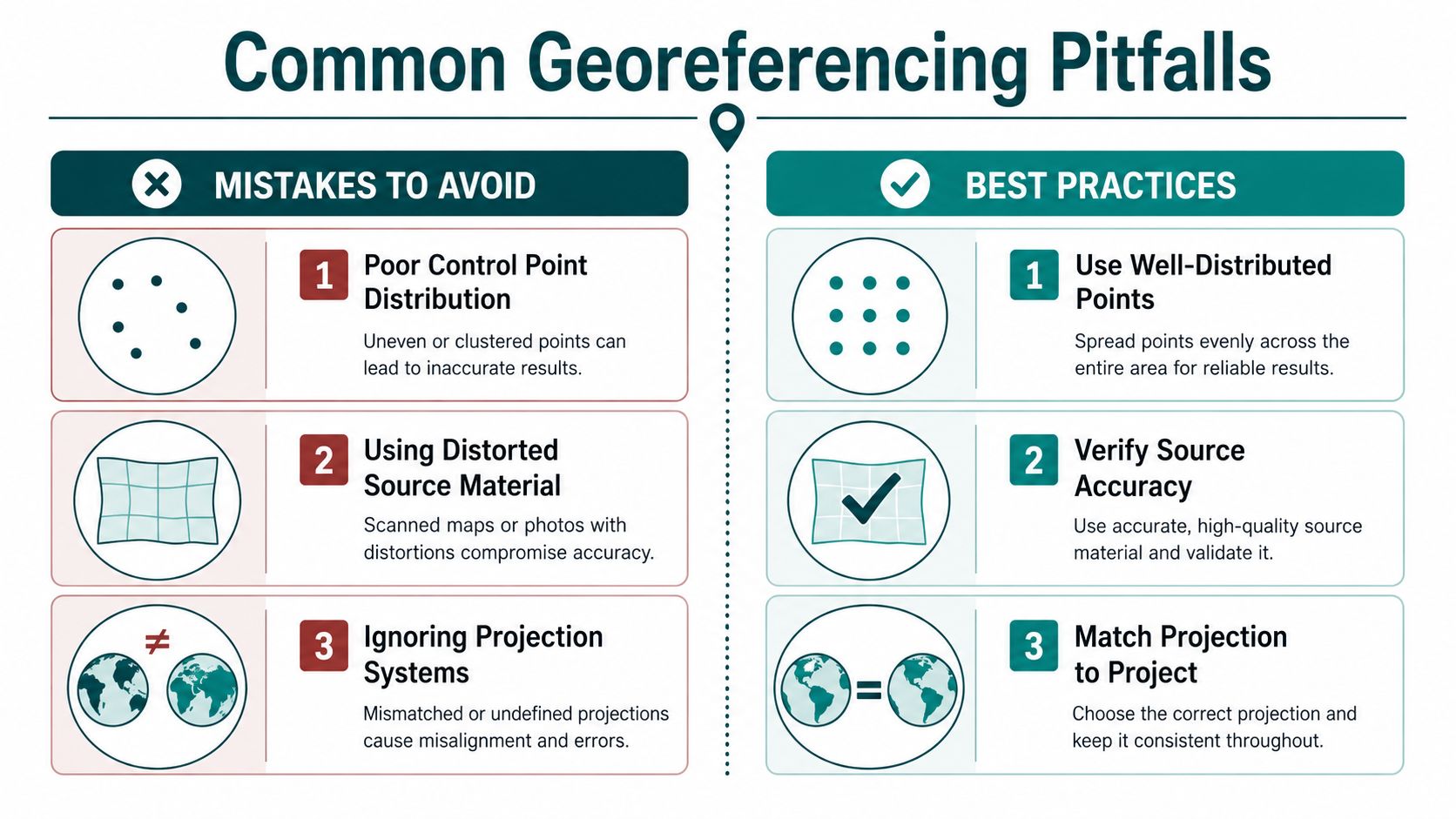
Several shortcuts create false confidence:
- Control points in one area: Points clustered near one corner may fit that area while the rest of the map shifts or warps.
- Ambiguous features: Broad symbols, rounded edges and temporary objects are weak anchors because different operators can select different pixel positions.
- Mixed map scales: A detailed site plan and a smaller-scale context layer do not offer the same positional tolerance. Combining them without recording that difference can make measurements appear more precise than they are.
- Unexamined projection: A map may align in one view while using a coordinate system that does not match the operational data.
HM Land Registry notes that measurements taken from Ordnance Survey mapping may differ from field distances because mapped data has a defined accuracy tolerance. Facilities directors therefore need to separate a useful navigation layer from a survey-grade record. A georeferenced overlay can guide someone to the correct entrance without supporting construction set-out work.
Treat the reference layer as versioned data
Administrative reference data changes. Data.gov.uk lists releases for UK Local Authority Districts and Local Administrative Units with different update cycles and formats. The data.gov.uk boundary dataset listings show why teams should record the precise release used.
The same discipline applies inside a venue. A station operator may rename a platform, move a gate line or close a corridor. A shopping centre may reconfigure a unit, while an NHS estate may alter reception arrangements and leave an older plan in contractor packs.
Maintain a register covering:
- Source identity, including file name, owner, date and scale.
- CRS and transformation, including the target reference system and method.
- Control-point record, with point names, coordinates and rejected points.
- Validation result, including RMSE and known limitations.
- Change responsibility, identifying who approves updates and publishes them.
A georeferenced map is not finished when it exports. It is finished when an operator can explain which source, version and validation decision supports the layer in use.
That record also supports consistent decisions about how a mapped position is shown to users. Waymap's Blue Dots explanation gives teams background on representing position clearly, an important detail when infrastructure-free navigation must remain understandable and accessible.
Beyond Static Maps How Georeferencing Powers Modern Navigation
Georeferencing is the foundation, not the complete navigation system. It establishes where map features are. A navigation service still needs to model how people move through those features, interpret changes and provide instructions that make sense at the point of decision.
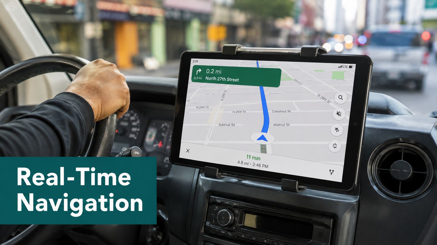
For a venue or transport authority, the relevant model isn't just a polygon around a building. It needs meaningful relationships between corridors, floors, rooms, walls, height changes, doors, platforms and external paths. A route that ends at the building outline has little operational value if the user needs the exact entrance, lift or platform access point.
Waymap's SmartStep engine processes spatial data into a detailed digital map for navigation. Its system uses a smartphone's device-native motion sensors and dead-reckoning algorithms, rather than relying on GPS, Wi-Fi or installed beacons, and the stated capability includes sub-3-metre accuracy in infrastructure-free environments. That combination matters in underground stations, large venues and indoor spaces where satellite positioning is weak or unavailable.
The operational value of an infrastructure-free layer
Beacon-based projects introduce a physical estate to maintain. Staff must install devices, replace batteries, verify coverage and account for changes to walls, entrances and routes. For a transport operator with high footfall and frequent layout changes, the hardware register can become a second accessibility project.
A map-based approach shifts attention to the digital source and its change process. If a platform closes, the operator updates the route model. If a venue changes its doors, the team revises the spatial layer and validates the user journey. That doesn't remove the need for testing, but it can reduce dependence on equipment installed throughout the estate.
For teams evaluating aerial or site-survey inputs beyond the UK, drone mapping services for Florida agents provides a useful example of how mapping data can support property documentation. The same principle applies here: source capture is valuable only when the resulting data is structured for the decision it must support.
The Waymap overview of accuracy solutions is relevant for directors deciding how a georeferenced foundation should connect to live positioning and route guidance.
The strategic question is therefore not whether a venue owns a digital map. It is whether the map can remain a dependable, updateable representation of the environment and support clear instructions when conditions change.
Why Accurate Georeferencing Is Non-Negotiable for Accessibility
A person who can see a sign may correct a small map error by scanning the space. A blind or low-vision traveller often needs the navigation system to identify the correct entrance, provide the next decision at the right time and distinguish a public route from a service corridor. In that context, georeferencing quality affects whether digital accessibility information is usable, not merely whether a layer looks tidy on a screen.
The Equality Act 2010 creates an important UK legal context for accessible services and facilities. BS 8300 provides guidance for the accessible design of buildings and the built environment, while BS EN 17210 addresses accessibility and usability of the built environment. These standards don't turn a map into a compliant service by themselves. They do reinforce the need to think about the complete journey, including information, entrances, circulation and changes in level.
Public guidance still leaves a practical gap. Existing material often explains georeferencing historical maps, but gives less UK-specific advice on making spatial layers operational for accessibility and navigation in dynamic transport environments. The relevant data.gov.uk boundary resource illustrates the wider issue: authoritative spatial information changes, so teams need governance and update workflows as well as coordinates.
Why the capital decision matters
NHS estates managers and transport operators face a practical constraint. Beacon infrastructure may require capital approval, installation access, battery replacement, survey work and ongoing maintenance across a busy estate. The physical burden is especially difficult where layouts change regularly or contractors manage parts of the site.
An infrastructure-free navigation model can be easier to align with those constraints because it uses the user's smartphone sensors and a maintained digital map rather than requiring installed positioning hardware throughout the venue. That doesn't make poor mapping acceptable. It makes the quality and governance of the spatial layer more important.
For accessibility teams, the test should include:
- Entry accuracy, whether guidance identifies the correct public and accessible entrance.
- Route continuity, whether the model handles corridors, doors, stairs, lifts and level changes.
- Change control, whether staff can update closures, renamed platforms and relocated services.
- User validation, whether disabled people can complete representative journeys with the instructions provided.
A map that is accurate in a GIS viewer but stale in the app still creates a barrier. Conversely, a well-maintained map can support clearer information without asking disabled users to compensate for undocumented changes. Waymap's accessibility features are relevant to teams assessing how a mapped environment becomes a practical navigation experience.
Frequently Asked Questions About Georeferencing a Map
What is georeferencing a map?
Georeferencing a map means linking its pixels or features to real-world coordinates. It converts a static scan or plan into a spatial layer that software can align with other geographic data. It does not repair distortions, omissions or inaccuracies in the source, so source assessment and validation remain necessary.
How many control points do you need for georeferencing a map?
A standard workflow needs at least three control points, while additional points can improve the fit. Select features that are recognisable on both the source and reference maps, then spread them across the mapped area rather than clustering them in one corner. The National Library of Scotland's guide to using its georeferencer tool provides practical guidance on this process.
Which coordinate system should UK projects use?
UK projects commonly use the British National Grid, EPSG:27700, when surrounding reference data uses that system. The appropriate CRS depends on the project extent, source data and intended application. Record the CRS and any transformation parameters so another team can reproduce the output and troubleshoot discrepancies.
What does RMSE tell you?
RMSE summarises the fit between control-point positions on the source map and their expected real-world positions. A lower value usually indicates a closer mathematical fit, but it does not confirm that every feature is accurately positioned. Review point distribution, source scale and the locations that affect entrances, routes, platforms or services.
Can georeferencing support indoor navigation?
Yes, georeferencing can support indoor navigation when the map also records navigable features and their relationships. An outline alone cannot describe a usable journey. The spatial data must represent doors, corridors, levels, lifts, stairs, platforms and route restrictions, with updates that reflect operational changes. That foundation helps infrastructure-free navigation systems provide clearer directions without installed positioning hardware throughout the estate.
Does a georeferenced map stay accurate permanently?
No, it requires version control and maintenance. Venue layouts change through refurbishment, closures and operational decisions, while reference boundaries can also change. Keep the source, date, CRS, control points and validation record with the published layer, and assign responsibility for updates. This audit trail supports accessibility reviews and reduces the cost of correcting outdated directions after deployment.
Waymap helps venue and transport teams turn a properly georeferenced map into an updateable navigation layer for indoor, outdoor and underground journeys. Visit Waymap to discuss how spatial data can support infrastructure-free wayfinding and more dependable accessibility information.
