
Accessibility Features That Actually Work in 2026
Most advice about accessibility features starts with installation: add a ramp, mark an accessible parking bay, publish an access statement, and assume the job is done. That assumption is wrong. A feature only creates access when a person can discover it, reach it, understand it, and rely on it throughout a real journey.
The UK's transport accessibility gap makes that distinction difficult to ignore. Disabled people take 38% fewer trips than non-disabled people, and the Motability Foundation said the figure hadn't changed for over a decade. It also estimated that 1 in 5 disabled people, about 1 in every 20 people in the UK, reported being unable to travel because suitable transport options weren't available, according to the UK Disability Survey research report.
The practical question is therefore not, “Which accessibility features do we have?” It's, “Which features help someone move and orientate themselves when the environment is busy, unfamiliar, changing, or poorly documented?”
Why Most Accessibility Features Fail in Practice
More accessibility features don't automatically produce better access. A venue can provide a ramp and still leave a wheelchair user unable to find the entrance. A station can advertise step-free access and still provide no dependable information about a lift outage. A shopping centre can install tactile paving that leads nowhere useful.
The transport baseline is stark. Disabled people take 38% fewer trips than non-disabled people, a figure the Motability Foundation said hadn't changed for over a decade (UK Disability Survey research report). That gap can't be explained by the absence of legislation alone. It reflects the distance between a feature existing on a plan and a person being able to use it confidently in context.
Presence isn't the same as usability
A checkbox approach asks whether a venue has an accessible entrance, an accessible toilet, priority seating, or an access statement. A usable approach asks harder questions:
- Can someone find the feature? Information buried in a PDF doesn't help a person making a journey on the day.
- Does the route remain available? A blocked ramp, closed lift, temporary barrier, or changed platform can invalidate an otherwise compliant plan.
- Does the feature connect to the next stage? Step-free access to a building is incomplete if the person can't locate reception, a ticket machine, a platform, or a seat.
- Does the information match reality? Transport accessibility data is often inaccurate or incomplete, according to the National Centre for Accessible Transport's report on accessibility data.
That last point is operationally important. Accessibility information isn't a static description of a building. It's a live service that depends on accurate maps, maintained points of interest, reliable route choices, and clear communication when conditions change.
Practical rule: Treat every accessibility feature as part of a journey, not as an isolated object.
Navigation-enabling features solve the difficult middle
Accessible parking illustrates the problem. Parking directly outside an accessible entrance is useful, but it doesn't tell a blind visitor which path to follow, where the entrance begins, or how to reach a destination once inside. VisitEngland guidance recommends positioning accessible parking spaces and drop-off bays directly outside the accessible entrance, with International Symbol of Accessibility signage (VisitEngland accessible facilities guidance). That's a sound arrival baseline, not a complete navigation system.
The same distinction applies to digital services. UK public-sector monitoring found 29,787 accessibility issues across monitored websites and apps, with 16,482 fixed, a 55.3% fix rate (UK accessibility monitoring data). In completed cases, 67.9% of organisations had either fixed the issues or created a short-term plan, while overall compliance reached 70%, up from 59% in the previous monitoring period. Those figures show progress, but they also show why compliance status alone doesn't prove that a person can complete a physical journey.
A navigation-enabling feature reduces uncertainty at decision points. It helps someone identify the right entrance, avoid stairs, understand a transfer, locate a specific platform, and recover when the environment differs from the plan. The Waymap explanation of Bluetooth access points is useful here because it highlights the operational question that many accessibility programmes miss: how much hardware can an organisation install and maintain before the system itself becomes fragile?
Legal Standards That Drive Accessibility Feature Demand
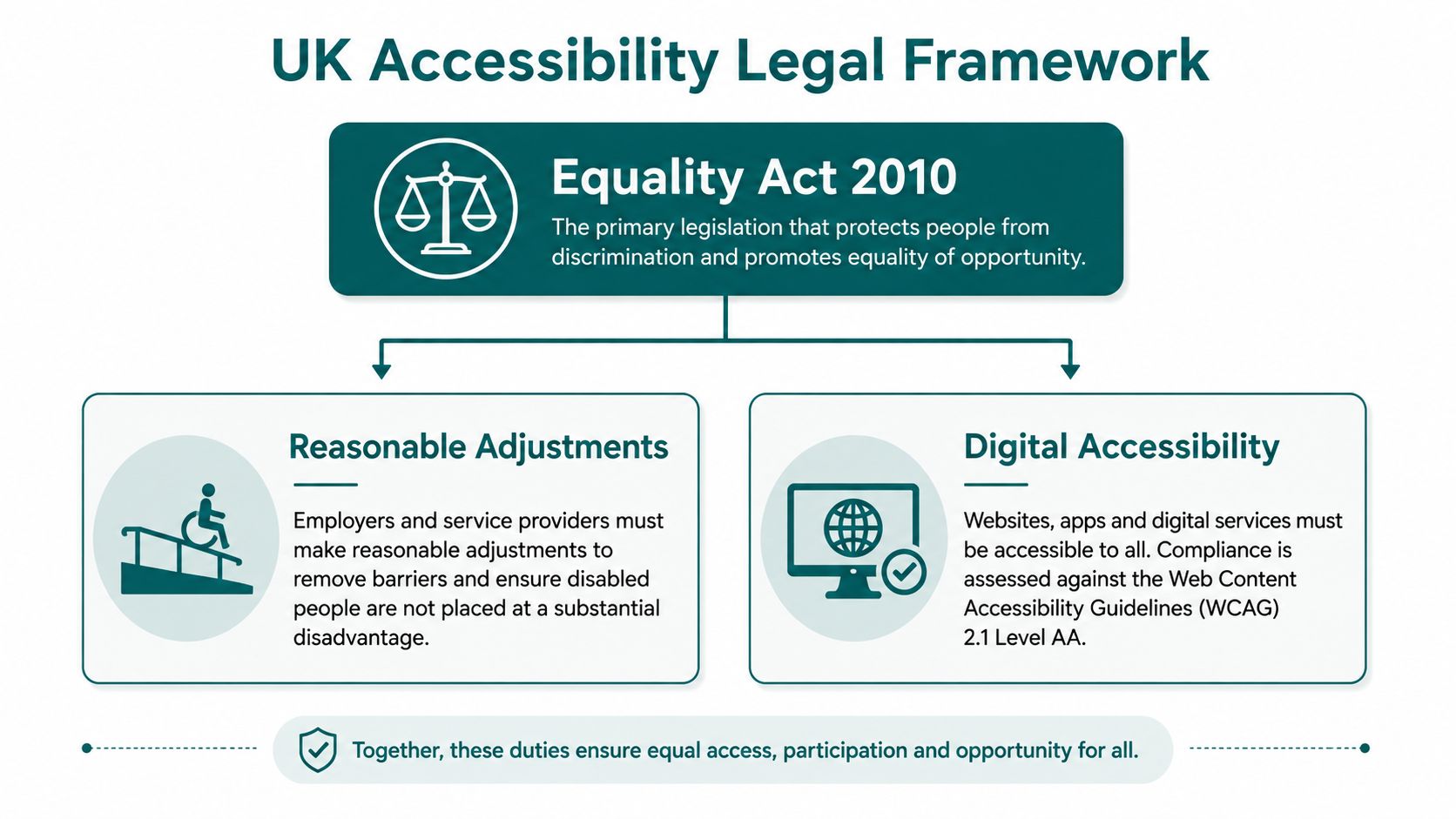
UK accessibility duties create demand for more than ramps and signs. The Equality Act 2010 requires organisations to consider reasonable adjustments for disabled people, while built-environment standards such as BS 8300 and BS EN 17210 provide detailed principles for inclusive design. PAS 78 addresses accessible website commissioning and management, and the UN Convention on the Rights of Persons with Disabilities establishes participation and independent access as fundamental rights.
These frameworks don't prescribe one universal navigation product. They do, however, make a weak operational model increasingly difficult to defend. If a venue knows that a lift is unavailable, a route is obstructed, or a visitor needs information in an accessible format, publishing a permanent sign or generic access statement won't necessarily deliver a reasonable adjustment.
What each framework means operationally
The Equality Act 2010 turns accessibility from a design preference into an organisational responsibility. For a transport operator, that can include providing usable information about accessible routes and assistance. For an NHS estates manager, it raises questions about how reasonable adjustments work during capital works, temporary closures, and service changes. The Waymap overview of Equality Act 2010 requirements connects that duty to practical navigation.
BS 8300 and BS EN 17210 guide the design of accessible buildings and the built environment. Physical dimensions, circulation routes, entrances, signage, lighting, acoustics, and facilities all matter. Neither standard makes digital wayfinding a substitute for good design. Their practical implication is that a building should be understandable and usable, not merely technically reachable.
PAS 78 helps organisations procure accessible digital services. A venue's website, booking journey, access statement, and mobile experience must support the person before arrival. VisitBritain guidance says participants are required to publish accessibility information on their website and state the venue's key accessibility features (VisitBritain accessibility information guidance). A digital map that doesn't reflect current access conditions can undermine that information.
The UN Convention on the Rights of Persons with Disabilities provides the broader rights-based context. Independent movement and participation depend on the whole chain, from public transport to the building entrance and the destination inside.
A practical resource such as this ADA compliant thresholds guide can help teams understand one specific physical access issue. It shouldn't be mistaken for a complete journey strategy. Thresholds, ramps, and doors remove barriers at particular points. Dynamic navigation connects those points into a route.
Physical Accessibility Features Versus Digital Wayfinding
Physical accessibility features establish the conditions for access. Digital wayfinding explains how to use those conditions in a specific journey. One cannot replace the other.
A ramp provides a traversable gradient. Tactile paving can communicate a boundary or route. Colour-contrasting handholds and step edges support bus users, and UK rules for public-service vehicles designed to carry over 22 passengers require at least one wheelchair space, a lift or ramp, priority seating, and colour-contrasting handholds and step edges when those vehicles operate local and scheduled services (National Disability Strategy).
Those features are valuable, but they don't answer every orientation question. A passenger may still need to locate the correct stop, identify the accessible boarding point, transfer between services, and find the destination entrance after leaving the vehicle.
| Feature Type | Strengths | Limitations | Best Use Case |
|---|---|---|---|
| Ramps and step-free entrances | Remove physical barriers and support mobility | May be difficult to find or may lead to an unclear internal route | Building access and level changes |
| Tactile paving and contrasting signs | Communicate boundaries, hazards, and directions | Coverage and interpretation can vary across environments | Consistent physical cues |
| Accessible parking and drop-off bays | Reduce arrival distance and improve vehicle access | Don't guide visitors beyond the entrance | Arrival planning |
| Audio and digital wayfinding | Provides contextual, step-by-step guidance to destinations | Depends on accurate maps and maintained access data | Complex buildings, campuses, stations, and stadiums |
| Accessible web information | Helps people plan before travel | Static pages can become inaccurate when conditions change | Pre-journey decisions and service updates |
Digital navigation is especially useful in the space between major landmarks. It can guide a person from a station entrance to a hospital department, from a stadium gate to a specific seat, or from a shopping centre car park to a shop. It can also present a step-free route where the standard route uses stairs or escalators.
The same principle applies to entry systems. Teams reviewing apartment intercom system basics should consider not only whether a resident can operate the intercom, but whether they can locate it, understand its controls, and reach the correct entrance without assistance.
A QR code, NFC tag, or accessible map can help at a decision point. The Waymap discussion of Braille and QR codes reflects the right relationship between physical and digital information. The physical marker provides orientation and access to information. The digital layer can provide the route detail that static signage can't carry.
Real Deployments That Solved Specific Accessibility Barriers
Wayfinding becomes credible when it addresses a named operational problem. At Lord's Cricket Ground, infrastructure-free navigation was introduced in a stadium where visitors need to move through entrances, concourses, hospitality areas, facilities, and seating zones while crowds and temporary arrangements change the environment.
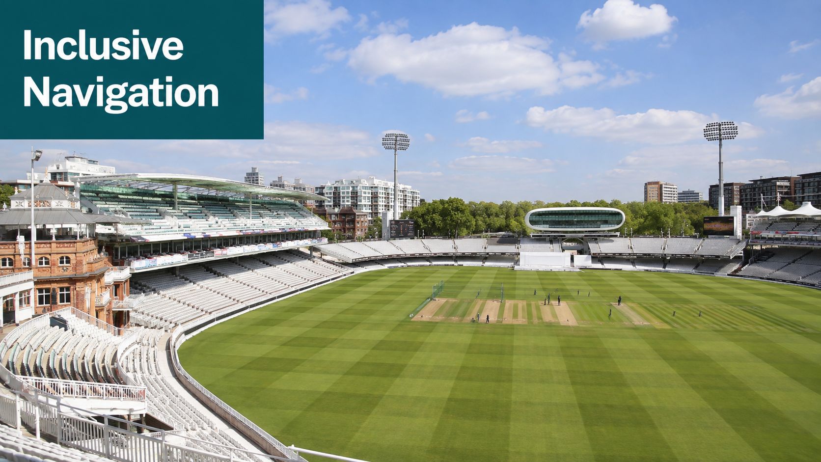
The relevant outcome isn't that the ground added an accessibility feature. The value lies in giving blind and disabled visitors a way to reach specific destinations with greater independence and less reliance on informal assistance. Infrastructure-free navigation also avoids placing a network of physical beacons across a venue that must prepare for high-footfall matchdays, events, maintenance work, and changing layouts.
Different venues, different constraints
WMATA operates a complex metro network where platform access, station entrances, transfers, and service conditions affect the journey. The Waymap WMATA case study shows why a navigation layer needs to address the network as a connected environment rather than treat each sign or station feature as an isolated improvement.
SBS Transit and LTA Singapore represent the demands of large urban transport systems. Operators need accessibility information that can be updated as infrastructure and services change. Installing and maintaining hardware across every relevant route can create a considerable operational burden, particularly where staff must inspect, replace, and recalibrate equipment.
Westfield London presents a different challenge. A large retail environment has multiple entrances, levels, retailers, customer services, food areas, and temporary installations. Navigation can support access and also help visitors reach specific destinations without repeatedly asking staff for directions.
The technical result described for Waymap is sub-3-metre accuracy in infrastructure-free environments, using step-accurate audio directions that adapt to a person's walking style. These capabilities matter because a route that ends somewhere near a destination may still leave a blind visitor searching for the final door, platform, or seat.
For education and public buildings, the same design logic applies. Teams studying modular classroom accessibility for disabilities face a comparable question: how can a space remain usable when its configuration, occupants, and support needs change?
The following video provides additional context on the approach and its use in real environments.
How to Prioritize Accessibility Features That Enable Navigation
Start with the failure point, not the product category. Ask where a disabled visitor loses confidence or independence: before arrival, at the entrance, during a transfer, at a level change, or near the final destination.
A useful prioritisation process has four stages.
Identify the journey that breaks
Map the complete route from a realistic origin to a precise destination. “The building is accessible” is too broad. The relevant route might be a bus stop to an outpatient clinic, a station entrance to a platform, or a stadium gate to a numbered seat.
Record every decision point, including temporary barriers, lifts, ticketing areas, doors, crossings, queues, and changes in level. Transport operators should include disruption scenarios. NHS estates teams should include construction phases and departmental moves. Retail managers should include the route from parking or public transport to the individual store.
Separate baseline access from orientation
A physical modification may remove a barrier without helping someone understand where to go next. The UK Disability Survey found that 31% of disabled people said they had difficulty using public spaces “all the time” or “often”; among people who experienced difficulty accessing public buildings at least sometimes, shops and shopping centres were reported as inaccessible most frequently, at 78%, followed by pubs, bars, restaurants, and cafes at 66% (UK Disability Survey report).
A beach access example makes the difference clear. Independent research cited in the brief found that 70% of UK beaches had accessible parking, while only 8% had beach matting or boardwalks, 16% had beach wheelchairs, and 3% had staff support (reported beach accessibility survey). Parking helps someone arrive. It doesn't necessarily create a usable route across the beach.
Test the operational burden
For an NHS estates manager, the right solution must survive budget approval cycles and capital-spend restrictions. For a transport operator, it must work across high-footfall sites without creating a new inspection and replacement programme. For a retail venue, it should support access without adding friction to customer movement or reducing the ease of reaching shops and services.
Evaluate each proposed feature against:
- Discoverability: Can users find it through the channels they already use?
- Continuity: Does it guide the whole journey, rather than one isolated point?
- Accuracy: Can the organisation update closures, lifts, entrances, and destinations quickly?
- User choice: Does it support audio, visual, haptic, step-free, and screen-reader-friendly interaction?
- Maintenance: Does it rely on hardware that staff must install, power, monitor, and replace?
Infrastructure-free navigation is relevant when the environment is signal-poor or frequently rearranged. Waymap uses dead reckoning from device-native sensors, so it doesn't depend on Wi-Fi, GPS, or installed hardware. That makes the infrastructure decision part of the accessibility decision, not a separate technical detail.
The Technical Foundation of Infrastructure-Free Navigation
Infrastructure-free navigation uses the sensors already present in a smartphone to estimate movement through a mapped environment. Waymap's approach uses dead reckoning with device-native sensors, fused with detailed maps to calculate a route and deliver heads-up, hands-free audio instructions.
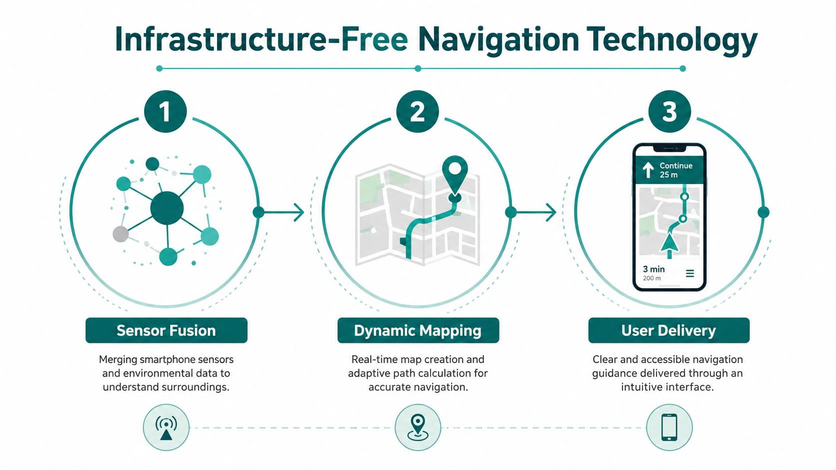
The important distinction is between positioning and navigation. A positioning system tells an app where a person may be. A navigation system must also understand the route, the next decision, the user's movement, and the destination's exact location. In a station or stadium, “near the entrance” isn't enough. The useful instruction identifies which entrance, which corridor, which lift, and which final access point.
Why sensor fusion matters
Smartphone motion sensors can detect movement and changes in direction, but raw sensor readings aren't sufficient on their own. The algorithm must interpret those readings against a detailed map and account for how a person walks. Waymap's system learns stride and movement patterns to provide step-accurate guidance, with reported accuracy of sub-3 metres in infrastructure-free environments.
That design removes the dependency on Bluetooth beacons and similar installed equipment. For venues with high staff turnover or frequent layout changes, avoiding a hardware estate can simplify ownership. Managers can amend points of interest and route information without installing new beacons at every updated location.
The Waymap explanation of its sensor-fusion algorithm provides more detail on the technical principle. For accessibility leaders, the practical test is straightforward: does the system help a user move through a real environment when GPS is unavailable, Wi-Fi is unreliable, and physical conditions differ from the original plan?
Accessible output is part of the system
A technically accurate route can still fail if the interface is inaccessible. Useful delivery may include audio instructions, haptic feedback, contrast options, and a screen-reader-friendly interface. Step-free routing also matters when stairs, escalators, or other barriers make the shortest route unsuitable.
Data maintenance remains essential. The National Centre for Accessible Transport has warned that UK transport accessibility data is often incomplete or inaccurate. Sensor technology can estimate movement, but it can't correct a map that says an open lift is available when it's closed. The operator still needs a process for updating access conditions, validating destinations, and communicating disruption.
Common Questions About Accessibility Features Answered
What's the difference between accessibility compliance and usability?
Compliance shows that an organisation has addressed defined obligations, while usability shows whether people can complete real journeys. A ramp, access statement, or accessible website may satisfy part of a requirement, but users also need discoverable, accurate, continuous information.
Do digital navigation tools replace physical accessibility features?
No, digital navigation complements physical accessibility features. Ramps, lifts, tactile paving, accessible parking, contrasting edges, and priority seating provide the physical conditions for access. Digital wayfinding helps people locate and use them.
Which accessibility features improve movement most?
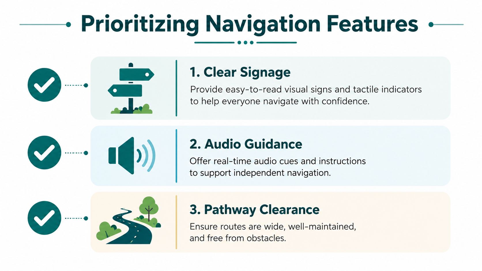
Features that connect a person to a precise destination improve movement most. Step-free routes, reliable access data, clear signs, audio guidance, and obstacle-free paths address orientation as well as physical access.
How should organisations measure accessibility features?
Measure whether users can find and complete intended journeys, not only whether features are installed. Track route accuracy, current access information, successful destination arrival, disruption handling, and feedback from disabled users.
What data must operators maintain?
Operators must maintain route, entrance, lift, platform, facility, and point-of-interest data. The National Centre for Accessible Transport report identifies incomplete and inaccurate transport accessibility data as a practical barrier to planning and completing journeys.
Waymap provides infrastructure-free indoor, outdoor, and underground navigation with step-free routing, precise audio and on-screen instructions, haptic feedback, contrast mode, and screen-reader-friendly interaction. If your transport network, stadium, hospital, campus, or shopping centre needs accessibility features that work across the whole journey, visit Waymap to discuss the environment you need to make navigable.
