
Emergency Evacuation Planning: 2026 Venue & Transit Guide
Emergency evacuation planning fails at the exact moment most paper plans look complete. The alarm sounds in a crowded underground station, smoke starts to flatten sightlines, a public address announcement turns to noise, and people stop behaving like neat arrows on a floor plan. Staff revert to instinct. Visitors look for cues that have just disappeared. Anyone who depends on visual signage is suddenly at a disadvantage.
That's the operational reality venue and transit teams have to plan for. A compliant document in a folder isn't enough. Emergency evacuation planning has to work in noise, congestion, confusion, and partial system failure. It has to account for staff turnover, blocked routes, mixed occupancies, and people who don't process information the same way under stress.
At Waymap, we look at this through a practical lens. The job is to create a plan people can execute, test, adapt, and improve. That means risk assessment, legal duties, route design, accessibility, command structure, and the technology needed when static instructions stop being useful. If you're refining procedures across a shopping centre, campus, stadium, airport, rail interchange, or civic building, start with the basics and build a functional emergency plan that people can use under pressure. Then make it dynamic enough to survive real conditions.
Introduction
A fire alarm at 5:40 p.m. in a busy station or shopping centre does not test the document. It tests whether people can still find, understand, and follow a safe route when noise rises, sightlines fail, and staff have to make decisions fast.
Emergency evacuation planning needs to be built as a live operating system for the building or estate. It has to reflect how the site performs at peak occupancy, during maintenance, after tenant changes, and under partial failure of alarms, screens, radios, lifts, or public address. In practice, plans fail in ordinary places. A route pinches down at a service door. A refuge point exists but no one owns the status check. An accessible path depends on visual signage that disappears in smoke or crowding.
The hardest failure point is usually guidance. Blind and low-vision occupants, people with hearing loss, visitors unfamiliar with the building, and anyone under stress may get little value from static signs or shouted instructions. That is why inclusive planning cannot stop at compliant drawings and generic PEEPs. Teams need dynamic instructions, clear accountability, and tools that still work when infrastructure is degraded. Wayfinding technology that can support real-time hazard awareness for indoor routes changes what is possible here, especially where visual cues, fixed signage, or staffed escort models are unreliable.
Good plans are tested in operational detail. They define route priorities, decision points, fallback options, team handoffs, and how incident control receives usable information from the ground. If you are reviewing procedures across a campus, transport hub, civic building, hospital, or mixed-use estate, start by making sure you can build a functional emergency plan that staff can execute under pressure. Then improve it so it can adapt in real time, including for people who cannot rely on sight, screens, or intact building systems.
How to Conduct a Risk Assessment and Meet Your Legal Duties
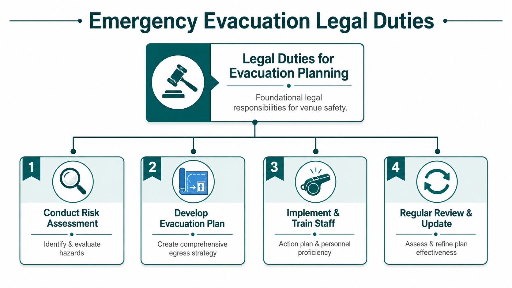
The legal duty starts with the person or organisation responsible for the premises. The operational duty starts earlier. If your risk assessment only lists hazards and exits, it's incomplete. A usable assessment has to identify who may struggle to perceive the alarm, understand instructions, move without assistance, or find their way if the normal route is no longer available.
What your assessment must capture
A serious assessment for emergency evacuation planning should document:
- Hazard locations: ignition sources, plant rooms, storage risks, and areas where smoke or crowding will alter normal movement.
- Occupant profiles: staff, contractors, visitors, patients, students, spectators, and anyone unfamiliar with the site.
- Movement constraints: stairs, escalators, turnstiles, pinch points, doors with complex ironmongery, and routes that depend on staff enabling access.
- Information failure points: areas where alarms are hard to hear, screens are not visible, or public address messages become muddled.
If you're managing a large estate, it also helps to identify and mitigate property risks in parallel, because evacuation reliability usually depends on conditions created by the building fabric, maintenance regime, and day-to-day operational changes.
Where the law is getting more specific
The current shift in England is towards person-centred evacuation planning. Under the Fire Safety (Residential Evacuation Plans) (England) Regulations 2025, the duty to create Personal Emergency Evacuation Plans applies specifically to residential buildings in England that are either 18 metres (approximately 7 storeys) or higher, or over 11 metres if a simultaneous evacuation strategy is in place, as set out by Avon Fire & Rescue Service guidance on residential PEEPs.
That matters beyond residential settings because it signals how regulators now expect operators to think. Generic plans are no longer enough where people may need individualized support.
Practical rule: Compliance is the floor. If your plan can't tell staff what to do for a person who can't self-evacuate, can't see the signs, or can't follow a visual route under stress, it isn't operationally complete.
The newer framework also pushes operators towards genuine conversations rather than paper exercises. A person-centred approach means asking what the individual can do, what they can't do, what conditions change that answer, and what support is reasonable and proportionate in that building.
For teams building out that capability, hazard communication should be tied into live operational awareness as well. That's where a stronger internal process for hazard awareness in public spaces becomes useful. It helps connect the formal risk assessment with the way staff detect and respond to changing conditions on the ground.
How Should We Map Venue Egress and Identify Barriers
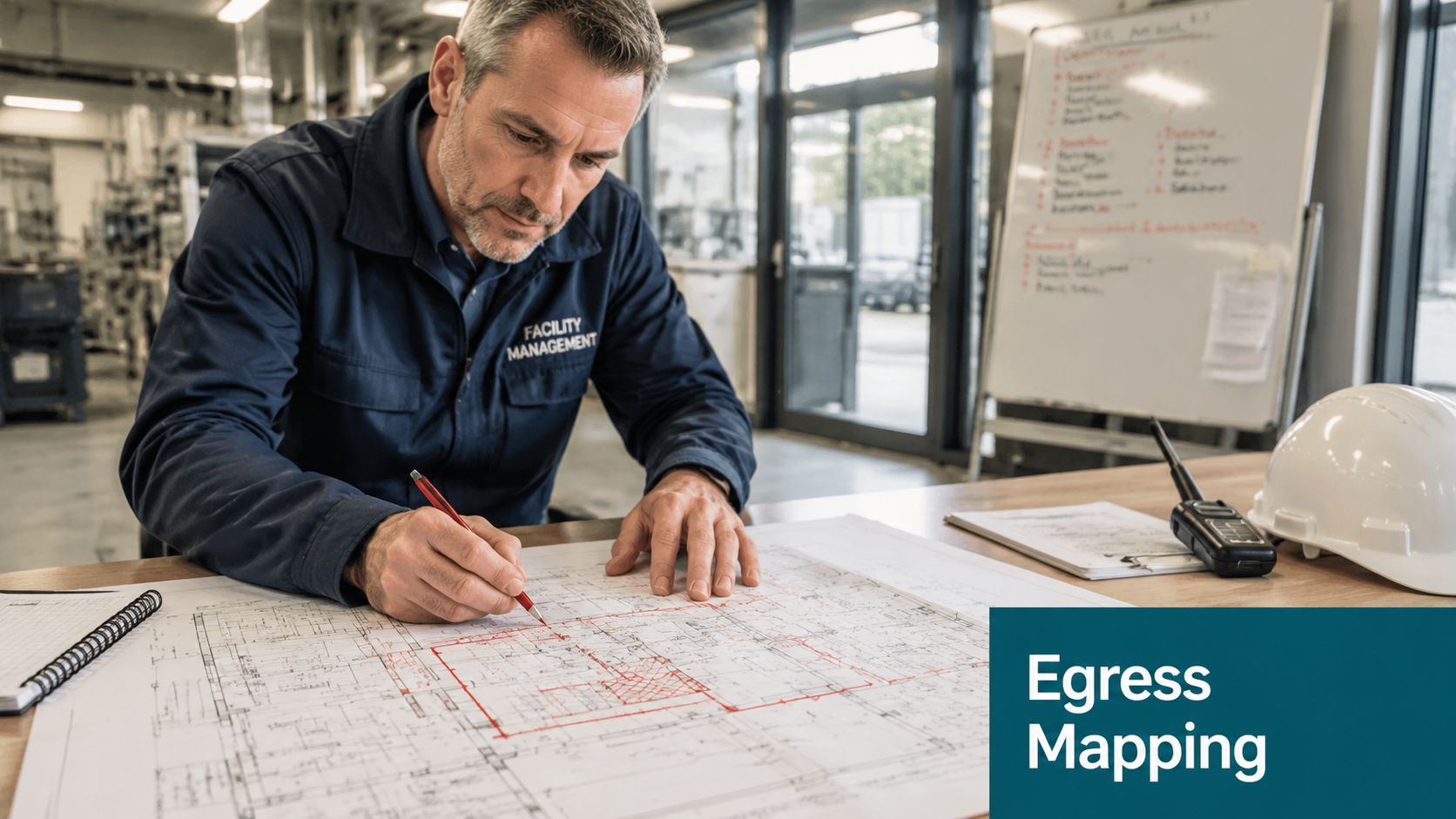
A route map isn't an evacuation map until it shows what can go wrong. In practice, the strongest egress mapping starts with movement rather than architecture. Where do people hesitate, bunch, reverse direction, or need instruction? Which routes depend on good visibility? Which spaces become noisy enough that verbal direction fails?
Map decisions, not just corridors
When we review complex venues, we usually separate the mapping task into three layers.
| Mapping layer | What to document | Why it matters |
|---|---|---|
| Primary egress | Main exits, route width, door operation, surface changes | These routes carry most people and fail first under crowd pressure |
| Fallback routes | Alternative paths, controlled access points, refuge spaces | A blocked main route is common in live incidents |
| Barrier layer | Steps, chokepoints, poor acoustics, visual clutter, confusing junctions | This is where plans succeed or fail for disabled users and unfamiliar visitors |
That barrier layer is often missing. The map may show a compliant route, but not the confusing junction halfway through it, the service door that looks identical to the fire exit, or the narrow landing where two streams of evacuees collide.
Vertical evacuation is where weak plans get exposed
This is especially serious in multi-storey sites. Existing UK guidance often fails to address how to manage vertical evacuation for users with mobility impairments in buildings where stairwells are congested or unsafe, particularly under the new simultaneous evacuation strategy mandated for many high-rises. This creates a critical gap in protecting the 14% of the UK population with disabilities, as highlighted by Fire Safe on evacuation planning and procedure.
That figure should change how you map. Stairs are not a neutral feature. They are a variable hazard.
Use a field-based walkthrough process that records:
- Where vertical circulation narrows: landings, door swings, transfer points, and places where evacuation chairs would be difficult to deploy.
- Which refuge areas are credible: not just labelled, but reachable, identifiable, and connected to a communication process.
- What happens when the preferred route is lost: not theoretically, but in terms of exact turn points and staff actions.
The best egress maps are built with operations, security, estates, and accessibility staff in the same walk-through. Each team sees a different failure point.
If your building information model is clean, that helps. If it isn't, detailed survey work matters more than desktop assumptions. We've found that high-fidelity spatial capture can improve route accuracy and barrier identification, particularly in sites with layered circulation or frequent layout changes. For venues assessing that level of detail, 3D LiDAR scanning for navigation and built environment mapping is a useful reference point.
How Can We Ensure Safe Evacuation for Blind and Low-Vision People
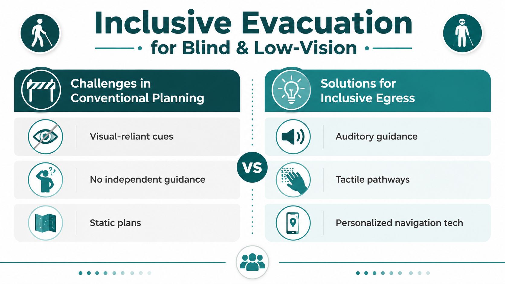
Most conventional evacuation planning is visual. Exit signs, wall maps, directional arrows, printed notices, and staff gestures all assume the person can see the cue and interpret it quickly. In an emergency, even sighted occupants may lose that advantage. For blind and low-vision people, the weakness is built in from the start.
Why static guidance breaks down
Static signage works only if three conditions hold. The route must still be available. The person must still be able to perceive the sign or map. The stress of the incident must not overwhelm route recall.
Those conditions often fail together. Smoke obscures signs. Public address systems become hard to understand. Crowds alter the usable path. A person who normally makes their way independently may suddenly have no reliable reference point.
That's why the current policy gap matters. Despite new 2025 UK regulations mandating Personal Emergency Evacuation Plans by April 2026, existing guidance fails to address how to execute dynamic, real-time navigation for blind or low-vision users when static signage and corridor maps become unusable. This leaves a critical gap for the 1.8 million blind and low-vision people in the UK, as discussed in Keystone Law's note on residential personal emergency evacuation plans.
What a person-centred plan should include
If you're responsible for evacuation planning in a complex venue, don't write a generic accessibility paragraph and assume the issue is covered. A person-centred process needs operational detail:
- Identify the actual navigation method: verbal support, tactile reference, independent audio guidance, staff escort, or a combination.
- Define the fallback condition: what happens if the usual route is blocked, the person is alone, or the nearest trained staff member is elsewhere.
- Record the handoff points: who takes responsibility, how they're notified, and where assistance is expected to meet the person.
- Test under degraded conditions: noise, low visibility, changed routes, and disrupted crowd flow.
A static PEEP that names an exit but not the method of getting to the exact door is not enough.
Dynamic guidance is the missing operational layer
Technology reshapes the problem. In signal-poor environments, the route guidance has to work without depending on GPS, Wi-Fi, or installed hardware. It also has to remain useful when the plan changes quickly.
Waymap was built first for blind and low-vision users, and that matters here because the navigation model addresses the exact failure mode static planning can't solve. The platform uses dead reckoning with device-native sensors to provide sub-3-metre accuracy in infrastructure-free environments, guiding people to exact doors and decision points without GPS, Wi-Fi, or Bluetooth beacons. For estates and transit operators, that removes a major weakness of hardware-dependent systems in high-change environments.
You can see the broader accessibility context in Waymap's work on technology for visually impaired users.
Blind and low-vision evacuation planning should not rely on memorised routes. It should rely on a guidance method that still works when the route changes.
This also connects directly to legal and policy duties. Under the newer regulations, person-centred fire risk assessments must be real conversations. In practice, that means asking a harder question than “Do you need help?” The better question is “How will you find your way if signs, maps, and normal visual landmarks stop being usable?” Until that question has an operational answer, the plan is incomplete.
What Technology Improves Real-Time Evacuation Response
Most sites still run evacuation on a static model. Draw the routes. Print the notices. Train the staff. Review next year. That approach gives you a baseline, but it doesn't give you a live response capability when a corridor is suddenly unusable or a station entrance has to be taken out of circulation.
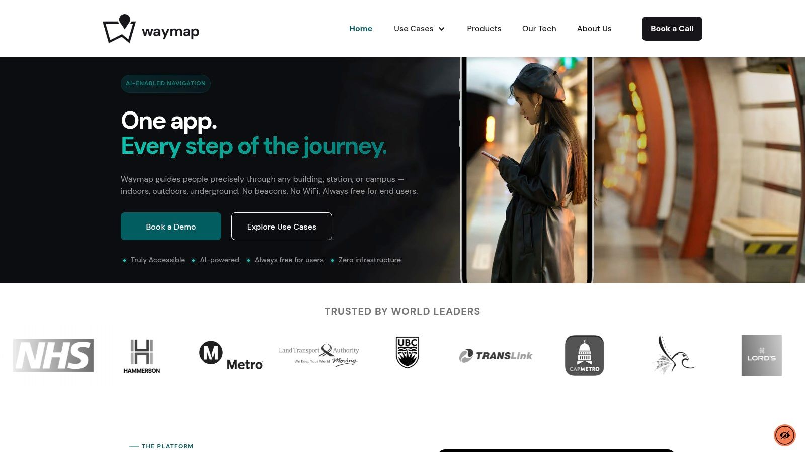
What a dynamic system changes
A more resilient model combines the formal evacuation plan with a live digital layer. That allows operators to alter routes, suppress unusable paths, and push revised instructions without replacing signage or dispatching teams to update physical hardware.
For estates managers, the trade-off is straightforward:
- Hardware-heavy systems can work, but they create maintenance burden across large, high-footfall estates.
- Software-led systems are easier to update quickly, especially where layouts change, temporary works are common, or public areas are reconfigured.
- Infrastructure-free navigation is particularly useful underground and indoors, where satellite-based positioning is unreliable.
That distinction matters in venues with political or financial pressure on capital spend. If every update requires installed devices, battery checks, fault reporting, procurement, and physical access coordination, the system becomes harder to maintain than the plan itself.
Why named deployments matter
Waymap's value in this category isn't theoretical. It has been deployed in named, operationally complex environments including WMATA, Westfield London, SBS Transit, and the Royal Hospital for Children and Young People. Those settings have one thing in common. They are challenging environments for movement and orientation, and they don't tolerate brittle infrastructure.
A transit operator, for example, needs route guidance that can cope with platform changes, temporary closures, works access, and underground conditions. A hospital needs precision to exact doors in a space where users are often stressed and unfamiliar with the environment. A shopping centre needs adaptable guidance without adding maintenance overhead across a constantly changing tenant mix.
For teams evaluating the operational value of live data in this context, real-time information in navigation systems is the right frame. It shifts emergency evacuation planning from static instruction to active route management.
A short product view helps illustrate what that looks like in practice.
The practical test for any evacuation technology
Ask three questions before adding any tool to your evacuation stack:
- Does it still work when signals are weak or absent?
- Can operators change route logic quickly without physical retrofitting?
- Does it improve access for people who can't rely on visual cues?
If the answer to any of those is no, it may still be useful for visitor information. It isn't strong enough for emergency response.
How to Test and Maintain Your Evacuation Plan
At 10:17 on a wet Tuesday, an alarm sounds, one stair is out of use because of contractor works, and a visually impaired visitor is standing in a noisy concourse waiting for clear direction. That is the standard your plan has to meet. A document that works only on a quiet day, on the expected route, with full visibility, is not fit for purpose.
Testing shows whether people can get out, whether staff make sound decisions under pressure, and whether your accessibility arrangements still work when conditions are messy. In practice, that means exercising the plan in layers and treating every drill, incident, near miss, layout change, and complaint as maintenance input.
Use an exercise cycle that reflects real operations
A good plan is tested often enough to stay current and in enough different ways to expose weak points. Annual review is a minimum. It should not be the only time anyone looks at the plan.
I use four types of test because each one reveals a different failure.
- Tabletop exercises: test decision-making, escalation points, control room actions, and role clarity.
- Route walk-throughs: verify exact paths, door hardware, refuge points, temporary obstructions, and how long assisted movement really takes.
- Live drills: show how occupants behave, where congestion forms, and which instructions are ignored or misunderstood.
- Post-incident reviews: capture what happened in real conditions, especially communication failures and access barriers that were not obvious on paper.
This cycle matters most in complex estates. Hospitals, transport interchanges, campuses, shopping centres, and mixed-use buildings change constantly. A static plan drifts out of date faster than teams expect.
Train for judgement under pressure
Staff do not need more script reading. They need to recognise changing conditions and act early.
That includes knowing when to redirect flow, when to hold a route, when to call for assisted evacuation support, and how to communicate with people who cannot rely on signs, screens, or shouted instructions. Those skills need structured practice, not a once-a-year briefing. If you are building capability around command roles, triage, and on-the-ground response, guidance on skilled emergency response teams can help shape the training standard.
One hard lesson from exercises is that timing alone is a poor measure. A drill can finish quickly and still fail. If blind and low-vision users were left waiting for ad hoc help, if staff gave conflicting verbal directions, or if a temporary closure forced people onto an untested route, the exercise exposed a gap that needs fixing.
Test accessibility in the conditions people will actually face
Accessibility testing cannot stop at checking whether a route exists on a drawing. Teams need to observe how people move through the space, where instructions become ambiguous, and what happens when the usual reference points disappear.
Use realistic conditions. Reduce lighting where appropriate. Add background noise. Test with diverted routes. Include lifts being unavailable if that is a credible scenario. Involve disabled users directly and record what they experienced at each handoff point. Accessibility testing for navigation and public environments gives a useful model for turning those observations into evidence instead of assumption.
This is also where newer technology proves its value. If your evacuation method depends on fixed signage, staff memory, or intact visual infrastructure, testing will eventually show the same weakness. It breaks down when the environment changes. Dynamic, audio-led, infrastructure-light guidance gives operators a better option for sensory-impaired occupants because routes can be updated in real time without waiting for physical changes on site.
Update the plan when operations change
Plans need version control and clear triggers for revision. In my experience, these are the changes that most often invalidate an evacuation plan before the annual review date:
- Layout changes: fit-outs, partitions, tenant churn, works compounds, locked doors, or altered circulation.
- Occupancy changes: different visitor profiles, higher peak loads, new residents, or service users with different support needs.
- Operational changes: revised security procedures, reduced staffing, new contractors, or changed assembly arrangements.
- Exercise findings: confusion at decision points, failed communications, inaccessible alternatives, or poor coordination between teams.
Record the change, update the plan, retrain the relevant staff, and retest the affected route or procedure. That discipline keeps the plan usable.
A maintained evacuation plan works like a live operating procedure. It is tested, corrected, reissued, and checked again until people can follow it under real conditions, including those who cannot rely on visual cues or fixed infrastructure.
Frequently Asked Questions About Emergency Evacuation Planning
What is emergency evacuation planning
Emergency evacuation planning is the process of preparing people, routes, roles, and communications so occupants can leave or move to safety during an incident. In practice, that includes risk assessment, route mapping, accessibility planning, staff training, drills, and regular review.
Who is responsible for an evacuation plan in a large venue
The responsible organisation or duty holder for the premises is accountable for having a workable plan. In large venues, that usually means estates, operations, security, and health and safety teams all have defined roles, even if one person owns the formal plan.
How often should an evacuation plan be reviewed
An evacuation plan should be reviewed at least annually and whenever conditions change. Layout changes, staffing changes, new access controls, altered occupancy, and lessons from drills should all trigger updates.
Do evacuation plans need to cover disabled people individually
Yes, where a person may need specific support, the plan must address their actual needs rather than rely on generic statements. Person-centred planning is especially important for people with mobility, cognitive, sensory, or communication impairments.
Why do static signs and maps fail during evacuations
Static signs and maps fail when visibility drops, routes are blocked, or people can't interpret visual information under stress. They are useful as a baseline, but they don't provide dynamic guidance when conditions change.
What makes evacuation technology useful in real conditions
Useful evacuation technology still works when normal positioning or communications are unreliable. It should support rapid route updates, reduce reliance on installed hardware, and improve guidance for people who can't depend on visual cues.
If your venue, network, or estate needs evacuation planning that works beyond paper compliance, Waymap can help you build a more accessible, real-time navigation layer for complex indoor, outdoor, and underground spaces. We work with operators who need precise guidance to exact doors, platforms, and refuge points without relying on GPS, Wi-Fi, or installed hardware.
