
Downton Abbey Floor Plans: Highclere Castle Guide
A bell rings in the library, someone moves through a hall, and a tray appears from somewhere below. The drama of Downton Abbey works because the house works.
That's why Downton Abbey floor plans attract so much attention. People aren't only looking for room labels. They're trying to understand how architecture controlled status, movement, privacy, and service in one of television's most recognisable country houses.
Exploring the World of Downton Abbey Through Its Floor Plans
The appeal starts with a simple question: where, exactly, is everyone in relation to everyone else? In Downton Abbey, that question is never just spatial. It's social.
A visitor entering the grand rooms experiences one version of the building. Staff moving between service spaces experience another. The house separates those worlds by design, and that's what makes floor plans so useful. They show how the setting shaped the story before a line of dialogue was spoken.
Highclere Castle, the house associated with Downton Abbey, gives that interest a solid architectural basis. It isn't a compact manor with a straightforward domestic layout. It's a large, layered country house whose circulation logic was built around hierarchy, visibility, and control.
For anyone working in wayfinding, accessibility, estates, or heritage interpretation, that's where the subject becomes more than fan interest. A historic floor plan shows:
- How visitors were meant to arrive through formal spaces
- How family circulation differed from staff movement
- How major rooms were grouped for ceremony rather than convenience
- How vertical separation mattered just as much as horizontal distance
Practical rule: A famous heritage building is rarely organised for intuitive first-time navigation. It's organised around the social values of the period that built it.
That distinction matters for those seeking Downton Abbey floor plans today. Some want an authentic historic layout. Others want a fictional TV geography that ties scenes together. Others still want design inspiration for a modern house. Treating those as the same thing produces confusion and poor guidance.
We've seen the same pattern in real venues. If the map source is unclear, the user experience breaks down fast. That's as true for a heritage estate as it is for a hospital or station. The technical side of that problem is explored in our piece on technology in mapping, but the cultural trigger is often a building people already know and care about.
Download and View the Highclere Castle Floor Plans
If you want the most credible starting point for Downton Abbey floor plans, use the published Highclere Castle plans that distinguish the ground floor from the first floor. Those aren't interchangeable views of one generic layout. They represent different circulation layers within the house.
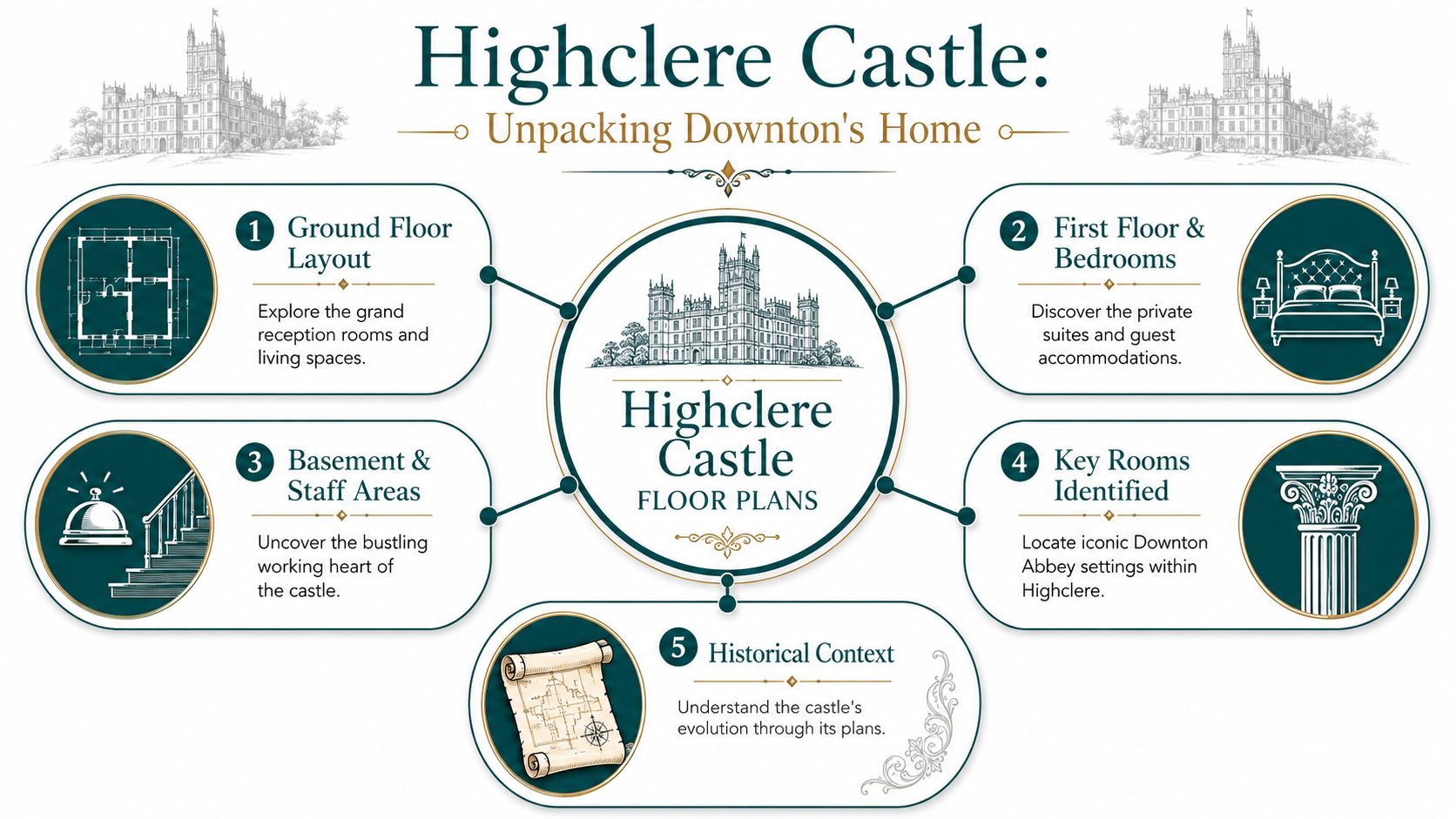
One of the clearest public references notes that the published plans separate the main levels and describes the first floor rooms as “ringing the gallery”, which is a useful clue to how the building works spatially, as discussed in this Highclere floor plan analysis. For anyone reading plans professionally, that central gallery matters because it creates a circulation loop rather than forcing movement through one room after another.
What to look for on the ground floor
The ground floor is where most visitors anchor their mental map. This is the level associated with the grand public rooms and ceremonial movement through the house.
When you read that plan, focus less on individual room names and more on adjacency. The key question isn't only “where is the library?” It's “what sits beside it, what opens into it, and what route would a guest take to reach it without crossing private territory?”
A practical reading approach:
- Find the entrance sequence so you can understand arrival and reception.
- Identify the principal rooms that appear in social scenes.
- Track connecting halls and openings rather than assuming direct shortcuts.
- Note which spaces feel public and which look transitional.
A separate but related issue is data quality. For digital navigation work, teams often start from scans, drawings, or estate plans. If that process interests you, our overview of floor mapping software looks at how static plans become usable spatial models.
A video tour can help readers connect the plan to the lived building:
Why the first floor matters just as much
The first floor is often treated as the “bedroom level”, but that undersells it. In a house like Highclere, this level reveals how privacy was organised.
The phrase about rooms ringing the gallery tells you the floor isn't a random cluster of chambers. It's organised around a central spatial feature that distributes people horizontally while preserving a hierarchy of access. That's why first-floor plans are so useful for understanding family suites, guest accommodation, and routes that don't rely on passing through occupied rooms.
The best historic floor plans answer movement questions first. Room names come second.
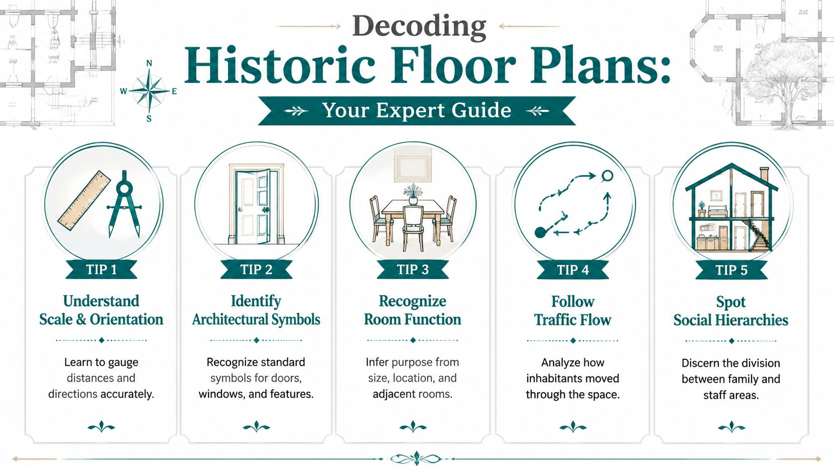
How to Read a Historic Floor Plan Like an Expert
A common approach to a historic plan is to start by hunting for famous rooms. Professionals do the reverse. They start with structure, circulation, and uncertainty.
That matters with Downton Abbey floor plans because the public often isn't sure what sort of plan they're looking at. One useful reference points out that many searchers confuse a plan of Highclere Castle with a TV set diagram or a modern house inspired by the show, and it also notes that a black-and-white plan is the ground floor while the colour plan is the floor above in that particular presentation, as explained in this design-library discussion.
Start with plan type, not room names
Before you interpret any drawing, classify it.
| Plan type | What it usually shows | What can go wrong |
|---|---|---|
| Historic house plan | A real building at a specific period | Readers assume it matches the TV narrative exactly |
| TV set geography | Spaces built for filming continuity | It may ignore the real building's logic |
| Inspired home plan | A modern design borrowing the aesthetic | It can be mistaken for an authentic Downton layout |
This single step removes a lot of confusion. In heritage work, wrong assumptions at the start create bad decisions later. The same issue appears when estates teams inherit mixed plan files with inconsistent labels, missing dates, or remodelled spaces.
Read circulation before decoration
Historic plans don't merely record walls. They record priorities.
Use this checklist:
- Look for central organising features such as galleries, halls, and major stair connections.
- Watch for separation of routes between ceremonial movement and service movement.
- Read room size as a clue to status, gathering, or private use.
- Treat unlabeled or lightly described areas carefully because they may hide operational functions that matter more than the famous rooms do.
One reason this analysis still matters is that modern digital capture doesn't eliminate interpretation. It just changes the workflow. Even with advanced tools, teams still need to know what they're looking at before turning plans into usable navigation layers. That's one reason we pay attention to data provenance when discussing LiDAR and 3D scanning.
A beautiful drawing can still be a poor operational map.
Spot the upstairs-downstairs split
The strongest reading of a Downton plan comes from recognising social hierarchy in the geometry. Grand rooms tend to sit on routes designed for presentation. Service spaces, where publicly shown at all, sit off those routes or below them.
That split is more than narrative flavour. It affects accessibility planning, visitor interpretation, staffing routes, and emergency communication. If you only map the famous rooms, you miss how the building actually functioned.
The Real vs The Reel Where Highclere Ends and Ealing Begins
Many readers assume that every memorable room in Downton Abbey belongs to one coherent, documented house plan. It doesn't work that neatly.
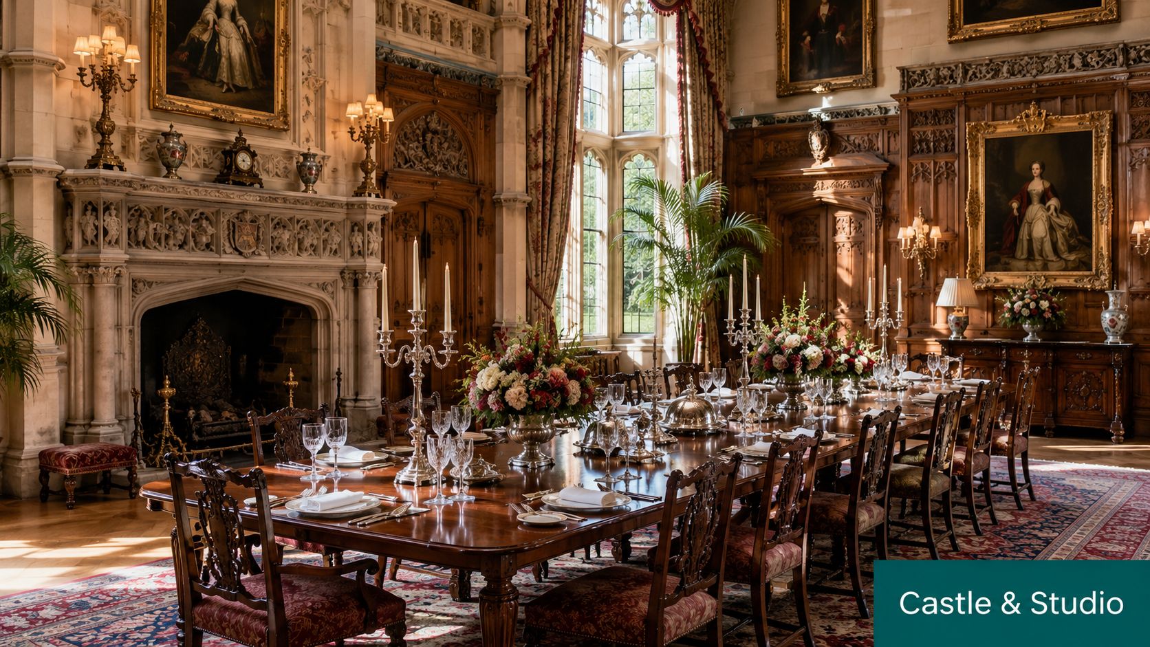
Highclere Castle provided the physical and visual foundation. According to Britannica's Highclere Castle entry, the house has more than 200 rooms and stands on an estate of about 1,060 acres, and it was enlarged in the mid-19th century into a grand mansion with roughly 60 to 80 bedrooms. That scale helps explain why the building could convincingly represent the world of aristocratic “upstairs-downstairs” life on screen.
What belongs to the real house
Highclere gives the series its architectural authority. The exterior presence, the ceremonial rooms, and the overall logic of a great country house come from a real place with real circulation constraints.
That's important because large historic houses have patterns that production designers can exploit but not casually reinvent. Public reception rooms need convincing relationships to halls, stairs, and one another. If those relationships feel false, audiences notice, even if they can't explain why.
What television production changes
Television also needs control. It needs repeatable lighting, removable walls, camera access, and scene continuity. That's where studio work enters the picture.
For viewers searching online, this creates a hybrid geography. Some “Downton” spaces map to Highclere. Some belong to constructed production environments. Some public diagrams blend the two so smoothly that readers assume the whole thing is architecturally unified.
That's where floor-plan discussions often go wrong:
- Fictional continuity gets mistaken for building accuracy
- Room relationships are inferred from editing, not architecture
- Back-of-house spaces appear more complete on screen than they are in public plans
- Composite diagrams get shared without any note on what is real and what is interpretive
Heritage buildings don't become simpler because a drama series makes them familiar.
For wayfinding, conservation, or accessibility work, the distinction is decisive. A visitor route, evacuation sequence, or access assessment can't rely on cinematic geography. It has to rely on verified building information.
The Modern Challenge Navigating a Real-Life Downton Abbey
A stately house can be legible on television and confusing in person. Those aren't contradictory conditions. They're often the same condition viewed from different angles.
For a first-time visitor, the very features that make a heritage estate memorable can make it difficult to use. Layered levels, indirect routes, formal entrances, restricted thresholds, and incomplete public maps all complicate navigation. The problem gets sharper when visitors need step-by-step guidance rather than general orientation.
One underappreciated issue is missing operational detail. A useful reference on house touring notes that the downstairs service routes and basement levels were central to how a country house functioned but are rarely shown in the diagrams most people share, as described in this Downton house tour discussion. That gap matters because practical navigation depends on complete route knowledge, not only iconic spaces.
Why static plans often fail on site
A printed plan can help with overview, but it usually breaks down at the point of action.
What doesn't work well:
- Aesthetic-only diagrams that highlight showpiece rooms but omit support routes
- Single-sheet plans that flatten multiple levels into one mental model
- Interpretive sketches used as if they were operational documents
- Signage-heavy fixes that add visual clutter without solving route confidence
For owners and managers of older properties, the pressure is familiar. They need to preserve significance while introducing modern usability. That balancing act isn't unique to British country houses. A thoughtful parallel appears in this guide for Vancouver heritage homeowners, which looks at how conservation goals and present-day comfort can sit in tension.
The estates problem behind the visitor problem
In practice, navigation failures are often data failures. Teams don't have one trusted, current, route-ready model of the building. They have fragments.
That's why digital wayfinding projects in heritage settings need more than attractive graphics. They need verified geometry, controlled updates, and route logic that reflects the building as people use it. Our overview of the internal navigation system challenge looks at the broader issue across complex venues, but heritage sites add a further constraint: every intervention must respect the building.
Digitising Heritage Plans for Inclusive Visitor Experiences
The practical route forward isn't to bolt more hardware onto a historic building. It's to turn verified plans into a reliable digital navigation layer that can change without physical disruption.
For heritage teams, the trade-off is usually clear. Physical infrastructure can create maintenance burden, conservation objections, and operational friction. Software-led wayfinding is more attractive when it can work from trusted floor data, support updates, and avoid dependency on installed devices.
What a usable digital model must do
A heritage navigation model has to serve more than tourists. It has to support estates teams, visitor services, access planning, and temporary operational changes.
A workable model should:
- Use verified plan layers first and treat speculative sketches cautiously
- Handle multi-level routing without flattening the building into one abstract map
- Represent public and staff logic separately when the site requires it
- Adapt quickly when exhibitions, closures, or access arrangements change
This is also where legal and standards context matters. In the UK, accessibility decisions sit within a framework that includes the Equality Act 2010, BS 8300, PAS 78, and BS EN 17210. Those aren't decorative references. They shape how venues think about inclusive access, information, and independent use of the built environment.
Why infrastructure-free navigation fits heritage settings
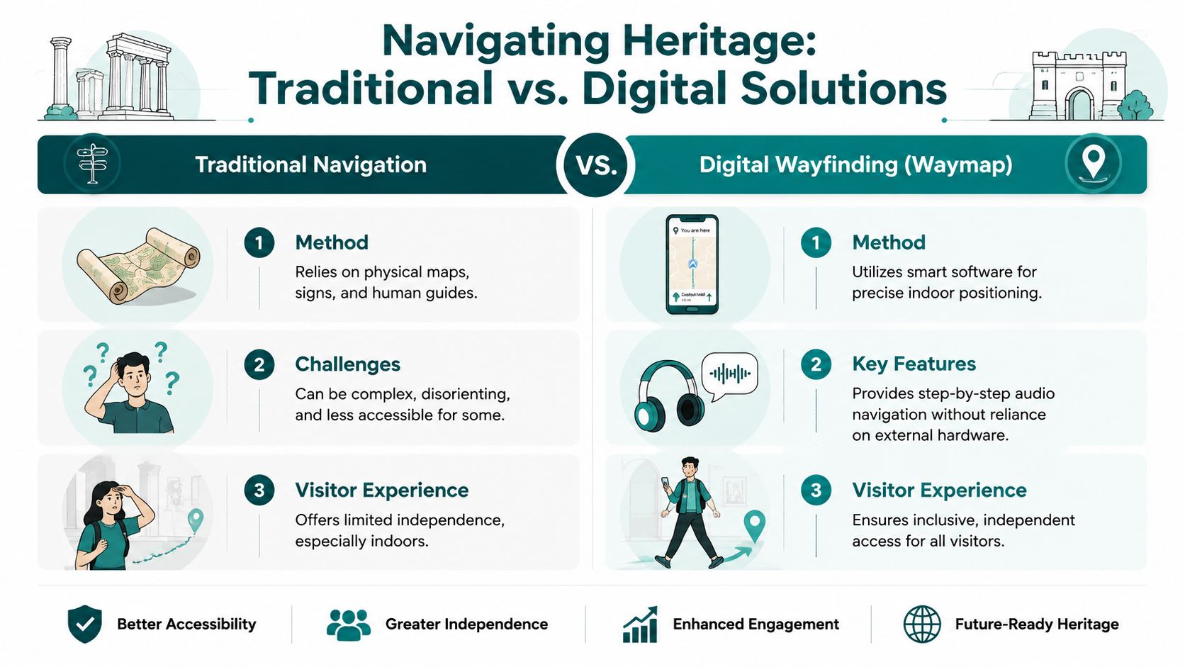
Where a site needs precise guidance but can't justify intrusive hardware, an infrastructure-light or infrastructure-free approach makes operational sense. One example is Waymap, which uses dead reckoning from device-native smartphone sensors rather than GPS, Wi-Fi, or installed beacons. That matters in heritage settings because the venue can provide digital guidance without adding physical equipment throughout sensitive interiors.
The logic is straightforward. If a venue can convert floor plans or CAD information into a maintained digital map, it can give visitors route-specific instructions while keeping the building fabric untouched. The same basic need appears in large public venues such as WMATA, Westfield London, the Royal Hospital for Children and Young People, and SBS Transit. Different settings, same core challenge: people need dependable navigation in places that are large, layered, and operationally busy.
Better accessibility in heritage buildings often starts with a better map, not a bigger hardware budget.
Inclusive design guidance also needs to reach beyond visual signage. That's why the principles in our piece on inclusive design principles remain relevant here. A floor plan becomes useful when it supports independent movement, not just architectural appreciation.
Frequently Asked Questions About Downton Abbey's Layout
Are Downton Abbey floor plans the same as Highclere Castle floor plans
No. Some Downton Abbey floor plans refer to Highclere Castle, while others mix in fictional or interpretive material linked to the television production.
Can you trust published Downton Abbey floor plans
Only with caution. An architectural source warns that many reconstructions are speculative and states that, “apart possibly from the ground floor (main house), [the drawings] are completely invented,” which is why technical uses should rely on verified plan data, as noted in this Highclere Castle architectural review.
What are most people actually looking for when they search for Downton Abbey floor plans
Interest typically falls into three categories: the actual Highclere layout, a diagram of the TV world, or a modern home plan inspired by the series. These are distinct use cases and shouldn't be merged.
Why do historic floor plans matter for accessibility
They matter because route quality depends on spatial accuracy. If stairs, galleries, thresholds, or adjacencies are misunderstood, the guidance given to visitors won't match the actual building.
What is the main navigation problem in a house like Downton Abbey
The main problem is that the building wasn't designed for intuitive public wayfinding. It was designed around hierarchy, ceremony, and service separation, which makes first-time navigation harder.
How should a heritage venue use Downton Abbey floor plans in practice
Use them as a cultural and interpretive starting point, not as automatic source-of-truth operational data. For visitor guidance, access planning, and digital routing, venues need verified drawings and a maintainable navigation model.
If you manage a heritage site, public venue, or complex estate and need floor plans turned into usable navigation, Waymap provides a practical route from static drawings to step-by-step digital wayfinding without relying on GPS, Wi-Fi, or installed hardware.