
The Technology in Mapping: From Paper Charts to Intelligent Navigation
Not long ago, finding your way around a large airport or a multi-building university campus meant unfolding a paper map. It was static, often out of date, and couldn't tell you where you were in real time. That experience highlights just how far we've come from static charts to the intelligent, dynamic digital maps available today.
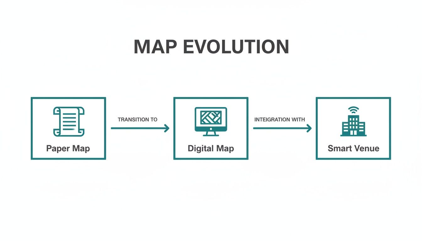
From Paper Maps to Smart Venues
The first major leap in mapping was getting everything into a computer. These weren't just scanning projects; they were significant efforts to convert centuries of paper records into the foundational data layers that power modern navigation.
The Foundation of Digital Mapping
You can see this journey in the work of the Ordnance Survey (OS), Britain's national mapping agency. Their story began in September 1841 with the first county maps, changing how the UK saw its own landscape. In the digital age, the OS, in partnership with Landmark Information Group, undertook the task of converting its entire archive—every map from 1841 to 1996—into high-resolution digital files. You can discover more about this historic mapping project and its data.
This work did more than preserve history. It created a detailed, searchable record of Great Britain's geography that became the foundation for everything from urban planning to environmental risk assessments.
The Rise of Interactive Environments
This evolution from flat images to interactive, data-rich "digital twins" is what makes modern venues navigable. A paper map or a simple digital image can show you the layout of a building, but it can't guide you to a departure gate, tell you an escalator is out of service, or give you directions in your language.
Today’s advanced technology in mapping fills those gaps, offering:
- Real-time updates: Information can be changed instantly, reflecting temporary closures or new shops without reprinting a single sign.
- Dynamic routing: Navigation can adjust on the fly, offering alternative routes based on congestion or a person's accessibility needs.
- Personalized guidance: Directions can be tailored to an individual’s pace or preferred language, creating a more inclusive and less stressful experience for every visitor.
This progression laid the groundwork for hardware-free solutions that turn our public spaces into truly navigable environments. By building on these rich digital foundations, we can now deliver precision guidance that works anywhere, for everyone, using only the technology people already carry.
Understanding the Core Mapping Technologies
To understand modern navigation, it helps to look at the technologies that make it possible. The world of digital mapping uses a handful of core methods. Each has its own strengths and, more importantly, its own weaknesses.
For any venue operator or transit planner, knowing the difference isn't just a technical detail—it’s the first step toward genuinely improving how people experience and move through your space.
We are all familiar with the Global Navigation Satellite System (GNSS), which we usually call by its American name, GPS. It's a remarkable piece of engineering. A network of satellites orbits the Earth, and your phone listens for their signals to determine your location. When you’re outdoors with a clear view of the sky, it works exceptionally well. It’s the standard for car navigation and how you find your way across town.
But the moment you step inside a shopping mall, head down into a subway station, or even walk under dense tree cover, those satellite signals are lost. This is the "GNSS-denied" problem, and it's the single biggest challenge in indoor navigation. This is where innovation must begin.
Navigating Without Satellites
To solve the puzzle of indoor wayfinding, engineers first turned to hardware. The idea was simple: if we can't use the global satellite network, let's build a local one inside the building. These systems create a kind of mini-GPS that a smartphone can use to find its position.
The two most common approaches are:
- Bluetooth Low Energy (BLE) Beacons: These are small, battery-powered transmitters placed on walls and ceilings throughout a venue. They broadcast a simple ID signal, and an app on a user’s phone measures that signal's strength to estimate its distance from several beacons.
- Wi-Fi Real-Time Location Systems (RTLS): This works on a similar principle but uses the Wi-Fi routers a building may already have. A device can calculate its position by measuring the signal strength from multiple access points.
This progression from paper maps to intelligent digital spaces is a huge leap, one that demands these new kinds of technologies to function.
As this graphic shows, our expectations have completely changed. We've gone from needing a basic layout to demanding real-time, interactive guidance that understands the complexities of our indoor world.
To get a clearer picture of how these different technologies stack up against each other, let’s compare them.
Comparison of Core Mapping Technologies
As you can see, the choice of technology has a direct impact on accuracy, cost, and maintenance—all critical factors for any real-world deployment.
The Problem With Hardware
While these hardware systems offered a first-generation solution to the GNSS problem, they come with significant drawbacks. The accuracy of both BLE and Wi-Fi positioning is often inconsistent, typically varying within a range of 3 to 10 meters. That might be good enough to get you to the right department in a large store, but it’s not precise enough to guide a person with a visual impairment to a specific help desk.
The real challenge is the constant upkeep. Beacons need new batteries, Wi-Fi routers have to be maintained, and if you rearrange the floor plan, you have to physically move and recalibrate the entire network.
This creates a hidden, ongoing cost for any venue. Furthermore, accuracy can be disrupted by anything from a crowd of people to simple radio interference, leading to a frustrating and unreliable user experience. If you want to dive deeper, you can learn more about the different types of indoor positioning systems and their unique challenges.
The Next Wave: Advanced Software and Sensors
Fortunately, the industry is moving beyond beacons and Wi-Fi. A new generation of more sophisticated technologies is redrawing the map.
Simultaneous Localization and Mapping (SLAM) is a concept where a device, like a robot or a person with a specialized scanner, creates a map of a new space while simultaneously tracking its own position within that map. It’s often powered by LiDAR (which uses laser pulses) or advanced cameras to "see" the environment in great detail.
Along the same lines, photogrammetry and computer vision use collections of photos or video to construct highly accurate 3D models. For example, some aerial roof measurement services now use a combination of drones, satellites, and AI to create precise digital twins of buildings. These tools are excellent for creating the initial map but aren't designed for guiding a user in real-time.
Instead, a promising path forward combines these hyper-accurate initial maps with the powerful sensors already inside every smartphone. This "sensor fusion" approach uses the phone's motion sensors—the accelerometer, gyroscope, and compass—to track a user's movement with high precision, turning the phone itself into a self-contained navigation tool that doesn’t need any external hardware to work.
Solving the Indoor Navigation Challenge
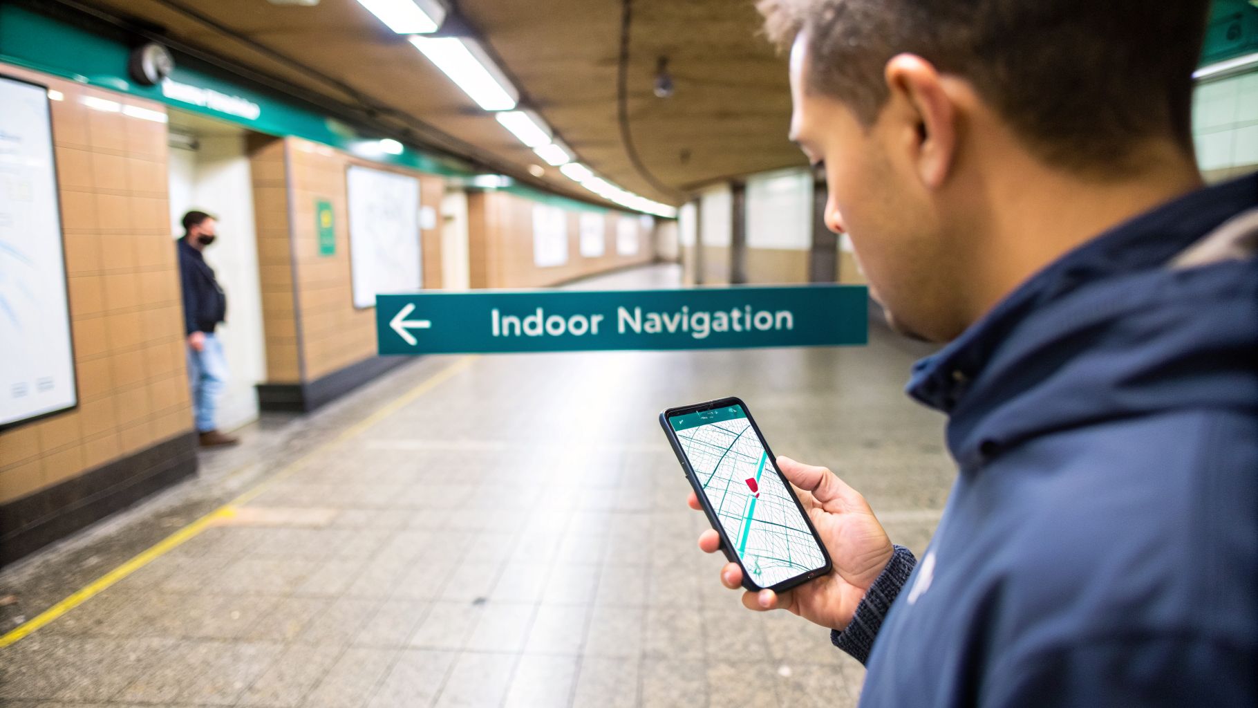
We’ve all felt that moment of frustration. You’re navigating a busy transit station or deep inside a large shopping center, and your phone’s blue dot starts spinning helplessly. That’s a ‘GNSS-denied’ environment in action.
It’s the fundamental problem that causes outdoor mapping apps to fail the moment you step indoors. The challenge is to find a way to pinpoint your location where satellites can’t reach. This has led to two very different approaches, each with major trade-offs in accuracy, cost, and long-term upkeep.
One path involves outfitting a building with physical hardware. The other puts its trust in the powerful sensors already packed into the smartphone in your pocket.
The Hardware-Dependent Approach
The first wave of indoor navigation solutions essentially tried to build a miniature satellite network indoors. The most common tool for this job is the Bluetooth Low Energy (BLE) beacon. These are small, battery-powered transmitters you place on walls and ceilings throughout a venue. Your phone’s app then estimates its position based on the signal strength from nearby beacons.
While it sounds straightforward, this hardware-first strategy leads to persistent operational challenges. Beacons demand a significant upfront spend on the devices and their installation. Worse, they create a constant maintenance burden.
- Battery Replacements: Beacons have batteries that need to be replaced. In a large venue, finding and replacing them becomes a never-ending and costly task.
- Signal Interference: Walls, pillars, and even crowds of people can block or disrupt signals. Other wireless devices can also cause interference, leading to inconsistent performance.
- Recalibration: If a shop moves or you change the layout, the beacons must be physically relocated and the whole system recalibrated.
Ultimately, this approach ties a venue's wayfinding to a fragile network of physical devices that need constant attention. The result is often an expensive system that isn't accurate enough for true accessibility.
A Software-First Alternative: Sensor Fusion
There’s a smarter, more sustainable approach to technology in mapping that sidesteps external hardware completely. It’s a method known as sensor fusion, and it relies on the sophisticated motion sensors already built into every smartphone.
Your phone contains a small but powerful component called an Inertial Measurement Unit (IMU), which includes:
- An accelerometer to measure changes in speed and movement.
- A gyroscope to track your orientation and every turn you make.
- A magnetometer that works like a digital compass.
By blending the data from these sensors, an application can build an incredibly detailed picture of how you're moving through a space. It can track each step, every turn, and any change in elevation with remarkable precision.
When this real-time motion data is fused with a highly accurate digital map of the venue, the phone can calculate its position without needing any external signals from beacons, Wi-Fi, or satellites.
This software-based method is a significant advance for venue operators and mobility planners. It removes the cost and complexity of installing and maintaining a grid of physical hardware. Because it’s powered by software, the system is more scalable and easier to update. Our team pioneered this approach, and you can learn more about how we enable navigation without any signal dependency in our article on signal-free location technology.
The contrast between these two philosophies is clear. One requires a building to be kitted out with hardware just to support navigation. The other empowers every visitor to navigate using only the device they already carry, making reliable indoor guidance accessible, scalable, and operationally efficient for any venue.
How AI Is Making Maps More Intelligent
Modern mapping has grown beyond simply showing you where you are. Today, it’s about creating an intelligent, responsive, and personal experience. The engine behind this change is artificial intelligence (AI) and machine learning, which are bringing static building data to life and turning it into a dynamic tool that can anticipate a user's needs.
This isn’t an abstract, far-off concept. For a venue manager, AI is a powerful way to analyze how visitors move and find ways to optimize the space. For a traveler, it’s the difference between generic directions and guidance that feels intuitive. This leap in intelligence is turning maps from a basic utility into an essential service.
The most immediate impact is on navigation accuracy. Instead of just taking raw sensor inputs at face value, AI algorithms can learn to interpret them with nuance.
At Waymap, our system uses AI to learn a person's unique walking gait, including their stride length and pace. This allows us to provide truly personalized, step-accurate audio directions that adapt to each individual, turning a generic map into a personal guide.
It’s this kind of personalization that makes for a navigation experience that feels both natural and reliable, especially in places where every step matters.
From Predicting Paths to Unlocking History
Beyond just getting from point A to B, AI is fundamentally changing how we understand and interact with mapped places. It’s opening up new possibilities in predictive analysis and data extraction, creating value for everything from day-to-day operations to historical research.
For example, machine learning models can analyze aggregated movement data to spot bottlenecks or underused areas inside a venue. A shopping center manager could use these insights to rethink their tenant mix, while a transit operator could reposition staff to better manage peak hours. The technology in mapping suddenly becomes a source of business intelligence.
AI is also proving invaluable for bringing the past to life. Countless historical maps exist only as scanned images, their rich details locked away. Now, AI can "read" these maps, extracting place names, boundaries, and other features to make them searchable for the first time.
A great example is The Alan Turing Institute's 'Machines Reading Maps' project. It uses machine learning to sift through thousands of digitized Ordnance Survey maps of Great Britain, transforming scanned text into a queryable dataset. Researchers can now ask questions like, "where were the libraries in 1800s Edinburgh?" and get answers in minutes—a task that once would have taken months of work. You can read about how this project unlocks historical archives on the Turing Institute's blog.
The Future of Data-Driven Environments
As this intelligence deepens, maps are becoming much more than just navigation aids. They are evolving into a foundational layer for smarter, more responsive public spaces, bridging the gap between a physical building and its digital twin to create a constant feedback loop.
This connection offers powerful benefits:
- Predictive Maintenance: By analyzing footfall patterns over time, AI can help predict wear and tear on infrastructure, flagging areas that need attention before a problem occurs.
- Enhanced Safety: In an emergency, intelligent routing can guide people away from hazards in real-time, always calculating the safest possible path to an exit.
- Operational Agility: Venue managers can test the impact of layout changes in a digital model first, before committing to expensive and disruptive physical alterations.
This intelligent layer transforms a simple building diagram into a living system. By integrating AI, the technology in mapping is no longer just about showing you where you are; it’s about understanding the space around you and helping you navigate it more safely and effectively.
Putting Modern Mapping Tech into Practice
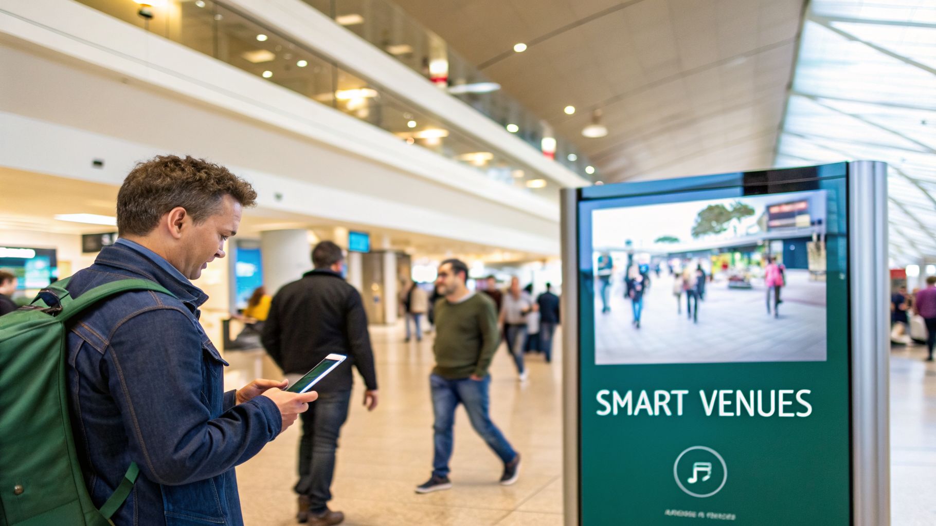
The theory behind mapping is fascinating, but the real test is when these technologies are put to work. This is where we see how technology in mapping truly changes the way people experience a place, and what value it brings to the organizations running these complex spaces.
Across busy public transport networks, large university campuses, and massive sports stadiums, we’re seeing the impact firsthand. This is the point where complex algorithms solve everyday problems—improving passenger flow, making spaces more inclusive, and creating better visitor experiences.
For a transit agency, this means giving every passenger the confidence to travel independently. For a shopping center, it's about helping visitors discover more. It’s about turning a physical building into a responsive, interactive, and welcoming environment for everyone.
Enhancing the Visitor Journey in Public Venues
Think about navigating a large airport or stadium. Static signs are expensive to keep up-to-date, impossible to change instantly, and offer no personal guidance. A dynamic digital wayfinding layer, built on modern mapping tech, changes everything.
Instead of ordering new signs, a venue manager can update points of interest on the fly through a simple digital portal. Gate change? A certain entrance temporarily closed? That information can be sent straight to visitors’ phones, preventing queues and confusion.
This digital-first approach brings immediate benefits:
- Multilingual Support: Directions can be delivered as audio in a visitor’s native language, making the venue more accessible to international travelers.
- Cost Reduction: The reliance on extensive physical signage decreases, slashing the costs of printing, installation, and ongoing maintenance.
- Increased Engagement: In retail, dynamic maps can highlight special offers or guide customers to new stores, directly shaping footfall and spending.
When you layer digital information over a precise map, a venue stops being just a static structure. It becomes a living environment that can communicate with its visitors, adapting to their needs and the operational realities of the day.
This dynamic potential is especially clear when you look at how historical data can inform the present. Projects like Colouring London, from UCL's Centre for Advanced Spatial Analysis, have digitized huge amounts of data on the city's buildings. This shows how planners can understand the impact of preserving heritage while also meeting modern accessibility needs. It proves that a dynamic wayfinding layer can be added to any building, old or new, to modernize the experience. You can learn more about this historic mapping initiative and its findings.
Making Public Transit Accessible for All
Nowhere is the power of precise, hardware-free navigation more obvious than in public transport. The complex, often underground maze of a metro system can be a significant barrier for many people, especially those with sight loss.
Accurate, step-by-step audio guidance changes everything. A passenger can be guided from the street outside, through the ticket gates, to the right platform, and onto the correct train—all without needing to see a sign.
This is a major step forward for independent travel, a fundamental goal for both accessibility advocates and transport authorities. Because the system is based in software, it can be rolled out across an entire network much faster and more affordably than any solution that depends on installing physical hardware.
You can see for yourself some of the real-world locations where our technology is making a difference at Waymapped venues. This is how you turn a public service into one that is truly public, and truly for everyone.
Choosing the Right Mapping Solution for Your Venue
Picking a mapping and navigation partner is a critical decision that has long-term consequences for your budget, your operations, and most importantly, your visitor experience.
Get it right, and you can transform accessibility, find new efficiencies, and unlock valuable insights. Get it wrong, and you could be stuck with high maintenance costs and a system that doesn't meet the needs of your community.
As a venue operator or mobility planner, you must look past marketing claims and evaluate any potential solution against a clear set of criteria. The best technology in mapping for your venue isn't just about pinpoint accuracy; it’s about reliability, scalability, and what it truly costs over the lifetime of the system.
A future-proof solution should empower your team, not create a new list of technical headaches. It has to be flexible enough to keep up with the constant changes in your space and the diverse needs of your visitors, especially those who rely on specific accessibility support.
Key Questions for Potential Vendors
To make an informed choice, you need to ask the right questions – the ones that get to the practical, real-world implications for your team and your visitors.
Start with these essential queries:
- Does your system rely on physical hardware? You need to know if their system depends on BLE beacons, special Wi-Fi routers, or any other equipment that needs installing. A hardware-free approach sidesteps large upfront costs and the cycle of battery replacements and maintenance.
- How do we maintain and update our maps? In a dynamic environment like a transit hub or a shopping center, things are always changing. A modern solution should give your team a simple portal to instantly update points of interest, add temporary closures, or adjust pathways without calling a technician.
- Does it genuinely meet accessibility standards? True accessibility for people with visual impairments demands step-level accuracy, which is typically within 1-2 meters. Vague claims about being "accessibility-friendly" are not enough. Demand specifics on how the system supports independent navigation for everyone.
- How is our users' privacy protected? Any system that involves location must have a robust, transparent privacy policy. It’s crucial to understand what data is collected, how it’s stored, and whether it’s properly anonymized to protect individual identities.
Choosing a mapping partner is about more than just buying technology; it’s about forming a strategic partnership. The right partner will work with you to ensure the solution aligns with your long-term goals for accessibility, operational excellence, and visitor satisfaction.
Evaluating the Total Cost of Ownership
The initial price tag is only one piece of the puzzle. A proper evaluation has to consider the total cost of ownership (TCO).
Hardware-based systems often look tempting with low initial software fees, but they almost always come with substantial hidden costs for installation, ongoing maintenance, and the eventual replacement of all the physical equipment.
In contrast, a hardware-free, software-as-a-service (SaaS) model provides a more predictable and manageable cost structure. By using the sensors already built into your visitors' smartphones, you avoid spending capital on infrastructure. This frees you to redirect resources toward what really matters—providing a seamless and inclusive experience.
This approach ensures your investment is not only sustainable but also delivers a clear return by boosting operational efficiency and helping you meet important accessibility mandates.
Frequently Asked Questions
As venue operators, mobility planners, and accessibility teams explore modern mapping technology, a few practical questions often come up. Here are our answers to the most common ones, clarifying the essentials of how this works in the real world.
What's the Real Difference Between Beacon-Based and Sensor-Fusion Navigation?
Think of beacon-based navigation as setting up a breadcrumb trail of physical hardware. You have to install a network of Bluetooth beacons throughout a building, which then helps estimate a user's position. It’s a significant upfront project and means someone is constantly responsible for replacing batteries and recalibrating the system.
Sensor fusion, on the other hand, is a completely different approach. It uses the motion sensors already inside every smartphone – the accelerometer, gyroscope, and others. By combining that data with a highly detailed digital map, it calculates your position without needing extra hardware. This makes it far more scalable, affordable, and much easier to maintain.
How Accurate Does an Indoor Navigation System Really Need to Be?
It all comes down to what you’re trying to achieve. If you just need to guide someone to the right section in a large store, an accuracy of 3-5 meters might be fine.
But when we talk about genuine accessibility, especially for people with sight loss, the standard is much higher. You need step-level accuracy – down to 1-2 meters. That’s the kind of precision it takes to guide someone confidently to a specific door, a help desk, or the edge of a train platform. When looking at solutions, you have to ask: is the accuracy good enough for everyone who needs it?
How Difficult Is It to Update Maps for a Large Venue?
That depends on the technology in mapping you've chosen. If your system is tied to physical hardware like beacons, updating a map can be a major task. It often means physically moving and reconfiguring devices across your entire site.
Modern, software-based platforms change this completely. A venue manager can log into a portal, change a point of interest, mark a temporary closure, or reroute a path. Those changes are pushed out to everyone's app instantly. No physical work is needed, just an always up-to-date and reliable map.
Ready to make your venue navigable for everyone? Waymap delivers precision indoor navigation without beacons or hardware. Discover how our software-first approach can enhance accessibility and improve visitor experience at https://www.waymapnav.com.