
Wayfinder Digital Signage for Accessible Venues
Wayfinder digital signage shouldn't be treated as a prettier replacement for printed maps. Adding more arrows, directories and wall signs often leaves the underlying problem untouched: visitors still have to interpret inconsistent information at the exact point where they need to make a decision. A better approach combines accessible physical signs with a dynamic, updateable routing layer that can respond to closures, lift outages, temporary layouts and individual access requirements.
For estates managers, the important question isn't whether a screen looks modern. It's whether the whole journey works for someone finding an entrance, locating a lift, reaching a platform or responding to a service change. This article sets out how to assess that system, where static signage still matters, and why infrastructure-free navigation can reduce the operational burden of maintaining a large venue.
Rethinking Navigation Beyond Static Signs
The common advice is simple: add more signs. In practice, that can create a denser environment without creating a clearer one. A visitor may see several arrows but still lack an answer to the most important question, which route works for their destination and access needs right now?
London rail audits illustrate the problem. Thirty-one per cent of station audits found platform directions unclear, while 42% reported missing or hard-to-read maps, according to London TravelWatch's digital exclusion annex. Those findings describe static-signage failures, but they also identify where a digital wayfinding layer has the greatest value: entrances, junctions, lift landings, platform approaches and other decision points.
Static information has a short operational lifespan
Printed maps are fixed when the building is not. A retail centre changes tenants. A hospital closes a corridor. A transport operator moves a boarding point. A stadium changes its access arrangements for an event. Each alteration creates a gap between the route shown on the wall and the route available on the ground.
A screen or mobile route can be amended centrally, but that doesn't make physical signs redundant. Visitors still need clear visual information when they aren't using a phone, and people with different access requirements may need different forms of guidance. The practical model is a continuous information system, not a choice between paper and software.
Practical rule: Put the most reliable information at the point where a visitor must choose, then make sure the same destination, route and access status appear across every channel.
Wayfinder digital signage is most useful when it connects three layers:
- Physical orientation: Consistent signs establish entrances, circulation routes, lifts, stairs and platforms.
- Dynamic venue information: Digital displays communicate closures, temporary diversions, service changes and emergency instructions.
- Personal routing: A browser or app can provide step-by-step guidance suited to a visitor's chosen destination and route requirements.
That approach turns navigation from a passive directory into an operational service. The Waymap perspective on mapping and navigation is relevant here because the route should be treated as live information that can change with the environment, rather than as a graphic asset that gets replaced only during a refurbishment.
The design test is straightforward. Ask a visitor to find a particular destination without staff intervention, then repeat the task after a lift closure or temporary diversion. If the physical sign, digital display, web route and staff instruction disagree, the venue has an information-management problem, not merely a signage problem.
Accessibility Standards and the Legal Duty to Guide
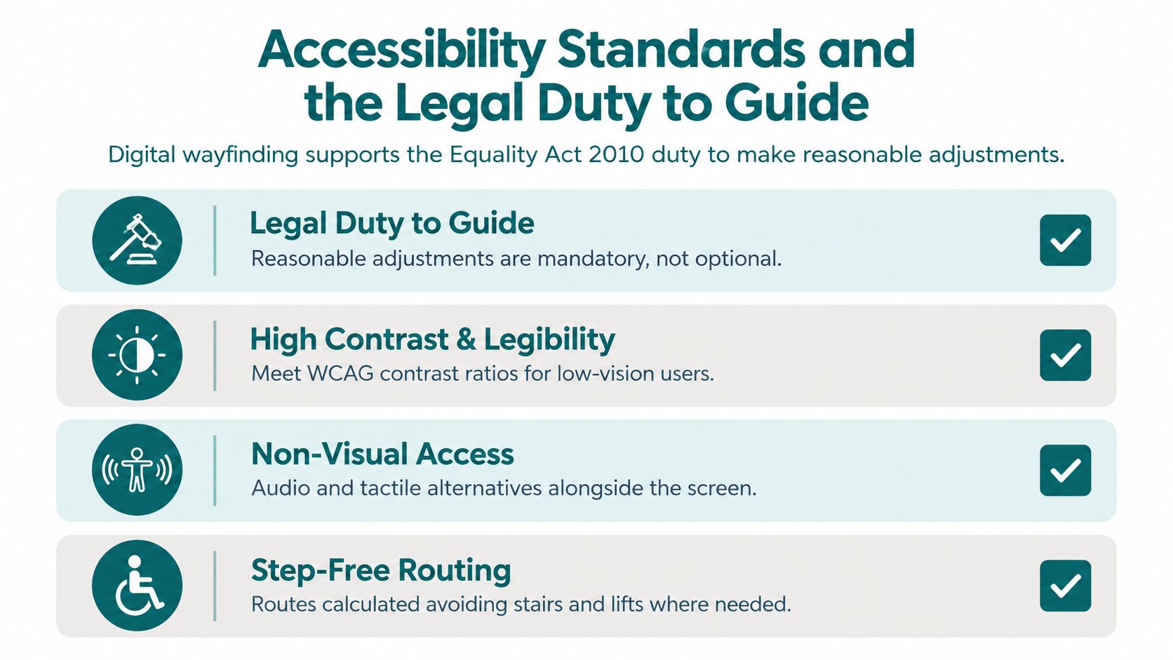
Digital wayfinding can help a venue meet its duty to make reasonable adjustments under the Equality Act 2010. A screen by itself does not demonstrate compliance. The practical test is whether disabled visitors can access information and complete a journey through a coordinated combination of signs, announcements, staff support, digital interfaces and step-free routes.
The Department for Transport's inclusive mobility guidance calls for a continuous chain of directional information. It also states that important information for wheelchair users should not be positioned more than 1700mm above ground. These requirements give estates teams practical parameters for coordinating physical signs with digital wayfinding. They also show why an infrastructure-free digital layer can support access information without adding another network of beacons or fixed hardware to maintain.
Accessibility is a journey-level responsibility
Transport for London illustrates why route information must be treated as part of access provision. Around a third of Tube stations, half of Overground stations, most piers, all tram stops, the IFS Cloud Cable Car and all DLR stations have step-free access, according to TfL's accessible journey information. TfL also states that stations and piers are signposted, with more prominent step-free signage introduced at some locations.
Step-free infrastructure only helps when passengers can identify and reach it. A lift may be available, yet a visitor can miss it because the sign appears too late, uses an unfamiliar symbol or points towards a route that has changed. Digital layers can expose current access information and guide people around temporary restrictions, provided the content follows the same placement and hierarchy rules as the physical sign family.
Build a combined accessibility audit
Audit realistic journeys rather than checking screens in isolation. Test whether a person can:
- Find the accessible entrance from the public approach.
- Locate a lift or step-free alternative.
- Reach a platform, department, auditorium or retail destination.
- Respond to a closure, service change or emergency announcement.
- Complete the task using the available visual, audio and digital formats.
UK guidance for inclusive venues, including the Centre for Excellence in Information Support for Care and Health guidance on accessible events, emphasises large print, strong tonal contrast, consistent positioning at entrances, lift landings and circulation junctions, plus audio or alternative formats where needed. The audit should check those details across signs, displays, kiosks and personal devices.
For digital interfaces, WCAG 2.1 AA provides an important reference where it applies. Assess keyboard access, focus order, contrast, text alternatives, scalable text and compatibility with assistive technologies. A touchscreen kiosk with an attractive map but no alternative route for a blind visitor is incomplete.
Emergency and service-change information belongs in the same system. The Department for Transport guidance treats such announcements as part of the wider accessibility duty. Digital signage therefore forms part of public information infrastructure, not a branding channel.
TfL's customer information strategy provides further operational detail. It describes a distinctive, separate trail for customers with impaired mobility, specifies Accessible Blue Pantone 3005 with white symbols, text and border, and recommends positioning signs at a consistent height of 1300mm from floor level to the top edge. Those requirements should shape the relationship between digital content, permanent signs and accessible route markers.
For a fuller checklist of accessible wayfinding practice, see the Waymap accessibility best-practices guide, which covers placement, contrast and alternative formats.
Static Signage Networks Versus Dynamic Digital Layers
Static signage remains valuable. It works during network outages, requires no user interaction and provides orientation for people who don't want to use a phone. Its weakness is change management. Every altered route creates a risk that some signs, maps or directories will remain wrong.
Dynamic wayfinder digital signage addresses that risk through software updates, but it introduces its own dependencies. Screens need power, media players need support and content changes need governance. A venue that installs displays without assigning ownership can replace one form of inconsistency with another.
The comparison below is deliberately practical.
| Feature | Static Signage Networks | Dynamic Digital Wayfinding |
|---|---|---|
| Route updates | Each affected sign or map must be identified and replaced or covered | Route information can be changed centrally, subject to system and network availability |
| Temporary closures | Staff need temporary notices, barriers or printed diversions | Displays and digital routes can present an updated alternative, provided the data is maintained |
| Accessibility formats | Must be designed into each physical sign and supplemented by other channels | Can support visual, audio and interactive outputs, but only when accessibility is built into the product |
| Multilingual information | Requires additional sign space or separate materials | Can present selectable languages without adding more wall panels |
| Emergency messaging | Relies on staff deployment, announcements or pre-designed panels | Can prioritise urgent messages across connected screens |
| Failure mode | Usually remains visible, but may be out of date | May lose content, connectivity or power, so physical fallback remains essential |
| Maintenance burden | Surveys, fabrication, installation, cleaning and replacement | Hardware maintenance, content governance, map updates and technical support |
| Best use | Permanent orientation and resilient baseline information | Live changes, complex routes, search, personalisation and high-change environments |
The operational case for dynamic signage is strongest where the venue changes frequently. It's weaker where the map is simple, stable and easy to understand. Estates teams shouldn't digitise a route merely because screens are available.
Measure the points where visitors fail
A useful digital layer should improve decisions, not just display more content. Review incidents and staff queries around:
- Platform or gate identification.
- Accessible entrances and lifts.
- Temporary diversions.
- Large junctions with several competing destinations.
- Routes between transport modes, buildings or event zones.
The Waymap guidance on digital signage requirements reflects an important distinction. A digital sign needs more than a map graphic. It needs clear destination data, accessible presentation, a dependable route model and a process for updating the information when the venue changes.
A screen that shows an outdated map is worse than a plain sign that accurately identifies the next decision point. The procurement question should therefore be, “Who changes this information, how quickly can they do it, and how does the change reach every related route?” That answer matters more than screen resolution.
Real-World Deployments in Transit and Large Venues
Large transport and venue environments expose weaknesses that smaller sites can hide. A visitor may need to move from a street entrance to a concourse, through a lift, across a platform interchange and into a final building. Each transition introduces a decision point, and each temporary change can invalidate a route.
Transport for London's network shows the scale of the coordination challenge. Its accessible journey information covers Tube, Overground, piers, tram stops, the IFS Cloud Cable Car and DLR locations, with step-free access distributed across a mixed network. The presence of signs and step-free infrastructure doesn't remove the need for accurate routing. It makes route clarity more important because passengers must identify the usable path within a complex system.
Named deployments associated with Waymap include WMATA, SBS Transit, LTA Singapore and CapMetro Austin. These organisations represent the kinds of networks where navigation must cope with multiple stations, changing passenger flows and different levels of infrastructure. For an operator assessing a digital layer, the relevant question isn't whether a deployment has a polished interface. It's whether the system can keep route information aligned with the physical network and support people who can't rely on visual signs alone.
Complex venues need task-specific routes
Shopping centres, airports, stadiums and campuses have a similar problem, even when they aren't transport networks. A visitor may search for a shop, gate, ticket desk, accessible toilet or auditorium. Staff may need to publish a temporary entrance or close a corridor without waiting for a full signage project.
That's where a digital route can complement a directory. Instead of showing every corridor at once, the system can guide a visitor from their current decision point to a defined destination. The venue team can also distinguish between a general route and an accessible route, provided the underlying map contains accurate information about stairs, lifts, surfaces and barriers.
Digital Souls Studios' Minday Digital Souls case study is a useful resource for teams examining how a digital experience can be designed around a defined audience and venue context. It also reinforces a procurement lesson: a digital wayfinding project needs a clear user problem, not just a screen deployment.
The Waymap discussion of airport wayfinding systems points towards the same operational reality. Airports and other major hubs have to coordinate arrivals, departures, security areas, retail zones, accessible routes and service updates. The route layer must be treated as part of the venue's operating model, with named owners for map data, access information and change approval.
A successful deployment starts with the journey that routinely fails, not with the screen that has an available mounting point.
For sports and entertainment venues, event mode deserves separate testing. A route that works during a quiet weekday may fail when gates open, temporary barriers appear or visitors are redirected. Estates managers should test normal operation, event operation and disruption operation before treating a wayfinding system as complete.
The Case for Infrastructure-Free Navigation Systems
Beacon-based navigation can look attractive because it promises a physical reference point inside a building. The difficulty appears after installation. Beacons need site surveys, placement decisions, batteries or power, asset registers, replacement plans and checks that the signal still supports the intended route. High-footfall venues add the possibility of damage, interference and layout changes.
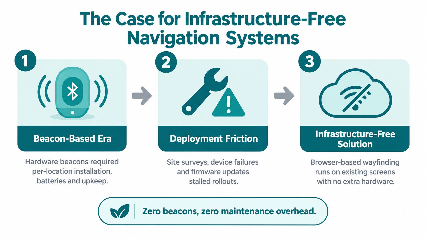
Infrastructure-free navigation takes a different approach. Waymap uses dead reckoning with device-native motion sensors, rather than relying on GPS, Wi-Fi or installed beacons. The platform is described as providing sub-3-metre accuracy in infrastructure-free environments, and it can use a smartphone's sensors and detailed maps to deliver routes in indoor, outdoor and underground settings.
That architecture matters to estates teams facing capital constraints. Removing beacon hardware doesn't remove the need for accurate mapping, testing or support, but it avoids a separate physical network that must be installed and maintained across the venue. It also suits buildings where layouts change frequently or where staff turnover makes a complex infrastructure inventory difficult to manage.
Software-first does not mean maintenance-free
Infrastructure-free navigation still requires disciplined operations. The venue must maintain points of interest, route restrictions, lift status, temporary closures and destination names. A sensor-based route can only be as useful as the map and access data behind it.
The trade-off is where maintenance happens. With beacons, teams maintain both the route data and a distributed hardware estate. With an infrastructure-free approach, the hardware burden shifts towards the visitor's device and the venue's software and mapping workflow. That can make rollout easier, but only if the organisation has a named owner for updates.
For venues with no reliable indoor signal, the model is particularly relevant. GPS can be unavailable indoors or underground, while Wi-Fi coverage may vary by room, operator or security policy. A route that relies on those signals can become fragile precisely where a visitor needs dependable guidance.
Infrastructure-free navigation also supports a more proportionate business case. A venue can begin with a difficult route, such as a station interchange, hospital campus or stadium approach, validate the task and expand the mapped area without first fitting every corridor with new hardware. That staged approach is easier to govern than committing to a large beacon estate before the operator has proved the user need.
Evaluating Wayfinding Solutions for Operational ROI
A digital wayfinding business case should measure operational friction, not screen activity. Screen views and interaction counts may show that people noticed a display, but they won't tell an estates manager whether visitors reached the correct platform, avoided a closed lift or needed staff intervention.
Start with the route inventory. List the destinations that generate the most confusion, then document the available physical signs, digital displays, web pages, apps, announcements and staff instructions. Record where those sources disagree. This creates a baseline without pretending that every navigation failure has the same cause.
Use five procurement tests
1. Test live change control. Ask the supplier to demonstrate a lift closure, temporary entrance and route diversion. Watch how the change is created, approved, published and withdrawn. A system that requires a developer for every operational amendment may create a new queue for estates teams.
2. Test accessible alternatives. Check high contrast, scalable text, keyboard operation, screen-reader compatibility, audio guidance and the ability to select a step-free route. The route should also identify inaccessible or unavailable links rather than directing users towards them without warning.
3. Test resilience. Establish what happens when a screen loses connectivity, a media player fails or a visitor's device has no signal. Physical signs, staff escalation and cached information should form part of the fallback design. The Waymap material on operational cost savings is relevant to this assessment because lower hardware overhead only creates value when the operating model remains dependable.
4. Test realistic tasks. Use tasks such as finding an entrance, booking or locating a ticket point, reaching a lift and finding a platform. Include blind and low-vision participants, wheelchair users and people unfamiliar with the venue. Test during ordinary operation and during a planned disruption.
5. Define useful measures. Track staff assistance requests, wrong turns at known decision points, route completion, time to publish a change and the number of information sources updated for one operational event. These measures tell you whether the system reduces friction and update effort.
Assign ownership before launch
A venue needs a content owner, an accessibility owner and an operational approver. Those roles may sit with different teams, but someone must be accountable for every route restriction and point of interest.
The supplier should explain how map changes are versioned, reviewed and tested. It should also show how physical signage references are reconciled with digital destination names. “Lift 2”, “Step-free access” and “Accessible entrance” need consistent labels across the user journey.
The most convincing ROI case usually combines several modest improvements: fewer printed replacements, quicker publication of closures, less staff direction at repeated decision points and stronger evidence that accessibility information remains current. Don't promise savings before measuring the current burden. Document the time and people involved in today's process, then compare that baseline with the proposed workflow.
Frequently Asked Questions About Digital Wayfinding
Can wayfinder digital signage replace physical signs?
Wayfinder digital signage should supplement physical wayfinding, not replace it. Fixed signs still matter for people who do not use a phone, and they remain visible when screens, networks, or batteries fail. Digital layers add value where conditions change, routes need to be searched, or access information must be updated quickly.
Does digital wayfinding support the Equality Act 2010?
It can support reasonable adjustments, but it does not, by itself, establish compliance. Operators need to review the full journey, including physical signs, digital interfaces, announcements, staff support, step-free routes, and emergency information. As noted earlier, the Department for Transport's inclusive mobility guidance describes continuous directional information as part of accessible infrastructure.
Does infrastructure-free navigation need beacons, Wi-Fi or GPS?
Infrastructure-free navigation can work without installed beacons, Wi-Fi, or GPS. A sensor-based system uses device motion data and mapped routes, which is useful indoors, underground, and in other signal-poor settings. The trade-off is operational discipline, because map data, closures, access routes, and destinations still need active maintenance.
What standards apply to accessible indoor wayfinding?
There is no single UK indoor wayfinding standard that covers every venue. Operators usually work from Equality Act duties, built-environment guidance, British Standards such as BS 8300, and WCAG 2.1 AA where digital interfaces apply. In practice, signage also needs clear contrast, controlled glare, consistent positioning, legibility, and alternative formats.
How should venues handle network outages?
Venues should keep physical fallback signs and define an outage procedure. Screens may need cached content, local emergency messaging, or controlled failover, and staff should know which routes stay open. For example, a venue can set a 15-minute cached-content window on kiosks and assign a named duty manager who can authorise emergency panels.
What should a venue measure after deployment?
Measure route completion, errors at decision points, staff assistance, update time, and accessibility-task performance. Screen impressions are secondary, because they do not show whether someone found the correct entrance, lift, or platform. Compare those results with a baseline taken before the digital layer was introduced.
