
Map Theme Parks: Expert Wayfinding Guide for 2026

Families rarely get lost because a park is large. They get lost because the information system is weak.
That usually looks familiar. A parent is holding a paper map that was accurate when the gates opened. A child wants the nearest ride with a short queue. One member of the group needs a step-free route. A food kiosk has moved to event mode. A path is temporarily closed. The map can't respond, the app can't locate precisely enough, and staff end up filling the gap manually.
For operators trying to map theme parks properly, that isn't a branding problem. It's an operational one. It affects guest flow, accessibility, queue distribution, complaints, app adoption, and the credibility of every other digital layer you've built on top. In a market projected at £1.4 billion in 2026 and made up of 582 active businesses, visitor experience isn't ornamental. It's a competitive variable, according to IBISWorld's UK amusement and theme parks industry profile.
Primary keyword: map theme parks
Semantic variants: theme park wayfinding, accessible park maps, digital theme park maps, theme park navigation, infrastructure-free wayfinding
Meta description: Map theme parks with an infrastructure-free wayfinding strategy. Learn how to plan accessible park maps, capture accurate data, avoid beacon maintenance, and maintain a living digital map.
By Tom Pey, Founder at Waymap and blind accessibility technologist.
Why an Accessible Park Needs More Than a Paper Map
A paper map still has value. It gives a visitor the shape of the day. It doesn't give them a reliable route through a live operating environment.
In a theme park, conditions change constantly. Temporary barriers appear. Parade routes interrupt circulation. Food outlets switch use. Indoor and underground spaces disrupt signal quality. Families split up and regroup. Visitors don't need a static diagram. They need directions that reflect what the venue is like at the point of travel.
Where the visitor journey breaks down
The first failure is usually simple. The map tells people where something is, but not how to get there in a way that matches their needs.
That matters for everyone, and it matters most for disabled visitors. The lack of accessible, real-time wayfinding maps for blind and low-vision visitors at UK theme parks remains critically underserved, with 2.2 million UK residents living with sight loss and 78% of disabled visitors abandoning UK attractions due to poor navigability, as noted in this RNIB-related accessibility discussion.
For a blind or low-vision visitor, a generic “you are here” map isn't assistance. It's an exclusion mechanism if it can't provide step-accurate guidance. The same is true when a wheelchair user is shown the shortest route rather than the usable one, or when a family needs the nearest accessible toilet and the app points them to the wrong side of a barrier.
Practical rule: An accessible park map must describe routes, not just destinations.
A park that takes inclusion seriously has to model the environment as a navigable network. That means paths, crossings, gradients, entrances, circulation pinch points, route permissions, and points of interest that can change during the day.
Accessibility is not an add-on layer
Many operators still treat accessibility as an overlay added near the end of a digital project. That's backwards. Accessibility needs to shape the map structure from the start.
A strong accessible mapping programme usually includes:
- Route logic first: The system has to know which path is step-free, which entrance is usable, and which route is blocked by temporary operations.
- Real-time amendability: Managers need to update points of interest and route conditions without waiting for a full app release.
- Non-visual guidance: Audio-led navigation matters for visitors who can't rely on visual screens or printed diagrams.
- Clear inclusion criteria: Quiet zones, accessible toilets, rest areas, and support points should be treated as core wayfinding content, not secondary metadata.
The design principles behind that approach aren't cosmetic. They determine whether the map is useful under pressure. Wayfinding teams that want a stronger foundation should start with inclusive design principles for navigation and public environments.
The Hidden Costs of Outdated Wayfinding Systems
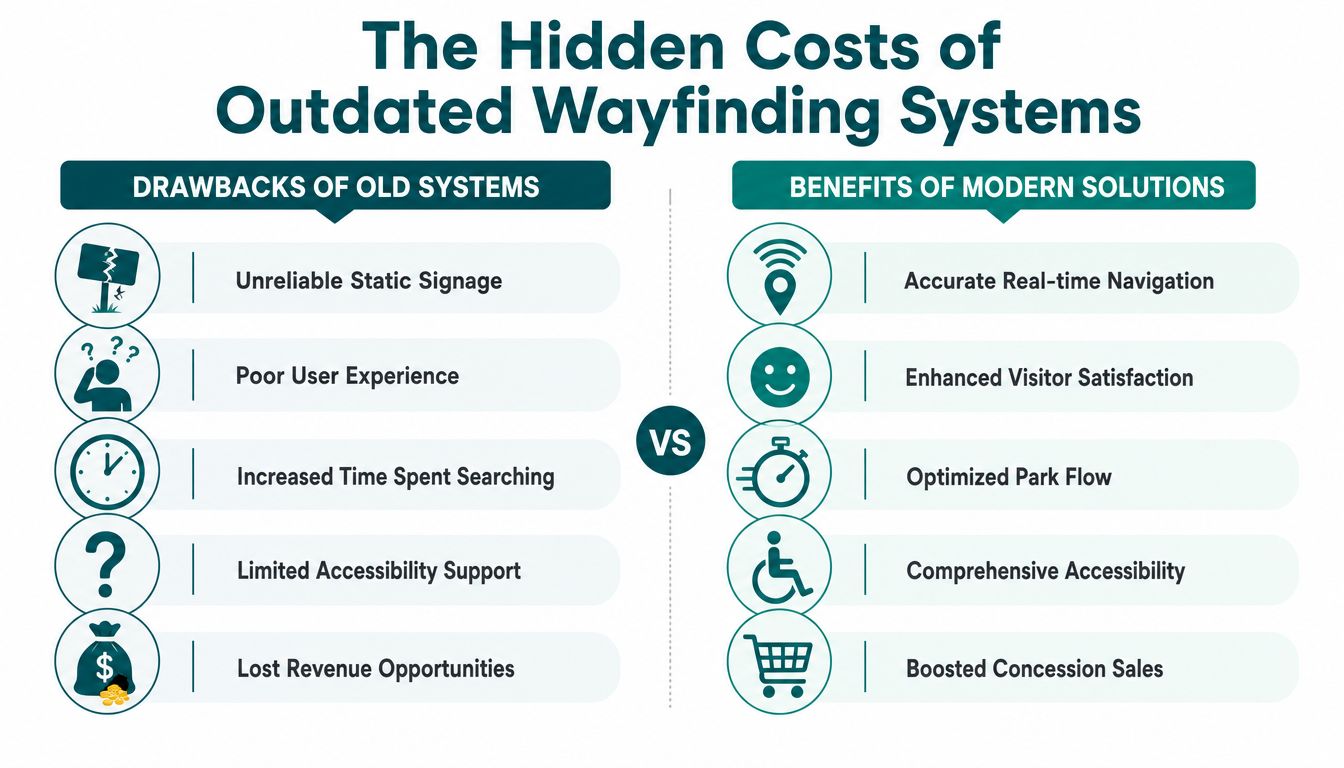
Static signs and first-generation apps don't usually fail all at once. They fail in fragments. A route is technically available but badly explained. A digital pin lands in the wrong place. A beacon goes quiet. The user blames the venue, not the stack.
In UK theme parks, 72% of superfans regularly use mobile phones during their visit, yet only 19% believe mobile phones improve their overall experience, and 53% of users face friction due to poor UX, according to the Katapult survey on theme park fan behaviour. The same source notes that success requires sensor-fused motion algorithms achieving 94% step-accuracy, which is particularly relevant at the scale of Alton Towers, which welcomed 2.5 million guests in 2024.
Why “we already have an app” isn't enough
Having an app is not the same as having a wayfinding system. Many park apps are good at tickets, promotions, and ride information. They're poor at turn-by-turn navigation in environments where GPS drifts and paths are operationally complex.
Three common failure modes appear again and again:
- Static logic in a dynamic venue: The map looks polished but can't reflect closures, temporary diversions, or event overlays fast enough.
- Location uncertainty: If the user's position is wrong, every subsequent instruction is wrong.
- Interface overload: Visitors under time pressure won't tolerate excessive taps, hidden menus, or route choices that don't explain accessibility consequences.
Why beacon estates become an operations burden
Beacon-based systems can work in controlled areas. They are harder to defend across large outdoor-indoor estates with weather exposure, dense footfall, seasonal overlays, and frequent operational change.
The trade-off isn't theoretical. Hardware creates a maintenance regime. Someone has to install it, monitor it, replace batteries, investigate dead zones, and keep signal behaviour aligned with the map. In a theme park, those costs sit inside live operations, not inside a clean lab environment.
| Feature | Static Signage | Beacon-Based Apps | Infrastructure-Free |
|---|---|---|---|
| Position accuracy in complex spaces | Limited | Variable | High when map and motion model are well configured |
| Response to temporary changes | Slow | Moderate | Fast |
| Hardware dependency | None | High | None |
| Accessibility support | Limited | Inconsistent | Stronger potential for audio-led and route-specific guidance |
| Operational maintenance load | Physical replacement and reprint | Hardware monitoring and battery upkeep | Map governance and data updates |
Operators often underestimate the cost of maintaining certainty. Hardware-heavy systems make certainty expensive.
That's why the operational case matters as much as the UX case. A park doesn't just need digital mapping. It needs mapping that stays trustworthy over time. The cost of getting that wrong is wider than guest complaints, as explored in this piece on the hidden price of getting lost in complex venues.
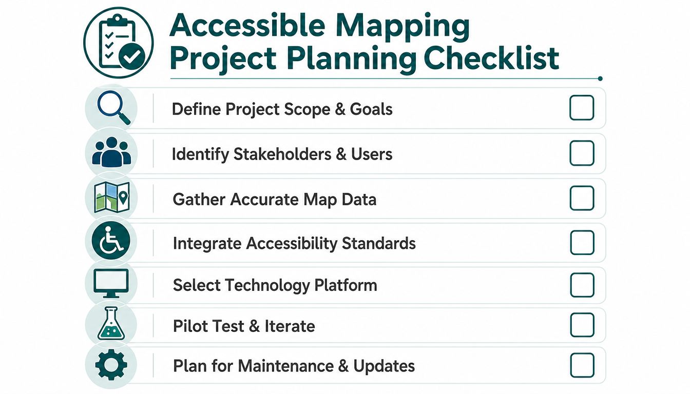
How to Plan Your Accessible Mapping Project
A family arrives for rope drop, scans the park app, and picks the route the map presents as accessible. By 10:15, that route is blocked by a temporary queue extension and a service gate change that never made it into the guest-facing layer. Operations gets the complaint. Guest services absorbs the delay. Accessibility takes the reputational hit.
Planning has to prevent that failure before any map is drawn.
The strongest projects start with an operating model. Parks that treat accessible mapping as a design exercise usually end up with attractive screens, unclear ownership, and update delays whenever the site changes. Parks that define the map as operational infrastructure tend to get better results because responsibilities, data standards, and approval paths are set early.
Start with the operating problem
A theme park mapping project needs a business case that operators can act on. "Improve wayfinding" is too broad to scope, too broad to budget, and too broad to test.
Use questions that tie directly to park performance:
- Where do route failures happen: arrival zones, security approaches, indoor attractions, inter-land crossings, queue exits, transport stops, or toilets and first aid?
- Which accessibility issues are recurring: missing step-free options, unclear gradients, inaccessible entrances, poor transfer guidance, or amenities that are hard to find under time pressure?
- Which teams carry the consequences: operations, guest experience, accessibility, estates, digital, or revenue teams affected by misdirected footfall?
- What changes every day or every week: parade routes, ride downtime, weather plans, event overlays, temporary barriers, or food outlet trading hours?
That last point matters more than teams expect. If the venue changes often, the project should be planned around infrastructure-free wayfinding from the start. Beacon-based systems add another maintenance layer in an estate that already has enough failure points. Batteries die, devices drift, enclosures get damaged, and temporary build-outs change signal behaviour. None of that helps an operator trying to keep accessible guidance current.
Anchor the project to compliance and service delivery
For UK operators, the compliance case sits alongside the service case. The Equality Act 2010, BS 8300, PAS 78, and BS EN 17210 all shape how accessible information, routes, and service touchpoints should be provided.
A usable digital map helps parks apply those duties in day-to-day operations:
- Provide route information in accessible formats: guests need guidance they can use independently, including audio-led instructions and route-specific detail.
- Support reasonable adjustments: accessible entrances, toilets, quieter routes, rest areas, and step-free paths need to be visible in the navigation layer.
- Reduce avoidable staff dependency: staff assistance remains important, but basic orientation should not depend on finding the right employee at the right moment.
- Control temporary change: closures, diversions, and event layouts need an update process that protects access, not one that leaves guests guessing.
Compliance also changes the acceptance criteria. A map is not ready because the geometry looks correct. It is ready when route logic, entrance rules, and accessibility attributes reflect real operating conditions.
Build the right stakeholder group early
Theme park maps usually fail in production because the wrong people approve them. Marketing can validate branding. They cannot validate whether a wheelchair user can pass a queue merge point during peak operations.
Include these groups from the beginning:
- Operations leads: They know where circulation breaks down and which temporary arrangements appear without much notice.
- Accessibility specialists and disabled users: They identify route assumptions that technical and non-disabled teams often miss.
- Estates and facilities teams: They hold plans, maintenance constraints, and information on surfaces, gradients, lifts, and restricted areas.
- Digital product owners: They define the app workflow, content model, and update permissions.
- Health, safety, and compliance teams: They check that public guidance aligns with emergency arrangements and controlled access rules.
- Commercial and guest experience teams: They understand dwell patterns, concession priorities, and the service impact of poor routing.
In practice, one team must own map governance. Without that, updates stall between estates, operations, and digital, especially during seasonal overlays.
A useful planning reference is this guide on how to create a theme park navigation experience.
Define the map as a maintained system
Before procurement starts, set the rules for how the map will be updated, approved, and audited. In this context, infrastructure-free mapping provides a clear operational advantage. The park only has to maintain the map data and routing logic, not a second estate of physical positioning hardware spread across indoor and outdoor spaces.
Set policy on four points early:
- Source of truth: which team approves route closures, entrance changes, and accessibility attributes
- Update windows: how fast guest-facing guidance changes after an operational decision
- Exception handling: how temporary barriers, pop-up retail, entertainment zones, and weather diversions are recorded
- Verification: who checks that the published route still works on the ground
That planning work is less visible than interface design. It is usually what determines whether the map remains trustworthy in July, in Halloween build, and on a wet weekend with half the site on altered circulation.
Capturing the Data for a Truly Useful Park Map
A park map becomes useful when it stops being an illustration and starts becoming an operating model. That shift depends on data quality.
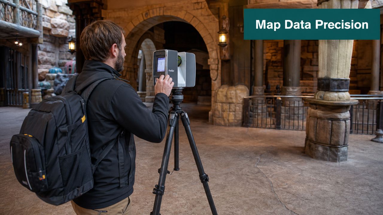
The benchmark methodology is clear. Detailed floor plans should be mapped at 1:50 scale accuracy, and managers should be able to amend points of interest instantly. Venues adopting that approach reduce maintenance costs by 35% and improve visitor satisfaction scores by 22% compared with static signage, according to Amusement Logic's discussion of technological innovation in theme parks.
Geometry is only the start
Most venues already have drawings. Those drawings are rarely enough for live wayfinding.
A navigation-grade park map needs more than footprint geometry. It needs the path network a person can traverse, and the route attributes that determine whether a path is appropriate.
That usually means collecting and validating:
- Walkable routes: outdoor paths, interior corridors, queue approaches, exits, bridges, tunnels, and circulation around barriers.
- Decision points: forks, thresholds, turn locations, crossings, and level changes.
- Entrance logic: public entrances, staff-only thresholds, emergency-only routes, and attraction-specific access points.
- Vertical movement: ramps, lifts, stairs, and changes in gradient that affect route suitability.
Rich POI data makes the map usable
A point of interest isn't just a pin. It needs context. “Toilet” is incomplete if the visitor needs to know whether it's accessible, temporary, inside a paid zone, or closed during an event.
The strongest theme park navigation models tag POIs with practical attributes such as:
- Accessibility detail: step-free access, accessible toilet provision, hearing support locations, rest spaces.
- Operational status: open, closed, temporary, relocated, event-only, or staff-managed.
- Use type: ride, retail, food and beverage, guest services, quiet zone, first aid, locker bank.
- Arrival context: front entrance, side entrance, queue entry, accessible entrance, or collection point.
A route engine can only make a good decision if the source data contains those distinctions.
Survey methods need to reflect venue reality
Large parks combine open-air routes with signal-poor indoor spaces. They also change often. Seasonal overlays, refurbishments, queue reconfigurations, and temporary food units all create map drift if the update process is weak.
That's why teams increasingly use precise survey workflows rather than relying on legacy visitor maps. In many environments, tools such as 3D capture and LiDAR-based surveying help establish reliable geometry and route logic. For teams considering that route, this overview of 3D LiDAR scanning for accurate wayfinding maps is a useful starting point.
Map what the visitor can do, not just what the architect drew.
Don't forget the information disabled visitors need first
Accessible mapping fails when it only labels designated facilities and ignores route experience. A blind visitor needs turning logic and orientation cues. A wheelchair user needs to avoid a route that is technically connected but practically unusable. Neurodivergent visitors may benefit from quiet zones and predictable path options away from the densest circulation.
Those details should be captured as part of the core model, not added later as a separate accessibility pass.
Why Infrastructure-Free Is the Future of Wayfinding
The central technical choice in theme park navigation is straightforward. Do you want to maintain hardware across the estate, or do you want the map and the handset to do the work?
For many operators, the legacy answer has been BLE. That's reflected in market share. Bluetooth Low Energy holds 33.76% of the global indoor navigation software market, according to Market.us research on indoor navigation software. But share isn't the same as suitability. Legacy deployment volume says more about what was installed before than what makes sense for a complex public venue now.
Why beacon logic weakens at park scale
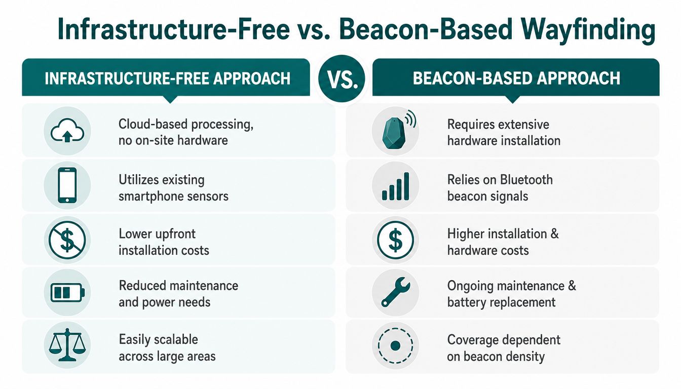
Beacon systems introduce a familiar pattern of compromise. The operator gains location anchors, but also inherits installation cost, maintenance routines, battery management, signal variability, and replacement cycles.
That burden matters more at park scale. The same Market.us source notes the challenge in complex environments, and Alton Towers welcomed 2.5 million guests in 2024, making hardware maintenance across a busy estate a serious operational consideration.
Beacon-based mapping also struggles when:
- Layouts change often: ride entrances shift, queue lines move, and event overlays alter pedestrian flow.
- Mixed environments interfere with signals: indoor attractions, metal structures, and dense crowds can degrade consistency.
- The estate is large: more coverage means more hardware points to monitor and maintain.
- Sustainability is under scrutiny: battery replacement and hardware refresh cycles create waste as well as cost.
What infrastructure-free navigation changes
An infrastructure-free approach removes the installed hardware layer and shifts the intelligence into the map and the phone. In practice, that means using device-native motion sensors such as the accelerometer and gyroscope, then applying dead reckoning and sensor fusion against a detailed map model.
The strongest implementations learn a user's stride and movement pattern to improve route guidance over time. That matters in theme parks because people don't move like laboratory subjects. They stop suddenly, turn in crowds, carry bags, push buggies, and traverse sloped or uneven routes.
A good wayfinding system for a public venue should be judged on these criteria:
- Accuracy without external signal dependence
- Low operational overhead
- Fast response to POI and route changes
- Accessibility support for non-visual guidance
- Scalability across outdoor, indoor, and underground environments
This video offers a concise view of the infrastructure-free navigation model in practice.
If your wayfinding stack needs a maintenance team before it can guide a visitor, it's carrying too much infrastructure.
There's also a commercial upside to keeping the stack lighter. Once navigation is dependable, parks can layer in digital engagement without making route guidance compete with it. For operators thinking about loyalty, offers, and repeat visitation, a lightweight mobile loyalty platform can complement wayfinding without adding physical estate complexity.
For a deeper technical view of non-signal-dependent guidance, this explanation of GPS-denied navigation in complex venues is worth reviewing.
How to Launch, Test, and Maintain Your Living Map
A theme park map is never finished. The venue changes too often for that. The right launch model assumes continuous revision from day one.
The first production rule is simple. Don't treat acceptance testing as a technical sign-off done only by internal staff. You need user acceptance testing with people who move through the venue in different ways, including blind and low-vision users, wheelchair users, families with children, and staff who know where real confusion happens.
Test routes in live operating conditions
A route that works before opening may fail under crowd pressure. Queue spill-out, parade controls, food trolley placement, weather barriers, and temporary fencing all alter route clarity.
A practical launch programme usually includes:
- Peak and off-peak testing: You need to understand route performance when circulation is clean and when it is congested.
- Task-based journeys: Test “find the nearest accessible toilet”, “go from ride exit to food outlet”, and “reach guest services from an unfamiliar point”.
- Accessibility-specific validation: Check route wording, usable entrances, non-visual instructions, and step-free logic with real users.
- Failure logging: Record where the route broke down, whether the issue was geometry, POI data, wording, or operational change.
Keep map governance close to operations
The best living maps are owned by the people who can see change happening in the venue. If every POI amendment has to wait for a long digital release cycle, the map will drift away from reality.
Strong maintenance practice usually includes a short governance loop:
- Operations identifies a change such as a closure, diversion, or temporary activation.
- A designated editor updates the map layer and POI metadata.
- A quick validation check confirms the route effect for affected journeys.
- The update goes live promptly so staff and visitors work from the same information.
That operating rhythm matters more than flashy front-end design. Visitors trust a map that stays current.
Integrate the navigation layer properly
If the wayfinding feature sits awkwardly inside the app, adoption will suffer even when the routing engine is strong. Navigation should be reachable from the task the user is already doing, such as viewing a ride, checking food options, or locating facilities.
The most effective parks treat the map as a shared operational asset. Guest experience uses it. Accessibility uses it. Commercial teams benefit from clearer circulation. Operations relies on it during change. That's when the system stops being a digital brochure and starts becoming infrastructure.
Frequently Asked Questions About Mapping Theme Parks
What does it mean to map theme parks properly
Proper park mapping means building an operational wayfinding model that staff can trust and guests can act on. That model needs route geometry, entrances and exits, queue access points, vertical circulation, surface changes, step-free options, temporary closures, and point-of-interest data that can be updated without a redevelopment cycle.
What is the best wayfinding approach for large theme parks
For large parks, infrastructure-free wayfinding is usually the better operational fit. It removes the installation, battery replacement, recalibration, and fault-finding work that comes with beacon networks. That matters in venues where routes shift for seasonal overlays, parade control, weather response, and short-notice maintenance.
Why aren't paper maps enough for accessible park navigation
Paper maps still have value as an overview tool, but they do not support turn-by-turn guidance, non-visual use, or route selection based on mobility constraints. They also cannot reflect live diversions with the speed operations teams need.
How accurate does a theme park map need to be
It needs to be accurate enough for route decisions at junction level, entrance level, and accessible path level. A commonly cited trade reference is 1:50 scale accuracy for detailed floor plans and route mapping, discussed by Amusement Logic here: https://amusementlogic.com/project-management-architecture-engineering-construction/theme-park-design-scale-floor-plans/
How do operators keep digital theme park maps up to date
They treat the map as an operational asset, not a one-off design deliverable. In practice, that means giving trained editors a controlled process to update closures, reroutes, renamed venues, temporary barriers, and accessibility attributes as conditions change on site.
Are beacon-based apps still the right option for theme park navigation
They still suit some deployments, but many operators are moving away from them for sound operational reasons. Hardware estates fail. Batteries die. Signals drift. Assets get moved during refurbishments and events. In a busy park, those issues create a maintenance queue that competes with frontline operations. Infrastructure-free systems avoid that dependency.
How does accessible theme park mapping support compliance
It gives visitors route information in forms they can use, including step-free options and guidance that does not depend on reading a printed board. It also helps operators show that accessibility has been built into everyday visitor journeys, rather than handled as a separate exception by guest services.
Why do so many visitors dislike theme park apps
The problem is usually not the idea of using a phone in the park. It is poor execution. Visitors will use mobile tools for tickets, timings, and directions if the app is quick and the routes are credible. Katapult reported high smartphone use among UK theme park visitors, while satisfaction with app experience lagged when usability fell short: https://katapult.co.uk/blog/theme-park-apps-mobile-usage-and-guest-expectations/
If you're reviewing how to map theme parks without adding another hardware maintenance problem, Waymap is built for exactly that challenge. Waymap delivers precision navigation indoors, outdoors, and underground using smartphone motion sensors and detailed maps, without relying on GPS, Wi-Fi, or installed beacons. For operators, that means an updateable wayfinding layer that supports accessibility, reduces operational drag, and stays usable in the signal-poor spaces where conventional park navigation often breaks down.
