
Kemble Drive Swindon: Your Practical Local Guide

You can arrive at Kemble Drive, Swindon with a postcode in hand and still miss what the road does. A visually-impaired visitor heading in by train for a morning appointment at the local studies library needs more than a pin on a map, because the route, the kerb line, the crossings and the destination entrance all matter. On kemble drive swindon, those details sit inside a compact corridor that serves museum visitors, retail shoppers, EV drivers and civic users at the same time.
Why Kemble Drive Matters Beyond a Postal Code
A lot of location pages treat Kemble Drive as a line of text under an address. That misses the actual function of the place, because this road is a working access corridor in the north of Swindon, not just a turn-off to ignore once the sat-nav has done its job. It is anchored by STEAM Museum of the Great Western Railway at SN2 2TA and The Discovery Service at SN2 2TA, both of which give the road a civic and heritage role rather than a purely retail one. The broader setting also matters, because Kemble Drive sits close to the Swindon Designer Outlet and the M4 corridor, which Countryfile describes as around 80 miles west of London.
Swindon itself gives the corridor its scale. The town had a built-up-area population of 224,942 at the 2021 census, which makes it the largest settlement in Wiltshire and a significant regional transport and services centre in South West England. That matters on the ground, because a road serving a large urban population is never just about one venue entrance. It has to handle mixed arrival patterns, mixed needs and a lot of people who are not familiar with the area.
Practical rule: if a road serves a museum, an outlet centre and a public records service, treat it as a destination cluster, not a single postcode.
Why the postcode is only the starting point
The presence of STEAM, which documents Swindon's railway heritage, and The Discovery Service, which operates as a public records and research access point, makes Kemble Drive historically and operationally important. That combination creates a corridor where leisure, research and retail overlap in one address family. Directory listings rarely tell you how that feels on foot, but that is exactly where the friction starts.
For anyone trying to plan an arrival, the practical question is not “what is the address”, it is “which entrance, which side of the road and which mode of travel gets me there with the least confusion”. That is why kemble drive swindon needs a guide that deals with movement, not just naming. A road like this serves a wider catchment across the UK rail and museum network, and it behaves like a shared access node, not a simple street sign.
Getting to Kemble Drive by Train, Bus and Foot
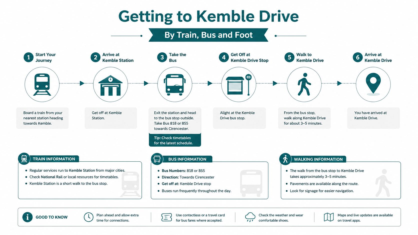
If you are arriving without a car, the cleanest way to think about Kemble Drive is as a set of interchangeable approaches rather than one fixed route. The road is linked to rail, bus and walking access, and the best option depends on where you start and how much wayfinding confidence you want at street level. For step-accurate guidance, the arrival journey matters as much as the destination itself.
Train access from Kemble to Swindon
Great Western Railway is listed as operating hourly trains from Kemble to Swindon, taking 12 minutes. That makes rail the most straightforward named public transport option in the area when you are planning a timed arrival into the Swindon side of the corridor. If you are coming for a morning visit, the shorter rail leg reduces decision fatigue before you even reach the town centre.
The practical issue is not the train itself, it is the handoff between station arrival and the onward walk or bus transfer. That is where a route that can identify the right street-side exit, the right crossing and the correct destination entrance becomes useful. If you are designing a plan for a visitor who does not know Swindon well, the last few minutes on foot matter more than the rail timetable.
Bus routes that actually serve the outlet side
The Swindon Designer Outlet is served by regular bus routes 1, 1a, 8, 12, 13, 14, 19 and 54. That list is useful because it gives planners an honest view of the corridor's bus accessibility rather than a vague “served by buses” note. If the visit is short, bus arrival can be more sensible than parking, especially when the outlet estate is busy.
For route planning, the main trade-off is between convenience and certainty. Bus stops solve the car park hunt, but they shift the burden to the pedestrian leg, where kerb edges, crossing points and the final turn into the estate can be harder to read without accurate guidance. A good public transport plan stops pretending the walk is trivial.
Waymap's public transport directions guide covers the logic of turning a transit arrival into a usable walking journey, which is exactly the kind of handoff Kemble Drive demands.
The weak point in most route advice is the last 200 metres, not the rail or bus itself.
Walking in from the town centre
Walking from Swindon town centre or the Steam heritage quarter is feasible, but only if the pedestrian route is treated as a sequence of decisions. The corridor sits close enough to key destinations that a confident walker may choose it, but confidence drops quickly when crossings are unclear or the correct entrance is hidden behind car flow. That is why step-by-step guidance matters more than a general map pin.
The best walking advice is practical. Identify the destination side first, then the safest crossing, then the approach to the entrance. If you are helping someone with low vision or mobility needs, do not rely on “head towards the outlet” language. On kemble drive swindon, the useful detail is always the one that tells you what happens at street level.
Parking, EV Charging and Curbside Access on Kemble Drive
A drive onto Kemble Drive shifts the task from reaching the area to managing the stay. This corridor brings retail parking, EV charging, and regular footfall into the same access strip, so a sensible car-based visit starts with clear expectations about dwell time, turning space, and the pressure around the curb. For a short stop, the key question is whether you can get from vehicle to entrance without fighting the forecourt.
The outlet opening pattern changes demand
The Swindon Designer Outlet on Kemble Drive is stated to be open 364 days a year, with standard opening hours of 10:00 to 20:00 Monday to Saturday and 10:00 to 18:00 on Sunday. The listing also notes that larger stores open 11:00 to 17:00 on Sundays because of Sunday trading regulations. That creates a clear retail rhythm, and it also puts parking demand and pedestrian movement into the same access pattern.
For a driver, timing matters here. A short errand can slow down if you arrive during busy retail turnover and have to share the space with shoppers crossing between the car park and the outlet frontage. If you are collecting someone, meeting a researcher, or coming for a single appointment, the corridor works better when the visit is planned around curbside pressure rather than assumed to be free-flowing.
EV charging supports dwell-time, not fast turnover
The RAW Charging site at SN2 2DY provides 12 charging devices and 24 connectors. That density points to a multi-bay AC/DC destination-charging layout built for dwell-time retail parking rather than rapid-turnover roadside use. In practical terms, it suits people who expect to stay for a while, not drivers trying to add range for a quick stop and go.
Parking guides often stop at the charger count. They miss how the place behaves. On Kemble Drive, charging sits inside a shared retail and civic access node, so reversing, manoeuvring and pedestrian movement all compete for the same space. A driver should plan for the whole stay, not just the plug-in moment.
Virtual tour Google Street View guidance can help people preview a site before travelling, but it still will not tell them how the kerb line behaves when the car park is busy.
Curbside management is the real issue
The National Archives listing for the Swindon local studies library at SN2 2TA shows opening hours of 10–5 daily and a published telephone contact, which reinforces how mixed the corridor is. A retail bay, a library visit and an EV session can all be active within the same short stretch of road. That overlap means curbside management has to serve different users at once.
Show-on-map tools help here because they let a visitor compare entrances, car parks and nearby access points before setting off. The show on map view is useful for that kind of planning, especially on a road where the right stop is often the difference between an easy visit and a slow one.
For a short visit, walking or bus access can beat parking because it removes the search for a bay. For a longer stay, car access works better if you already know where the destination entrance sits relative to the parking field. The road is usable either way, but it only feels straightforward when the mode matches the purpose.
Accessibility and Step-Accurate Navigation on a Mixed-Use Road
A corridor like Kemble Drive shows the limits of generic mapping very quickly. The road is busy, mixed-use, and full of small decisions that matter more to some users than to others. Swindon's census profile shows a sizeable older population and a meaningful share of residents with disabilities, so routing has to work at the scale of street movement, not just a postcode.
What step-accurate actually means here
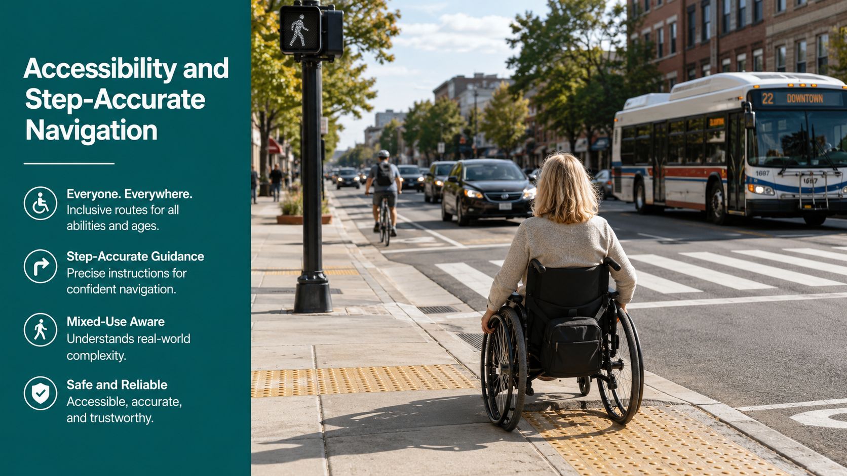
Step-accurate navigation means taking someone to the right entrance, across the right crossing, and past the right vehicle movements without asking them to infer the route from a flat map. A pin on STEAM Museum does not tell a wheelchair user which side access is easiest, and it does not tell a blind visitor where the route bends around the outlet frontage.
I have walked corridors like this with a blind colleague, and the difference becomes obvious at the kerb. One crossing looks fine on a map, then service vehicles, dropped kerbs, and frontage changes alter the route at walking pace. Kemble Drive combines retail footfall with civic footfall, so the edge conditions are not stable from one frontage to the next.
The practical point is simple. Route guidance has to respond to movement, not just location.
Operational insight: a map pin tells people where they are going. Step-accurate guidance tells them how to get there without improvising at the kerb.
Infrastructure-free navigation removes a maintenance burden
Waymap's approach uses only the smartphone's device-native motion sensors with a detailed map, and it is designed for sub-3-metre accuracy in infrastructure-free environments. That matters because a site team does not need to install beacons across an estate, then keep checking batteries, mounts, and layout changes. The trade-off is clear. Beacon systems add hardware to buy, fit, and maintain, while infrastructure-free guidance shifts the work into software and mapping.
For mixed-use sites, that difference is not theoretical. A corridor that carries retail parking, museum access, and public records access changes in response to deliveries, events, and seasonality, so fixed hardware can become a maintenance task that never quite ends. The walking pattern recognition approach helps explain why a phone-led system can keep pace with those changes, while Pinnacle Property Media's guide is a useful reminder that location planning only works if the route reflects how people move through a site.
On Kemble Drive, that flexibility helps a shopper, a researcher, and a blind visitor use the same corridor without forcing the estate to be rebuilt around each visit.
What Infrastructure-Free Wayfinding Means in Practice
On Kemble Drive, infrastructure-free wayfinding makes the most sense as an operating choice. A venue manager does not have to install beacons across a retail and civic corridor, then track batteries, mounts and layout changes every time the site shifts. The phone does the work instead, so the guidance can stay usable while the physical environment is busy, edited or partly reconfigured.
The mechanism that matters
The method uses the phone's own motion sensors, combined with a detailed map, to track movement by dead reckoning. That is how it can reach sub-3-metre accuracy without depending on GPS, Wi-Fi or installed hardware on site. On a mixed-use road like Kemble Drive, that matters because the route has to keep working as a person moves from open forecourt to building frontage to indoor threshold.
The more active the estate, the more often the wayfinding layer has to keep up. A corridor that serves retail parking, museum access and public records access changes with deliveries, events and visitor flow, so fixed hardware can turn into a maintenance task that never really ends. A software-led route layer avoids that burden and lets venue teams update points of interest as the site changes. Waymap's guidance on reliability, scalability and maintenance explains the operating logic behind that choice.
Why regulations create demand for it
The Equality Act 2010 and BS 8300 push operators toward usable access, not just a paper standard. On a public-access corridor like this, that means the route has to work for people with different mobility, sensory and cognitive needs. Fixed hardware can help in some spaces, but on a road with changing footfall and mixed destination types, infrastructure-free guidance is often the cleaner procurement conversation.
A floor plan shows layout. A route system shows movement through that layout. For teams that still start with the visual plan, Pinnacle Property Media's guide to what a floor plan is is a useful reminder that representation and navigation are not the same thing.
Why venue teams care about the difference
The operational gain is practical. No beacon network means no batteries to check, no dead hardware to find, and no install schedule that has to fit around trading or heritage constraints. That is a real pressure point for estates leads on a road like Kemble Drive, where the site still has to serve visitors while staying presentable and manageable.
For a blind visitor walking the corridor with a colleague, the trade-off is easy to see. Beacon infrastructure can be useful where a venue wants a fixed system tied to a single building, but it also creates hardware to maintain and replace. Infrastructure-free wayfinding shifts the work into software and mapping, which is a better fit for a mixed-use access road that changes over time and needs step-accurate guidance rather than a static directory listing.
What Venue Managers on Kemble Drive Actually Gain
A venue manager on Kemble Drive is usually not asking for another branded feature. The primary question is whether a route system will still work on a live mixed-use corridor where retail parking, civic access, and pedestrian movement all compete for attention. That is the practical test, and it is why the accessibility case and the operating case belong in the same conversation.
The hard part is maintenance, not deployment
Beacon rollouts look tidy on paper and become difficult once someone has to keep them working across a busy site. Physical hardware brings procurement checks, replacement cycles, battery management, and fault-finding, all of which add pressure on an estate that already has retail, heritage, and public service demands to juggle. Kemble Drive makes that tension clearer because it is not a single building, it is a corridor with different uses layered onto the same frontage.
Static signage only does part of the job. It cannot adapt when an entrance changes, when a destination shifts, or when a route has to reflect a temporary closure. A dynamic wayfinding layer gives operators a living map instead of another fixed sign on a wall, which matters when the corridor itself keeps changing.
Named deployments show the model works elsewhere
At Lord's Cricket Ground, Waymap became the first stadium in the world to implement Waymap, with step-by-step audio and on-screen instructions for blind and disabled visitors. Stadiums put heavy strain on circulation, entrances, and crowd flow, so the value of route guidance is easy to see there. Kemble Drive is different, but the lesson carries over. A mixed-use access road also needs instructions that match the site as it is used, not as it looked when the sign was installed.
The same operational logic appears in the WMATA partnership model, where a major transit operator needed navigation that could fit a large public network with constant movement. The environment is different, yet the trade-off is familiar. When a site changes faster than fixed hardware can be maintained, infrastructure-free wayfinding is usually the cleaner fit.
For teams that want to review the visual layer before procurement, a virtual tour Google Street View workflow can help with planning and review, but it does not solve turn-by-turn movement for people on the ground.
The Kemble Drive use case is broader than compliance
The strongest business case is not only accessibility compliance. It is better visitor flow, clearer arrival behaviour, and fewer avoidable questions at reception or on the kerb. On a road that serves the Swindon Designer Outlet, STEAM Museum, and the Discovery Service, the gain is a clearer estate for everyone who uses it.
Waymap's customer journey mapping guidance is a useful next read for teams weighing how those gains translate into service design.
Frequently Asked Questions About Visiting Kemble Drive
How far is Kemble Drive from Swindon station
Kemble Drive is close enough for an onward transfer, but the right mode depends on your mobility needs and your destination on the corridor. If you are heading to the outlet side or to STEAM, rail plus a short walk or bus connection is usually the most practical plan.
Is the Swindon Designer Outlet car park usable for a short visit
Yes, but a short visit works best when you already know your entrance and likely exit route. The car park sits inside a busy mixed-use access node, so a quick in-and-out trip can still feel slow if you arrive during heavier retail or civic footfall.
What should a blind visitor expect between STEAM Museum and the local studies library
Expect two nearby destinations that share the same corridor but still need precise wayfinding at street level. A blind visitor should not rely on a postcode alone, because the route depends on the correct entrance, the crossing choice and the exact approach path.
Which transport option is best for step-free arrival
The best option is the one that reduces the number of decisions after arrival, and for many visitors that means rail or bus combined with step-accurate walking guidance. The hourly Great Western Railway connection from Kemble to Swindon, plus the listed bus routes for the outlet area, give you workable choices before the final pedestrian leg.
Why do accessibility teams care about this road specifically
Kemble Drive combines retail parking, civic services and heritage destinations in one access corridor, so the wayfinding problem is more complex than it looks on a map. That makes it a strong test case for step-accurate navigation that works without installed hardware.
If you're planning a route, redesigning an estate, or trying to make a mixed-use corridor easier to move through, see what Waymap can do for exact, infrastructure-free wayfinding on Waymap. It's built for places like Kemble Drive, Swindon, where a postcode is never the whole story.
