
Indoor Positioning System: How It Works in 2026
Most advice about indoor navigation starts in the wrong place. It treats an indoor positioning system as if it were just a dot on a map, when the actual test is whether a person can reach the correct door, platform, lift, toilet, or assistance point after the building has changed and the route is no longer obvious.
That distinction matters for rail, hospitals, campuses, and large venues. RNIB's February 2025 survey found that more than one in three blind and partially sighted people could not make the train journeys they wanted or needed to make, and 82% struggled with the gap between the train and platform edge, while only 44% said they were reliably met by assistance staff RNIB's February 2025 survey on inclusive journeys. UK academic research also found that 70% to 87% of visually impaired participants lacked confidence in wide-open areas, hallways, and large rooms, especially when people and trolleys moved through the space UK research on indoor navigation problems.
For procurement leads, that changes the buying question. The issue is no longer “Can we locate someone indoors?”, it's “Can we keep guidance accurate when the venue is busy, the route changes, and staff can't escort everyone?” For accessibility teams, the same question becomes sharper still, because a technically precise location marker is useless if it doesn't translate into usable, hands-free instruction.
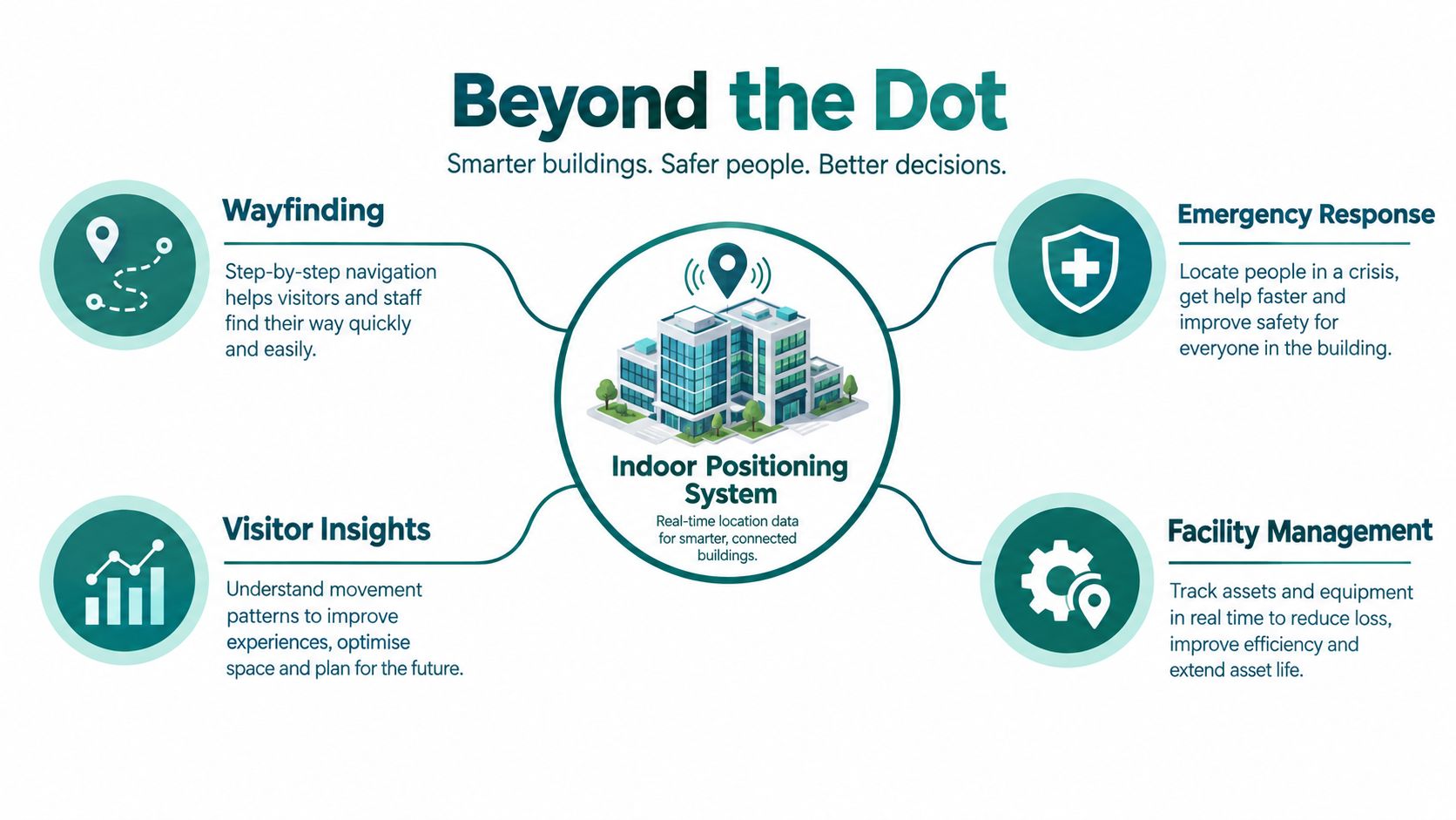
Why an indoor positioning system is more than a dot on a map
An indoor positioning system is often sold as a measurement problem. In practice, it is a navigation problem, because people do not need an abstract coordinate. They need to know where to go next, what to avoid, and when they have reached the right threshold.
A technically accurate dot can still fail a passenger, visitor, or patient. A person with sight loss does not experience a building as a static grid. They experience a sequence of decisions, corners, obstacles, queues, doors, lifts, and staff interactions, all of which can change during the day.
Practical rule: if the system cannot support the final metres, it has not solved wayfinding.
Waymap was built around that distinction, with a blind founder's perspective embedded in the product direction. UK accessibility law points in the same direction. The Equality Act 2010 requires service providers to make reasonable adjustments where disabled people would otherwise face a substantial disadvantage, and GOV.UK guidance says providers should think ahead rather than wait for each individual request Equality Act guidance for service providers.
An indoor location estimate is useful. An indoor route that reaches the correct assistance point is operationally valuable.
The gap between those two ideas is where most explanations fail. A system can look impressive on paper and still fail in a station concourse, a hospital corridor, or a shopping centre if it does not handle doors, temporary closures, and changing footfall. That is why accessibility leaders should judge an indoor positioning system by task completion and confidence, not by the elegance of its dot.
For a plain-language comparison with GPS, see does GPS work indoors.
How indoor positioning works
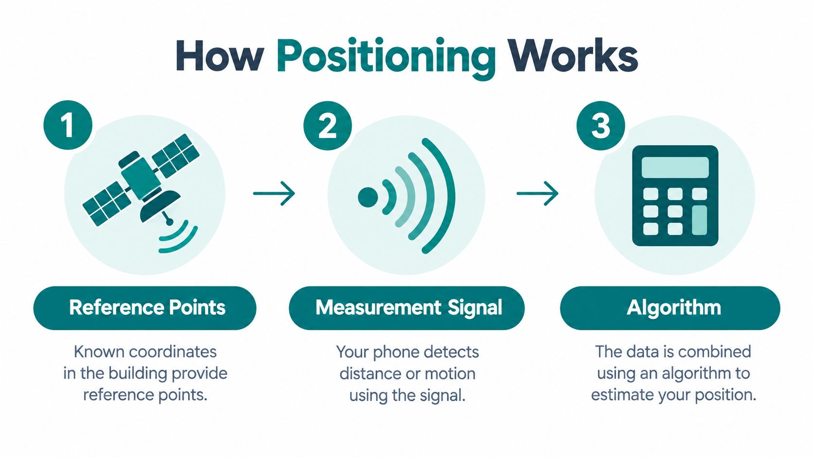
An indoor positioning system needs three inputs before it can estimate location. It needs a known reference point, a changing signal or motion source, and an algorithm that turns those measurements into a position estimate.
Reference points, signals, and the algorithm
Trilateration uses fixed points in the building as landmarks. If the system knows where those landmarks are and can estimate distance to them, it can calculate a likely position. Fingerprinting works differently. It records how signals behave at known spots, then compares the live reading with that stored pattern.
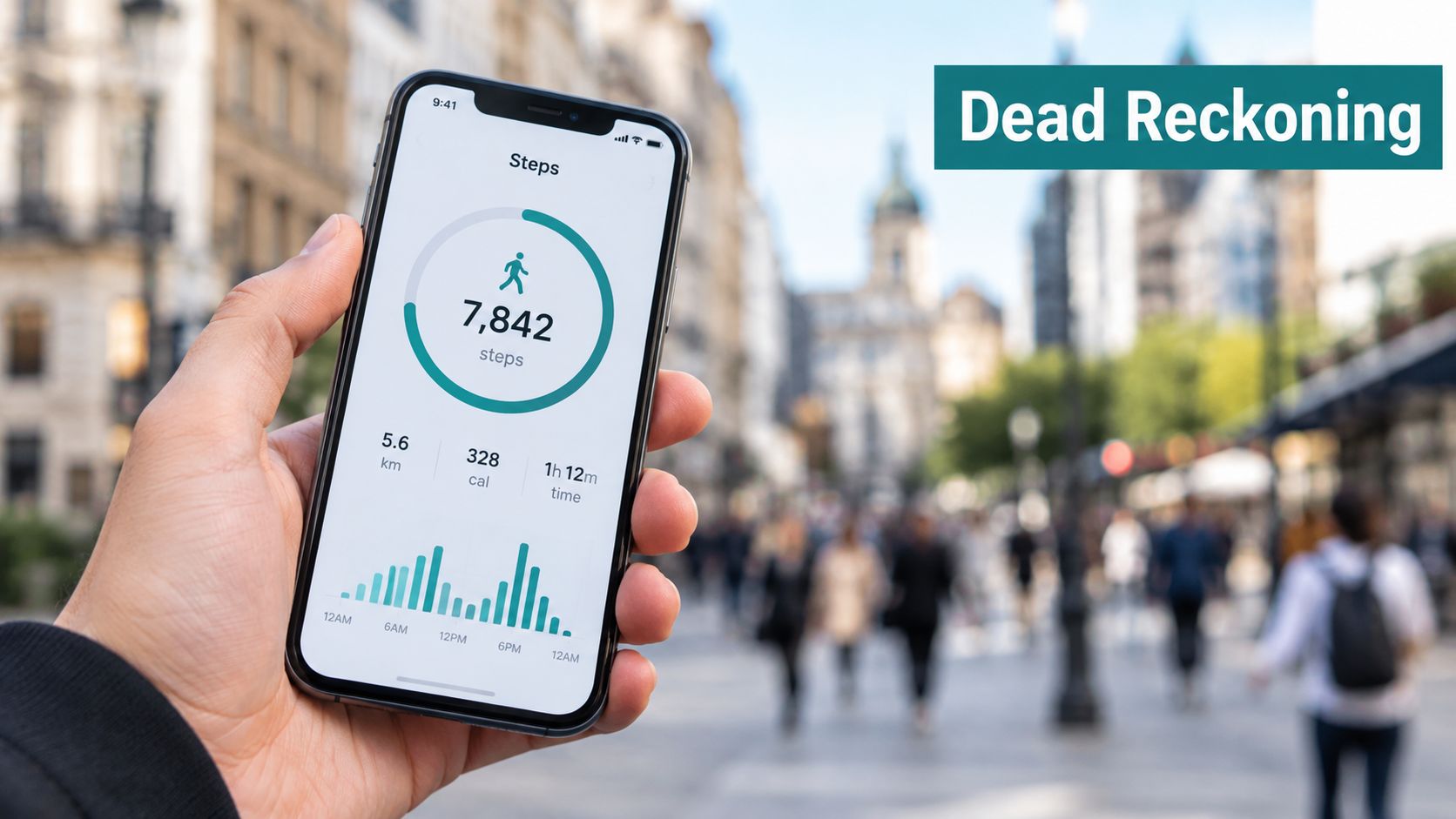
Dead reckoning uses motion instead of radio. The phone estimates steps, heading, and displacement from its own sensors, so it can still function when signals are weak or blocked. The University of Brighton review on smartphone-based indoor positioning explains the method clearly, and it notes the key limitation, cumulative drift as small errors build up over distance University of Brighton review.
That drift matters because indoor environments are messy. Signals bounce off walls, people absorb or block them, and buildings rarely stay still. GPS is structurally weak for the last 30 metres because satellite signals are blocked by roofs and walls, so an indoor system has to rely on local references rather than open-sky positioning.
Why the environment changes the answer
A station concourse, hospital lobby, or university corridor is not a static map. It is a crowded, changing space where doors close, queues shift, and radio conditions move with the crowd.
A good IPS does not assume the environment will cooperate, it compensates for it.
For a useful primer on related radio-signal trade-offs, the discussion of secure public WiFi with Purple Shield is a helpful adjacent read, because the same environmental realities affect indoor wireless services.
Wi-Fi, Bluetooth beacons, UWB and magnetic maps compared
Different indoor positioning system designs solve different problems, and each one creates a different operational burden. Procurement teams need to price that burden, because accuracy alone does not tell you how much upkeep a system will demand.
What each technology depends on
Wi-Fi fingerprinting can work where access points already exist, but the fingerprint library still has to be refreshed as the venue changes. BLE beacon systems depend on installed hardware, plus the ongoing work of battery checks, replacement, and calibration. The University of Leeds BLE study found an average location error of about 0.6 metres in line-of-sight testing within a 3-metre range, using 78,440 stationary-test samples, but that performance depended on BLE sensors installed in the environment University of Leeds BLE study.
UWB can deliver very fine positioning, but it brings anchor infrastructure and device compatibility constraints with it. Magnetic mapping avoids some radio problems, yet the venue still needs reliable surveys or crowd-generated observations to keep the map useful. The University of Glasgow study showed that combining crowd-sensing, particle filtering, and magnetic fingerprinting improved performance from 80.49% to 96.32%, with 85.86% reported for an IMU/PDR method augmented with magnetic-fingerprint data University of Glasgow study.
For a non-academic overview of Bluetooth-centric indoor systems, the Bluetooth in AI-driven platforms page gives a useful sense of how Bluetooth-based approaches are usually discussed in product stacks. On the deployment side, the discussion of Bluetooth access points shows the kind of hardware burden they create.
| Indoor positioning technology comparison | Typical accuracy | Infrastructure requirement | Accessibility relevance |
|---|---|---|---|
| Wi-Fi fingerprinting | Variable, environment-dependent | Existing access points plus re-surveying | Coarse guidance, but map upkeep matters |
| BLE beacons | Sub-metre to metre-scale in controlled testing | Installed beacons and battery maintenance | Useful where fixed hardware is acceptable |
| UWB | Fine-grained positioning | Anchors and compatible devices | Strong technical precision, higher deployment overhead |
| Magnetic fingerprinting | Depends on map quality and fusion method | Site survey or reliable crowd sensing | Helpful where radio signals are poor, but maps can drift |
A transit concourse, hospital lobby, or university corridor can change quickly. The deciding question for procurement is simpler, which option keeps working after the building changes?
Smartphone motion sensors and the case for infrastructure-free navigation
The most practical pivot in indoor positioning is the phone itself. Instead of asking venues to install more hardware, a system can use device-native sensors, including the accelerometer and gyroscope, to estimate movement through pedestrian dead reckoning.
Why motion sensing works, and where it fails
Dead reckoning is simple in principle. The phone infers steps, heading, and displacement, then updates the user's likely location as they walk. The motion sensor app overview shows how that sensor stack fits together in a real product.
The limit is drift. Every small error in stride length, phone orientation, sensor bias, or heading estimation compounds over distance. That is why a production indoor positioning system has to keep checking itself against floor plans and recognisable route geometry instead of trusting raw motion estimates on their own.
Why fusion beats a single sensor
The University of Glasgow study shows the same principle from another angle. When smartphone inertial sensors, PDR, magnetic fingerprinting, crowd-sensing, and particle filtering were fused, performance improved from 80.49% to 96.32%, and the study also reported 85.86% for an IMU/PDR method with magnetic-fingerprint data University of Glasgow study. The lesson is straightforward. A single signal is fragile, but a fused model can reduce ambiguity.
The fusion lesson from the Glasgow study in the previous section applies here. A single signal is fragile, a fused model reduces ambiguity.
Waymap's technical position sits in that category of infrastructure-free navigation, using device sensors and venue maps rather than installed beacons. That matters in places with high churn, because a venue team does not have to keep a beacon network alive just to preserve basic route guidance.
Midway through any procurement discussion, the operational question is usually the same. Can the system still guide visitors when the layout shifts, the crowd thickens, or the service team changes the route? If the answer depends on a maintenance visit, the system is not infrastructure-free in practice.
Where Waymap is deployed and what it changes for visitors
Waymap has been used in places where precision by itself is not enough, because visitors still need to reach the right door, platform, or assistance point without a helper beside them. Lord's Cricket Ground was the first stadium implementation, and that fits the setting. Stadium routes change, crowds shift, and access points are often temporary. The Royal Hospital for Children and Young People shows the same need in a different environment, where family visitors need clear directions in a building that cannot afford confusion.
The transit examples make the operational point even sharper. WMATA and SBS Transit work in high-flow networks where assistance points, platforms, and interchange logic matter more than a generic building pin. LTA Singapore and Westfield London show the same pattern in different settings, one transit-heavy and one retail-heavy. These are not abstract proofs of concept, they are places where the operator cares about arrival point, destination confidence, and route continuity.
The RNIB figures from the opening already showed why the platform gap matters, so the deployment question becomes simpler: does the system help someone reach the exact point where the handover happens? In that sense, the public value is practical, not decorative.
What operators buy is continuity, a way to keep visitors moving when signage is not enough and staff cannot escort everyone. Waymap's deployment footprint is judged on whether people complete the route on a busy day, after the layout has changed, and after the usual path is blocked or rerouted. That is a harder test than drawing a dot on a map.
Equality Act 2010 and the procurement case for infrastructure-free IPS
UK procurement teams do not need a theory of navigation. They need a defensible case that holds up under accessibility law, maintenance pressure, and service continuity. The Equality Act 2010 gives them that frame, because it requires reasonable adjustments in policies, the built environment, and auxiliary aids or services such as accessible information and specialist support GOV.UK disability quick start guide.
Why standards and duties point in the same direction
GOV.UK also says providers should anticipate barriers before a disabled person has to ask. That duty fits indoor wayfinding well, because route instructions, point-of-interest data, and temporary diversions can be prepared in advance rather than improvised at the customer service desk. The internal guidance on Equality Act 2010 requirements reflects the same operational reading.
The standards environment points the same way. BS 8300, PAS 78, BS EN 17210, and the UN Convention on the Rights of Persons with Disabilities all support accessible design that works in practice, not just on paper. For transport bodies, universities, NHS estates teams, and venue operators, digital wayfinding can sit inside the adjustment response when physical navigation barriers remain.
The practical friction in procurement
The friction is practical.
- NHS estates managers face capital spend restrictions and long approval cycles, so they prefer solutions that do not require a fresh hardware programme.
- Transit operators have to maintain equipment across crowded, high-change networks, which makes every beacon or anchor a lifecycle obligation.
- Venue managers need updates fast, often without engineers on site, because closures, diversions, and service changes happen constantly.
An infrastructure-free indoor positioning system addresses those constraints differently from beacon-heavy designs. It reduces dependence on installed hardware while still letting operators keep maps, destinations, and guidance current enough for real use.
That matters in procurement terms because the question is not only whether the system can localise a user. It is whether it helps a person reach the correct door, platform, or assistance point after the building has changed. For buyers under the Equality Act, that is a governance choice as much as a technical one.
Three myths that hold indoor positioning back
The first myth is that more beacons automatically mean better accessibility. Stale or hard-to-trust information breaks that logic. Euan's Guide found that 62% of disabled respondents avoid venues that do not publish disabled-access information, and 77% said venue websites were misleading, confusing, or inaccurate Euan's Guide accessibility survey results. Hardware does not repair poor information governance.
The second myth is that centimetre accuracy solves the whole problem. UK research on indoor navigation problems found that 70% to 87% of participants lacked confidence in wide-open areas, hallways, and large rooms, and moving people and trolleys affected up to 70% of participants UK research on indoor navigation problems. In practice, the harder problem is obstacle awareness and route confidence.
The third myth is that any indoor map is good enough once it exists. The accessible transport information research cited earlier found that 21% of disabled people encountered limited accessibility information when planning journeys, and 22% to 29% wanted real-time information about assistance staff, accessible toilets, lift status, mobility-aid spaces, ramps, and overcrowding. A map without live operational context goes stale quickly.
Decision rule: if the system cannot be updated when the building changes, it is only partly a navigation system.
Procurement teams should keep that test in view. More sensors, more data, or prettier maps do not automatically produce better journeys. The core question is whether the visitor still reaches the right door, platform, or assistance point when the environment is busy, closed, or reconfigured.
Choosing an indoor positioning system that survives the building changing
A useful indoor positioning system survives change. It keeps working when a lift is out of service, a corridor is blocked, a queue shifts, or a venue layout is amended after opening hours. That's the standard procurement panels should use.
The questions a buyer should ask
Start with the source of positioning accuracy. Is it coming from installed infrastructure, live sensor fusion, or a hybrid model? Then ask how maps are updated after layout changes, who owns point-of-interest updates, and whether those updates need engineers on site. If the vendor can't answer that clearly, the service will age badly.
Next, ask how the system handles dynamic obstacles and accessibility detail. A route that ignores temporary closures, assistance points, or lift outages won't serve passengers who need precise last-metre guidance. Finally, ask how evidence for the Equality Act 2010 is documented, because procurement teams should be able to show how the service reduces substantial disadvantage rather than merely describing an app feature.
The internal overview of implementation best practices is useful here because it foregrounds deployment discipline rather than just feature lists.
A simple buying checklist
- Accuracy source: What makes the position estimate reliable in real use?
- Map governance: Who updates routes, closures, and points of interest?
- Accessibility fit: Can the system support final-metre guidance to the correct door, platform, or assistance point?
- Operational burden: What hardware, surveying, or maintenance is required over time?
- Auditability: Can the team show how the service supports reasonable adjustments under the Equality Act 2010?
If the answers are vague, the platform will probably be hard to maintain and harder to defend. If the answers are specific, the system has a chance of surviving real-world change.
Waymap helps venues and transit operators move beyond static dots on a map and into route guidance that reaches the correct place in a live environment. If you're planning an accessibility upgrade, visit Waymap to see how infrastructure-free indoor navigation can fit your station, campus, hospital, or venue.
