
Indoor Location System: How Positioning Works
Your station has a digital map, your staff know the accessible routes, and passengers still struggle to find the right platform. On a busy concourse, a blind traveller needs more than a dot on a screen. They need an indoor location system that can identify their position, choose a usable route and explain the next decision before they reach it.
For operators, the challenge is delivering that guidance without adding an estate-wide hardware maintenance programme. At Waymap, our starting point is journey confidence, not a headline accuracy figure. Positioning matters, but the decisive question is whether someone can reach the correct destination independently when connectivity is poor and the building changes around them.
What an Indoor Location System Actually Does
Consider a passenger arriving through a station entrance while announcements compete with conversations and rolling luggage. Their destination is a platform, but the usable route passes through a ticket barrier, along a concourse and into a lift. A location estimate helps only if the navigation software understands those transitions.
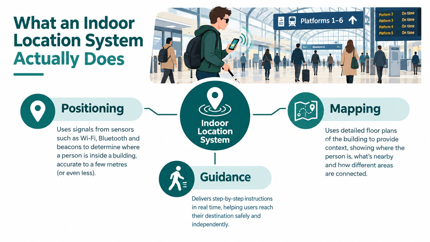
An indoor location system estimates where a person or object is inside a building. For passenger navigation, it must then connect that estimate to a mapped environment and usable instructions. Indoor positioning differs from outdoor GPS because satellite reception inside buildings can be unreliable or unavailable, as the University of Edinburgh's smartphone inertial-sensor research explains.
Positioning, mapping and guidance solve different problems
- Positioning estimates the user's current location and movement. It should also account for uncertainty rather than treating every estimate as equally dependable.
- Mapping describes entrances, corridors, floors and destinations. For accessible wayfinding, the map must distinguish a staircase from a lift and a public doorway from a staff entrance.
- Guidance turns the route into decisions the person can follow, including what to do when they deviate.
The same broad category also includes asset-location applications, but those have different requirements. An inventory team looking for equipment needs an identifiable asset and a useful location record, rather than spoken passenger directions. Reworx Recycling's resource on tracking retired IT assets efficiently is a separate reference for that lifecycle-management use case.
Practical rule: Define the arrival task before choosing the positioning technology.
For our station passenger, success means reaching the correct platform entrance through an appropriate route. A system that places them somewhere near the platform, but cannot distinguish the lift lobby from the staircase, hasn't completed the job. Indoor positioning is a component of navigation, not a substitute for it.
The Four Positioning Families Used Indoors
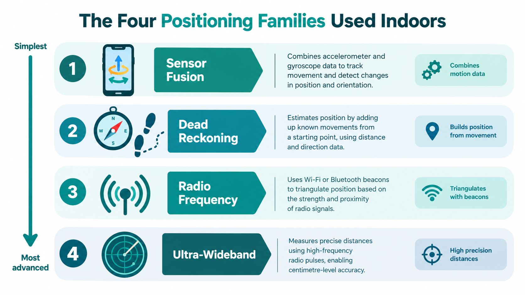
The useful distinction between indoor positioning technologies is what each system measures. Some estimate movement from the handset. Others infer location from radio observations. Neither automatically provides a complete indoor navigation solution.
How each approach handles a ticket barrier
Sensor fusion and dead reckoning use movement measurements from the phone to estimate changes in position. Accelerometer and gyroscope observations contribute to an estimate of motion and direction; dead reckoning advances a known starting position using those estimates. At a ticket barrier, the software must distinguish approaching, stopping and passing through, while controlling accumulated error.
Bluetooth Low Energy beacons provide local radio references. A handset observes signals from installed transmitters, and the positioning algorithm uses those observations to infer location. Signal-strength estimation isn't simple geometric triangulation: the radio environment affects the measurements, so a barrier-area installation needs testing under actual operating conditions.
Wi-Fi fingerprinting compares observed access-point signals with a previously recorded location database. At the barrier, the system looks for the closest match between the current observations and surveyed signatures. An existing Wi-Fi network can provide useful infrastructure, but network coverage alone doesn't establish a reliable positioning service.
Ultra-wideband ranging uses radio timing measurements to estimate distance to reference equipment. It deserves consideration where precise ranging is the primary requirement, but installed anchors, compatible devices and validation remain part of the deployment decision. Our ultra-wideband module overview provides a separate technical reference for evaluating that approach.
Map constraints make movement estimates useful
Sensor fusion and dead reckoning are related techniques, not competing product categories. A hybrid architecture can combine movement estimates, radio observations and map constraints, depending on the venue's needs. Our explanation of inertial measurement units covers the handset-sensor component.
The map is equally important. Virtual Tour Easy's schematic floor plan basics for designers offers useful background on floor-plan representation, but a navigation map needs additional route connectivity and destination information. A drawing that shows the barrier isn't enough; the routing model must know which passage the passenger can use.
Accuracy in the Real World Versus the Lab
Accuracy figures are meaningful only alongside their test conditions. Average error, median error and maximum error answer different questions. A short controlled experiment also answers a different question from an uninterrupted journey through a crowded station.
A BLE study involving researchers from Ulster University and the University of Sheffield reported an average location error of approximately 0.6 metres within a 3-metre line-of-sight test range, according to the published indoor-positioning study. That's a useful experimental benchmark, not evidence that every beacon deployment will deliver the same result.
A University of Reading study reported accuracy of up to 0.5 metres, with sensors deployed at 5–10 metre intervals, and deployment guidance recommending spacing within approximately 12 metres, in its university-library positioning research. The engineering implication is that infrastructure density belongs beside the accuracy figure, not in the small print.
Measure the passenger's task
The accessibility stakes are substantial. The National Travel Survey 2025 disability findings report that 32% of disabled adults lived in households without access to a car, compared with 16% of non-disabled adults. A transport navigation pilot should therefore assess dependable access, not merely an attractive location display.
Useful service measures include:
- Door-level arrival: Did the person reach the intended public entrance rather than an adjacent doorway?
- Independent completion: Did they finish without unplanned staff intervention?
- Decision timing: Did the instruction arrive before the relevant turn or lift entrance?
- Deviation recovery: Could they resume the journey after missing a turn?
- Connection outcomes: Did navigation-related delays contribute to a missed departure?
These are proposed evaluation measures, not claimed performance results. Suppliers should report their outcomes by route and user group, alongside positioning error.
A precise position estimate can still produce a poor journey if the map, route or instruction is wrong.
Our discussion of navigation accuracy solutions addresses that broader distinction. For procurement, require a venue-specific ground-truth route and retain failure cases in the assessment. Don't let a successful demonstration on an empty concourse stand in for passenger testing during normal operations.
Beacons, Wi-Fi and Sensor Fusion Compared
The deployment decision should follow the operating model. A stable building with an established technical maintenance team presents a different problem from a stadium that changes its public routes for events.
Comparing indoor positioning approaches
| Criterion | BLE beacons | Wi-Fi fingerprinting | Sensor fusion |
|---|---|---|---|
| Deployment work | Locate, install and validate transmitters | Survey signal signatures and validate matches | Prepare route data and validate movement estimation |
| Cost exposure | Hardware, installation and servicing | Survey labour and network-change validation | Mapping, software integration and testing |
| Layout updates | Review map and affected radio performance | Review map and affected fingerprints | Update routes and validate changed journeys |
| Maintenance | Transmitter condition and placement | Access-point changes and reference database | Map quality, handset behaviour and algorithms |
| Accessibility suitability | Depends on complete guidance design | Depends on complete guidance design | Depends on complete guidance design |
| Main trade-off | Local references create physical dependencies | Existing infrastructure can carry survey obligations | Fewer radio dependencies, but movement error needs control |
These are engineering considerations, not universal price rankings. A supplier's quotation should expose the work behind each row rather than compressing everything into an installation fee.
Match the architecture to the constraint
For a fixed industrial asset-location project, beacons may be worth evaluating because the task can prioritise presence in a defined area. For a venue with established Wi-Fi infrastructure, fingerprinting may be viable if the operator accepts the survey and change-control obligations.
For public-facing transit, retail and stadium routes, infrastructure-free sensor fusion deserves early consideration when physical installations are difficult to approve or maintain. It removes a class of venue hardware work, but it doesn't remove route validation.
Separate visitor wayfinding from security applications. Overton Security's safety assurance technologies explained provides adjacent context on NFC and GPS, but those applications shouldn't be treated as evidence that a passenger-navigation system satisfies a safety-critical requirement.
The practical friction is often ownership. Estates teams approve installations, network teams manage access points, accessibility teams assess journeys and operations teams manage closures. If nobody funds the ongoing work, even a technically capable pilot can become an unsupported service.
Our recommendation is to compare maintainable services, not isolated sensors. Existing infrastructure may help, but its availability doesn't make it free to survey, govern or support.
Accessibility Standards and Data Protection in the UK
A navigation route must be physically usable, and its data processing must be governable. These requirements should influence the architecture before the operator signs a contract.
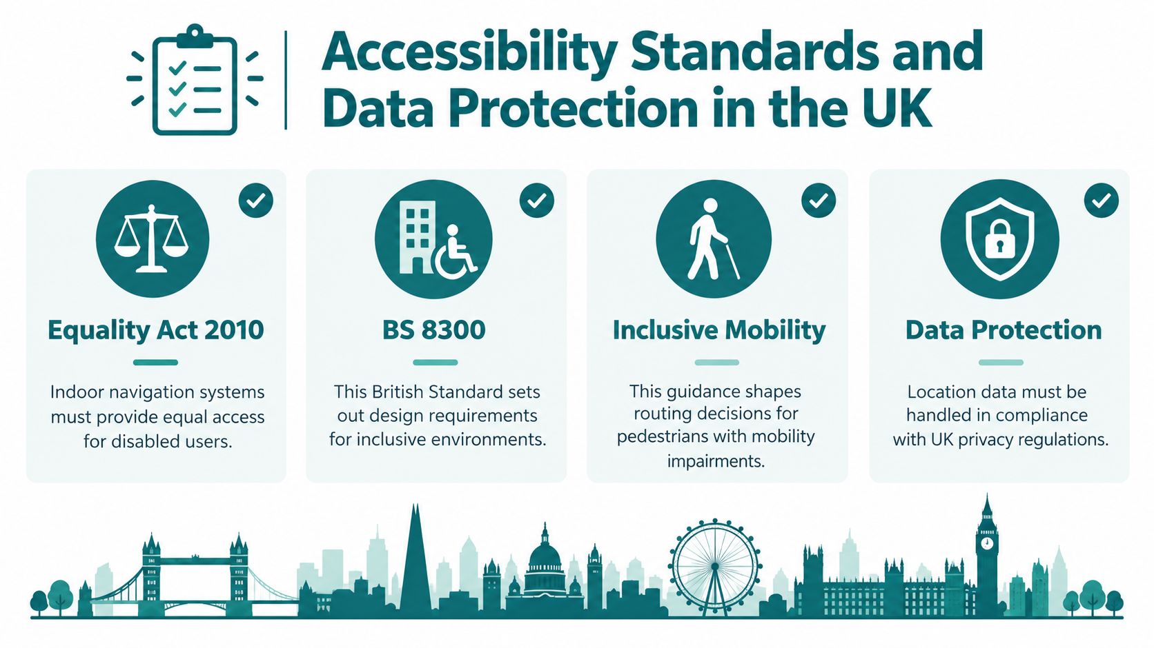
The Equality Act 2010 and BS 8300 belong in a UK accessibility review, but neither should be reduced to a vendor claim that installing an app establishes compliance. Operators need appropriate accessibility and legal assessment of the service and built environment. An infrastructure-free approach can reduce installation obligations; it doesn't remove those wider responsibilities.
Turn physical access requirements into route attributes
The Government's Inclusive Mobility guidance specifies at least 900 mm of unobstructed width for someone using two sticks, crutches or a walking frame, and 1,100 mm for a blind person using a long cane or assistance dog. Those dimensions should inform route assessment rather than allowing the software to select the shortest geometric path.
The Lewes and Eastbourne accessible-wayfinding design note recommends audio information in lifts, reception areas, auditoria and meeting rooms. Digital instructions should complement accessible physical information, not assume every visitor can read a sign.
Keep navigation and identifiable analytics separate
Persistent device or account identifiers can make location records personal data. Procurement should therefore document what the system collects, the purpose, access permissions, retention and deletion arrangements, rather than assuming that all location processing is anonymous.
- Minimise collection: Specify the information needed to deliver the journey.
- Define accountability: Assign responsibility for legal-basis assessment and any required impact assessment.
- Control secondary use: Evaluate movement analytics separately from navigation.
- Test deletion: Require an operational process, not just a policy statement.
Our consent-management discussion is relevant to this design work, but consent isn't a substitute for reviewing the complete processing model. Accessibility and privacy need implementation evidence, including route tests, data-flow documentation and named owners.
How Waymap Delivers Indoor Location in Practice
Waymap is an option for operators who want navigation without a dedicated positioning-hardware installation. Our platform combines smartphone motion sensing with detailed maps to guide people indoors, outdoors and underground without relying on GPS, Wi-Fi or installed beacons.
The platform view below provides a visual reference for that navigation service.
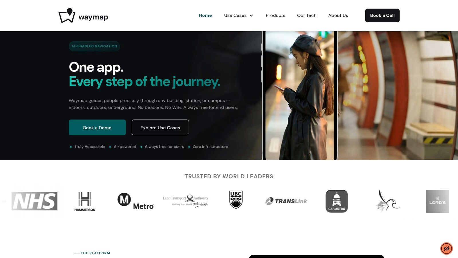
SmartStep addresses movement rather than radio coverage
SmartStep analyses smartphone movement information, including cadence, stride, direction and acceleration, to maintain a changing location estimate. The system adapts to the person's walking style and combines that estimate with mapped routes to deliver heads-up, hands-free audio instructions.
That mechanism addresses a specific operational constraint: the operator doesn't need to establish a local radio positioning network throughout the passenger route. It's relevant where access to ceiling spaces, installation permissions or hardware maintenance windows would otherwise delay delivery.
Detailed maps remain essential. Infrastructure-free doesn't mean map-free, and movement sensing cannot identify a newly closed corridor because the user's phone is still estimating their steps.
The video provides another view of the navigation experience.
Make the operational outcome explicit
Dr Tom Pey founded the platform around the needs of blind and low-vision users. That accessibility-first starting point places the instruction and destination at the centre of product evaluation, rather than treating spoken guidance as an addition to a visual map.
For a stadium operator, the acceptance task might be arrival at the correct public entrance and designated destination under the event's current route configuration. For a shopping centre, it might be identifying the correct shop entrance across floors. For a transit operator, it might be completing an entrance-to-platform journey through the appropriate lift.
These are pilot scenarios, not claimed deployment results. An operator should request named customer references and documented outcomes before treating any supplier's capability description as proof of performance in a comparable venue.
Why More Infrastructure Is Not Always Better
Adding positioning hardware can improve measurement opportunities. It can also create equipment that somebody must inspect, replace, relocate and validate. The right question is whether the added infrastructure improves the required service enough to justify those obligations.
The Reading research demonstrates the relationship between deployment density and measured performance. It doesn't establish that continually increasing hardware density will solve every navigation problem. Incorrect destination data, an unavailable lift or a late instruction won't necessarily improve because the operator installs another transmitter.
Identify the dependencies before expanding coverage
A hardware proposal should name its failure modes and ownership arrangements:
- Equipment changes: Who detects a missing, moved or failed transmitter?
- Calibration changes: What triggers a new survey or performance check?
- Network changes: Who tells the navigation supplier that access points have changed?
- Route changes: Who validates the replacement accessible journey?
- Data changes: Can stored identifiers reveal an individual's movement history?
Our Bluetooth access-point discussion is a useful starting point for examining physical dependencies.
Procurement principle: Buy the minimum dependency set that meets the service requirement, not the maximum hardware coverage available.
Temporary closures test the operating model
A temporary barrier creates an immediate question: who updates the map, and how does the operator verify the alternative route? The estates team may know about the closure before the digital team, while passenger-facing staff may discover it through complaints.
Assign that workflow before launch. The operator needs an authorised editor, a publication process and a way to confirm that the amended instructions match the physical route.
The UK indoor-navigation regulatory and standards overview identifies distributed accessibility and privacy requirements, rather than a single British Standard governing indoor navigation. Its governance considerations reinforce the need to assess operating cost, resilience and data handling together.
Infrastructure-free sensing is attractive when hardware dependencies obstruct estate-wide delivery. It isn't the only architecture that can scale, and it shouldn't be exempt from scrutiny. Removing beacons removes beacon work, not service ownership.
Choosing an Indoor Location System for Your Venue
Start procurement with a defined journey and an accountable service owner. A technical demonstration can show that positioning works; a credible pilot must show that the venue can operate the resulting navigation service.
Choose a route containing the decisions that matter to visitors, such as an entrance, a floor transition and an exact destination. Include blind and partially sighted participants, alongside people with other relevant access requirements. Test ordinary operating conditions and agreed failure scenarios, including a deviation and a route closure.
What should the procurement checklist include?
- Whole-life cost: Include software, mapping, integration, validation, hardware where applicable and ongoing support.
- Update latency: Establish how closures reach the published route and who approves them.
- Offline resilience: Demonstrate what continues working when connectivity is unavailable.
- Accessibility evidence: Request results by user group and route type.
- Data retention: Specify collection, storage, access and deletion arrangements.
- Supplier portability: Confirm which maps and operational data the operator can export.
Set an exit criterion around independent arrival at the correct destination. Record interventions and unsuccessful journeys, then investigate whether the cause was positioning, mapping, instructions or venue operations.
Frequently asked questions
What is an indoor location system?
An indoor location system estimates position inside a building. A navigation service adds mapped routes and instructions so the user can reach a destination.
Can indoor navigation work without Wi-Fi or beacons?
Yes, smartphone motion sensing can support positioning without dedicated radio infrastructure. Its suitability still depends on the route map, movement-estimation method and venue testing.
Which indoor positioning technology is most accurate?
There's no universal answer across venues and test conditions. Compare published measurement methods, then test candidate systems against the same ground-truth journeys.
Does infrastructure-free navigation eliminate maintenance?
No, it removes dedicated positioning-hardware maintenance but leaves software, maps, route changes and accessibility validation to manage.
Before signing, ask the supplier to demonstrate failure recovery, map updates and an export process. Those tests reveal whether you're buying a sustainable navigation service rather than a successful launch-day demonstration.
Waymap offers smartphone-sensor navigation with detailed maps and hands-free audio guidance for indoor, outdoor and underground journeys. Visit Waymap to discuss a venue pilot built around your accessible routes, operational constraints and door-level arrival criteria.
