
Digital Twin Technology: What It Is and How It Works
A digital twin is a virtual model linked to its real-world counterpart through a two-way flow of real-time data. If you're being sold digital twin technology for a station, campus, hospital or stadium, that two-way test is where your buying decision should start.
A vendor shows you a polished 3D building you can rotate on screen. It looks convincing, until someone asks a live operational question and the model can't answer it. I would ask whether data flows in from the asset, whether scenarios can be tested, and whether the result changes anything on the ground.
What a Digital Twin Is in Plain Terms
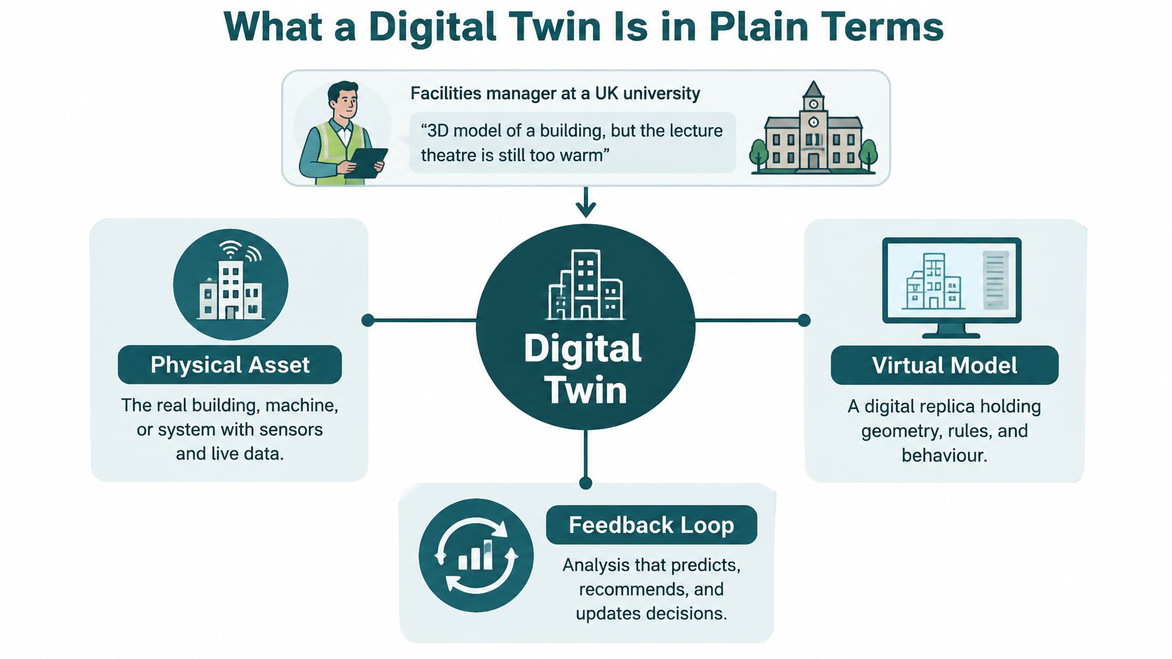
The UK Government infrastructure digital twins data requirements guidance defines a digital twin as a virtual model connected to its real-world counterpart through a two-way flow of real-time data, and states that this connection distinguishes it from a static 3D model or ordinary simulation.
Say a facilities manager at a UK university holds a detailed 3D model but still can't tell why a lecture theatre is too warm. The model shows ducts and vents. It doesn't show today's temperatures, valve positions or occupancy, so it can't explain the complaint in front of her.
Think of a ship's engine-room panel. Gauges show live readings from the engine, and the engineer can change the throttle from the same panel. Information flows in from the asset, decisions flow back out, and the next readings confirm whether the change worked.
Four Model Types Compared On The Same Criteria
| Model type | Main data source | Update pattern | Tests scenarios | Feeds decisions back to the asset |
|---|---|---|---|---|
| Static 3D model | CAD, BIM or LiDAR scan | Re-survey only | No | No |
| Dashboard | Live sensor and system feeds | Live or near-live | No | Indirectly |
| Simulation | Assumed inputs and rules | On demand | Yes | No |
| Digital twin | Live operational and sensor data | Continuous | Yes | Yes |
Ask three questions of any product. Does it update from the asset without someone re-exporting a file? Can it test scenarios before you act? Do its results change the asset, through an operator or an automated rule?
A 3D model isn't a digital twin because it has no live data connection or feedback path. Adding more sensors doesn't make a better twin when assumptions and governance are missing, since extra data can create false confidence.
How the Data, Model and Feedback Loop Fit Together
A working twin has three layers. The physical asset carries sensors and operational systems, the virtual model holds geometry, rules and behaviour, and the analysis layer predicts, recommends and prioritises action.
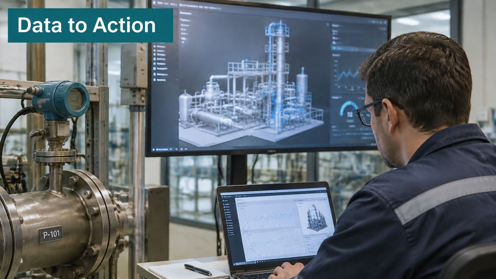
The view below shows the analysis end of that stack, where staff work with model outputs rather than raw feeds.
The Loop In Five Stages
- Readings arrive: Sensors and systems send data at a set interval, whether that's temperatures, lift status or gate counts.
- State updates: The model changes to match the asset as it is now, not as it was designed.
- Analysis compares: Expected behaviour is checked against actual state, which is where machine learning insights from Forge Reliability help teams spot deterioration patterns early.
- Someone or something acts: An operator approves a recommendation, or a rule triggers it automatically.
- The asset responds: The next readings show whether the action worked, and the loop closes.
Take a heating zone that drifts above its set point overnight. The twin flags the drift, points to a stuck valve as the likely cause, and a technician fixes it before the first complaint arrives. That pattern depends on connected building systems, covered in our guide to the Internet of Things in smart buildings.
This short video walks through the loop visually before you test it in your own estate.
The UK approach is federated, not centralised. The UK Government guide to what a digital twin is describes the National Digital Twin as mechanisms that bring information and models together for specific problems, so separate systems keep their own data while contributing to cross-sector analysis.
Practical rule: Change one space in the model and check whether the change reaches the operational system within the time your decision requires.
Stable identifiers and version-controlled maps make that test pass. Without them, each system invents its own name for the same room, platform or door, and updates go nowhere.
Digital Twin Technology Approaches and Platforms Compared
A clinic floor and a rail corridor do not need the same twin. Match the approach to the asset and to the decision in front of you, then test whether data flows both ways. A model that only stores a survey, and never sends a change back into operations, is a static record.
| Approach | Main data | Typical update | Best suited to | Main limit |
|---|---|---|---|---|
| Geometric twin from LiDAR or BIM | Point clouds and CAD drawings | On re-survey | Wayfinding and space planning | Goes stale when layouts change |
| Sensor-driven live twin | IoT sensors feeding live conditions | Continuous | Facilities, energy and wellbeing | Sensor cost and maintenance |
| Process or simulation twin | Schedules, rules and flow models | On demand | Crowd and disruption testing | Depends on assumptions |
| Federated network twin | Connected twins from several owners | Continuous per source | Multimodal transport corridors | Governance and data-sharing effort |
A geometric twin is the spatial base for wayfinding and space planning. Move a partition or relocate a clinic and the model is wrong until someone re-surveys it. Stable layouts suit it. Fast-changing terminals and retail floors do not. If a revised drawing never updates the live route, the loop is open.
A sensor-driven live twin shows facilities and energy conditions as they happen, using IoT sensors rather than a one-off survey. Budget for the sensors, batteries, calibration, network coverage and replacement. Installation is the easy line item. The maintenance tail is where budgets slip. Readings that never trigger a control change fail the two-way test.
A process or simulation twin runs schedules and flow models on demand. That makes it useful for crowd and disruption testing before you change a real concourse. The output is only as honest as the assumptions on arrival rates, dwell times and behaviour. Ask to see those assumptions in writing.
A federated network twin links separately owned twins across a corridor or city. It fits multimodal transport. The hard work is governance, permissions and a shared name for the same asset, not a software feature list.
What the platforms actually do
BIM and CAD authoring tools build the geometric base. Quantity-focused teams comparing drawing tools may find the Exayard vs Bluebeam comparison useful context on that layer. IoT and operational analytics platforms, such as Bentley AssetWise Operational Analytics, handle live data and dashboards. Simulation engines run the scenario work. Integration layers expose data through permissioned APIs so other systems do not copy your master records.
Our overview of 3D mapping software covers the authoring side in more depth. Whatever you shortlist, I would judge it on five criteria.
- Data sources: Which feeds connect on day one, in what format?
- Update rate: Does it match the speed of your decisions?
- Feed ownership: Who owns and maintains each input?
- Integration method: Open APIs or manual file transfers?
- Audit trail: Can you see who changed what, and when?
Digital Twins for Buildings, Campuses and Transport Hubs
At the Royal Hospital for Children and Young People in Edinburgh, Waymap's team mapped the interior with a LiDAR scanner to produce a three-dimensional digital twin of the building before the app went live. NHS Lothian confirmed it as the first hospital in the world to deploy this category of personal navigation technology.
Families were getting lost between departments. The twin of corridors, lifts and destinations is the spatial base for step-by-step guidance, so a route change in the model becomes a route change for visitors. A floor plan that never receives that change is a static drawing. The return path is the test: a facilities edit updates the model, and the model changes the route a visitor is given. Good spatial records underpin that kind of work, much as digital jobsite records for AEC teams keep construction evidence tied to the building.
A campus twin answers a different question. At the University of Cambridge, the IfM building digital twin pilot case study used data from 50 environmental sensors captured at one-minute intervals, processed into contextualised indicators and dashboards for facilities, productivity and wellbeing decisions. One-minute readings suit comfort and plant faults. They do not, by themselves, tell a visitor which lift to take.
Transport operates at corridor scale. The Department for Transport Integrated Transport Digital Twin Programme paper proposes Integrated Corridor Digital Twins for multimodal corridors and a national Crisis Response Digital Twin, supporting reactive and proactive decisions on resilience and efficiency.
The economics support prioritisation. The UK Government integrated network management digital twin economic benefits analysis projects approximately £850 million in present-value benefits over a 10-year appraisal period, about £1.85 billion undiscounted, across five use cases driven by journey-time savings, reliability, roadworks coordination and traffic-management interventions. One use case contributes approximately £530 million in present value. Twinning the highest-impact scenarios first beats twinning everything.
Lord's Cricket Ground became the first stadium in the world to implement Waymap technology, with the deployment in 2025. There, the twin of routes to seats, amenities and exits supports matchday access, where a closed gate or diverted concourse route must reach spectators quickly.
| Setting | What the twin models | Decision it supports | Named example |
|---|---|---|---|
| Hospital | Building interior and routes | Wayfinding and route changes | Royal Hospital for Children and Young People, Edinburgh |
| University campus | Building sensors and conditions | Facilities and wellbeing action | University of Cambridge IfM pilot |
| Transport corridor | Multimodal network and incidents | Disruption and roadworks response | DfT Integrated Transport Digital Twin Programme |
| Stadium | Seats, amenities and exits | Matchday access routing | Lord's Cricket Ground, Waymap deployment in 2025 |
A guide to 3D site models explains how these spatial bases are built.
Match the setting to the decision you must make, whether that is a wayfinding change, a facilities fault, a disruption response or a matchday route. If the asset's state does not flow back into the model, you have a map, not a twin.
How Digital Twins Connect to Indoor Navigation and Mapping
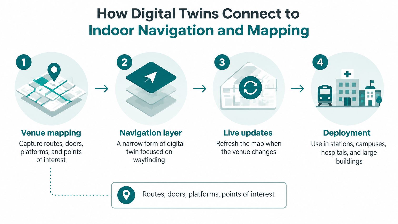
A route change matters only if it reaches the map people use. For indoor navigation, the digital model needs to represent routes, doors, platforms and points of interest, then reflect changes to the venue.
Deployment In Six Stages
- Share the drawings: The venue provides CAD drawings or floor plans. For simpler venues with existing drawings, the typical time from engagement to go-live is 4 to 6 weeks.
- Build or survey: The navigation model is built from available drawings. If drawings are not available, the venue is physically mapped.
- Combine with movement: The venue's plans and movement patterns form a precise model of how people travel through the space.
- Calibrate positioning: Waymap calibrates positioning to the venue's environment, so the model accounts for the space where it will be used.
- Guide from the phone: AI processes smartphone sensor data to estimate step length and direction, providing turn-by-turn guidance without GPS, Wi-Fi or installed beacons.
- Apply venue changes: Changes such as a relocated entrance, platform closure or temporary route need to be reflected in the model before guidance can account for them.
The phone's inertial sensors measure movement against the calibrated venue model. That is how guidance can work without GPS, Wi-Fi or beacons; it still depends on accurate venue drawings or a physical survey and calibration. Avoiding installed hardware reduces the need to maintain beacons, but it does not remove the work of keeping the model current.
A navigation model should receive authoritative changes from the operator's master data. If an entrance moves, the update needs to reach the model promptly rather than wait for a separate redraw.
A navigation layer functions as a twin when venue changes flow into the model and usage feedback informs updates.
Feedback can reveal where routes are difficult to follow. Patterns such as abandoned routes, missed doors or repeated stops can help operators identify problems with the model or the building.
Operational and ESG Benefits Worth Measuring
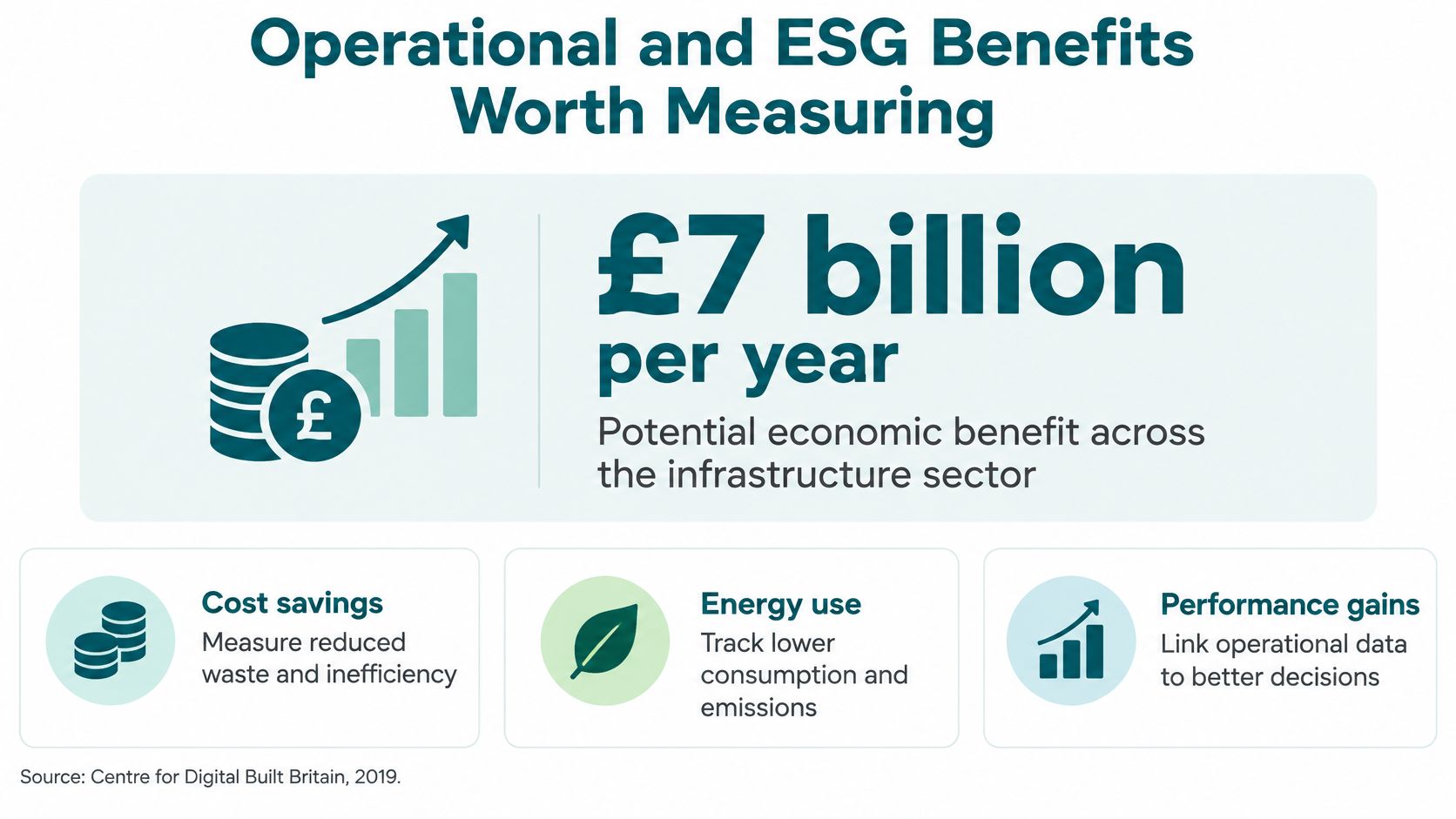
A facilities director is asked to fund a wayfinding layer in the same capital round as roof works and plant replacement. The UK Government digital twins summary report records a potential economic benefit of approximately £7 billion per year across the UK infrastructure sector, cited by the Centre for Digital Built Britain in 2019 from a 2017 Deloitte report for the National Infrastructure Commission. Treat that figure as a potential benefit, not a measured return. Your business case should not present it as one.
Capital budgets are approved in cycles. Physical signage and beacons create recurring maintenance cost on high-footfall sites, and that spend rarely sits in the same approval as the original install. Our article on maintenance cost reduction breaks down where that recurring spend hides.
A navigation layer can support reasonable-adjustment duties under UK equality law without new fixed hardware to install, power and maintain. That trade-off matters when capital spend on building fabric is hard to approve. Match the twin to the decision in front of you. If the decision is visitor access, measure whether people reach the right door, not whether a 3D model looks complete. A twin earns the name when usage comes back and changes what the operator does next. Geometry on its own does not.
For retail and leisure operators, I would put dwell time and revenue next to compliance. Visitors who find shops and amenities easily tend to stay longer, but only if you measure it rather than assume it.
Measures Your Business Case Should Track
- Successful journeys: Completed routes as a share of started routes.
- Missed connections: Particularly at interchanges and during disruption.
- Staff interventions: Wayfinding help your team still has to give in person.
- Reachability: Whether accessible doors and platforms can be reached.
- Satisfaction by disability group: Reported separately, not averaged away.
- Signage and infrastructure cost: What you still maintain, repair and replace.
A twin can create public value even when its direct financial return is modest, particularly when it reduces exclusion or supports compliance.
Scope a Digital Twin Pilot for Your Venue
A useful pilot answers one operational question in a defined area. Start with a specific decision, then agree who owns the data and how often it needs updating. The implementation best practices for planning a venue deployment offer guidance on setting up that work.
- Gather your drawings: Collect existing CAD drawings or floor plans for the pilot area.
- Name one decision: Choose a wayfinding change, a facilities fault or a matchday route.
- Assign feed owners: Name the owner of each data feed and agree its update frequency.
- Choose the scope: Select a navigation layer or a fuller operational twin based on the decision.
- Test with real users: Include disabled visitors before anyone relies on the model.
Waymap Core works from existing CAD drawings, and where they are available, no further mapping is often needed. Where drawings are unavailable, Waymap Pro includes venue LiDAR scanning and returns the raw LiDAR data to the client. Waymap's navigation uses smartphone inertial sensors and AI, rather than GPS, Wi-Fi or installed beacons.
Dr Tom Pey founded the Waymap technology business in 2018 and serves as its President. Contact Waymap through waymapnav.com to discuss a pilot for your venue.
Frequently Asked Questions About Digital Twin Technology
What Is Digital Twin Technology
Digital twin technology is a virtual model connected to its real-world counterpart through a two-way flow of real-time data, as the UK Government defines it. Data from the physical asset updates the model, and analysis from the model supports decisions that affect the asset.
Is A Digital Twin The Same As BIM
No, BIM is a design and information model, while a digital twin adds live operational data and a feedback path to the physical asset. BIM often supplies the geometric base that a twin then keeps current.
Do Digital Twins Need Sensors
Not always, because a geometric twin can run from surveys and drawings, but it can't show live conditions. If your decision depends on temperature, occupancy or asset status right now, you need live feeds from sensors or operational systems.
Who Pays For A Digital Twin After The Pilot
The owners of each data feed and the operator who maintains the model pay, so lifecycle funding and procurement responsibility must be agreed before the pilot ends. Pilots fail at this handover more often than they fail on technology.
How Do You Check That A Digital Twin Is Trustworthy
Ask who owns accuracy, how often the model updates, which confidence threshold applies, what the failure modes are, and whether the model documents its assumptions and validation envelope. A vendor who can't answer those questions is selling visualisation, not an operational twin.
Does Waymap Need GPS, Wi-Fi Or Beacons
No, Waymap works from your venue's own CAD drawings and the phone's motion sensors, so it needs no GPS, Wi-Fi or beacons. That makes it usable indoors, outdoors and underground, including signal-poor areas of stations, hospitals and stadiums.
If your venue's model can't yet answer live questions about routes, doors and access, we can build the navigation layer that does, starting from drawings you already hold. Visit Waymap to talk through a pilot for your station, campus, hospital or stadium.
