
Campus Location Guide: Finding Buildings and Services
44% of UK students with physical or sensory needs surveyed for the 2024 Access Insights Report had been unable to attend an in-person teaching session or supervision because the location was inaccessible. That changes how we should judge a campus location. Finding the right building isn't enough if a student can't reach the room where teaching happens.
At Waymap, we judge campus navigation by a practical question: can someone reach the exact entrance, room or exit independently? A useful university map must support that journey, including the moments when an entrance closes or a lift stops working.
What a Campus Location Includes and Why a Campus Has Many Locations
A campus location is any point someone must reach on a university or college site. A campus is better understood as a network of routes than as a single address.
The scale matters: 2,991,100 students were enrolled in UK higher education in 2023/24, with 72% studying undergraduate programmes and 28% postgraduate programmes, according to the Department for Education. The UK Government's official statistics framework covers providers across England, Scotland, Wales and Northern Ireland, distinguishing study levels, full-time and part-time study, and student characteristics.
Those distinctions matter operationally. Someone attending an evening course might encounter different entrances and reception arrangements from a resident undergraduate. A visiting researcher may know the department's name but not its building abbreviation.
What each campus destination needs
A campus directory tells people what exists. Campus wayfinding must also establish how to get there and whether the route is usable.
| Destination | Typical examples | What a route must confirm |
|---|---|---|
| Teaching rooms | Lecture theatres, seminar rooms, laboratories | Exact door, lift or ramp access, step-free route from the nearest entrance |
| Libraries and study spaces | Main library, reading rooms, quiet study floors | Entrance type, opening hours, step-free route to each floor |
| Residences | Halls, flats, accommodation blocks | Route from the residence to the nearest transport stop and teaching block |
| Student services | Advice desks, disability services, registry, cafés | Room-level location, reception access, staffed hours |
| Transport stops | Bus stops, rail stations, cycle parking | Walking distance to the campus entrance and a step-free link |
| Accessible entrances | Side doors, ramp entrances, lift-served entrances | Whether the entrance is open, its door type and the route inside |
How to organise a multi-site university map
Use a consistent hierarchy: estate → site → building → floor → room, ending at the door. Each level resolves a different ambiguity.
The estate identifies the institution's whole property network. The site identifies the correct campus, while the building and floor narrow the search. The room identifier must then connect to a physical doorway, not merely a label placed near the centre of a floor plan. Our classroom map guide addresses that final destination problem.
Oxford illustrates why these levels shouldn't be collapsed. In 2021–22, the University of Oxford and Oxford Brookes University together recorded 34,945 full-time students and 9,815 part-time students, while Oxford Brookes had three campuses outside the city boundary, according to Oxford City Council's student statistics. Those enrolments aren't a count of people occupying one campus.
Every location record should answer:
- Where is it? Give the site, building, floor and room identifier.
- How do I reach its exact door? Identify the entrance and internal approach.
- What happens if the usual route is blocked? Provide a checked alternative or explain the restriction.
The new-student test: Can a first-year travel from the city bus stop to the right room on a site they've never visited?
Test the return journey too. A student who arrives through a staffed reception may leave after that entrance has closed. A complete campus map should distinguish a destination's physical position from the conditions under which someone can reach it.
How Accessible Wayfinding Finds the Exact Door
Accessible wayfinding translates a destination request into instructions a person can follow through the actual space. That requires both a dependable navigation model and a clear definition of arrival.
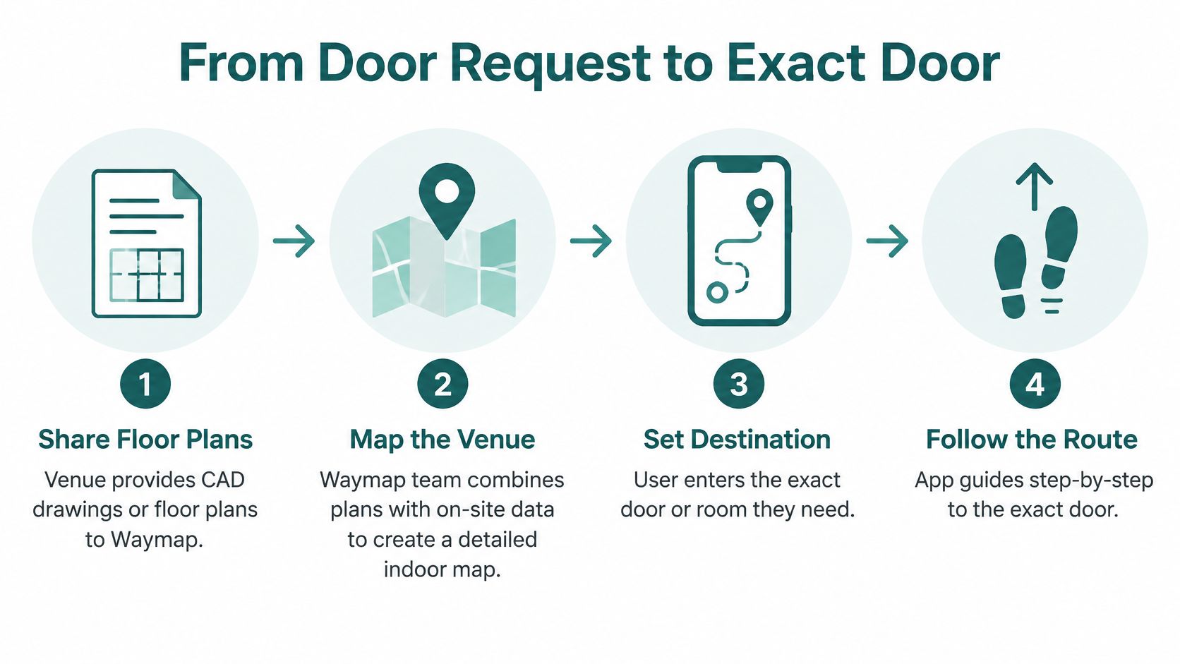
In our first deployment step, the venue shares CAD drawings or floor plans with Waymap. Our team combines those plans with movement patterns to create a precise navigation model, then Waymap's AI calibrates positioning to the venue's environment after its data has been processed.
How positioning becomes practical guidance
The navigation mechanism combines the smartphone's own motion sensors with detailed maps, using dead reckoning to track movement. It doesn't rely on GPS, Wi-Fi, Bluetooth beacons or mobile data to determine the person's position. Our explanation of navigation accuracy addresses why positioning and usable directions must be considered together.
Audio and heads-up instructions matter because users shouldn't have to interpret a visual map at every junction. For blind and low-vision users, the instruction must identify the action at the decision point. Learning the person's stride and movement patterns helps adapt guidance to their walking style.
The route-building process connects the venue's plans with the visitor's destination.
What the visitor does
Choose the destination room or service. Search for the actual teaching room or advice desk, rather than stopping at a department name. This removes uncertainty before the journey starts.
Receive a route suited to access requirements. Avoid stairs or steep gradients where an appropriate alternative exists. A route can't create physical access where none exists, so restrictions must remain explicit.
Follow audio instructions at decision points. Guidance should explain when to turn, enter a doorway or approach a lift. Instructions delivered too early or after the junction aren't useful.
Confirm arrival at the correct door. The final instruction should distinguish the destination from adjacent rooms. Reaching the right corridor isn't the same as arriving.
Reliable existing plans can remove the need for a separate mapping exercise. That doesn't eliminate maintenance: frequent layout changes require updates to the navigation model, while staff turnover makes clear ownership of those updates especially important.
An accessible route is only as good as the last instruction before the door.
Where Campus Routes Fail Disabled and Blind Visitors
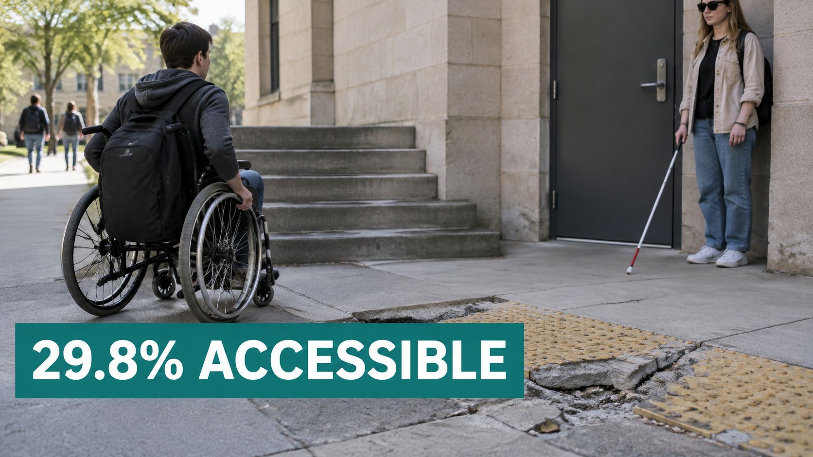
A building marked accessible can still contain teaching rooms a visitor can't reach. The Office for Students briefing on disabled students describes how disabled students continue to meet barriers across teaching spaces, facilities and information, even on campuses that report accessibility provision. The label applies to the building. The route decides whether the room inside is reachable.
That is the standard to judge by: whether one person can reach the exact room, entrance or exit independently. An overall satisfaction score can't show that, and the practical failure can occur before someone enters the building.
Why accessibility belongs in the route model
The Equality Act 2010 requires higher- and further-education providers to take reasonable steps to prevent disabled people being placed at a substantial disadvantage, including access to buildings, facilities and information, as explained by the Office for Students. BS 8300 covers inclusive building design, while BS EN 17210 covers accessibility and usability of the built environment. A navigation layer supports that work. It doesn't create physical access where none exists, and it doesn't establish compliance by itself.
Represent entrances, lifts, ramps, alternative paths, surface changes, restricted doors and room destinations as separately maintainable map objects. A campus route works like a chain: the accessible label sits at one end, the destination door at the other, and a single broken link, a lift taken out of service, invalidates the journey while the building's label stays unchanged.
Tom Pey, Waymap's founder and a blind accessibility technologist, brings lived experience to our focus on decision-point audio for blind and low-vision navigation. Waymap locates people indoors and outdoors without signal or beacons, using only a smartphone, so guidance can keep working in the signal-poor corners of an estate where routes often go quiet.
The same attention to decision points applies when routes serve visitors with different needs.
What estates teams should challenge
- The correct building, wrong entrance. A route ends at stairs even though a usable entrance exists around the corner.
- The unavailable lift. The published step-free route stays visible after the lift it depends on fails.
- The construction diversion. Temporary fencing removes a connection that still appears on the map.
- The after-dark approach. A path legible at noon becomes ambiguous under poor lighting, so a familiar route turns uncertain at dusk.
A verified journey to the exact door is therefore an accessibility-management question, not just a signage task. Fixed signs alone can't explain a newly unavailable route, and ordinary navigation must never be presented as a substitute for approved emergency arrangements.
Campus Wayfinding in Practice at Real Venues
Our listed clients include the University of British Columbia and the Royal Hospital for Children and Young People. University and healthcare estates share a navigation problem: visitors must move between named destinations, not just reach a recognisable building.
The University of British Columbia client page provides a university reference point. For an estates team, the useful comparison is how destination records connect across buildings, public approaches and internal circulation.
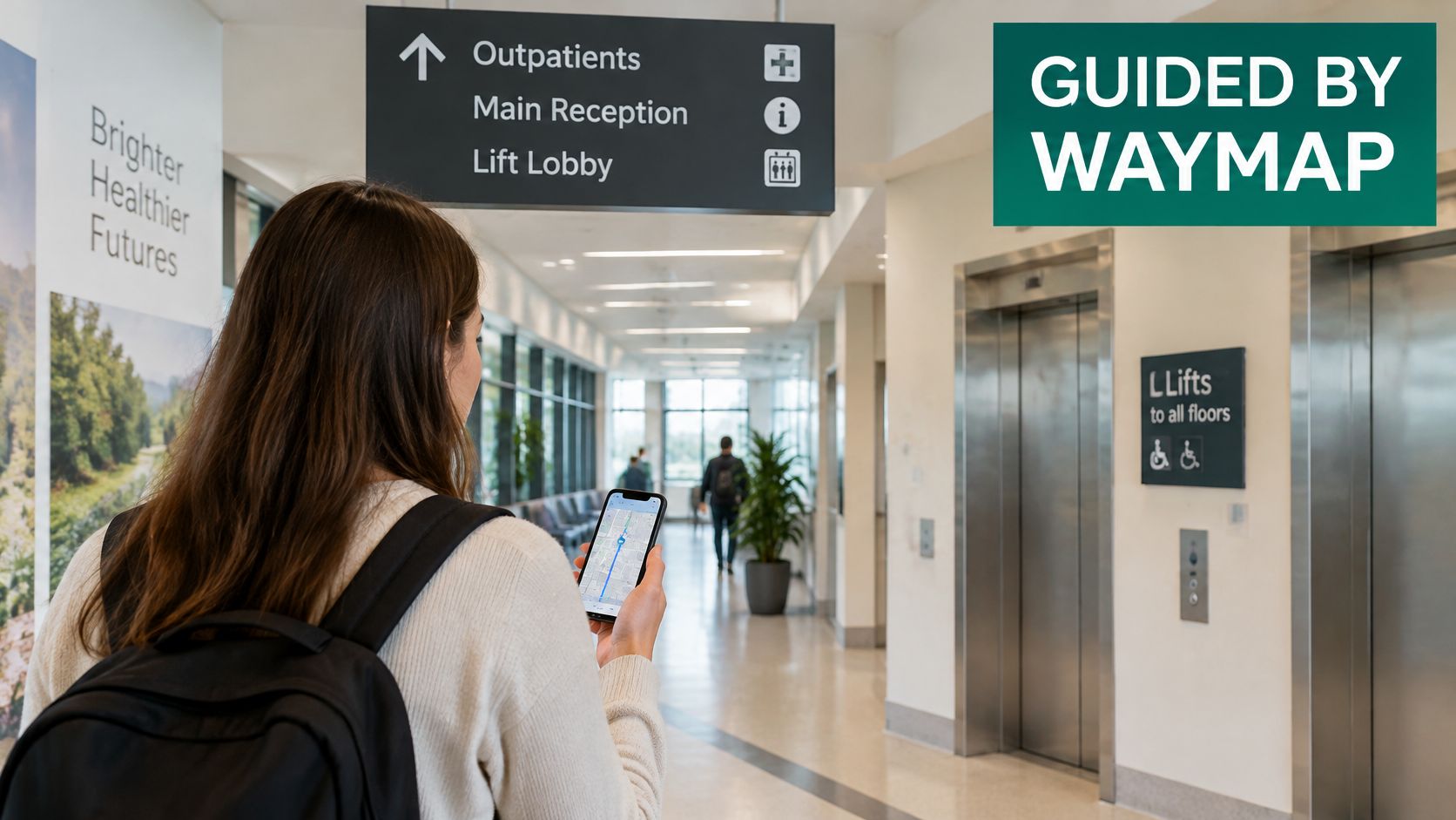
A hospital corridor illustrates the final part of that journey.
What rail approaches teach campus teams
Waymap was deployed at Birmingham New Street Station and University Station in October 2024. University Station covers approximately 120,000 sq ft and has two overground platforms.
For a university, that station environment provides a useful planning scenario: start the journey at the platform, identify the appropriate station exit, then check the connection towards campus. Don't assume that a successful station deployment proves every onward campus route has been mapped or tested.
Lord's Cricket Ground is also among our listed clients. Its campus-like arrangement offers another useful comparison: a visitor's destination may be a seat, an amenity or an exit rather than the venue's main entrance. Deployment-specific outcomes should be distinguished from what a campus team hopes to achieve.
What detailed access guides contribute
The University of Hertfordshire's access guides cover buildings, teaching spaces, libraries, accommodation and bus routes across College Lane, de Havilland and Bayfordbury. Their detail includes accessible parking, step-free access, ramp sizes and weight limits, hearing loops, Braille signage and tactile paving.
Use that level of detail as a benchmark for destination records. Then test whether a visitor can act on it while moving.
Strong examples should provide:
- A named entrance, matched to the approach route.
- A named room, connected to its actual doorway.
- A tested backup route, with restrictions made explicit.
These are acceptance criteria for a campus project, not outcomes to assume from a client name alone.
How to Check a Campus Route Before You Rely On It
A route audit should produce a record someone else can inspect, update and retest. Give each finding an owner and record when it was checked, rather than leaving observations in an unstructured email chain.
A repeatable route audit
List destinations by room-level identifier. Include the site, building and floor. A building name doesn't tell a visitor which doorway they need.
Walk from the nearest transport stop to the exact door. Log every junction, crossing, entrance and vertical transition. Note where someone unfamiliar with the site would need an instruction.
Record physical access attributes for each leg. Capture entrance type, lift, ramp, surface and gradient. Describe the constraint rather than applying a blanket accessible label.
Repeat the walk at peak teaching times and after dark. Check whether queues obscure signs, crowded corridors complicate turns or lighting changes the approach. Record conditions, not just a pass or fail.
Test the backup with the lift treated as unavailable. Don't disable equipment for the exercise. Follow the alternative and record its additional walking distance, access restrictions and available resting places.
Compare the floor plans with the walk. Where a venue's plans are available and reliable, further mapping is often unnecessary. Log missing doors, altered partitions and inconsistent room labels where the drawings don't match.
Publish approved changes through the content management process. Separate a proposed correction from an authorised update. Recheck the visitor-facing result before closing the issue.
Our guide to accessibility testing provides a useful starting point for turning observations into testable requirements. Include disabled users in evaluation, while keeping responsibility for corrections with the venue.
How to keep updates manageable
Budget approval cycles and capital-spend limits can make cabling or beacon projects difficult to justify. Physical hardware also introduces inspection and maintenance work across estates affected by construction, room changes and term-time traffic.
Our modelling process combines venue plans with movement patterns. For the estates team, the important operational task is to assign responsibility for keeping those plans and destination records accurate.
Audit discipline: Record the failed instruction, the physical cause and the person responsible for resolving it.
This week, run the opening checks on one journey from a transport stop to a teaching room. Record precisely where the route becomes ambiguous or unusable, rather than concluding that the whole campus is easy or difficult to get around.
Campus Location Questions Answered
Is this campus easy to get around?
Judge a single journey, not a satisfaction score. 83% of surveyed University of Sussex students agreed that their campus was easy to get around, yet students still asked for clearer signage and more reliable lifts, according to the University of Sussex campus-development review. The better test is whether a new visitor can reach the exact room, entrance or emergency exit independently, at the time they will travel and with the lifts and doors available then.
What does campus wayfinding need to cover beyond the building?
A building pin is only the first link in the chain. The route has to carry someone from the transport stop or car park to the right entrance, through stairs or lifts to the room, and back out through an exit they can use. Emergency confidence belongs in that model too: knowing a lecture theatre is not enough if the approved exit procedure is unclear or depends on help from someone else.
Does campus wayfinding need GPS or beacons?
No. Waymap locates people indoors and outdoors without signal or beacons, using only a smartphone. What matters is an accurate, maintained map of the space, because a strong signal beside the wrong door still leaves the visitor short of the destination.
Can wayfinding cover indoor and outdoor areas?
Yes. At the Royal Hospital for Children and Young People, Waymap covers the full six-floor indoor environment and the surrounding outdoor campus. A university project should draw the boundary around the visitor's journey, including pavements, ramps, entrances and room-level destinations, rather than stopping at the external wall.
Waymap helps universities connect campus approaches, buildings and room-level destinations through precise guidance and maintainable location information. Visit Waymap to discuss your estate's floor plans, access requirements and a priority route from the transport stop to the exact door.
