
Smart City Solutions: Categories, Access and Deployment

In an England-wide analysis, 71% of areas, representing 70.6% of residents, could reach fewer than one in twenty of the destinations available to a car user, according to a study published in Frontiers in Big Data. That's a useful starting point for evaluating smart city solutions: more connected infrastructure doesn't automatically mean better access.
Councils and venues need to distinguish between seeing how a network operates and helping someone complete a journey. At Waymap, our position is straightforward: navigation is the last-metres layer of smart city delivery. Judge it by whether a person can reach the right door, platform or destination independently, not by whether an app displays a route.
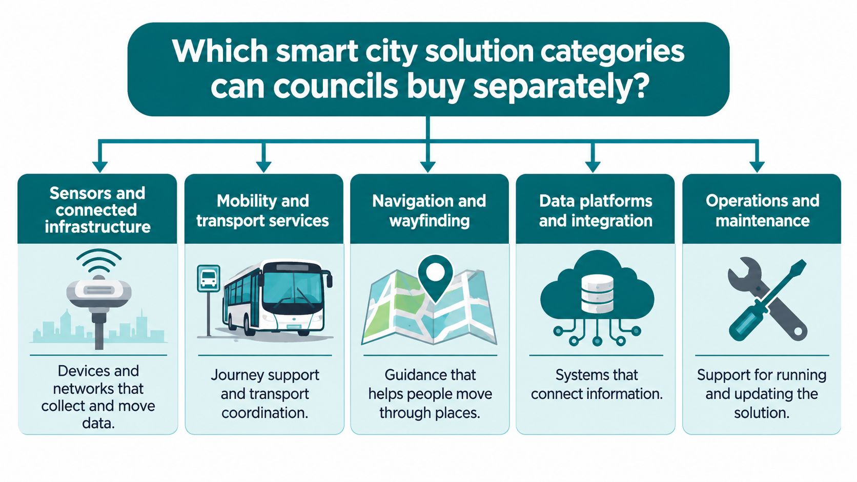
Which smart city solution categories can councils buy separately?
Councils can procure connected systems by service area rather than buying a single city-wide platform. The main categories differ in what they manage and how much they depend on network access.
Smart city solution categories and their network dependence
| Category | What it covers | Typical use | Network dependence |
|---|---|---|---|
| Sensors and connected infrastructure | Sensors, actuators and network devices using LoRa, NB-IoT or Wi-Fi | Traffic-light management, public-realm CCTV | Remote monitoring and control depend on a network link |
| Mobility and transport services | Journey planning and live transport information | Transport services and journey planning | Live information depends on data feeds |
| Waste and public services | Operational systems for public services | Bin-fill sensing and collection routing | Readings and revised collection instructions need connectivity |
| Environmental and building systems | Monitoring of the environment, buildings and utilities | Air-quality and building energy monitoring | Local controls can continue offline; remote reporting needs connectivity |
| Accessible wayfinding and navigation | Indoor, outdoor and underground routing to exact doors and platforms | Transit hubs, stadiums, shopping centres, hospitals | Sensor-based guidance can work without GPS or Wi-Fi; map and service updates need connectivity |
The UK Government's connected places survey received 188 valid responses, including 173 local authorities. It found that 36% had a connected-place or smart-city strategy, while 53% managed connected-place technologies without one. The survey's definition spans sensors, networks and applications used for transport, buildings, utilities, environmental management, infrastructure and public services.
These are distinct procurement decisions. A building-management system can address energy use without becoming the council's transport-data platform. Accessible navigation can also be procured without replacing existing information systems.
Integration and maintenance still need an owner. Councils should specify which systems provide data, who approves changes and how updates reach the public-facing service. The Internet of Things in smart buildings helps explain the distinction between connected assets and the applications that use their information.
Buy a service outcome, not a technology bundle
Specify the boundary between devices, networks and the service residents use. If an estates project also includes residential charging, teams can compare home charging wallboxes, while assessing public charging and pedestrian navigation against their separate requirements.
Procurement rule: Start with one named service problem at one fixed site, not a city-wide platform specification.
Choose a transit hub, shopping complex or public building. Define the person's task, the operational owner and the evidence that will show whether people can complete the journey to their destination without staff help.
Why Connectivity Gaps Still Shape Smart City Design
A strong national connectivity headline cannot guarantee a usable signal along a passenger's entire journey. Underground passages, transit corridors, dense buildings and rural approaches can all interrupt service, so councils and venue operators need to assess the route people will take.
Design for the location, not the coverage headline
Test the intended journey on site, including basements and internal transfer corridors. A coverage map is a planning reference, not an operational guarantee.
Digital services should keep core guidance available when a connection drops and synchronise updates when service returns. The practical limits of navigation without Wi-Fi show why offline guidance and fresh operational information need separate consideration.
Include these checks in acceptance testing:
- Offline operation: Which functions continue when mobile data and Wi-Fi are unavailable?
- Basement performance: What happens between the station entrance, underground concourse and platform?
- Information freshness: How does the system flag an expired cached route or an unavailable operational update?
A stored route can remain usable while a newly reported lift outage is unavailable. For each planned service, identify what stops working underground, inside dense buildings or on rural approaches, and assign an owner to the fallback.
How does navigation work without GPS, Wi-Fi or installed hardware?
A visitor leaves a train platform, crosses an indoor concourse and exits onto the street. The route crosses a platform-to-concourse transition, an indoor-to-outdoor threshold and a final approach to the destination entrance. A street-level map pin doesn't describe those handovers.
The app interface is the visible part of a more detailed navigation process.
Waymap's AI algorithms process smartphone sensor data in real time to estimate step length and direction of travel, combining that estimate with detailed maps to provide turn-by-turn guidance without GPS or Wi-Fi. This is a form of dead reckoning: estimating movement from the person's previous position rather than repeatedly obtaining a satellite position.
The system adapts to the person's walking style rather than assuming a fixed stride. Audio instructions support heads-up, hands-free movement, with guidance to specific doors, platforms and points of interest. No positioning hardware is fitted across the venue, and there are no beacon locations to pre-map.
Infrastructure-free doesn't mean map-free
Detailed venue and street maps still matter. Removing installed positioning hardware doesn't remove the need to maintain entrances, route connections, restricted areas or accessibility information.
Our routing automatically avoids works or faults in escalators, lifts and areas when those operational conditions are available to the system. Live CapMetro transit data also supplies real-time arrival times, service changes and platform details. Offline positioning and live operational updates are different functions: the former can continue without a signal, while the latter requires a way to receive new information.
This demonstration provides a view of the navigation experience.
For blind and low-vision visitors, the distinction between a building's location and its usable entrance is fundamental. Guidance needs to identify the route through the building, not stop at its boundary.
A council or venue can test that requirement directly:
- Named entrance: Start outside a specified public entrance and check the arrival point.
- Threshold handover: Follow the route between the street, concourse and platform without restarting navigation.
- Closed lift: Publish a test closure, confirm the accessible alternative and record when the update becomes available.
Run the test with disabled users and operational staff. Record completion, wrong turns and assistance requests, rather than relying on a successful demonstration by someone who already knows the building.
Which Accessibility Duties Smart City Solutions Address
In England, disabled adults made 713 trips per person in 2025, compared with 901 trips among non-disabled adults, a gap of 21%, according to the National Travel Survey's 2025 disability figures. Lower trip rates do not identify a single cause, but they make a practical question for councils and venues clear: can someone complete the journey to a specific destination without relying on staff?
Trip rates for disabled and non-disabled adults in England
| Measure | Disabled adults | Non-disabled adults | Gap |
|---|---|---|---|
| All adults, 2025 trips per person | 713 | 901 | 21% |
| Aged 60 and over, 2025 trips per person | 648 | 945 | 31% |
| Aged 16 to 59, 2025 trips per person | 773 | 885 | 13% |
| All adults, 2023 trips per person | 740 | 989 | 25% |
The Department for Transport's 2023–24 accessibility statistics recorded 99.5% of England's buses with accessibility certification in 2023. Certification describes the vehicle, not whether a passenger can find the stop, make an interchange and reach the right door.
Turn accessibility obligations into an operational test
The Equality Act 2010 requires service providers to make reasonable adjustments for disabled people, including in relation to physical features. BS 8300 provides guidance on inclusive design in the built environment, while BS EN 17210 sets functional accessibility requirements. Article 9 of the UN Convention on the Rights of Persons with Disabilities addresses accessibility.
These frameworks do not require a particular navigation app. They do make it important to assess whether people can use a service in practice. The public sector equality duty and its implications for public bodies provide further context for councils assessing how services affect disabled people.
For estates managers, the practical constraints are familiar: capital approval cycles, competing maintenance priorities and limits on changes to historic buildings. Updateable navigation can address gaps in wayfinding information, but it cannot create a step-free route where none exists.
A route to an inaccessible entrance does not complete the journey.
Set a measurable outcome before approving a project. For example: can a blind visitor reach the named reception door without asking staff? Test the whole journey, record where assistance is still needed, and provide a clear way to request it.
Dr Tom Pey founded Waymap, which was built first for blind and low-vision users.
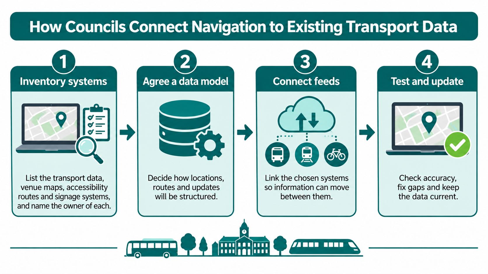
How Councils Connect Navigation to Existing Transport Data
The Department for Business and Trade and Department for Transport's transport smart-data assessment identifies fragmentation across organisations, modes and sectors, caused by inconsistent formats, incompatible systems and limited data-sharing arrangements. For councils, that makes integration an operating-model decision, not an API connection.
Establish ownership before connecting feeds
Inventory existing systems. List the systems holding transport information, venue maps, accessibility routes and signage records, and name the owner of each. Include spreadsheets and contractor-managed files, because an unofficial closure list can contradict an otherwise well-maintained passenger-information system.
Agree a canonical map of entrances, platforms, stops and points of interest. Give each record a stable identifier and an accountable owner so that different systems don't treat the same entrance as unrelated locations.
Use documented, standards-based interfaces. Define field meanings, location identifiers, accessibility attributes and error handling before connecting systems. A feed that can be parsed but uses inconsistent meanings still creates bespoke integration work.
The high-level workflow is straightforward; the ownership decisions require care.
Make changes traceable and testable
Define update ownership and version control. Specify who approves a closure, who publishes it and how users receive it. Keep an audit trail and a rollback process so an incorrect change can be corrected without guessing which version is live.
Connect operational feeds where the operator permits, including service changes and accessibility disruptions. Agree refresh behaviour, stale-data warnings and outage handling; real-time transit information is useful only when its relationship to the pedestrian route is clear.
Pilot a bounded site before scaling. Test with disabled users and staff, including temporary closures and conflicting records. Resolve the update workflow before repeating the deployment elsewhere, or each additional site will reproduce the same manual work.
- Coverage boundary: Indoor areas, outdoor connections and excluded spaces.
- Maintained destinations: Entrances, platforms, facilities and other points of interest.
- Supported routes: Step-free options and routes affected by temporary changes.
- Measured outcomes: Journey completion and operational effects, distinguished from coverage.
- Alternative support: Keep staff assistance, tactile information and audio announcements alongside the app.
- Data protection: Check UK GDPR obligations before collecting movement data, including purpose, access and retention.
- Review ownership: Publish an accessibility review date and name the person responsible for acting on findings.
Procurement specifications should name the interface documentation, data dictionary and acceptance tests the supplier must deliver. Also distinguish public passenger information from restricted operational information, with access controls appropriate to each.
The benchmark is reliable updates across organisational boundaries without rebuilding the integration for every site. A polished route demonstration doesn't establish that capability.
Before starting the inventory, answer the question that determines whether the process can work: which team owns accessibility route data?
What have named UK deployments actually covered?
Published deployment accounts establish scope, not comparable journey-completion results. A shopping complex and a city-centre route present different navigation requirements. For councils and venue operators, the practical test is whether a person can complete the full journey from the city network to a destination without staff help.
Mixed-use retail and city-centre connections
Liverpool ONE covers a mixed indoor and outdoor shopping complex of approximately 1.4 million sq ft. Waymap's navigation app and content management system were deployed there as a mass-market solution for all customers. The CMS brought a significant improvement in operating efficiency, and the app led to a notable reduction in the use of static kiosks for directions. Repurposing those kiosks for advertising is another outcome of the deployment.
Retail sites change. Liverpool ONE's CMS lets venue teams monitor points of interest, hide or rename stores, and publish approved updates to the mobile app. That operational layer matters because a route is only useful while its destination information remains current.
At Bullring and Grand Central, the coverage includes accessible navigation across the two central Birmingham destinations and outdoor routes between train stations and city landmarks. The Birmingham deployment illustrates how venue wayfinding can connect with the surrounding city rather than stop at a building entrance.
Network coverage and event-day destinations
CapMetro provides a transport-network example. Its downtown Austin deployment integrates 82 bus stops into live transit navigation, with step-free routing and personalised settings. A custom outdoor mapping environment of approximately 8 million sq ft covers downtown pedestrian zones and uses proprietary datasets provided by CapMetro. Live transit data supplies arrival times, service changes and platform details.
The operating scope extends beyond the stops themselves. CapMetro's internal teams used insights from usage data to support transport and pedestrian-flow planning. This shows how navigation can support operational decisions as well as individual journeys.
For supplier comparisons, request a consistent scope schedule:
A deployment footprint alone does not show whether people can reach their destination independently. Compare the route boundary, the destinations maintained and the evidence of completed journeys.
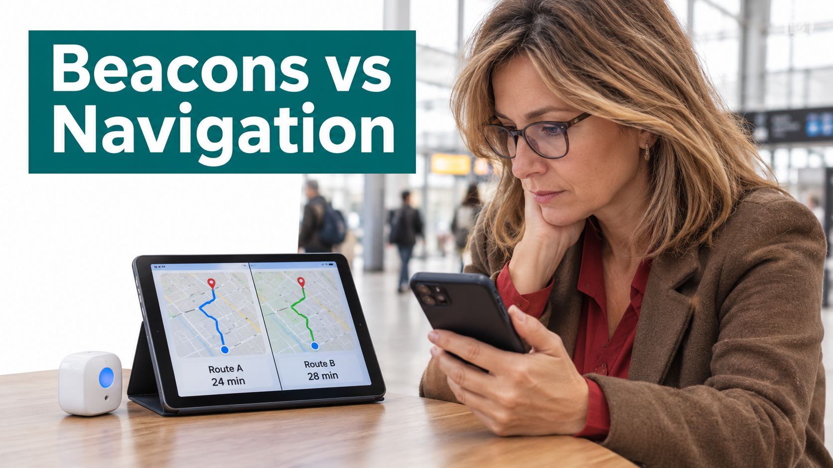
Choosing Between Beacons and Infrastructure-Free Navigation
Fixed hardware compared with infrastructure-free navigation
| Criterion | Fixed hardware such as beacons | Infrastructure-free navigation |
|---|---|---|
| Installation before launch | Hardware fitted across the site | No fitting of positioning hardware required |
| Ongoing upkeep | Battery replacement and hardware repair where applicable | No site positioning hardware to maintain |
| Response to a layout change | Relevant hardware may need moving or resurveying | Venue updates points of interest in the CMS, published after approval |
| Operation without Wi-Fi or GPS | Beacon positioning can operate without either; implementation determines other dependencies | Uses smartphone motion sensors with detailed maps |
| Cost profile | Installation, asset servicing and information maintenance | Mapping, software, integration and information maintenance |
Beacons are not dependent on Wi-Fi or GPS. The meaningful comparison is what the full system requires to position the user, maintain its map and receive operational changes. Neither option eliminates information management.
For an existing beacon estate with established maintenance arrangements, replacement needs a clear operational case. For a council managing dispersed sites, adding physical assets means assigning access, inspection and replacement responsibilities across those locations.
Compare whole-life responsibilities
Frequent layout changes strengthen the case for separating navigation from installed positioning hardware. They don't remove the need to approve route changes, verify destinations or fund map maintenance.
Budget structure matters too. An estates team may struggle to secure capital approval for installations but still need recurring funding for software and information stewardship. Infrastructure-free doesn't mean cost-free.
Measure access and sustainability without excluding people
Lord's links navigation with its sustainability ambition of helping fans plan and complete journeys by sustainable modes. Councils can evaluate the same proposition through visitor travel-mode surveys and the share of guided journeys completed without a private car, rather than assuming an app causes a mode shift.
The Office for Statistics Regulation's accessibility review identifies a gap between component statistics and whole-journey accessibility. Define route-level outcomes such as completed journeys, missed connections and assistance requests, with clear denominators.
Digital inclusion needs equal attention: London TravelWatch's Logged Out report found 1.5 million Londoners were being left behind by digital-first transport, with one in six respondents unable to buy a ticket because they lacked or couldn't use a smartphone or internet connection, and one in five paying more because they couldn't buy online or through apps.
Independence should be an available choice, not a condition imposed on visitors.
Retain these safeguards:
Smart City Solutions Questions Answered
What are smart city solutions?
Smart city solutions are systems that use sensors, networks and applications to improve public services and infrastructure. The UK Government's connected places survey applies that definition across transport, buildings, utilities, the environment and public services. Procurement should specify the service outcome, information owner and operational dependencies, rather than just the technology.
Do smart city navigation solutions work without GPS or Wi-Fi?
Yes, some navigation systems can provide guidance without either. Waymap uses smartphone motion sensors to estimate step length and direction, combined with detailed maps. That doesn't mean live service changes arrive without connectivity: navigation, map availability and operational updates need separate acceptance tests.
Do UK councils need a smart city strategy before deploying?
No, councils can scope a bounded deployment before adopting a smart-city strategy. The Government's connected places survey distinguishes technology adoption from formal strategy. A pilot still needs procurement approval, accessibility requirements, data governance and an operational owner; absence of a city-wide strategy isn't an exemption from those responsibilities.
How do smart city solutions help meet accessibility duties?
They can support reasonable adjustments by making routes and service information more usable. The Equality Act requires reasonable adjustments, while government inclusive transport policy supports equal access. Digital guidance should complement accessible physical routes and assistance, not be presented as proof that a site meets every legal obligation.
Does navigation replace staff help for disabled visitors?
No, navigation should complement staff assistance rather than remove it. London TravelWatch's digital-exclusion findings underline why an app cannot be the only access channel. Retain tactile information, audio announcements and clear ways to request support, including for people without smartphones or confidence using them.
Why do councils need door-to-door measures?
Councils need door-to-door measures because an accessible component doesn't establish that the whole journey is usable. The Office for Statistics Regulation identifies gaps in whole-journey evidence. Define the start, destination, permitted assistance and completion criteria, then record where visitors encounter barriers between transport modes and building entrances.
Waymap provides infrastructure-free navigation across indoor, outdoor and underground routes, connecting transport networks with precise destinations. Visit Waymap to discuss a pilot at a named site, with clear map ownership, closure-update tests and independent journey-completion measures.
