
Peel Centre Gloucester: Ultimate Visitor Guide 2026

You've probably landed here because you already know the Peel Centre in Gloucester is “at Gloucester Quays” and you want the bit the listings miss, the actual move from car park to storefront, the places people get turned around, and whether the site works for visitors who can't rely on signage alone. That's the key question at peel centre gloucester, not whether it exists or has a postcode.
What the Peel Centre Gloucester Actually Offers
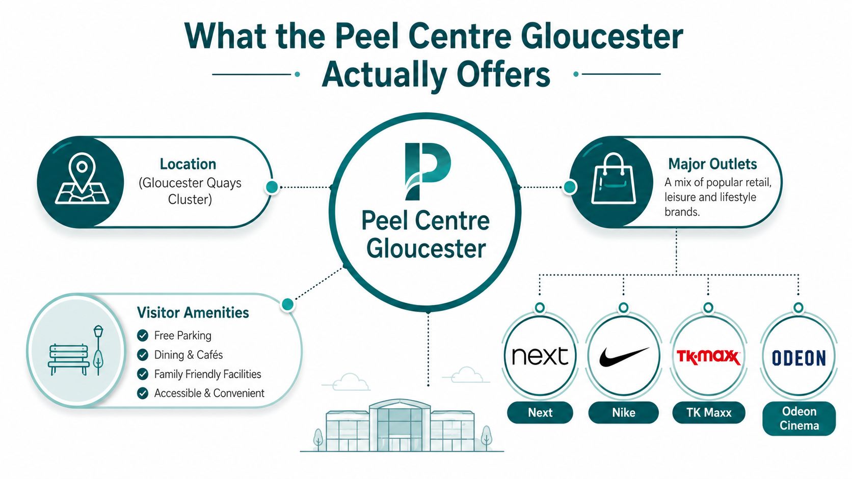
Arrive at the wrong entrance and the site can feel larger and less obvious than it looks on a map. That happens because the Peel Centre in Gloucester is a retail park on St Ann Way, Gloucester GL1 5SF, sitting adjacent to Gloucester Quays and operating as part of the same central retail cluster (Visit Gloucester's Peel Centre listing). For visitors, that matters more than the marketing label, because this is a mixed-unit scheme where the shops are separated, and the front doors don't always line up neatly with the road network.
What you're actually looking at on arrival
Visit Gloucester lists the site with major outlets including Bensons for Beds, Burger King, Dreams, Iceland – The Food Warehouse, and Hobbycraft (Visit Gloucester). That mix tells you what the Peel Centre does well, comparison shopping, food stops, and larger-format retail that works best when you're driving in with a clear plan.
The wider setting explains why the centre draws from beyond the city core. Gloucester Quays sits on St Ann Way in the former High Orchard area, and Gloucester's position is described as roughly 7 miles from Cheltenham, 33 miles from Bristol, and 17 miles east of the Wales border (Gloucester Quays overview). In practice, that makes the Peel Centre part of a broader destination trip, not just a neighbourhood convenience stop.
Why the layout creates a navigation problem
A retail park like this is not one building with one door. Tenants sit in separate units, and the route from the road into the correct storefront can be more confusing than the postcode suggests. That's why simple site-level directions often disappoint, they tell you where the park is, but not where Unit 6D or another specific frontage is.
One useful example is the NEXT store at Unit 6D, The Peel Centre. A unit-level listing like that shows the actual navigation challenge, because visitors need storefront precision, not just a destination pin. The Waymapped venues directory is the kind of resource people usually end up wanting when they realise the site needs more than a generic map.
Practical rule: if the destination is a retail park with multiple tenants, the “right” address is only half the job. The other half is the last 50 metres from parking or drop-off to the correct entrance.
How to Reach the Peel Centre from Key Arrival Points
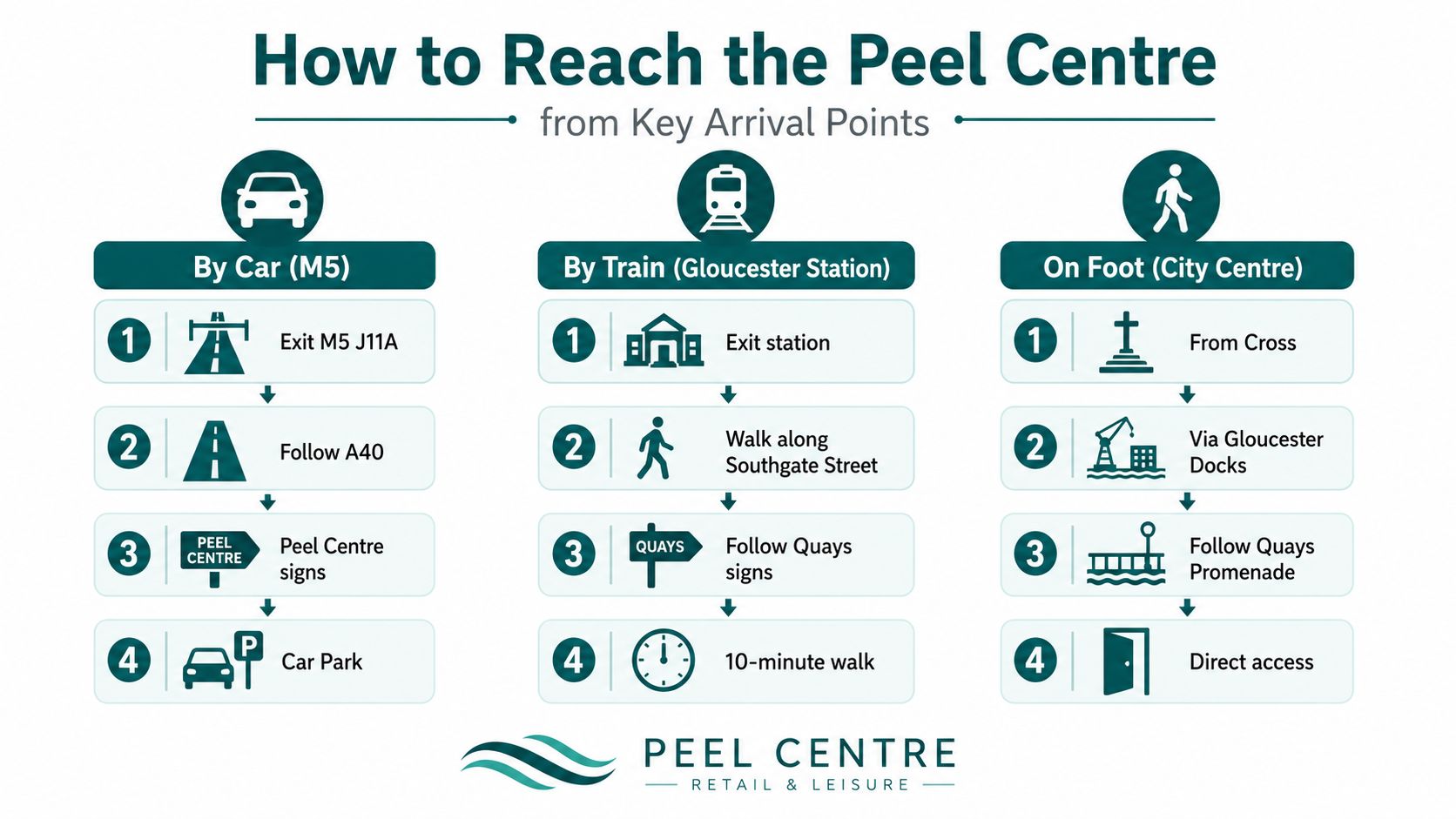
The easiest way to think about the Peel Centre is as part of the St Ann Way retail corridor, not as a stand-alone block. Gloucester Quays sits next to it in the same area, formerly High Orchard, which is why drivers and pedestrians can confuse the two sites when they first arrive (Gloucester Quays overview). That confusion usually starts at the point where a route planner has already done its job, but the final turn still matters.
By car from the motorway side
From the motorway approach, the key task is staying oriented once you leave the broader road network and head towards St Ann Way. The decision point is not just “reach Gloucester”, it's recognising when you're entering the retail-leisure zone shared with Gloucester Quays, because the destination sits within that cluster rather than in an isolated retail estate.
Drivers who use sat-nav often get the broad location right and the final turn wrong. That is where the site's mixed retail layout creates friction, since the car park, the retail frontage, and the specific unit may not appear in the same line of sight. If you're already familiar with the Gloucester Quays side, treat that as your orientation anchor and look for the St Ann Way retail corridor rather than expecting a separate district.
By train from Gloucester station
Rail visitors usually do best when they think in landmarks, not pure distance. The station puts you into the city, but the site is still in the Gloucester Quays/St Ann Way area, so the route is about moving from the railway side of Gloucester towards the retail-leisure cluster that sits beside the water and city-centre edge.
The critical moment is knowing when you've left the city core and entered the Quays corridor. That's why station-to-destination guidance should be tied to named places, not just a direction of travel. Generic “follow signs” advice isn't enough if the signs don't match the exact storefront or entrance you need.
On foot from the city centre
Pedestrian arrivals need the clearest mental map of all, because the route can feel obvious on a busy afternoon and vague after dark or in poor weather. Gloucester Quays acts as the main landmark, and once you're in that zone, the Peel Centre is part of the same retail pattern on St Ann Way.
The most common mistake is assuming the Peel Centre and Gloucester Quays are interchangeable. They're adjacent, but not identical, and that difference matters when you're looking for a particular store or entrance.
The public transport directions guide is useful as a format reference for teams that want route information to feel specific rather than promotional. For visitors, the practical takeaway is simpler, use the Quays area as the anchor, then refine to the exact unit.
Accessibility and Step-Accurate Navigation at the Peel Centre
The Peel Centre is the kind of retail park where basic accessibility wording doesn't solve the core problem. A visitor who uses a cane, a mobility aid, or a screen reader doesn't just need to know that parking exists, they need the exact route from the bay to the entrance and then from the entrance to the right unit. That distinction matters because the site is built around multiple large-format units, and mixed-unit layouts usually demand building- and unit-level POI resolution rather than broad site guidance.
What the common accessibility gap looks like
Current public coverage of The Peel Centre, Gloucester is heavily review-led and address-led, but it often skips the questions that decide whether a visit is workable. The gap is practical, not theoretical. Visitors want to know whether they can find a step-free route, whether the front door they need is the obvious one, and whether a unit can be reached independently without guessing.
That gap is especially important in the UK, where an estimated 2 million people live with sight loss and around 360,000 are registered as blind or partially sighted (Tripadvisor review context for the site). Retail park content that stops at generic statements leaves those visitors to do the hardest part themselves.
What good wayfinding needs to answer
A useful accessibility briefing for a site like this should answer four things plainly:
- Where to stop or park: the nearest practical arrival point, not just the main postcode.
- Which entrance to use: the exact doorway that avoids unnecessary detours.
- How to orient inside the park: the relationship between units, car park edges, and the visible frontage.
- What changes when the layout changes: how visitors cope if a unit is vacant, closed early, or temporarily rerouted.
That last point is where many retail parks fall short. Temporary changes are normal, but if the visitor can't see the whole site or can't rely on signage, those changes become a barrier rather than a minor inconvenience. A good comparison point for teams thinking about layout clarity is find your stand at the Principality, because it shows how venue-specific orientation matters when the destination is only useful if people can reach the right point.
Why site-level accessibility statements aren't enough
Retail parks should think like navigation environments, not brochure pages. A park can be “accessible” in the legal sense and still be awkward for independent navigation if the route from parking to shopfront depends on sightlines, familiarity, or verbal help from staff. For blind and low-vision visitors, that difference is the difference between comfort and uncertainty.
Practical rule: accessibility content should describe the journey, not just the facility. If the route can't be followed independently, the listing hasn't done enough.
For teams auditing this properly, the navigation instructions resource is a sensible benchmark for the level of detail users need.
Practical Visitor Tips for Parking and Opening Times
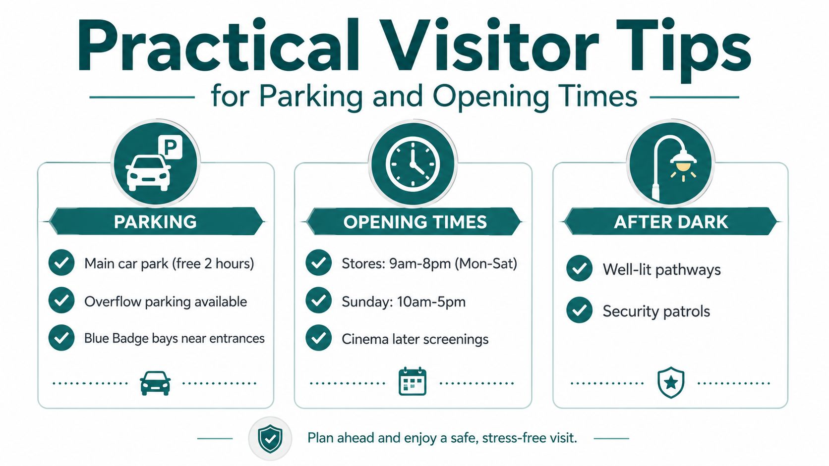
Parking is usually straightforward here because the Peel Centre operates as a retail park with a surface layout, while Gloucester Quays also gives visitors an alternative parking context nearby. The problem is not whether there's space, it's whether you know which parking area best matches your destination, especially if you're heading to a specific unit rather than browsing the whole site.
Parking choices that reduce friction
If you want the simplest visit, choose the parking area that puts you closest to your store, not the one that looks closest on a map. That sounds obvious, but on mixed-unit retail parks it's where visitors lose time. The same applies if you're returning after a long break, because unit changes can alter the route from the bay to the entrance.
Retail visitors also benefit from thinking about the park as a sequence, park, orient, walk, enter. That sequence matters more than the postcode because a surface car park doesn't automatically tell you which side of the scheme you've arrived on. If you're using a mobility aid or pushing a buggy, the shortest visible path is often better than the theoretically direct one.
Opening times and why timing changes the experience
Visitor searches usually focus on opening hours, but the key issue is matching your visit to the type of journey you're making. A daytime trip gives you more visual cues, while an evening visit asks more of lighting, route confidence, and the ability to identify the correct unit when the park is quieter.
Store timings can also vary across tenants, which is why a retail park is never just one opening time. If your purpose is a single purchase, check the individual store rather than assuming the whole scheme runs on the same schedule. If your purpose is a leisure visit, later trading at some tenants can change the flow of footfall and make the site feel different from a standard shopping stop.
After dark and during disruption
The live gap in public coverage is what happens when things aren't ideal. Roadworks, weather, vacant units, or a store that has closed early can all change the route experience. In those conditions, the visitor needs a way to re-orient, not just a directory board.
A few habits help:
- Pause at the edge of the car park: confirm the unit name before walking in.
- Use the nearest visible anchor: Gloucester Quays is the clearest nearby reference point.
- Re-check after dark: lighting and closed frontages can make unit identification harder.
- Assume change is possible: retail parks evolve, so a route that worked last month may not look identical now.
The WCAG governance and testing checklist is a useful reminder that accessibility only works when content is tested against real use, not just written into a policy page.
How Dynamic Wayfinding Reduces Costs and Boosts Accessibility Compliance
Venue managers rarely lose sleep over whether a shop listing exists. They lose time, and budget, on the part that keeps changing, signage updates, tenant moves, temporary closures, altered access routes, and the repeated effort of keeping a physical wayfinding system aligned with a live retail environment. That is the operational friction at a place like the Peel Centre, and it's why static directory thinking ages badly in mixed-use parks.
Why static signage struggles in retail parks
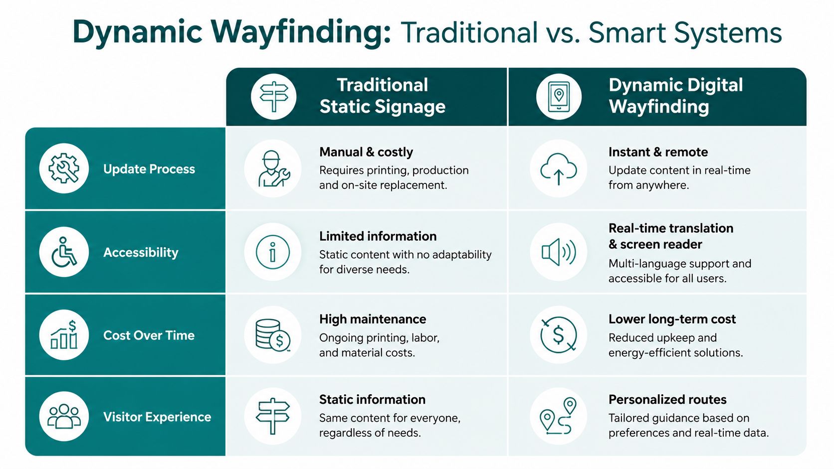
Static signage works when the environment barely changes. Retail parks don't behave like that. Tenants refresh, entrances get reinterpreted, and the “obvious” route for one visitor may be unclear for another, especially if they can't rely on distance vision or local familiarity.
The compliance pressure is real as well. Equality Act 2010 duties and BS 8300 design expectations push operators towards accessible journeys, not just accessible buildings. For decision-makers, the hard part is that beacon-based infrastructure and frequent sign replacement can be awkward to approve and maintain, especially when estates teams are asked to do more with less.
What dynamic digital wayfinding changes
Wayfinding that updates digitally changes the maintenance model. Waymap's deployment at Lord's Cricket Ground is relevant here because the Marylebone Cricket Club implemented step-by-step audio and on-screen navigation without relying on GPS, WiFi, Bluetooth, or mobile data. That matters because it shows a large venue can replace static guidance with something that changes when the venue changes.
Waymap's system uses dead reckoning with device-native sensors, and it's designed to deliver sub-3-metre accuracy in infrastructure-free environments. It also removes the need for pre-mapping in venues with high staff turnover or frequent layout changes. For a retail park operator, that is not a technical nice-to-have. It is the difference between keeping pace with a live site and chasing it.
The business case managers actually face
Retail and leisure operators need a system that supports accessibility without turning every layout change into a facilities project. That's where the financial logic intersects with the compliance logic. If a site can update routes and points of interest centrally, the team spends less time reprinting, refixing, and revisiting the same signage problems.
Maintenance cost reduction guidance is useful reading for estates teams because it frames the issue the right way, as an operating model, not a one-off installation. The strongest case for infrastructure-free navigation is simple, it helps visitors find the right door and helps managers avoid locking the site into hardware they have to keep chasing.
Practical rule: if the venue layout changes often, the navigation layer should be as easy to update as the tenant list.
Frequently Asked Questions About the Peel Centre Gloucester
Is the Peel Centre the same as Gloucester Quays?
No, the Peel Centre is not the same as Gloucester Quays, but it sits adjacent to it on St Ann Way and forms part of the same retail cluster (Visit Gloucester's Peel Centre listing). Visitors often use the names together because the sites are close and function as a shared destination.
What shops are at the Peel Centre in Gloucester?
The Peel Centre includes several major outlets, including Bensons for Beds, Burger King, Dreams, Iceland – The Food Warehouse, and Hobbycraft (Visit Gloucester). A NEXT store at Unit 6D also shows how the site is organised around individual units, not one single front door.
How do I get to the Peel Centre from public transport?
The main public transport approach is via Gloucester's transport network and then a walk into the St Ann Way and Gloucester Quays area. The practical challenge is not just reaching Gloucester, it's identifying the correct retail frontage once you're in the Quays corridor, which is why named landmarks matter more than a vague final direction.
Has the Peel Centre been part of formal planning activity?
Yes, a Gloucester City Council planning document for a Peel Centre cinema proposal shows the site has been part of formal redevelopment and strategic land-use planning, including a refused permission outcome in the city plan examination material (Gloucester City Council planning document). That makes it more than a simple directory listing, it's a site that has featured in planning decisions.
How can visitors with accessibility needs get better navigation help?
Visitors need route-level guidance, not just a postcode, and they often need the exact path from parking or drop-off to a specific unit. For organisations auditing their own accessibility content, governance and testing for WCAG is a useful benchmark for checking whether the information is usable.
Where can I find more practical navigation help for venues like this?
The Waymap FAQ is a good place to start if you want plain-language answers about precise navigation in complex environments. For the Peel Centre specifically, the key is to think in terms of exact arrival point, exact entrance, and exact storefront, because that's what turns a retail park from “found it” into “practically usable.”
If you're responsible for a retail park, visitor destination, or mixed-unit site like the Peel Centre, speak to Waymap about infrastructure-free navigation that helps people reach the right door without depending on brittle signage or hardware-heavy installs.
