
GPS Free Navigation: How It Works and Why Venues Need It
You've followed the blue line across the concourse, reached the station entrance, and started the final leg of the journey. Then the route disappears underground. The map stops updating, the building has several entrances, and “turn left after the stairs” isn't enough information for someone who can't rely on visual signage. GPS free navigation addresses that gap by guiding people indoors, underground, and through signal-denied spaces using the smartphone's own sensors and a detailed map.
For venue operators, this isn't a convenience feature. It's an accessibility, continuity, and operational resilience issue. A system that works only until a passenger enters a station or a visitor crosses a stadium threshold leaves the most complex part of the journey unsupported.
Why GPS Alone Cannot Guide You Everywhere
A passenger can follow an outdoor route to a station, shopping centre, hospital, or stadium, then lose reliable positioning at the entrance. Concrete, steel, glass, underground levels, and enclosed concourses interfere with satellite signals just as the journey becomes more demanding. The required destination may be a platform, lift, step-free entrance, or reception desk rather than the building's general address.
Satellite positioning is not designed for dependable indoor use. Underground platforms, tunnels, enclosed interchanges, and dense urban streets can block or distort the signal. The result is a broken handoff between outdoor routing and indoor wayfinding. Venue operators then have to support two parts of one journey with systems that may not share the same level of detail. Waymap's explanation of why GPS doesn't work reliably indoors describes a physical constraint that planning teams must account for, not an app fault that an update will necessarily fix.
Indoor guidance already covers a broad set of public environments. A UK parliamentary evidence submission cited Deloitte's estimate that 25% of journeys made with the assistance of a navigation application would involve indoor journeys by the relevant timeframe (UK Parliament written evidence). Stations, shopping centres, transport interchanges, hospitals, and civic buildings all contain routes that cannot be represented adequately by a street address.
The final metres create the greatest friction
Outdoor routing can reach a building without identifying the correct door, ticket hall, platform, accessible entrance, or service point. Inclusive Mobility guidance treats entrances, exits, pedestrian routes, platforms, widths, surfaces, and obstructions as practical design considerations. Those details determine whether a route works for the person using it.
For blind and low-vision travellers, “head towards the station” provides little help when several doors or corridors follow. People with mobility needs face another failure point. A short route may include stairs, a blocked lift, a narrow passage, or a platform connection without step-free access. Geographic accuracy does not guarantee a usable route.
The National Centre for Accessible Transport reported that 23% of respondents said effective wayfinding was important, while also identifying significant gaps in accessibility information (UK Parliament evidence submission). The operational implication is clear: accessible wayfinding requires route feasibility and environmental detail, not only a position marker. For operators working under the Equality Act 2010, those details also support the practical delivery of accessible services.
GPS free navigation connects an outdoor coordinate with a usable indoor journey. It extends guidance through signal-denied areas, complements satellite positioning, and gives venue teams a way to plan for continuity when GPS cannot provide dependable location data.
How GPS Free Navigation Works Without Satellites or Beacons
At a crowded station or stadium, GPS can disappear beneath concrete, beside metal structures, or underground. The phone can still estimate movement, follow a mapped route, and provide instructions when the system combines internal sensors with environmental data. That continuity supports operational resilience and helps operators deliver accessible journeys under the Equality Act 2010 and Inclusive Mobility guidance.
GPS free navigation uses pedestrian dead reckoning to estimate movement from a known starting position. The phone detects steps, changes in direction, and pauses, then updates the traveller's position against a mapped environment. The approach does not depend on satellites or installed beacons along the route.
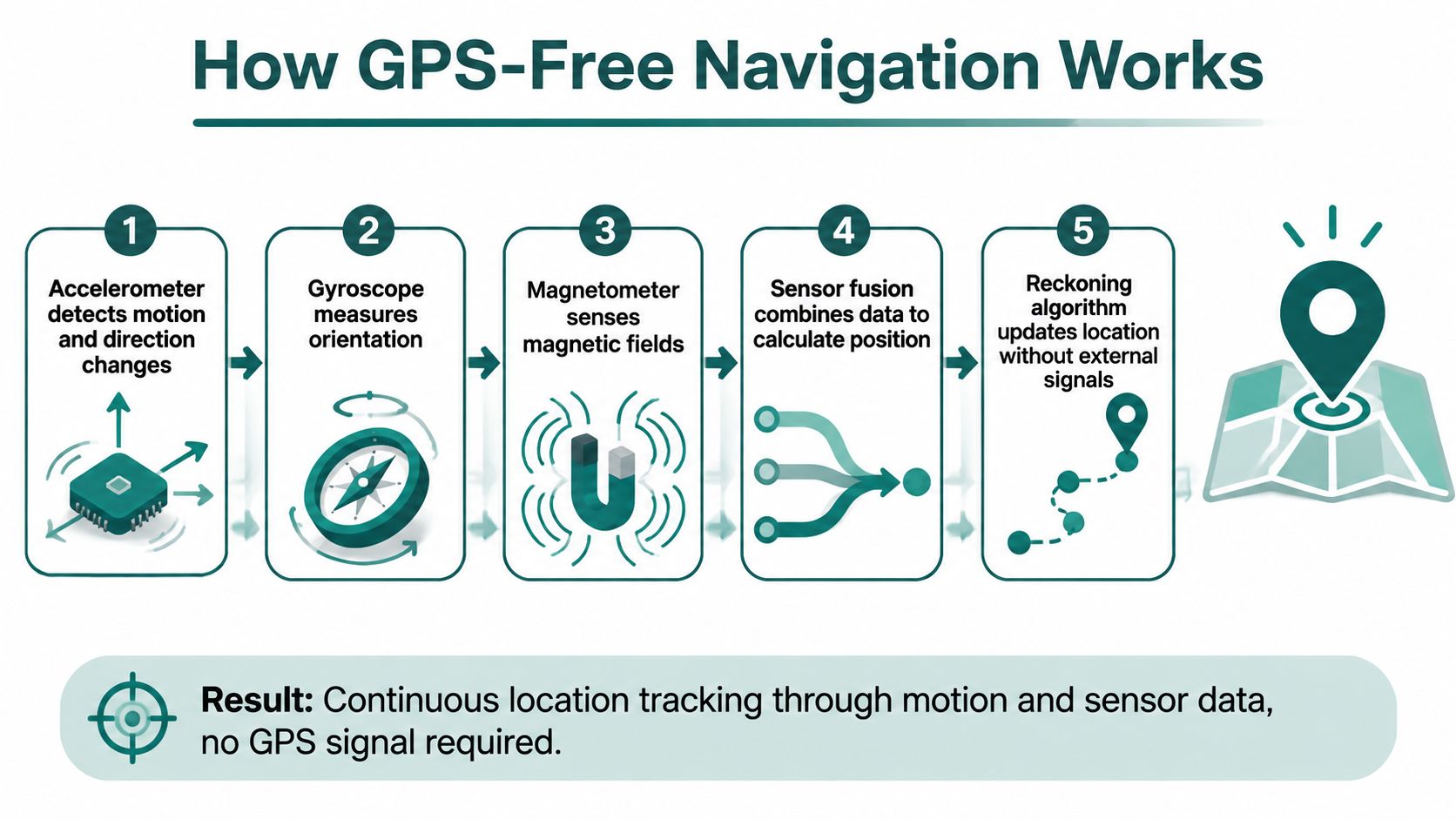
The sensor process in practical terms
- The accelerometer detects movement: It identifies changes in speed and motion, helping the system recognise walking patterns and steps.
- The gyroscope measures orientation: It tracks how the phone rotates, helping identify turns and changes in heading.
- The magnetometer senses magnetic fields: It contributes directional information, although indoor structures and electrical equipment can distort magnetic readings.
- Sensor fusion combines the evidence: Algorithms reconcile the inputs rather than relying on one sensor.
- The reckoning algorithm updates the position: The system propagates the traveller's location along a mapped route without an external radio signal.
Sensor readings alone cannot identify whether someone is beside a ticket machine, approaching the wrong entrance, or standing in a corridor. The map provides that spatial context. It describes corridors, stairs, lifts, doors, platforms, facilities, and route alternatives, allowing the algorithm to match detected movement with a feasible path.
Waymap describes its sensor-fusion approach as using device-native smartphone sensors and maps for guidance without GPS, Wi-Fi, Bluetooth, or mobile data. For venue operators, that means avoiding a network of beacons that would require installation, power or battery checks, and replacement across the route. The trade-off is greater dependence on accurate mapping, route testing, device behaviour, and clear user instructions.
Accuracy depends on the device and the environment
Dead reckoning accumulates error, so deployment testing must include turns, pauses, entrances, stairs, lifts, and complex junctions rather than a single straight corridor. UK research into foot-mounted inertial pedestrian dead reckoning achieved median relative position accuracy of 0.3 to 0.6 metres when sensor positions were known in advance, while 90% of range errors stayed below 2 metres in most experiments without prior environmental knowledge (Lancaster University research).
A UK systematic review of wearable inertial sensing reported a median pedestrian dead reckoning error of around 1%, with one study reaching 0.61% displacement error and approximately a 2x improvement over a conventional method (University of Oxford systematic review). Those findings do not guarantee the same outcome for every phone, traveller, or venue. They show why sensor models, route tests, map maintenance, and movement patterns must be assessed together.
Walking style, stride, phone position, turns, pauses, and missed destinations all affect the estimate. Operators should test the complete accessible journey, including whether instructions remain usable at decision points and whether staff can update routes when construction, crowd control, or a closed lift changes the environment.
Practical rule: Treat the map, route model, sensor processing, and user instructions as one system. Improving only one component will not fix an inaccessible journey.
Comparing GPS Free Navigation to Other Indoor Positioning Systems
No indoor positioning technology is suitable for every venue. The right choice depends on the environment, required precision, available capital, connectivity, accessibility objectives, and the operator's ability to maintain the system after launch.
A UK public-sector review of wayfinding apps found clear differences in infrastructure and connectivity requirements. Briteyellow uses augmented reality and requires internet access and venue sign-up. Evelity uses Bluetooth, doesn't require internet, but does require venue sign-up. Seeing AI uses LiDAR and requires internet (UK wayfinding apps guide).
| Technology | Infrastructure Required | Maintenance Burden | Signal-Poor Performance | Accessibility Support | Deployment Speed |
|---|---|---|---|---|---|
| GPS | Satellites and an outdoor signal | Low venue hardware burden | Poor indoors and underground | Limited for exact indoor routes | Fast outdoors |
| Bluetooth beacons | Installed beacons and venue mapping | Hardware checks, battery or power management, map updates | Can work indoors, but depends on beacon coverage | Can support audio routes when carefully designed | Slower where hardware installation is extensive |
| Wi-Fi positioning | Wi-Fi network and location fingerprints | Network and fingerprint maintenance | Variable where networks change or coverage drops | Depends on the application and route data | Moderate, dependent on network readiness |
| Ultra-wideband | Compatible anchors and devices | Specialist hardware and calibration | Potentially strong in equipped areas | Requires accessible guidance design beyond positioning | Slower for large estates |
| AR navigation | Camera, visual features, internet or local processing depending on product | Map, content, and environmental maintenance | Vulnerable to lighting, clutter, and camera usability | May be unsuitable for people who can't use visual interfaces | Moderate, dependent on venue mapping |
| Smartphone sensor fusion | Smartphone motion sensors and a detailed map | Digital map and route maintenance | Designed for signal-denied movement, subject to drift and testing | Can provide audio, tactile, and step-aware guidance | Fast when mapping data is ready |
What venue teams should compare
Bluetooth beacons can work well in a stable, controlled space, but every physical device becomes part of the estate. Transport operators may face difficult access, battery replacement, vandalism, construction work, and changes to passenger flows. Wi-Fi positioning can inherit network outages and access-point changes.
AR can provide useful visual overlays, particularly for sighted visitors, but it shouldn't be treated as a complete accessibility solution. A camera-based interface may be difficult for blind users, people with low vision, or visitors who need hands-free guidance in crowded spaces.
Infrastructure-free sensor fusion removes the hardware estate, but it doesn't remove operational responsibility. The operator still needs accurate maps, current route closures, accessible alternatives, and clear instructions. Waymap's mapping and navigation approach is relevant to that distinction. The system's value depends on maintaining the digital route layer as the venue changes.
Where GPS Free Navigation Delivers Real Results
The most useful deployment examples are environments where outdoor positioning stops at the point of greatest complexity. Transit hubs, stadiums, shopping centres, campuses, and hospitals all contain internal routes that change more frequently than public street maps can represent.

Transit operators
WMATA and SBS Transit are named Waymap deployments in public transport environments where passengers need guidance through stations and interchange areas, including spaces in which GPS isn't dependable. The operational challenge isn't just locating a station. It's guiding a passenger from the correct entrance to a platform, interchange corridor, lift, exit, or service point while avoiding the assumption that a signal will be available.
The same logic applies to London Underground and other metro systems. Beacon-based coverage across a large network creates a physical maintenance obligation, while a digital sensor-based approach can be updated when corridors, access points, or passenger flows change. That makes the route model central to service continuity.
Stadiums and event venues
Lord's Cricket Ground became the world's first stadium to implement Waymap technology, creating a case for indoor and outdoor guidance through a complex event environment. Stadiums combine gates, turnstiles, hospitality areas, toilets, concessions, seating blocks, accessible routes, and temporary crowd-control measures. A visitor may need exact instructions to a particular entrance or facility, not a general venue pin.
The accessibility benefit has to include matchday conditions. Crowds alter movement patterns, staff place temporary barriers, and routes can change quickly. A navigation platform that lets venue teams update points of interest and route information digitally is better suited to those conditions than signage or hardware that requires physical intervention.
Retail, campuses, and healthcare estates
Westfield London represents the type of retail environment where navigation can influence both inclusion and visitor experience. Large shopping centres contain multiple levels, entrances, lifts, toilets, customer services, and frequently changing units. A route that ends at a centre entrance doesn't answer the customer's actual question, which may be how to reach a particular shop or accessible facility.
Universities and hospital estates face similar complexity. An NHS estates manager may struggle to secure capital approval for beacon infrastructure, particularly when budgets prioritise clinical or core estate needs. Facilities teams also have to account for building works, temporary closures, ward moves, and staff turnover. A digital route layer can reduce the need to install hardware, but it still requires disciplined ownership of maps and accessibility data.
Operational test: Ask whether the venue can update a closed corridor, moved entrance, inaccessible lift, or changed point of interest before the next visitor needs the route. If it can't, the system isn't ready for live operations.
The Accessibility and Resilience Case for Infrastructure-Free Wayfinding
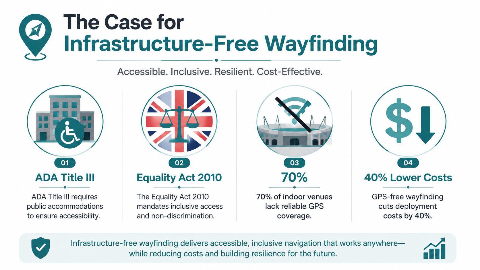
Accessible wayfinding is part of a venue's broader duty to provide usable access. The Equality Act 2010, ADA Title III, BS 8300, BS EN 17210, PAS 78, and the UN Convention on the Rights of Persons with Disabilities create important reference points for inclusive environments, although the specific legal duties depend on jurisdiction, organisation, and context.
GPS free navigation doesn't replace compliant physical design. It adds a digital layer that can explain routes, identify entrances, provide audio guidance, and support changes that static signs can't communicate quickly. UK Inclusive Mobility guidance gives buildable details for physical wayfinding, including a 300 to 400 mm lower tapping rail or skirting on low-level signs supported by two vertical poles, helping prevent blind pedestrians from walking between the posts and colliding with the sign (Inclusive Mobility guidance).
Accessibility requires route feasibility
A map can be accurate and still fail a traveller. Inclusive route planning needs to account for step-free continuity, lift availability, corridor widths, crowding, surface conditions, temporary closures, and the distinction between an entrance and the correct entrance. Department for Transport guidance identifies a minimum width of 1100 mm for vision-impaired cane users and 3000 mm on sub-surface station platforms in relevant pedestrian and transport contexts (updated Inclusive Mobility material).
Research into indoor navigation for blind people found that indoor landmarks were significantly useful to visually impaired users, supporting route instructions that refer to meaningful environmental features rather than broad directional language (indoor navigation research). Tactile guidance can combine natural cues, tactile paving or floor markings, and information readable by touch. Audio guidance can add real-time directions through a mobile phone or navigation system.
Resilience extends beyond accessibility
The UK's dependence on satellite-derived positioning and timing has a national economic dimension. A UK government review estimated that a five-day GNSS disruption would cost the UK £5.2 billion, linking navigation and timing dependency to transport, communications, finance, and public services (Blackett Review).
That estimate doesn't mean an indoor navigation app solves national PNT resilience. It does show why operators shouldn't assume GPS will always be available. Stations, tunnels, airports, venues, and campuses need continuity plans for weak, degraded, spoofed, or unavailable signals. Infrastructure-free navigation gives operators an option that doesn't depend on installing a separate radio network across every route.
Waymap's work on smartphone navigation for visually impaired users illustrates how accessibility and resilience can share the same technical foundation. A route that works without GPS can support a blind passenger, a visitor during a signal outage, or an operator managing a rapidly changing venue.
Planning Your GPS Free Navigation Deployment
Start with the journey, not the technology. Identify the routes that currently generate assistance requests, fail underground, exclude step-free travel, or leave visitors uncertain between the building entrance and their final destination.
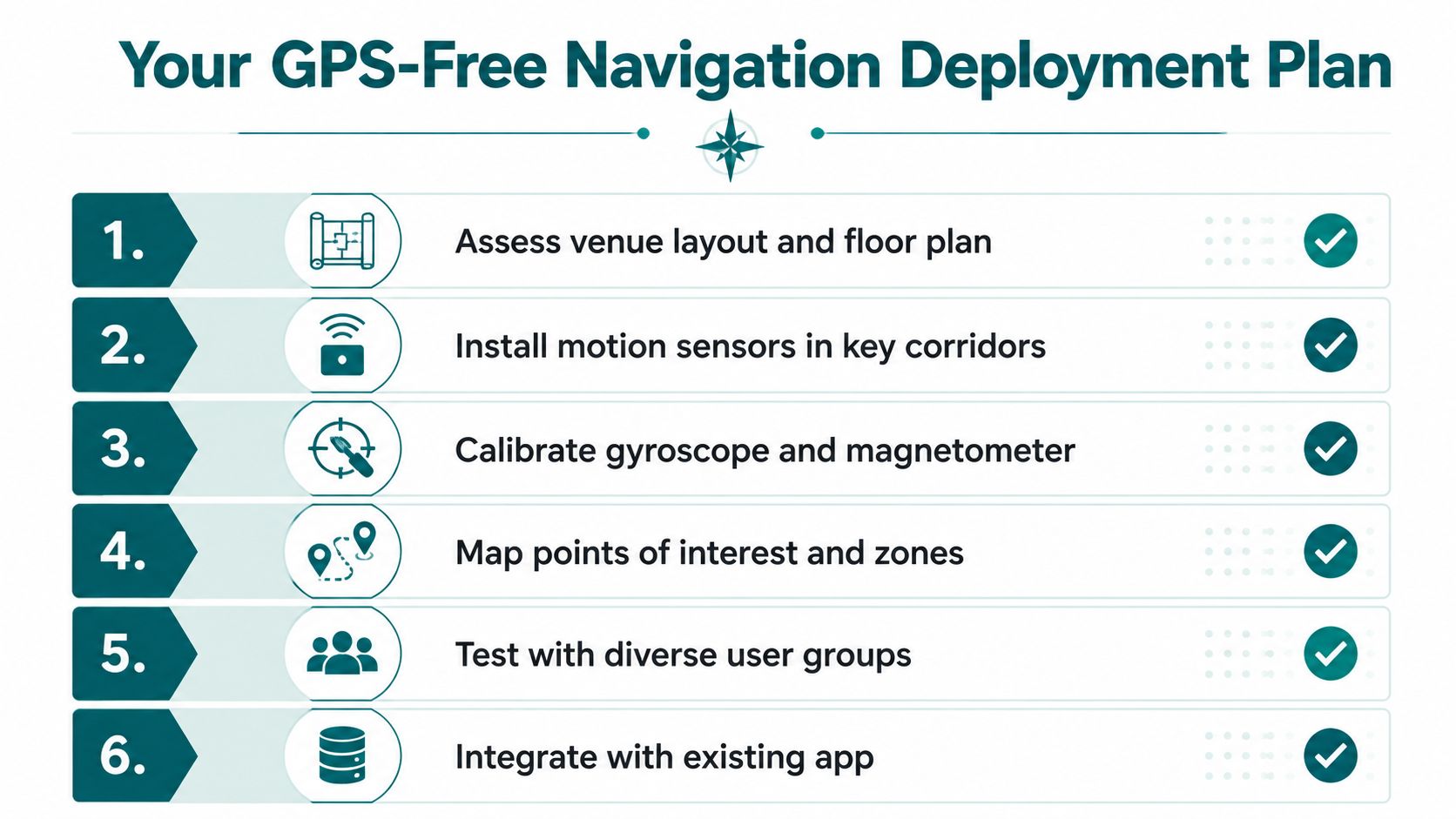
A practical deployment plan should include:
- Audit the physical environment. Collect current floor plans, entrances, exits, platforms, lifts, stairs, corridors, toilets, service points, and temporary restrictions.
- Define route rules. Record step-free alternatives, restricted areas, staff-only zones, crowd-control routes, and conditions that make a path unsuitable.
- Assign operational ownership. Estates, accessibility, customer service, security, transport operations, and digital teams all hold different pieces of the route truth.
- Test real journeys. Include blind and low-vision users, people with mobility needs, staff unfamiliar with the venue, and visitors carrying bags or using different walking speeds.
- Create an update process. A closed corridor or failed lift must trigger a route change, not a notice on a webpage.
- Measure usable outcomes. Track help requests, missed destinations, failed handoffs, route completion, accessibility feedback, and the time required to publish a change.
Build the business case around the friction
For NHS estates managers, the constraint may be capital approval and the difficulty of justifying beacon hardware across a changing estate. For transport operators, it may be the maintenance burden of devices in high-footfall locations. For retail operators, the case can include visitor confidence, dwell time, customer service demand, and the ability to direct people to facilities and retailers.
The implementation best-practice guidance should sit alongside the venue's accessibility policy and incident procedures. The implementation team needs a clear answer to one question: who updates the route when reality changes?
A sensor-based system doesn't remove mapping work, user testing, or governance. It removes the requirement to deploy physical positioning hardware throughout the venue, which can make the first operational trial easier to approve and quicker to adapt.
Frequently Asked Questions About GPS Free Navigation
Does GPS Free Navigation work underground?
Yes, GPS Free Navigation can work underground by combining smartphone motion sensors with a digital map instead of satellite signals. Reliable operation still depends on tested routes and current information about platforms, corridors, lifts, entrances, and closures.
How accurate is sensor-based positioning?
Sensor-based positioning can support metre-scale indoor guidance, depending on the device, how it is carried, movement, map quality, and the surrounding environment. Accuracy varies in real venues, so operators should validate routes on site rather than rely only on laboratory results.
Does GPS Free Navigation require venue hardware?
No. Some systems work without Bluetooth beacons, Wi-Fi positioning, or installed venue hardware. The venue must still maintain its digital map, route data, and closure updates.
Can it support blind and low-vision travellers?
Yes, it can support blind and low-vision travellers through audio instructions and landmark-based guidance. Deployment also requires accessible physical routes, clear handoffs, and testing with disabled users.
Which obligations does it support?
It can support an operator's wider accessibility approach under frameworks such as the Equality Act 2010, ADA Title III, BS 8300, and BS EN 17210. Technology does not replace legal advice, inclusive construction, signage, tactile information, or staff assistance.
Waymap provides indoor, outdoor, and underground navigation using smartphone motion sensors and detailed maps, without GPS, Wi-Fi, Bluetooth beacons, or installed venue hardware. Visit Waymap to discuss route, accessibility, and operational requirements.
