
Floor Map App Guide: How Indoor Navigation Works
Disabled adults in England made 712 trips per person in 2024, compared with 999 among non-disabled adults, according to the Department for Transport's National Travel Survey figures published in 2025. A floor map app can address part of the information barrier behind difficult journeys, but only if it answers more than where a room sits on a plan. Visitors need to know whether they can complete their route right now.
For venue teams, that means connecting approved floor plans to operational information about closed corridors, unavailable lifts and relocated services. A beautifully drawn map that directs someone towards a failed lift isn't useful navigation.
What a Floor Map App Shows Visitors
A floor map app is a digital plan of each level of a building that turns a visitor's location and destination into step-by-step directions to a specific door, lift, platform or service point. Unlike a static sign, it can change its instructions when the usable route changes. Physical signs remain important, but they can't calculate a personalised diversion around a closed lift.
By Tom Pey, Founder of Waymap and a blind accessibility technologist.
The earlier travel figures show a similar gap: disabled adults in England made an average of 740 trips per person in 2023, compared with 989 for non-disabled adults, according to the Department for Transport's disability and accessibility statistics. These figures describe travel overall, not the effect of indoor navigation. They make the case for removing avoidable information barriers, without suggesting that an app alone can close the gap.
Visitor-facing features of a floor map app
| Feature | What the visitor gets | What the venue controls |
|---|---|---|
| Multi-level navigation | Directions across every floor of the venue | Floor plans for each level loaded into the map |
| Journey planner and route preview | Chosen route shown before walking starts | Points of interest the route can target |
| Visual map with on-screen routing | Current route drawn on the floor plan | Layout of the map built from approved plans |
| Live point-of-interest status | Current status of shops, services and facilities | Hide, rename or add points of interest in the CMS |
| Routes that avoid works or faults | Detours around escalators, lifts or areas under works | Works and fault status entered in the CMS so routes update |
Our platform includes multi-level navigation, a journey planner, route preview and a visual map with on-screen routing. The operational distinction is between a destination existing and a destination being reachable.
Quick check: Open your venue's existing map. Can a visitor identify every level, every lift and every accessible toilet, then trace a usable route between them?
How a Floor Map App Locates You Indoors
GPS signals are weak inside buildings, so many indoor positioning systems use Bluetooth beacons, Wi-Fi access points or other fixed hardware. That approach introduces equipment that someone must install, document and maintain. For an operator with changing layouts, hardware maintenance becomes another dependency.
Our sensor-fusion algorithm works without GPS, Wi-Fi, Bluetooth beacons or fixed positioning infrastructure. It combines motion and mapping on the phone, rather than relying on a signal transmitted by equipment in the building.
The distinction between these positioning approaches matters when assessing deployment requirements.
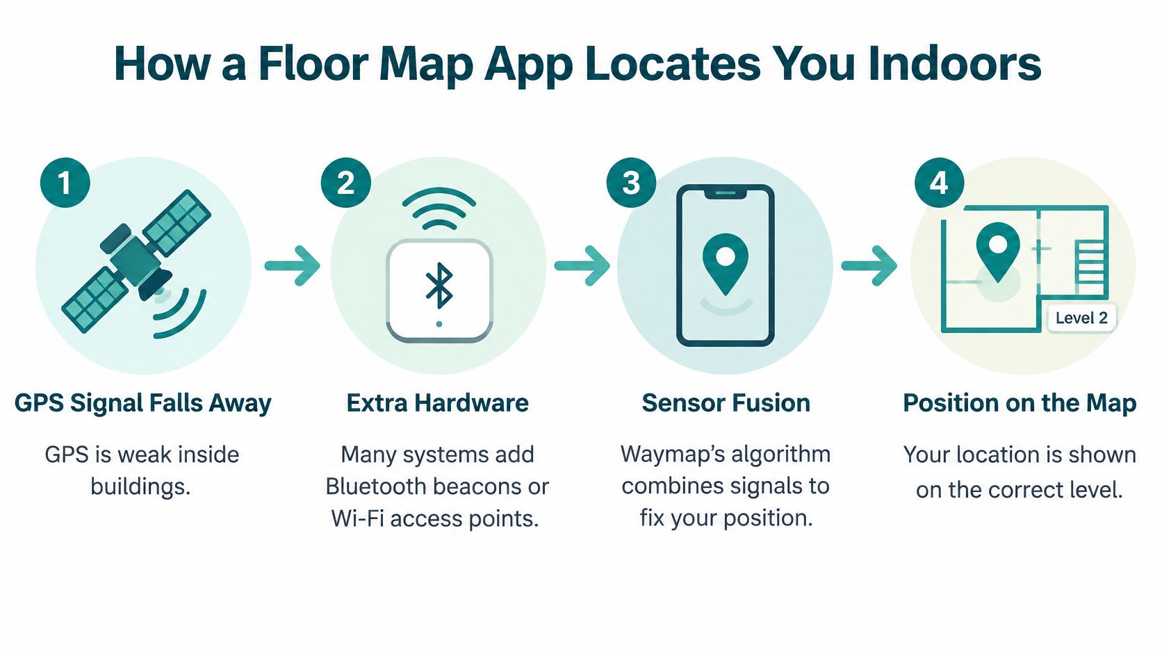
How movement becomes a position
- Build the walkable model. We combine the venue's plans with movement patterns to create a navigation model. Corridors, doors and connections between floors must describe where a visitor can travel.
- Estimate movement. The phone's built-in motion sensors support an estimate of how far and in which direction the visitor has moved. This is dead reckoning: estimating movement relative to an established position.
- Match movement to the map. The walkable model constrains the position estimate. Think of a pencil dot moving along the lines of a floor plan, rather than drifting through walls.
- Recalculate the directions. When the visitor moves away from the planned route, navigation must respond to the updated position rather than continue issuing instructions for a turn already missed.
The phone's location estimate and the building model have different jobs. Accurate positioning won't repair a missing doorway in the model, while a detailed drawing won't compensate for unreliable positioning.
What an accuracy comparison proves
At Birmingham New Street, we directly compared our navigation with Apple Maps along a measured indoor route and achieved higher location accuracy. Our indoor accuracy comparison gives context for that test; it shouldn't be treated as a guarantee for every building.
A comparison along one measured route doesn't establish performance at every entrance, interchange or floor transition. Before launch, test your own entrance-to-destination journeys and record position errors at identifiable landmarks.
Acceptance rule: Judge indoor positioning against a measured route in your building, not an animated demonstration or an accuracy adjective.
How to Set Up a Floor Map App for Your Venue
Before the first call, gather CAD drawings or floor plans for every level, a destination list and a named owner for the content management system (CMS). Include lifts, accessible toilets, assistance points and exits. Choose a likely access channel and prepare entrance-to-lift and entrance-to-exit test routes.
Use this readiness sequence to organise the work.
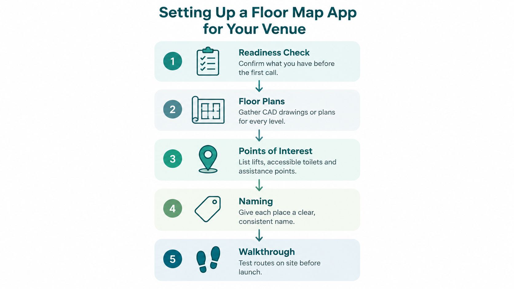
- Book the onboarding call. Establish the venue scope and decision-makers before handing over drawings. Don't leave operational ownership until launch.
- Share plans for every level. Include stairs, entrances, lifts, accessible toilets and platform access points. A common drawing error is showing a lift without clearly identifying every level it serves.
- Build the navigation model. Our team combines plans and movement patterns; you don't need to install beacons, wiring or positioning Wi-Fi. Infrastructure-free positioning still requires accurate mapping.
- Check destinations in the CMS. Verify locations and names, then hide or rename stores and services as needed. Avoid internal abbreviations visitors won't recognise.
- Approve publication. Approved updates publish to the mobile app. Assign responsibility for checking what visitors see.
- Walk the routes. Test from each main entrance to lifts, platforms and exits, logging wrong turns before launch. Don't test only from a convenient central concourse.
- Confirm visitor access. Choose the app, branded integration or browser route that fits how people arrive.
Our implementation guidance supports this preparation. The handover should leave staff able to maintain destinations, not dependent on a site visit whenever a service changes its name.
Which Delivery Option Fits Your Venue
| Option | Install needed | Branding | Best for |
|---|---|---|---|
| Waymap App | Free download for iOS or Android, no sign-up | Waymap | Visitors who want navigation on their own phone |
| Branded app (SDK) | Built into the venue's own iOS and Android app | Venue's own brand, white-label | Venues that already run an app |
| Web app | No download, opened by QR code in a browser | Platform branding | Occasional visitors and one-off events |
Core and Pro are available across all these delivery routes. Choose the access channel around visitor behaviour, rather than treating it as a product-tier decision. The practical question is how much effort someone will accept before receiving directions.
Choose the channel visitors will actually open
For a venue without an established app, start with QR-code browser access alongside our standalone app. An occasional visitor can open navigation without a download, while someone who wants the app can use it on their own phone without creating an account.
Place QR codes where people decide which way to walk: beside lift information, accessible-route signs and entrance directories. Don't put the only code beyond the confusing junction it's meant to help visitors negotiate. Keep physical directions available for people who can't or don't want to use a phone.
For a venue with an app people already use regularly, the SDK can embed our navigation engine into its own iOS and Android application. The white-label application approach keeps navigation within the venue's existing branded experience.
That option also creates an integration responsibility. Your app team needs to own releases, accessibility testing and the route into navigation from tickets, appointments or venue information.
Don't confuse distribution with maintenance
A browser link removes the download step, but it doesn't remove the need to maintain destination names and closure information. An SDK preserves branding, but branding won't rescue a poorly placed navigation button.
Before choosing, ask: where do visitors first decide which way to walk? Put access there, then test whether someone unfamiliar with the building can find and start a route without staff explanation.
Where Floor Map Navigation Is Already Live
Lord's Cricket Ground in London illustrates why venue navigation needs to connect arrival with the journey inside. We provide full journey routing from anywhere within the M25 to the ground, followed by step-by-step indoor navigation. The useful deployment lesson is to treat the entrance as a connection, not the final destination.
Stadium navigation involves finding the correct onward route after arrival.
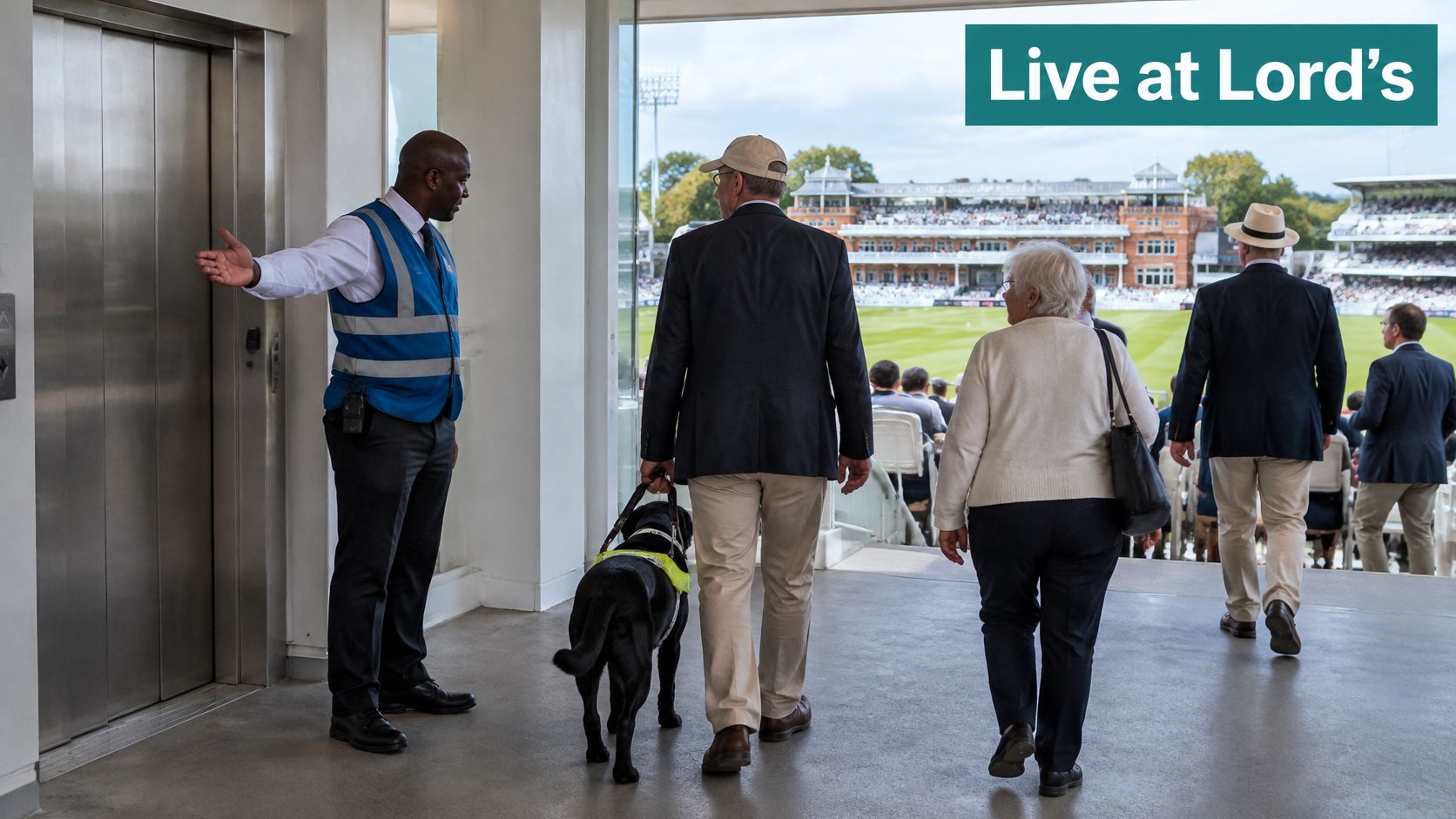
For another stadium, the setup priority is to validate the transition from the surrounding transport network into the ground. A route preview that ends outside doesn't resolve the visitor's next decision. Test the onward connections to the destinations included in the deployment.
What retail and hospital teams can copy
Liverpool ONE deployed our navigation as a mass-market solution for all its customers. That matters because a shopping destination shouldn't treat accessible navigation as a separate directory with different destination names. The transferable lesson is to establish one clear naming system for shops, facilities and entrances.
For a retail team, tenant changes create an immediate maintenance task. Make the person responsible for approving a store rename responsible for its navigation entry too.
A floor map is only as useful as its last update.
The Royal Hospital for Children and Young People required a detailed model of its interior. Before the app went live, our team used a LiDAR scanner to create a three-dimensional digital twin, which became the basis for the navigation model.
The lesson isn't that every venue needs the same survey method. It's that the model must capture the usable building, including connections that visitors must negotiate, rather than merely reproduce an attractive plan.
The venue video provides another view of navigation in use.
Our mapped venues directory provides deployment context. Use named examples to identify comparable constraints, not to assume another building will produce identical results.
Why the Equality Act 2010 Makes Floor Maps a Priority
Under the Equality Act 2010, service providers must make reasonable changes where disabled customers or potential customers would otherwise face a substantial disadvantage, as explained in the UK Government's guide for service providers. That guidance describes changes to service delivery, changes to the built environment, and auxiliary aids or services, including accessible information. It also states that disabled customers must not be charged for reasonable adjustments and that the disadvantage must be more than minor or trivial.
An accessible indoor map can support the auxiliary-aid category by helping someone understand and move through the environment. It isn't an automatic declaration of compliance, and it doesn't replace a usable physical route.
Information and physical access need separate checks
BS 8300, the British design code for an accessible and inclusive built environment, provides a design anchor. Floor map navigation complements that design rather than replacing it. An app can explain how to reach a lift; it can't provide the physical access that the lift supplies.
Keep these responsibilities distinct:
- Estates teams maintain the usable physical routes and report closures.
- Visitor-service teams maintain destination names and assistance information.
- Digital teams test whether visitors can access and understand the navigation.
- Legal and accessibility teams assess the relevant duties and adjustment decisions.
Infrastructure-free doesn't mean responsibility-free
Capital approval cycles can make beacon networks and cabling difficult to fund, particularly when an estates team must also justify ongoing equipment maintenance. Our positioning approach needs no beacons, Wi-Fi, wiring or fixed infrastructure at the venue. It works indoors, outdoors and underground wherever our maps have been deployed.
That removes an installed-positioning-hardware requirement from the project. It doesn't remove procurement, mapping, staff training or ongoing information ownership, and it doesn't dictate how your finance team classifies expenditure.
Tom Pey built the product as a blind accessibility technologist, working with mathematicians and technologists. Our recommendation is to judge navigation through complete visitor journeys, not through the presence of an accessibility feature on a procurement checklist.
This is not legal advice. Check the venue's duties and proposed adjustments with your estates, accessibility and legal teams.
Which Metrics Show a Floor Map App Is Working
A University of Cambridge account of work with UCL and ETH Zurich describes 149 participants completing six wayfinding tasks in virtual multilevel buildings, finding that the interaction between visibility and prior expectations affected wayfinding efficiency and strategy, especially between floors. That finding supports testing decision points, not just total journey duration.
Attach instructions to actionable landmarks, such as a named lift, stair entrance, barrier or platform access point. Confirm the destination level immediately after a floor change, then identify the onward corridor. A visitor needs confirmation that the transition worked.
Post-launch metrics for a floor map app
| Metric | How to measure it | What to compare |
|---|---|---|
| Route-completion rate | Share of started routes that reach the destination | Before and after launch on the same routes |
| Rerouting latency | Time from a closure to a new route on screen | Target set by the venue's operations team |
| Missed-turn frequency | Wrong-branch decisions per journey | Floor by floor and route by route |
| Time to destination | Minutes from start to arrival | Signage-only baseline |
| Step-free journey share | Share of journeys using step-free paths | Across route types |
| Decision time and assistance requests | Time at each decision point and staff help calls | Trend over the first months |
Test operational changes as well as normal journeys
Our platform automatically provides real-time routes that avoid works or faults in escalators, lifts and areas. Test the complete process: report a closure, update its status, check the alternative route and verify that reopening restores the intended options. Rerouting latency includes the reporting and approval delay, not just software calculation time.
During active navigation, our app collects location throughout the journey to provide on-trip support, including alerts about when to leave a bus. Journey information could support evaluation, but that isn't a promise that every table metric is an available dashboard field. Our three-dimensional heat-map discussion offers context for spatial analysis.
Complete a privacy review before reusing journey information. Define the purpose, access permissions, retention and reporting approach, and combine permitted measurements with observed walkthroughs.
Establish a signage-only baseline, then repeat the same routes with comparable user groups after launch. Start with route-completion rate and missed-turn frequency: they reveal whether people arrive and where instructions still fail them.
Floor Map App Frequently Asked Questions
What is a floor map app?
A floor map app turns a building's floor plans, a visitor's position and their destination into step-by-step directions. It should guide people to a specific door, lift, platform or service point.
How does a floor map app work without GPS?
It can estimate movement using the phone's built-in motion sensors and match that estimate to a walkable building model. The map constrains the estimate to usable paths.
Does a floor map app need beacons or Wi-Fi?
Not necessarily. Our positioning technology needs no beacons, Wi-Fi, wiring or fixed positioning infrastructure at the venue.
Does it replace step-free routes or lifts?
No, navigation complements physical access. It can identify an alternative route, but it can't make an inaccessible connection usable.
Is a floor map app a reasonable adjustment?
It can support a reasonable adjustment by providing accessible information. Your legal team should assess its suitability for the venue and the disadvantage being addressed.
Does a floor map app collect location data?
Our app collects location during active navigation to support the trip. Venues should complete a privacy review before using journey information for evaluation.
Which metric shows whether indoor navigation works?
Route-completion rate is the clearest starting measure, supported by missed-turn frequency. Compare both against a signage-only baseline on matched routes.
Waymap offers indoor navigation through our app, your branded app or a browser, supported by venue-controlled destination updates and routing around reported disruptions. Visit Waymap to discuss your floor plans, access channels and a route-testing plan for your venue.
