
The Airside of an Airport: An Operator's Guide
At 06:15, the airport doesn't feel abstract. It feels crowded, timed, and unforgiving. Turnarounds are underway, stands are changing, vehicles are crossing the apron, and every delay starts to ripple through teams that depend on one another seeing the same picture at the same moment.
That's why the airside of an airport matters so much to senior operators. It isn't just the space beyond security. It's the most tightly controlled part of the site, where safety, access control, accessibility, and operational flow all collide. If movement breaks down here, the problem rarely stays local.
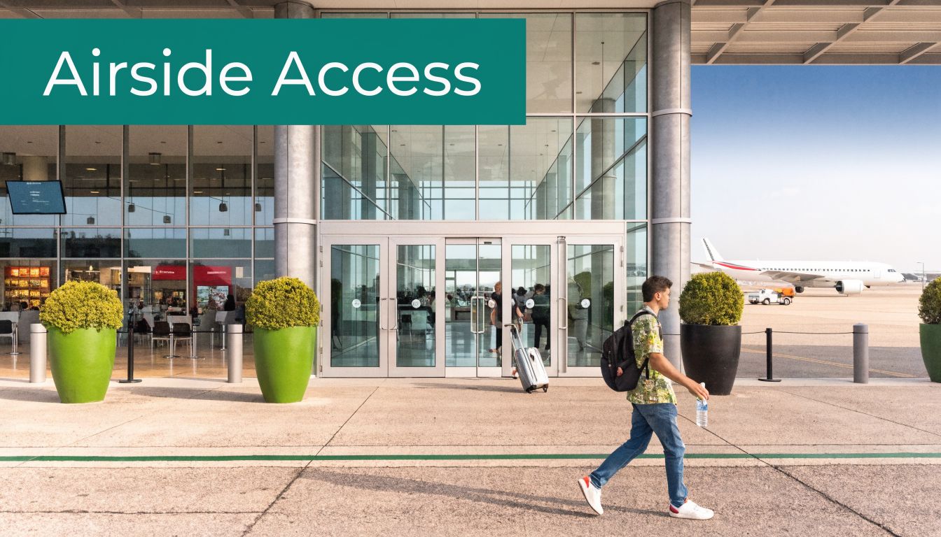
Beyond the Terminal Door What is Airside
The simplest definition is still useful. Airside is the part of the airport between the boarding gates and the airspace, including runways, taxiways, aprons, and air traffic control facilities. But for operators, that definition is only the starting point.
Cross the boundary from landside into airside and the entire operating model changes. Public circulation gives way to controlled movement. Informal wayfinding gives way to authorised routes. A missed turn isn't just an inconvenience. It can interfere with aircraft movements, stand servicing, or security procedures.
Why the boundary matters operationally
Inside the terminal, confusion is usually recoverable. Someone asks for directions, checks a screen, or follows a sign. Airside doesn't work like that. The environment is noisy, weather-exposed, vehicle-heavy, and access-restricted. Routes change with stand allocation, servicing activity, and temporary works. Staff and authorised users need instructions that match current operating reality, not just a static map on a wall.
The scale alone explains why this matters. In 2024, UK airports handled 252.2 million terminal passengers, with airside aircraft movements reaching 2.41 million across major hubs. Heathrow alone recorded 1.315 million movements, according to UK CAA airport data. That's a constant stream of assets, people, and decisions moving through a space where mistakes carry far more weight than they do in the public terminal.
Airside is where an airport stops behaving like a building and starts behaving like a live operational system.
Landside confusion is inconvenient. Airside confusion is expensive
This matters beyond aircraft and airport staff. Contractors, maintenance teams, assistance staff, and some authorised passengers all move through parts of this environment. If they're reliant on escort knowledge, local familiarity, or signage designed for ideal conditions, the system becomes fragile very quickly.
That same boundary is also why adjacent risks matter. Operators responsible for perimeter safety increasingly have to think beyond the fence line, including low-altitude activity nearby. For teams reviewing external risk controls, drone safety tips near airports are a useful operational reference because they show how quickly an airside issue can begin outside the terminal estate itself.
A senior management team doesn't need a textbook definition of airside. It needs to understand that this is the zone where throughput, safety discipline, and movement certainty have to work together all day, every day.
Why Airside Access is a Matter of National Security
Airside controls can look excessive to anyone who sees only the terminal side of the operation. They aren't. They exist because access to aircraft movement areas creates direct safety and security exposure.
A person in the wrong place airside can do more than slow a process down. They can enter a vehicle route, breach a controlled stand, interfere with servicing activity, or create a runway or taxiway incursion risk. The result is not just delay. It can become a security event or a surface safety event.
Regulation shapes the environment
In the UK, the Civil Aviation Authority governs aerodrome operations through requirements including CAP 168. That matters because the rules don't sit on a shelf. They dictate what the physical environment must be able to support.
A clear example is the Aerodrome Reference Code. Under CAA CAP 168, a Code E airport like Heathrow, serving aircraft with wingspans up to 79.8m, must have 45m wide runways and specific taxiway clearances to mitigate collision risks. Where those requirements aren't met, runway incursion risks increase by 15-20%.
That tells senior teams something important. Airside restrictions aren't administrative friction layered on top of operations. They're the operating conditions required to keep aircraft, vehicles, and people separated safely.
Access control is about more than ID checks
An airside pass is only one part of the control model. The rest is procedural discipline.
- Authorisation has to be location-specific. A person cleared for one apron route or service area isn't automatically safe in another.
- Training has to match the physical environment. Knowing a rulebook isn't the same as navigating correctly in low visibility, under time pressure, or around live equipment.
- Infrastructure has to support compliance. Markings, route design, and surface layout need to make the safe path obvious.
Practical rule: If safe movement depends on local memory alone, the control system is weaker than it looks.
Security and safety are joined at the hip
Senior management teams often separate security, accessibility, and operations into different workstreams. Airside punishes that kind of siloed thinking. A route that's difficult to understand is harder to secure. A zone that's hard to access correctly creates workarounds. A process that relies on escorting everyone everywhere absorbs labour that should be focused elsewhere.
This is why the airside of an airport needs joined-up design. The strongest environments are the ones where the compliant route is also the easiest route to follow. The weakest are the ones where authorised people still have to guess.
Mapping the Key Airside Operational Zones
If you want to improve airside performance, treat it as a system of zones, not one large secure area. Each zone has its own traffic pattern, risk profile, and operational priority. Problems usually start at the edges between them.
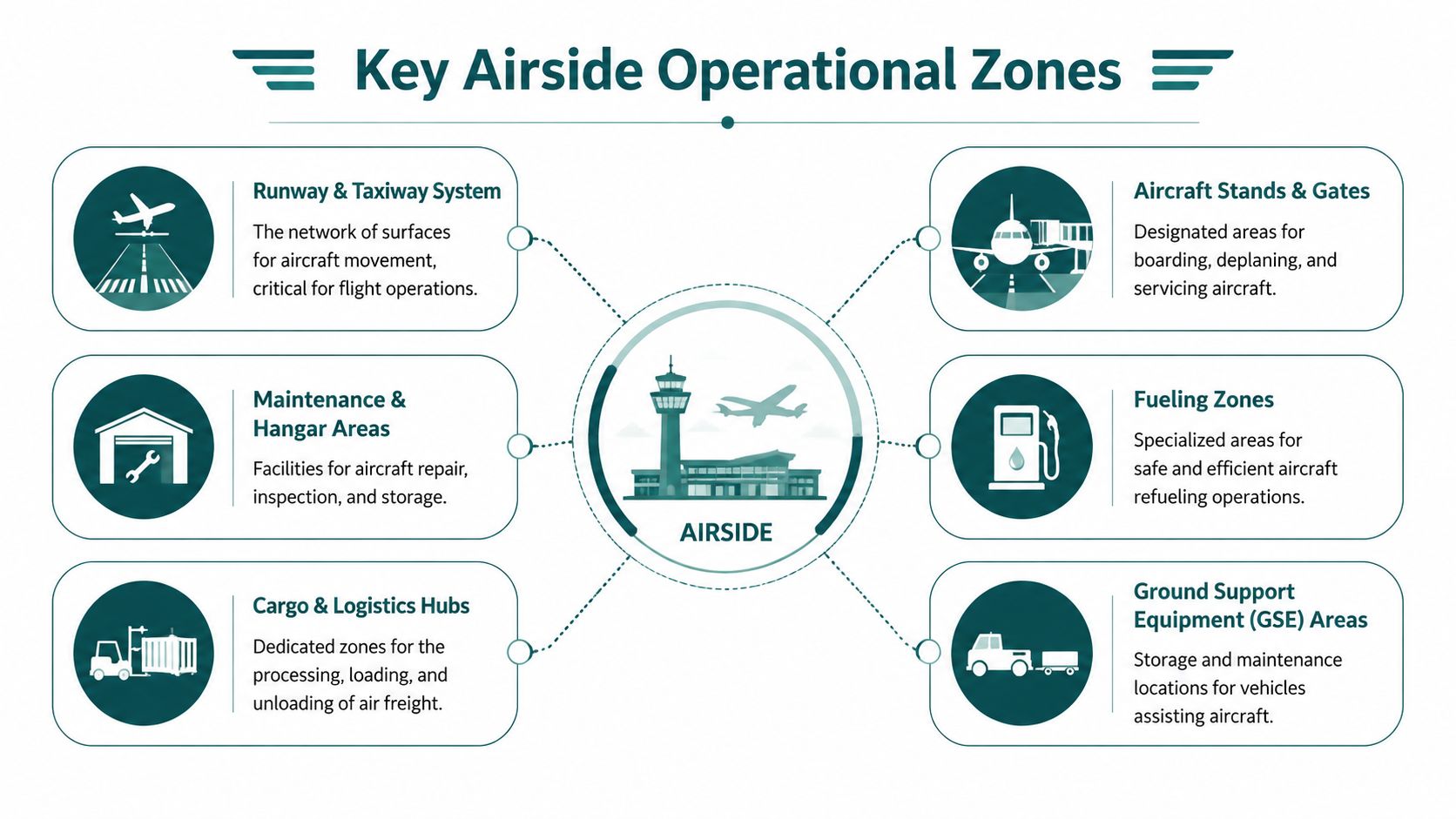
Apron space is where complexity shows up first
The apron is usually the most congested working part of airside. Aircraft are parked, turned around, fuelled, catered, cleaned, loaded, and pushed back here. Ground support equipment, baggage vehicles, steps, tugs, engineering teams, and assistance staff all converge in a relatively tight footprint.
This is also where poor wayfinding becomes operationally visible. A missed stand, a wrong service road, or a team arriving from the wrong side of an aircraft doesn't just waste time. It disrupts choreography that depends on sequencing.
Taxiways carry flow, not dwell time
Taxiways are movement corridors. They exist to connect stands and runways safely and predictably. That means they tolerate less improvisation than many non-aviation leaders assume.
A driver or operative who misunderstands a taxiway-adjacent route creates a very different kind of risk from someone getting lost inside a terminal concourse. On the public side of the airport, confusion slows people down. Near a taxiway, confusion affects separation.
Runways are the obvious high-risk zone, but not the only one
Runways draw most of the attention because they're the clearest example of operational consequence. Yet many avoidable airside issues start before anything reaches the runway. They begin in stand allocation, poor route clarity, handoff failures, or misunderstandings around temporary restrictions.
That's why detailed spatial data matters. Teams that are modernising this layer often start with accurate digital capture of the estate before they try to improve routing logic. For organisations looking at that groundwork, 3D LiDAR scanning for built environments is relevant because it shows how operators can create the map quality needed for dependable movement guidance.
Capacity pressure shows up in the gaps between zones
The operational tempo across these zones is high. UK airports managed 2.85 million Air Traffic Movements in 2024, and Gatwick handled 282,000 movements while operating at 99% capacity, according to UK aviation statistics data tables. For a single-runway airport, that pressure doesn't sit neatly on the runway alone. It spills into stand planning, towing decisions, taxi sequencing, and apron access.
A useful way to frame the zones is this:
| Zone | What matters most | What usually goes wrong |
|---|---|---|
| Apron | Coordination | Teams and vehicles converge without shared spatial certainty |
| Taxiway corridors | Separation | Route mistakes create immediate exposure |
| Runway interfaces | Clearance discipline | Small errors become high-consequence events |
| Support areas | Handoffs | Staff lose time locating exact assets or access points |
The key point for senior teams is simple. Airside efficiency isn't won in one place. It's won in the joins between zones, where people, vehicles, and aircraft all need the same operational picture.
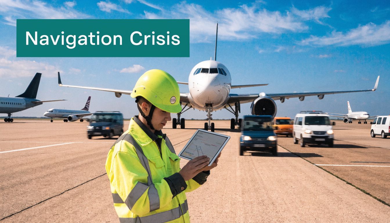
The Hidden Navigation Crisis Airside
Most airport leaders assume wayfinding is already solved because experienced staff know the site. That's true until conditions change, teams rotate, routes move, or someone without strong visual cues has to find their way independently.
That's where the gap becomes obvious. Airside still relies heavily on local knowledge, escorting, visual signs, painted routes, and verbal instruction. Those methods can work in stable conditions. They weaken fast when the environment becomes busy, noisy, unfamiliar, or visually complex.
The problem isn't limited to passengers
Ground handling teams feel it first because they work to the clock. Engineering teams feel it when they need to reach the correct service point without unnecessary detours. Assistance staff feel it because they often bridge the gap between formal process and inconsistent wayfinding. Contractors feel it whenever they enter a part of the estate they don't use every day.
What doesn't work well is the assumption that signage alone is enough. In airside and post-security environments, signs compete with glare, weather, clutter, urgency, and cognitive load. They're static in places where operations are dynamic.
The more a site depends on “someone will show them”, the less resilient its navigation model is.
Accessibility exposes the weakness fastest
The clearest evidence comes from disabled passenger experience. According to the UK CAA passenger survey report, 1.2 million disabled passengers annually report airside navigation challenges, and 68% experience disorientation after security due to a lack of effective audio or tactile guidance.
That's not a marginal issue. It shows that a large, regulated transport environment still expects many people to find their way with tools that don't match the environment. For blind and low-vision travellers, post-security movement often depends on staff availability, one-off escorting, and ad hoc verbal directions. If any part of that chain fails, independence disappears.
The same weakness affects authorised staff in different ways. People may know roughly where they're going but still lose time locating the exact gate door, service corridor, stand access point, or temporary reroute around works.
A useful primer on the wider technology choices in this field is this overview of indoor positioning systems, particularly for teams comparing navigation approaches across complex venues.
Later in the planning cycle, it helps to see the challenge in motion rather than just in policy documents:
What management should take from this
If your airport still treats wayfinding as a signage issue, you're likely underestimating the operational risk. In airside settings, navigation is part of task execution. It affects punctuality, staff utilisation, passenger confidence, and compliance with accessibility obligations.
Static tools work best in static environments. Airside isn't one.
How Sensor-Fusion Replaces Beacons and GPS
Airside is one of the worst places to depend on a single positioning method. GPS can be inconsistent around terminal structures, service roads, canopies, equipment, and transitions between indoor and outdoor areas. Wi-Fi and Bluetooth beacon approaches add hardware, maintenance, and interference questions that many estates teams would rather avoid.
That's why sensor-fusion matters. Instead of waiting for an external signal to tell the device where it is, the navigation layer uses the smartphone's own motion sensors together with a detailed map to work out position and direction as the person moves. In practical terms, that means guidance can continue through the messy edges of an airport environment where other methods tend to lose confidence.

Why hardware-heavy approaches struggle airside
Beacon-first thinking often looks attractive on paper. It appears controllable. Install devices, map the site, and push directions to users. The problem is the airport estate itself.
- Outdoor wear and tear: Airside infrastructure faces weather, vibration, vehicle movement, and constant operational pressure.
- Change management: Routes and access points move. Hardware tied to a previous layout quickly becomes stale.
- Maintenance overhead: Batteries, placement checks, and device failures create an ongoing support burden.
- Estate scale: Covering every edge case across terminal transitions, aprons, corridors, and support areas is hard to justify.
For senior teams considering digital experience beyond pure wayfinding, exploring KLM virtual tour strategies is a useful contrast. Virtual experiences are good at orientation and expectation-setting. They aren't a substitute for live positional certainty in an operational airside environment.
What works better in practice
Sensor-fusion is stronger because it aligns with how airports operate. The map can be updated without replacing field hardware. Guidance can carry across indoor and outdoor transitions. Users don't have to hunt for a visible marker or rely on perfect connectivity.
A straightforward use case is an authorised operative moving from a service entrance to a specific stand access point across mixed terrain and changing routes. What helps isn't a general blue-dot estimate. What helps is precise, heads-up instruction that keeps the person moving without needing to stop and decode the environment.
Operational test: If your navigation method needs fresh infrastructure every time the site changes, it won't age well on an airport estate.
The real shift is from signs to live movement guidance
Traditional wayfinding tells people where they should be in general terms. Modern navigation systems can guide them to the exact place they need to reach, using the actual geometry of the environment rather than broad directional cues.
That distinction matters in airports more than in many other venues. “Near the gate area” isn't enough for an assistance handoff. “Apron side of stand access” isn't enough for a contractor under time pressure. Precision is the requirement.
For teams evaluating that mapping and route layer in more depth, digital mapping and navigation for complex venues gives a useful view of what's involved behind the user interface.
The Business Case for Airside Navigational Certainty
Senior teams rarely fund navigation because they like maps. They fund it when they see the effect on operations, compliance, and resilience.
That's the right lens for airside. Better movement guidance isn't a cosmetic passenger-experience project. It supports punctual operations, reduces dependence on local memory, strengthens accessibility delivery, and gives managers a cleaner operational model in spaces where confusion is costly.
The gains show up across different budgets
Operations teams care about wasted time and missed handoffs. Accessibility leads care about whether disabled passengers can move with dignity and confidence. Security teams care about keeping authorised people on authorised routes. Digital transformation leaders care about replacing brittle, manual processes with a maintainable platform.
Those aren't competing priorities. In airside settings, they're closely linked.
A practical way to view the business case is through four questions:
- Can people reach exact locations without escorts where escorts aren't necessary?
- Can staff follow the compliant route without stopping to interpret the environment?
- Can the airport update route logic without rebuilding physical infrastructure?
- Can the organisation demonstrate that accessibility is operational, not just policy language?
What doesn't justify investment
The weak case is “we should modernise wayfinding because it feels digital”. Senior management teams are right to reject that.
The stronger case is that airside movement is already operational technology. It affects throughput, safety discipline, staff deployment, and the credibility of accessibility commitments. If navigation still depends on static signs and institutional memory, the airport is carrying avoidable fragility.
Airports don't need more directions. They need more certainty about how people move through controlled space.
Why this belongs in strategic planning
Airports spend heavily on physical capacity, surface management, and compliance controls. Navigation should be viewed in that same frame. It sits between the built environment and the people who have to use it correctly under pressure.
For operators, the implication is clear. If the airside of an airport is one of the most controlled and high-consequence parts of the estate, then movement guidance inside it should be treated as core infrastructure, even when it lives in software rather than concrete.
Frequently Asked Questions
What is the airside of an airport?
The airside of an airport is the secure operational area between the boarding gates and the airspace. It includes runways, taxiways, aprons, and related operational facilities used for aircraft movement and servicing.
Why is airside different from landside?
Airside is different because access, movement, and safety controls are far stricter. Landside is public-facing, while airside is a controlled environment where errors can affect security, aircraft operations, and ground safety.
Who is allowed into airside areas?
Only authorised people are allowed into airside areas. That typically includes airport staff, airline staff, contractors, emergency teams, and passengers who have passed the relevant security controls for permitted zones.
Why is airside navigation difficult?
Airside navigation is difficult because the environment is busy, noisy, changeable, and restricted. Static signs and verbal directions often struggle to keep up with temporary works, stand changes, vehicle activity, and mixed indoor-outdoor routes.
Why doesn't standard GPS solve airside wayfinding?
Standard GPS doesn't reliably solve airside wayfinding because airports include signal-challenging transitions around terminal buildings, service areas, and operational structures. Exact positioning also demands more than a rough location estimate.
Are airside wayfinding problems also an accessibility issue?
Yes, they are. The challenge is especially serious for blind and low-vision travellers and for disabled passengers who need clear, consistent guidance after security, where traditional visual systems often fall short.
What should airport managers look for in a navigation solution?
Airport managers should look for precise routing, support for indoor-outdoor transitions, low infrastructure overhead, easy map updates, and accessibility by design. If the system is hard to maintain or only works in ideal conditions, it won't hold up well airside.
If you're reviewing how your airport, station, hospital, or large venue handles complex navigation, Waymap is worth a close look. We help operators deliver precise, accessible guidance indoors, outdoors, and underground without relying on GPS, Wi-Fi, or installed hardware, so movement becomes easier to manage in the places where certainty matters most.