
Discover what UWB is and how it powers indoor positioning

So, what exactly is Ultra-Wideband, or UWB? At its core, UWB is a short-range radio technology that measures distance with high precision. You can think of it as an extremely accurate stopwatch for radio signals, making it well-suited for determining an object's location indoors where GPS can't reach.
Understanding UWB and Its Role in Indoor Positioning
![]()
UWB technology operates by transmitting billions of very short radio pulses across a wide portion of the radio spectrum. This allows it to precisely measure the “time of flight” of a signal—that is, the exact time it takes for a pulse to travel from a transmitter (like a tag on a piece of equipment) to a receiver (a fixed anchor on a wall).
By timing this journey down to the nanosecond, a UWB system can calculate distances with an accuracy often falling between 10 to 30 centimeters.
For a facility manager or logistics planner, this level of accuracy makes UWB an attractive option for specific industrial applications. It’s effective for keeping tabs on high-value machinery in a factory or managing inventory in a large warehouse. This is a classic example of what’s known in the industry as a Real-Time Location System (RTLS).
To get the full picture, it helps to see UWB as one piece of a larger puzzle. It’s a component technology within the broader field of Indoor Positioning System (IPS) solutions, which are all about finding people or things inside buildings.
However, there’s a catch. Bringing that centimeter-level accuracy to the public in large venues like airports, train stations, or shopping centers means dealing with a major hurdle: infrastructure. A UWB system depends entirely on a dense network of physical anchors that have to be professionally installed, carefully calibrated, and then constantly maintained throughout the entire building.
This heavy reliance on hardware introduces some serious challenges for any public-facing navigation system:
- High Upfront Costs: Purchasing and installing hundreds, or even thousands, of these anchors is a significant capital expense.
- Complex Deployment: Getting all that hardware installed is often a disruptive and highly technical process.
- Ongoing Maintenance: Physical devices need regular check-ups, recalibration, and eventual replacement, all of which adds to the long-term cost of ownership.
While UWB's precision is impressive on paper, its dependence on this hardware makes it a costly and difficult-to-scale choice for universal public wayfinding. This is a key reason why at Waymap, we chose a different path, developing an infrastructure-free solution that delivers reliable, step-accurate navigation without these heavy operational burdens.
So, How Does UWB Actually Pinpoint a Location?
![]()
The precision you get with UWB isn't magic; it all comes down to exceptionally accurate timing. The key principle is called Time-of-Flight (ToF). You can think of it like shouting in a large, empty hall and timing how long it takes for the echo to come back.
A UWB system does something similar, but with radio waves instead of sound. A mobile device, which we call a tag (attached to a person, a phone, or a piece of equipment), sends out a stream of incredibly short radio pulses—billions of them every second.
These pulses travel at the speed of light, where they are picked up by a network of fixed receivers called anchors. These anchors must be installed at key points all over a venue, typically on ceilings or walls.
Measuring Distance with Time
This is where the real ingenuity of the system lies. It can measure the exact time it takes for a single pulse to travel from the tag to each anchor. Because we know the speed of light is a constant, the system can perform a simple calculation:
Distance = Time × Speed of Light
By multiplying the signal's travel time—its time-of-flight—by the speed of light, the system knows the precise distance between the tag and that particular anchor. This process is called ranging, and it’s the secret behind UWB's centimeter-level accuracy.
This works so well because the UWB pulses themselves are fantastically short, lasting only a few nanoseconds. This lets the system easily distinguish the direct signal from any echoes bouncing off walls or people—a significant advantage over other radio-based technologies that can be confused by reflections.
From Distance to a Precise Position
Of course, knowing the distance to just one anchor doesn't tell you much. To get an actual position on a map, the system needs to receive signals at several anchors at once. This is where a method called triangulation comes in.
Think of it like this: the UWB system is constantly asking, "How far is that tag from Anchor A? What about Anchor B? And Anchor C?" By pulling together the distance measurements from at least three different anchors, the system can calculate the tag's exact coordinates in 2D or 3D space.
This paints a very clear picture of what it takes to deploy UWB in any facility. The technology itself is impressive, but it’s completely reliant on an extensive physical network to function. As we look at different indoor positioning systems, this dependence on hardware is a crucial factor to consider.
Achieving that centimeter-level accuracy demands a significant investment in installing, calibrating, and maintaining this web of anchors throughout your entire space—a challenge that infrastructure-free solutions are specifically designed to solve.
The Rise of UWB in Indoor Environments
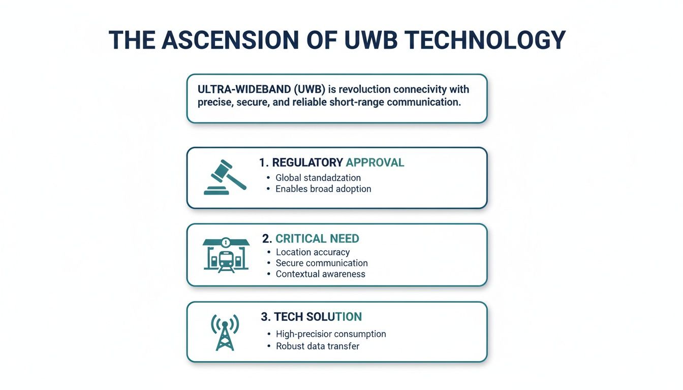
Ultra-Wideband’s journey into commercial use is a story of a technology finding its moment. For years, operators of large venues and transit hubs were looking for a solution to a simple question: how do you give people reliable directions inside, where GPS simply doesn't work? The answer started to emerge when regulators began opening up the radio spectrum that UWB needed to operate.
This wasn't just a technical exercise; it was a direct response to the growing challenge of navigating vast, confusing indoor spaces. Think of sprawling complexes like a major international airport or a large transit system–getting lost can be a common and stressful problem.
A Regulatory Green Light
A key moment for UWB came in 2002 when the US Federal Communications Commission (FCC) authorized the unlicensed use of UWB, a decision followed by other regulators around the world. This opened the door for commercial applications. At that time, many public venues were struggling with the limitations of existing indoor technologies and looking for more reliable solutions. To understand the early regulatory landscape, this EUWB white paper provides a useful overview.
With regulatory support, UWB quickly became a serious contender for solving these long-standing indoor navigation puzzles. Its impressive accuracy made it a natural fit for a couple of key areas:
- Tracking high-value assets: In busy factories, hospitals, and warehouses, UWB offered a precise way to monitor critical equipment and inventory in real time.
- Early-stage indoor positioning: For venues wanting to offer something better than less accurate technologies, UWB provided a route toward more reliable indoor guidance.
While UWB was a genuine technological leap, its history also reveals its fundamental nature: it’s an infrastructure-heavy solution. The centimeter-level accuracy it’s known for is completely reliant on a physical network of installed anchors, a fact that comes with major cost and operational baggage.
Understanding this history is crucial. It explains why UWB became such a powerful tool for specific industrial jobs. But it also throws its main drawback into sharp relief, especially when you try to apply it to the completely different challenge of public wayfinding.
For most public spaces, the cost and complexity of installing and maintaining a dense network of anchors is a non-starter. This limitation has ultimately cleared the path for more modern, efficient, and affordable solutions to tackle the same core problem, but without the heavy infrastructure burden.
Where Does UWB Fit in the Navigation Puzzle?
Picking the right navigation technology for a large venue can feel like a daunting task. While Ultra-Wideband (UWB) gets a lot of attention for its precision, it’s far from the only option. To make the right call for your space and your visitors, you need to understand where it excels and where other approaches might make more sense.
Let’s start with the one we all know: GPS. It’s brilliant outdoors, but the moment you walk through a door, it becomes ineffective. Those signals just can’t get through roofs and walls, leaving people stranded in the very places they need help the most – think sprawling airports or multi-level shopping centers.
This is where indoor specialists take over.
The Indoor Technology Spectrum
For years, the go-to technologies for indoor positioning have been Wi-Fi and Bluetooth. Wi-Fi positioning piggybacks on the signal strength from your existing access points to get a rough idea of someone’s location, usually within a few meters. It's suitable for general "you are here" dots on a map, but it's not nearly sharp enough for real, step-by-step directions, especially for a visually impaired person needing to find a specific platform or store entrance.
Then came Bluetooth Low Energy (BLE) beacons. These small, battery-powered devices broadcast signals that a smartphone can pick up. They’re a step up, but still only get you to within 2 to 5 meters of your target. More importantly, they create a huge operational headache, requiring you to install and maintain hundreds, sometimes thousands, of pieces of hardware across your venue.
UWB is in a different league entirely, offering accuracy down to the centimeter. But that precision comes at a high price, demanding a professionally installed and calibrated network of expensive hardware anchors.
This is why we’ve seen UWB gain traction. The technology was unlocked by new regulations and a clear need for something more reliable in complex indoor spaces.
As you can see, UWB has become a powerful, infrastructure-heavy solution for environments that absolutely demand high precision. For a deeper dive into the pros and cons, you can evaluate different indoor navigation technology in our comparison guide.
To help clarify the options, this table breaks down the key differences between the most common indoor positioning technologies.
Indoor Positioning Technology Comparison
| Technology | Accuracy | Infrastructure Cost | Primary Use Case |
|---|---|---|---|
| Wi-Fi | 5-15 meters | Low (uses existing network) | General location awareness |
| BLE Beacons | 2-5 meters | Moderate to High (hardware & maintenance) | Proximity marketing, basic routing |
| UWB | 10-30 centimeters | Very High (anchors, cabling & calibration) | Asset tracking, high-security zones |
| Waymap | < 1 meter | None (software-only) | Step-by-step accessible navigation |
Each technology has its place, but the choice often forces a difficult compromise between the accuracy you need and the budget you have.
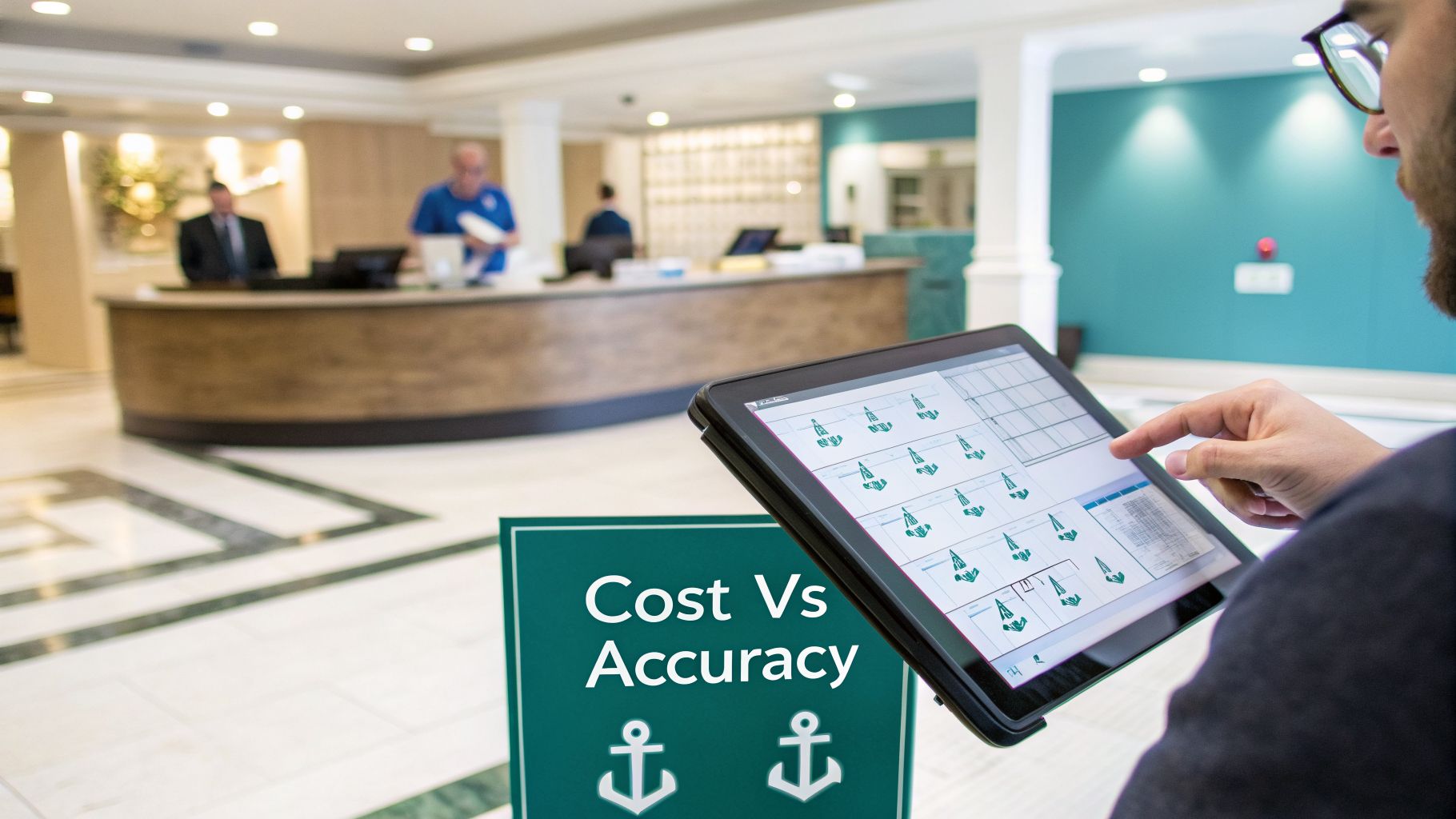
Weighing Accuracy Against Cost and Complexity
This leaves venue operators with a tough decision: Settle for the lower accuracy of Wi-Fi or Bluetooth, or make a massive investment in a UWB system?
We saw this as a false choice. So, we built something different.
Waymap was designed from the ground up to sidestep this trade-off completely. By using sophisticated algorithms and the motion sensors already inside every smartphone, we provide navigation that is accurate to the step without needing a single piece of hardware installed in the venue.
Our software-first approach gives you the reliability required for truly inclusive wayfinding, but without the high costs and maintenance burdens that come with UWB or beacon systems. It’s a smarter, more scalable way to open up large, public spaces to everyone.
Is UWB Really the Right Choice for Your Venue?
If you're a decision-maker for a large public space—whether you're focused on facilities, accessibility, or ESG goals—this is where the theory of Ultra-Wideband meets reality. The centimeter-level accuracy sounds impressive, but it’s crucial to ask the hard questions. Is it the right tool for public wayfinding? And is it the most efficient?
The first thing to understand is the total cost of ownership. A UWB system isn't a simple, one-off purchase. It’s a major, long-term infrastructure project. A large transit hub, a sprawling shopping center, or a busy airport could easily need hundreds of UWB anchors just to get full coverage.
That’s a huge capital expense right out of the gate, before you even consider the ongoing operational costs. You’re looking at maintenance, regular calibration, power consumption, and eventually, replacing all that hardware. For public-facing navigation, that model can become a significant financial burden.
Looking at the Return on Investment
For public-facing applications, the return on investment for a UWB system can be difficult to justify given the high costs and complex, often disruptive, installation process.
When considering a technology investment, it is useful to explore the history of UWB and its applications to see how the technology has evolved and where it is best applied. For many venue operators, the high total cost of ownership for UWB makes it an impractical choice for public navigation.
The Waymap Alternative: A Hardware-Free Solution
This is exactly where Waymap offers a completely different way of thinking. We believe that accurate, reliable indoor navigation for everyone shouldn’t depend on expensive and cumbersome infrastructure.
Our unique solution is built on a powerful, hardware-free sensor fusion algorithm. Instead of trying to catch signals from expensive anchors fixed to the walls, Waymap uses the motion sensors already built into every smartphone to deliver step-accurate guidance.
This simple shift turns a complex, capital-intensive hardware project into a straightforward software and mapping deployment. Here’s what that really means for your venue:
- Drastically Lower Cost: By removing the need for any physical hardware, you completely avoid the high costs of UWB anchors, installation, and all the ongoing maintenance that comes with them.
- Rapid Deployment: Our expert mapping team can digitize your entire venue and launch your navigation system in a matter of days or weeks, not the months or even years a hardware installation can take.
- Ultimate Scalability: Need to expand or change your layout? It’s as simple as updating a digital map, not ripping out and reinstalling hardware. You can adapt to new floor plans or points of interest almost instantly.
By sidestepping the need for any infrastructure, Waymap provides a far more scalable, cost-effective, and rapidly deployable solution for public wayfinding. It allows you to meet and exceed accessibility requirements, like those in the Equality Act (in the UK) or the Americans with Disabilities Act (in the US), while genuinely strengthening your ESG credentials through practical, meaningful inclusion.
Why the Future of Indoor Navigation Is Hardware-Free
While the precision of Ultra-Wideband (UWB) is a great fit for industrial settings, like tracking small parts on a factory floor, it is often overly complex and expensive for public wayfinding. For anyone managing a large venue or planning a city's infrastructure, the message is clear: the future of accessible, large-scale indoor navigation is built on software, not costly hardware.
A hardware-first approach means significant upfront investment, complicated installation projects, and a constant cycle of maintenance that software solutions simply don't have.
This move away from physical infrastructure isn't just a matter of saving money. It's about building public spaces that are more flexible and genuinely inclusive for everyone. Although UWB is being explored for some public venues, its infrastructure-dependent nature makes it a difficult fit for many locations, where cost and complexity are major barriers to providing reliable indoor positioning.
Navigation That Lives in Software
This is exactly where Waymap’s approach comes in. We’ve focused on creating a future that is entirely software-driven. By fusing the advanced motion sensors already built into every visitor’s smartphone with our own meticulously detailed digital maps, we deliver the step-accurate audio guidance people need.
And the best part? It requires absolutely zero hardware to be installed in your venue.
This method works on every level. It helps you meet accessibility requirements, vastly improves the visitor experience, and delivers real operational wins. For venue operators, it means hitting your targets faster and for a fraction of the cost.
When you get rid of beacons, anchors, and other pieces of equipment, you eliminate all the associated costs and maintenance headaches for good. A software-first model is naturally more inclusive, incredibly easy to update, and far more scalable than any system that's physically tethered to your building. You can discover more about the powerful benefits of infrastructure-free solutions for wayfinding in our detailed article.
We believe it’s time for venue operators and mobility planners to look past the initial appeal of hardware. Think about how a software-first solution can help you achieve your visitor experience and ESG goals more effectively, creating a truly welcoming environment for every single person who walks through your doors.
Here are some of the most common questions we get about Ultra-Wideband (UWB) from venue operators and decision-makers, along with our straightforward answers.
What’s the Real Cost of a UWB System for a Large Venue?
When we talk about cost, it's crucial to look beyond the initial price tag. A UWB system is a major capital investment, requiring you to buy and professionally install a whole network of anchors throughout your building. For a large, complex space like an airport or stadium, this can easily run into the tens or even hundreds of thousands of dollars.
But that's just the start. You also have to factor in the long-term running costs for ongoing maintenance, regular recalibration to keep it accurate, and the eventual replacement of all that hardware. These high, recurring expenses are a primary reason why many are now looking towards infrastructure-free solutions like Waymap for public wayfinding.
Is UWB the Same Thing That’s in Apple AirTags?
Yes, in a sense. The "Precision Finding" feature on an Apple AirTag is a perfect showcase of what UWB does best: pinpointing the location of one device from another over a short distance. It’s excellent for finding your keys behind the sofa cushions.
But there's a world of difference between finding a personal item and navigating an entire building. To scale that up for public use, you need a permanent, fixed infrastructure of anchors installed across the whole site. It’s a fundamentally more complex and costly challenge.
Can UWB See Through Walls?
UWB signals can pass through some materials like drywall, but their high accuracy diminishes significantly the moment something blocks the direct line of sight between the anchor and the user. In a crowded, ever-changing environment like a busy train station, this is a real problem.
This often means you end up needing to install even more anchors to get reliable coverage, which just pushes the cost up further. By contrast, Waymap’s sensor-fusion technology is unaffected by crowds or physical barriers. It works by understanding your natural movement and using our highly detailed digital maps, not by relying on radio signals from fixed points in a building.
Ready to provide truly inclusive navigation without the cost and complexity of hardware? See how Waymap delivers step-accurate guidance for everyone, everywhere. Learn more about how Waymap works.