
What Is a LiDAR Scanner and How Does It Work?

Simply put, a LiDAR scanner is a sophisticated measuring tool that uses laser light to map the world around it. By sending out rapid pulses of light and timing how long they take to bounce back, it can create remarkably precise 3D maps of its surroundings.
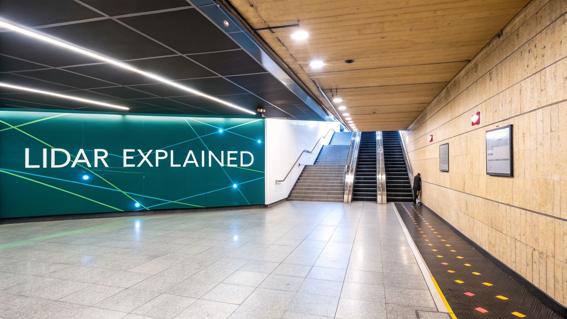
This makes it an ideal technology for charting complex indoor spaces like busy transit hubs, sprawling shopping centers, or historic venues. It’s one of the key tools we use at Waymap to build the digital foundations that power modern accessibility solutions.
The Foundation of a Digital Twin
You may have heard of how a bat navigates in total darkness using sound. A LiDAR scanner works on a very similar principle, but it uses focused beams of light instead of sound waves. This simple but powerful idea is making the technology a cornerstone for modernizing our large public spaces.
The process hinges on a concept called time-of-flight. The scanner fires out thousands of tiny, invisible laser pulses every second. As these pulses travel, they hit objects in the environment—a wall, a flight of stairs, a ticket barrier—and bounce back to the scanner's sensor.
By measuring the exact time it takes for each laser pulse to make that round trip, the scanner calculates its distance to that object with high precision. This happens millions of times in a scan, capturing a dense collection of accurate measurement points.
From Points to a Perfect Map
All those millions of individual data points are collected to form what’s called a point cloud. Think of it as a highly detailed digital blueprint of a physical space, captured in three-dimensional detail. It’s far more than a simple floor plan; it's a complete geometric model of an environment.
For venue operators and accessibility and inclusion teams, this isn't just a fancy map. It is the foundational data needed to build a true digital twin of your environment. This enables everything from smarter facilities management to advanced, reliable navigation for visually impaired travelers.
The role of this technology in mapping our cities and infrastructure is growing fast. Driven by these demands, the UK LiDAR market alone was valued at an estimated $49.6 million in 2021 and is projected to reach $102.7 million by 2030. You can explore more on the UK LiDAR market forecast and what’s driving this growth.
For us at Waymap, this level of detail is essential. A precise digital map created with LiDAR is what allows our app to:
- Guide users with step-by-step accuracy, without any need for GPS or beacons.
- Reliably identify accessible routes, including ramps, elevators, and other key features.
- Provide dependable navigation, even in the most complex, multi-level venues.
Ultimately, a LiDAR scan gives venue operators the reliable, permanent digital asset they need to become truly accessible and ready for the future.
How The Core Components Of LiDAR Work Together
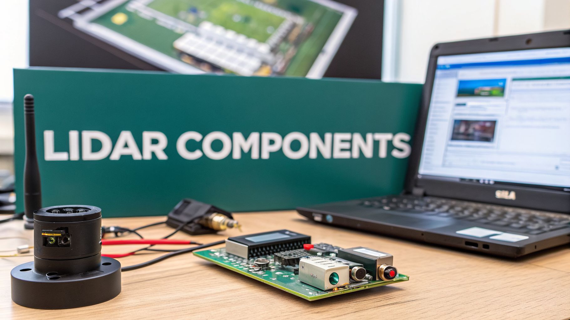
To grasp how a LiDAR scanner can produce such accurate digital maps, it helps to think of its core parts as a coordinated team. Each component has a specific job, and their flawless coordination turns simple pulses of light into a reliable, survey-grade model of a physical space.
This precision is exactly why LiDAR has become such a trusted source of truth for infrastructure teams and accessibility experts. When you need certainty about an environment's layout, this is the technology you turn to.
The Team Of Components
At the heart of the operation is the laser. Think of it as the system’s voice, sending out thousands of safe, invisible pulses of light every second to probe the surrounding environment.
Directing these pulses is the scanner, typically a small, rapidly rotating mirror. This component acts as the director, meticulously aiming the laser beams to cover every surface in the area—from the floor and walls to intricate architectural features.
Of course, to map a space, the scanner needs to know exactly where it is. That's where two critical navigators come in:
- A specialized GPS tracks the scanner’s precise geographical location.
- An Inertial Measurement Unit (IMU) constantly measures the scanner’s orientation—its tilt, pitch, and roll.
Working in concert, the GPS and IMU make sure every measurement is accurately georeferenced. This means each point has a precise coordinate in three-dimensional space, which is vital for building maps that line up perfectly with the real world.
As the light pulses bounce off objects and return, the receiver acts as the listener. It's an extremely sensitive optical sensor that not only detects the returning light but also records the exact time it arrives back.
The real work happens when a powerful onboard computer pulls all this data together. By combining the laser's firing time, the receiver's return time, the scanner’s angle, and the precise GPS/IMU data, it calculates the distance for millions of individual points.
This coordination of components is what transforms raw light signals into a rich, structured 3D point cloud. This provides the dependable data required for building detailed digital twins and, in turn, creating truly inclusive navigation experiences for everyone.
Choosing the Right Type of LiDAR for Your Space
When people talk about LiDAR, it’s easy to think of it as a single piece of equipment. In reality, it’s not a one-size-fits-all solution. Picking the right type of scanner is crucial for getting the results you need, whether you’re mapping a single building or an entire transport network.
The main difference between scanners boils down to how they move—or if they move at all. Some are designed to stand perfectly still and capture every detail, while others are built to map large areas on the go. For any transport operator or infrastructure manager, understanding these categories is the first step to making an informed choice.
Terrestrial LiDAR Scanners
Imagine a terrestrial LiDAR scanner as a meticulous photographer. It’s mounted on a stationary tripod and built to capture an environment with the highest possible accuracy and detail. An operator sets up the scanner, lets it perform a full 360-degree scan, and then moves it to the next spot to capture another, slightly overlapping scene.
This methodical approach is perfect for projects where precision is paramount. You’ll see them used for:
- Capturing the delicate architectural details of a historic building for preservation work.
- Creating highly accurate ‘as-built’ models of a facility, like a hospital or an airport terminal.
- Mapping out a complex, multi-level indoor space, such as a single busy underground station.
What you get is an exceptionally dense and precise point cloud—the ideal foundation for a high-fidelity digital twin or detailed analysis.
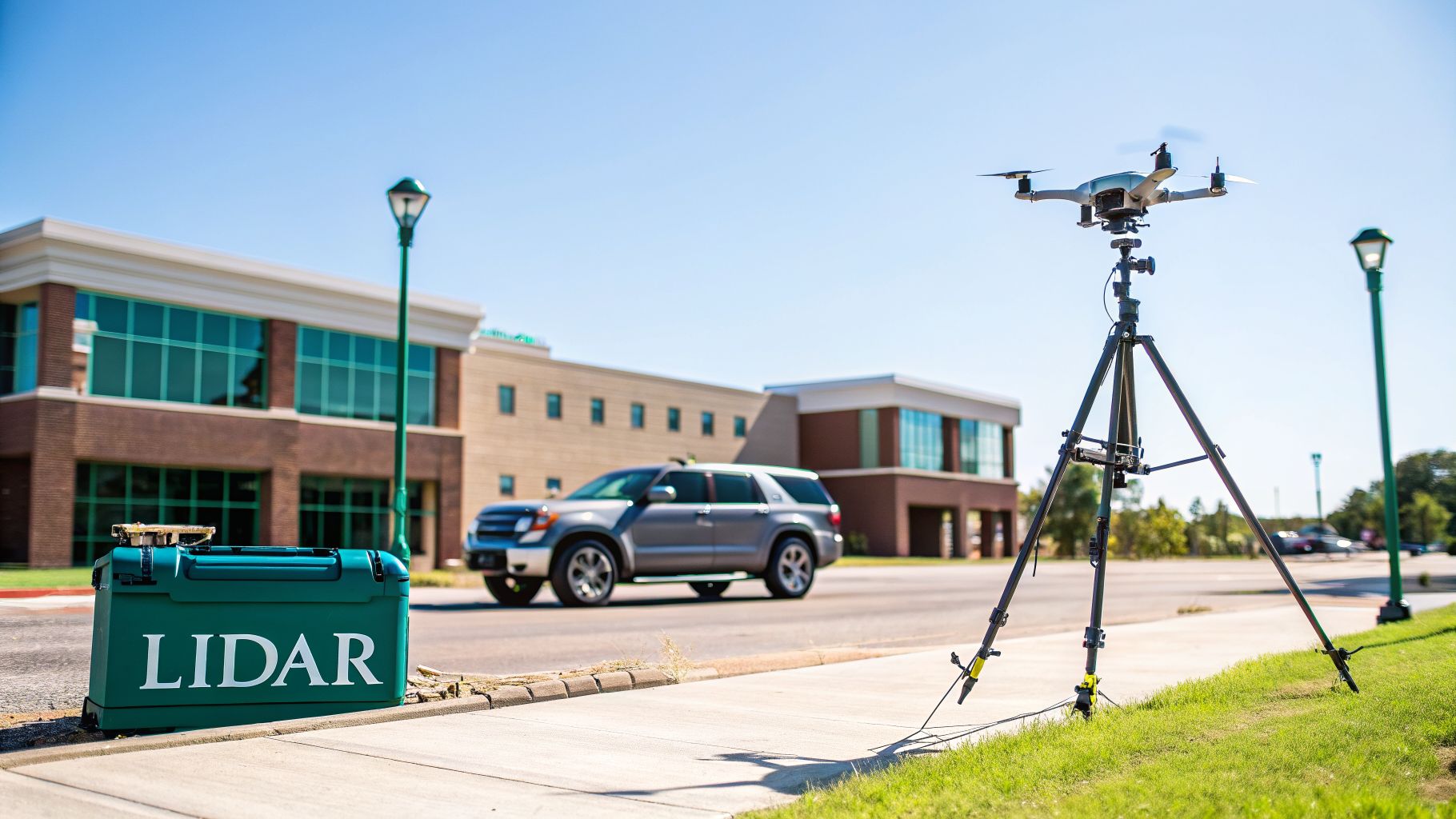
Mobile and Airborne LiDAR Scanners
On the other hand, mobile LiDAR is more like a filmmaker capturing a sweeping, dynamic scene. These scanners are mounted on moving platforms—vehicles, trolleys, or even backpacks—and they map the environment continuously as they travel through it. This makes them incredibly efficient for scanning large-scale infrastructure.
For instance, a mobile scanner fixed to a maintenance vehicle can map an entire railway network or miles of city streets in a fraction of the time it would take with a static scanner. The accuracy may be slightly less than a top-tier terrestrial unit, but it’s more than sufficient for network-wide asset management or creating the base maps for navigation systems like Waymap.
Interestingly, LiDAR is even being used in creative ways to study wildlife. Researchers at Katmai National Park have experimented with terrestrial scanners to measure the size of bears, offering a non-invasive way to track their health without direct contact.
Taking this idea even higher, airborne LiDAR is mounted on aircraft like drones and planes. This gives you a bird's-eye view, making it the perfect tool for mapping vast areas—think university campuses, regional transport corridors, or entire cities. It’s excellent at capturing terrain and building exteriors over huge geographical spaces. Thanks to the recent miniaturization of scanners, drone-based LiDAR has also become a go-to choice for safely surveying hard-to-reach places.
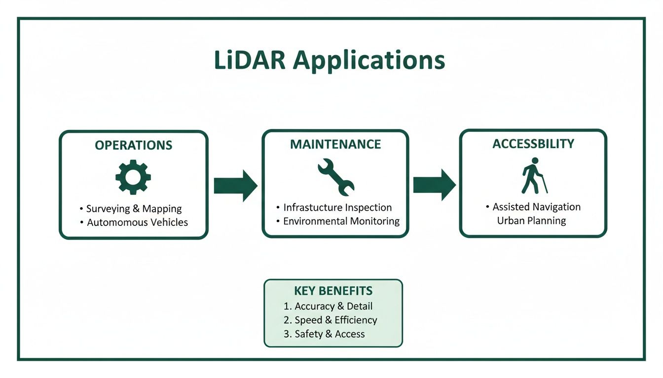
Real-World Applications of LiDAR Technology
So, what does all this technology actually do in the real world? It's easy to picture LiDAR on self-driving cars or mapping vast forests, but its most profound impact may be in making our public spaces smarter and more welcoming for everyone. For a venue operator, a LiDAR scan is the first step toward building a powerful ‘digital twin’.
Think of this digital twin as a perfect virtual copy of a building. It's not static; it’s an active, data-rich model that can be used to streamline operations, keep track of assets, and plan essential maintenance. For us at Waymap, these ultra-precise maps are the canvas on which we build the next generation of accessibility.
Creating Truly Accessible Spaces
The point cloud data from a LiDAR scan is the bedrock for inclusive design. When we scan a sprawling airport terminal or a multi-level train station, we capture the exact position of every feature that matters—elevators, ramps, ticket barriers, accessible restrooms, and information desks.
This is the core component that allows Waymap to deliver reliable, step-by-step audio directions to a visually impaired person with high accuracy. It turns a journey that might be fraught with stress and uncertainty into one that’s smooth and independent. And the best part? It all works without GPS, Wi-Fi, or any physical beacons.
This is where the answer to "what is a lidar scanner" becomes truly meaningful. It's not just a tool for making maps; it's a tool for creating independence and opening up the world for people who have been excluded from it for too long.
By capturing a venue with such high fidelity, we create a permanent digital asset. This is a foundational layer for countless other operational and visitor-facing improvements. You can get a deeper sense of this process by exploring resources on unlocking the potential of 3D Laser Scanning with Scan to BIM.
Beyond Navigation and Accessibility
While navigation is a huge win, the LiDAR-generated digital twin offers so much more to venue managers and smart city planners. The very same data can be used for:
- Operational Efficiency: Facility managers can use the 3D model to plot the most efficient maintenance routes, organize cleaning schedules, or even run simulations of emergency evacuation plans.
- Space Management: A shopping center or airport can analyze footfall and see where people linger. This helps them optimize store layouts, place tenants more effectively, and improve signage.
- Infrastructure Projects: For any refurbishment or construction project, having an accurate as-built model from a LiDAR scan saves a phenomenal amount of time and money, preventing design clashes and costly rework on-site.
Ultimately, investing in a high-quality scan provides a single source of truth that pays dividends across almost every department. It's the first step in transforming a static building into a dynamic, responsive, and truly visitor-centric environment. You can see this in practice right now at many of our Waymapped venues.
LiDAR Compared to Other Mapping Technologies
A LiDAR scanner is a powerful tool for creating a digital map, but it’s not the only option available. When you're looking to map a large, complex venue, you have a few different technologies to consider, and each comes with its own trade-offs.
Getting this choice right is about more than just tech specs. It's a strategic decision that shapes everything from your long-term operational costs to the quality of your visitor experience. The right approach depends on what you’re trying to achieve—and what you’re willing to invest upfront versus what you can afford to maintain over time.
Comparison of Indoor Mapping and Navigation Technologies
To make sense of the options, it helps to see them side-by-side. Each technology approaches the problem of indoor mapping and navigation from a different angle, with unique strengths and weaknesses.
Ultimately, the choice comes down to reliability versus ongoing effort. While options like beacons or Wi-Fi might seem cheaper at first glance, they often introduce a significant and continuous maintenance headache.
Photogrammetry: An Alternative Based on Photos
Think of photogrammetry as building a 3D model out of photographs. You take a large number of high-resolution pictures of a space from every conceivable angle, and then sophisticated software finds common points between the images to stitch them all together into a 3D model.
The appeal is obvious: the main piece of equipment you need is a good camera, making it seem like a cheaper route than LiDAR. But there’s a catch. Accuracy can be a real problem, especially across large or complex buildings. More importantly, it completely fails when dealing with surfaces that lack visual texture—think long white corridors, glass walls, or shiny floors. The software has nothing to latch onto, leaving you with gaps or distorted models.
Hardware-Based Navigation: Wi-Fi and Beacons
Other technologies shift the focus from creating a perfect map to providing live location tracking. These systems almost always depend on a network of physical hardware that you have to install and maintain throughout your venue.
- Bluetooth Beacons: These are small, low-energy devices you stick on walls all over your building. An app on a visitor's phone listens for their signals and uses them to guess where the person is.
- Wi-Fi Fingerprinting: This method piggybacks on your existing Wi-Fi network. It involves painstakingly mapping the unique signal strength of your various access points from every spot in the venue. A user’s phone then compares its live signal readings to this "fingerprint map" to work out its location.
These hardware-dependent systems might seem like a clever shortcut, but they come with a major hidden cost: the operational burden.
They demand a huge installation effort and, crucially, constant maintenance. Beacon batteries die. Wi-Fi routers get moved. If you renovate a wing or even just move some large furniture, the entire system needs to be recalibrated. This creates a cycle of recurring costs and introduces countless points of failure that can render your entire navigation system useless overnight.
For a deeper dive into these methods, our guide on indoor positioning systems offers a detailed comparison.
A Stable Digital Asset
This is where the philosophy behind LiDAR really sets it apart. A one-time, highly accurate scan creates a permanent digital foundation that can be used for countless applications—from operations and maintenance to world-class accessibility—without any ongoing hardware fuss.
The core insight here is that the map itself should be the stable, reliable asset.
At Waymap, our approach is built on this principle of long-term reliability. We decouple navigation from high-maintenance hardware. By using a pre-built, highly accurate map—often created with a single LiDAR scan—and combining it with the motion sensors already inside every smartphone, we can provide incredibly precise navigation.
This turns that initial scan from a simple expense into a lasting investment. You get a stable digital foundation for your venue, completely sidestepping the cost and complexity of maintaining a network of physical hardware forever.
So, is a LiDAR scan the right first move for your venue?
If you're a transport operator, facilities manager, or an accessibility lead, the thought of a major digital project can be overwhelming. The real question isn't just about what LiDAR is, but whether it’s the best starting point for you. Honestly, it all comes down to what you’re trying to achieve.
Are you looking to build a full-blown digital twin to get a better handle on your operations and maintenance? Or is your main priority to meet crucial accessibility requirements, like those in the Equality Act 2010, by making sure everyone can navigate your space reliably?
First, Figure Out Your Main Goal
The technology you choose should be a direct answer to your biggest needs. If your goal is to smooth out how visitors move through your venue and give them a better experience, then the high accuracy and lasting nature of a LiDAR-generated map provide an incredibly solid base to build on.
While a dedicated LiDAR scan is the gold standard for accuracy, it's not the only way to get a great, navigation-ready map. What truly matters is that the final digital map is precise enough to provide step-by-step directions people can count on.
The Upfront Cost vs. Long-Term Payoff
Let's be upfront: the initial cost of a professional LiDAR scan is a real factor. But it’s best to think of it as a one-time investment in a permanent digital asset for your building—an asset you’ll own forever.
This is a world away from hardware-based systems like beacons, which saddle you with ongoing maintenance costs, battery replacements, and a whole network of things that can—and do—fail.
By investing once in a high-fidelity map, you’re creating a future-ready foundation for your venue. It becomes the single, reliable source of truth that enables advanced, hardware-free navigation. You’re not just mapping a building; you’re turning a static space into a dynamic, accessible, and intelligently managed environment for everyone.
At Waymap, our team helps venues find the smartest way forward. Sometimes that means a new LiDAR scan, but other times we can use existing architectural plans or other mapping techniques. Our focus is always on creating the dependable foundation our system needs to work. The end game is to turn your physical space into an experience everyone can access, and a quality map is the first step on that journey.
Frequently Asked Questions About LiDAR
It's natural to have questions when you're looking at bringing new technology into your venue. Let’s tackle some of the most common ones we hear from transport operators and people leading the charge on accessibility.
How Much Does A Professional LiDAR Scan Cost?
This is often the first question people ask, and the honest answer is: it depends. The cost is shaped by the size and complexity of your space, the level of detail you need, and the specific scanner used for the job. A scan for a single building might be a few thousand dollars, while a large, multi-level transit hub could naturally be more.
The best way to think about it, though, is as a one-time capital investment in a permanent digital asset. This way of thinking completely changes the financial model, removing the endless cycle of maintenance and replacement costs that come with hardware like beacons.
Does Waymap Require A LiDAR Scan to Work?
Not necessarily. While a professional LiDAR survey is an excellent way to capture the kind of highly accurate digital map Waymap runs on, it’s not the only way to get there.
What really matters is the quality and precision of the map data itself. In many cases, we can work with high-quality architectural plans you already have, or use other mapping techniques. Our team will always work with you to find the most efficient path to creating a navigation-ready map for your venue.
Privacy is a top priority. A LiDAR scan creates a ‘point cloud’ of geometric measurements and does not capture personally identifiable information in the way a camera does. Any incidental data captured during the scanning process is removed or anonymized during map processing.
At Waymap, our system was built from the ground up with privacy at its core. We use anonymized sensor data from a user's phone purely to help them navigate—we don't track who they are or where they've been. This ensures both user privacy and your venue's security are always protected.
Ready to make your venue truly accessible for everyone? Waymap delivers step-accurate, audio-based navigation without needing GPS or beacons. Learn how our hardware-free solution can improve visitor independence and lower your operational costs at https://www.waymapnav.com.
Produced via Outrank app