
Inside the Airport: A Guide for Operations Leaders
Anyone responsible for terminal operations knows the pattern. A gate changes late. FIDS updates. Staff move quickly. Passengers don't. The queue that was flowing towards one pier starts doubling back, people stop under signs to reorient themselves, and the busiest part of the building gets slower for reasons that won't show up neatly in a single incident log.
Inside the airport, navigation is often treated as a passenger-experience layer. In practice, it's an operational control issue. If passengers can't move confidently through a terminal, the airport pays for it through congestion, staff interruption, accessibility failures, and slower recovery when disruption hits.
From the Waymap Team, this is how we'd frame the problem if we were discussing it with an airport peer: wayfinding isn't a static estate issue, and it isn't solved by adding more signs. It sits directly between operations, accessibility, and digital infrastructure.
The True Scale of Terminal Complexity
A late gate change during peak flow is where terminal complexity becomes visible. One update in the operational system triggers a chain of consequences across stands, service teams, screens, and passenger movement. The physical environment doesn't reconfigure itself. Passengers still have to understand where to go, how far it is, whether they're on the right level, and whether they can get there in time.
That's why “inside the airport” is a more difficult environment than many non-aviation stakeholders assume. The problem isn't just size. It's constant change under time pressure.

Scale turns small errors into operational friction
UK airports handled over 250 million passengers in 2023, with Heathrow alone reaching 79.2 million. A 2022 UK Civil Aviation Authority survey found that 42% of travellers cited finding their way around the airport as a top stressor, in an environment where peak flows can exceed 10,000 passengers per hour in a single terminal according to ACI airport key performance indicators.
At that scale, confusion isn't a minor customer-service issue. It becomes flow friction. Passengers stop in circulation space. Families cluster at decision points. People ask staff for directions instead of moving. Some head towards the wrong vertical core, then reverse. None of that is dramatic on its own. In aggregate, it affects the terminal's ability to keep moving.
Lost passengers are usually an information problem
Operations teams already understand that the terminal is a live system. Security demand changes by the hour. Retail footfall depends on dwell time. Boarding punctuality depends partly on how cleanly people move from one process step to the next. Passenger stress sits in the middle of that.
Practical rule: If passengers keep asking for directions in the same place, that isn't a passenger problem. It's a data and navigation problem.
What matters here is the distinction between visibility and precision. A passenger may be able to see a sign and still not know whether they're heading to the correct gate zone, lounge entrance, toilet, assistance point, or lift. In a straightforward station concourse, broad directional signage may be enough. In a multi-level terminal with changing allocations, long walking distances, and secure-zone constraints, it usually isn't.
Three characteristics make airports especially demanding:
- Layouts are conditional: The right route depends on security status, level, mobility needs, and live operational changes.
- Passengers are unfamiliar: Many users are first-time or infrequent visitors who don't know the building's logic.
- Decisions happen under pressure: People find their way while watching time, documents, baggage, children, and announcements.
That's why terminal wayfinding should be treated as a live operational discipline. The missed turn, the wrong escalator, and the hesitant crowd around a sign are all symptoms of the same thing: the airport knows more than the passenger at the moment they most need direction.
What Passenger Confusion Actually Costs Your Operation
The cost of confusion is rarely booked under a single line item. It shows up as staff interruption, avoidable calls, poor circulation, retrofit spending, and a slower operation during disruption. That's one reason airport teams can live with the problem longer than they should. The pain is distributed.
But the problem is measurable enough to take seriously.
Confusion creates cost before it creates complaint
Google Trends data for 2025-26 shows a 150% spike in UK searches for phrases like “Heathrow terminal 5 lost inside”, and the Airport Operators Association estimates annual retrofit costs at £500 million. The AOA also argues that static infrastructure costs could be reduced by moving towards more dynamic digital approaches, as outlined in its airport policy and publications work.
Search behaviour matters because it tells you where formal channels are failing. When passengers search for help while already in the building, they're not looking for inspiration. They're trying to recover from a navigation gap.
There's an operational parallel here with internal communications. In large, fast-moving organisations, breakdowns don't start with a major event. They start when the right instruction doesn't reach the right person at the right moment. That's why work on strategies for complex airline communication is relevant to wayfinding as well. Airports face the same core issue with passengers: timely information is only useful if it reaches the user in a form they can act on immediately.
Static fixes create recurring expense
A sign is simple to approve and slow to change. That trade-off is manageable in stable environments. Airports aren't stable environments.
Every time a terminal changes use, a concession moves, a lounge access path alters, or a security routing decision shifts passenger flow, the physical wayfinding estate starts falling out of date. You can patch it, over-sign it, or run staff workarounds. All three create cost. None solves the underlying problem of precision guidance.
The question isn't whether passengers eventually find the gate. The question is how much operational waste the airport absorbs before they do.
A practical way to think about cost is to separate it into three buckets:
- Direct operational cost: Staff giving directions, handling avoidable enquiries, and manually compensating for weak navigation.
- Estate cost: Reworking, replacing, and maintaining signs and other static wayfinding elements.
- Recovery cost: Slower response when live changes force passengers onto a new route with very little time to adapt.
For many operators, the business case starts there. Better navigation isn't a cosmetic digital layer. It's part of cost control. We've discussed that in more detail in our piece on the hidden price of getting lost.
Why Beacons and Signage Fail at Scale
Most airports don't lack wayfinding assets. They lack a wayfinding system that stays accurate under operational change. That distinction matters, because the failure mode is different. The issue isn't absence. It's brittleness.
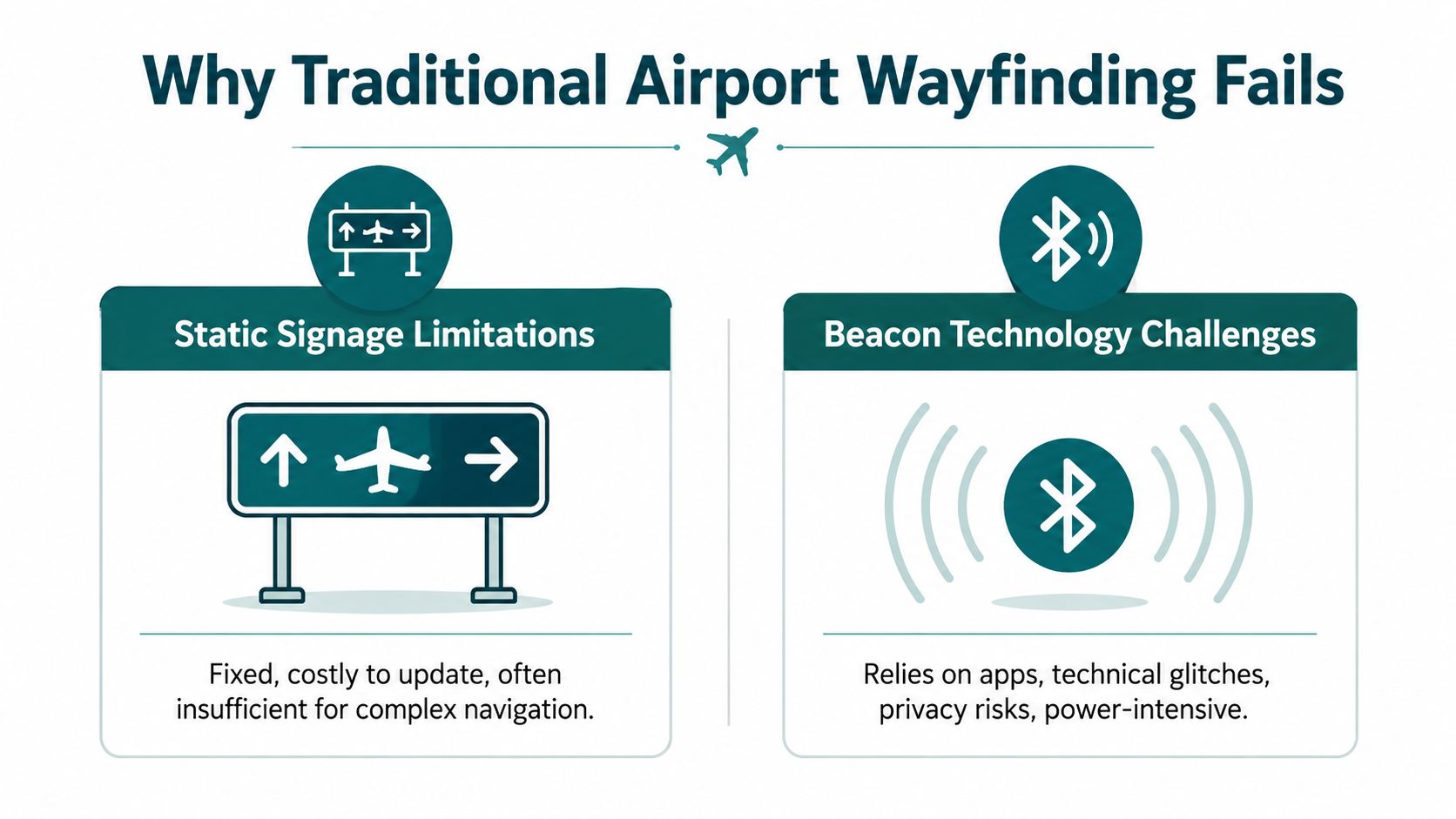
Static signage helps orientation, not precise movement
Signage still matters. It gives confidence, supports regulation, and helps passengers confirm they're broadly in the right place. But static signs aren't good at handling the last mile inside a terminal.
They struggle most when a passenger needs an exact route to a specific point in a complex environment: the correct security entrance, a particular lounge door, an accessible toilet after screening, or a quiet space that isn't visible from the main circulation path. Signs can point towards zones. They rarely provide dependable turn-by-turn guidance across levels and decision points.
They're also operationally slow. A building can change faster than the sign programme can.
Beacons solve one problem and create another
Bluetooth beacon schemes were attractive because they appeared to offer indoor positioning without rebuilding the whole digital stack. In practice, they introduce an estate that has to be installed, managed, powered, checked, replaced, and kept in sync with the map. That may be tolerable in a small venue. In an airport, it becomes a maintenance commitment.
The technical problem is only part of it. The operational problem is bigger. Hardware-dependent systems add failure points in exactly the environment where resilience matters most.
A useful evaluation lens is this:
| Approach | What it does reasonably well | Where it breaks down inside the airport |
|---|---|---|
| Static signage | Broad orientation and reassurance | Live changes, exact routing, accessibility-specific guidance |
| Wi-Fi based positioning | General location awareness | Accuracy, signal inconsistency, dependence on local infrastructure |
| Beacon-based positioning | Defined zones with installed hardware | Estate maintenance, updates, drift between hardware and operational reality |
| Sensor-led navigation | Detailed route guidance from mapped space | Requires high-quality mapping and disciplined digital maintenance |
What works better than hardware-first thinking
The more dynamic the terminal, the less attractive hardware-heavy navigation becomes. Airports need a navigation layer that can be updated quickly, mapped precisely, and connected to operational systems without creating another physical estate to maintain.
That's the practical case for a hardware-free approach. The technology we build at Waymap uses smartphone motion sensors and detailed maps rather than GPS, Wi-Fi, or installed beacons. For airport teams evaluating options, the important point isn't the brand. It's the architecture. If the navigation method depends on local hardware across a complex terminal, the total cost of ownership and operational fragility need very close scrutiny.
Anyone reviewing suppliers should look past the demo route and ask harder questions:
- How does the system cope with live route changes?
- What estate has to be maintained after launch?
- Can it guide to exact points of interest, not just zones?
- Does it still work in signal-poor areas?
Those are the questions that separate a consumer map overlay from a usable airport navigation layer. We've written elsewhere about the practical difference between maps and usable guidance in mapping and navigation.
The Unmet Mandate for True Accessibility
Accessibility inside the airport is often discussed through infrastructure. That matters, of course. Step-free routes, assistance points, lifts, hearing loops, tactile surfaces, and trained staff are all part of the operating model. But none of those, on their own, gives a passenger autonomy.

Compliance is not the same as independence
A Civil Aviation Authority survey found that only 25% of disabled passengers feel confident navigating UK airport terminals independently. RNIB research also notes that 22% of UK adults have sight loss, and that static signage is ineffective in a complex space such as Heathrow's 5km-long Terminal 5. Hardware-free, sensor-fused audio apps have shown the potential to cut disorientation by up to 70% in trials, as summarised in RNIB research on navigation and sight loss.
That gap is the essential accessibility mandate. The question isn't whether an airport can provide help when a passenger asks for it. The question is whether a passenger can move with confidence without having to surrender independence at every decision point.
For blind and low-vision passengers, generic digital maps don't solve this. A blue dot on a screen isn't useful if the environment is indoors, vertically layered, and changing. Public announcements aren't enough either. They tell you what has changed. They don't tell you how to move through the building safely and accurately to respond to that change.
Accessibility works when a passenger can act on information privately, immediately, and without needing to locate a member of staff first.
The hardest use case is the right design brief
This is why precise audio-led wayfinding matters. If a system can guide a blind passenger to an exact lift, gate door, toilet, or assistance desk without relying on local signal or installed hardware, it will usually improve the experience for many other users too. Parents with children, older passengers, neurodivergent travellers, and infrequent flyers all benefit from clearer, more reliable guidance.
A short example is useful here:
Airports that take accessibility seriously should treat indoor navigation as part of equal access, not as an optional digital amenity. If the route to the correct place depends on sight, confidence, or prior familiarity with the terminal, the experience still isn't equitable.
Connecting Wayfinding to Your Core Operations
Navigation becomes much more valuable when it's tied to the airport's operational systems rather than managed as a standalone passenger app. That's where many deployments fall short. They provide a static map in a dynamic building.
The AODB should inform the route
The Airport Operational Database is the technical heart of a UK airport, integrating real-time flight data, gate assignments, and resource allocation. By integrating a navigation platform through an API, real-time AODB updates such as gate changes can be pushed directly into passenger audio guidance, and this kind of connected workflow can reduce turnaround delays by up to 15-20% according to CAA performance benchmarks, as described in EUROCONTROL guidance on airport operations planning.
That matters because a gate change is not just a display event. It changes passenger movement, staffing pressure, and time available to board cleanly. If the route guidance doesn't update when the operation updates, the airport creates lag between what the system knows and what the passenger does.
What an operational navigation layer needs to do
In practice, a useful airport navigation layer has four jobs.
Receive live operational changes
The route engine has to ingest changes from the systems that already run the airport. If a gate, security path, or service point changes, the passenger guidance should change with it.Guide to exact places, not broad zones
“Terminal 2” isn't a destination. Neither is “departures”. Operationally useful navigation ends at an exact point of interest.Work across landside and airside logic
Routes need to respect passenger state. A path that works before security may be invalid after screening.Reduce dependence on manual recovery
If the only fallback when a passenger is confused is to find a member of staff, the system still isn't doing enough.
Integration should reduce noise for staff
This is the operational advantage teams often miss at first. Good indoor navigation doesn't just help the passenger. It reduces avoidable interruption across the terminal.
Operator test: If your front-line teams are still acting as the navigation layer, the digital layer isn't finished.
Staff should still provide reassurance and specialist help. They shouldn't spend large parts of the day compensating for weak directional systems. When routing is accurate and live, staff can focus on exceptions rather than routine direction-giving.
For digital transformation leaders, the implication is straightforward. Don't buy wayfinding as a visual feature. Specify it as a connected service within the airport stack, with live inputs, clear ownership of map updates, and operational use cases tied to disruption handling, accessibility, and flow management.
The Path to an Intelligent, Navigable Venue
The strongest airport navigation systems don't begin with a map. They begin with a decision about operating model. Do you want wayfinding to remain a mixture of signs, staff intervention, and passenger improvisation, or do you want a live digital layer that reflects how the terminal works?
Precision changes the economics
When navigation is precise, accessible, and updateable, several things improve at once. Passengers reach the right place with less hesitation. Staff spend less time on repetitive direction-giving. Accessibility moves closer to independence rather than escorted recovery. And changes in the live operation can be reflected without waiting for the physical estate to catch up.
This is also where hardware-free design changes the economics. If the solution depends on installed infrastructure across the terminal, every expansion, refresh, or route adjustment carries extra operational overhead. If the system depends on mapping quality and software integration instead, the airport has far more agility.
The venue becomes easier to manage
The end state isn't futuristic. It's practical. A passenger receives accurate route guidance to the exact place they need. The route changes when the operation changes. The same capability supports accessibility, passenger flow, and service consistency.
That requires disciplined spatial data. Airports that want this level of precision usually need a reliable digital representation of internal space, including entrances, vertical circulation, barriers, and points of interest. High-quality capture methods matter here, including approaches discussed in our work on 3-D LiDAR scanning for detailed indoor maps.
Three principles usually separate workable programmes from disappointing ones:
- Treat navigation as infrastructure: Own it like an operational capability, not a marketing feature.
- Prioritise exact destinations: Passengers need doors, desks, gates, lifts, and facilities.
- Design for the hardest user first: If the system works for someone who can't rely on visual cues, it will be stronger for everyone else.
A terminal that is easy to move through is easier to operate. That's the point worth keeping. Better wayfinding supports efficiency, supports compliance, and improves the passenger experience because it improves the operation underneath it.
Frequently Asked Questions for Airport Operators
| Question | Answer |
|---|---|
| How do we know whether navigation is an operations problem or just a customer-experience issue? | It's an operations problem when staff are repeatedly pulled into giving directions, disruption recovery slows because passengers don't reroute quickly, or accessibility support depends too heavily on manual intervention. If confusion affects flow, staffing, or recovery, it belongs in the operational plan. |
| Do we need to replace all existing signage to improve indoor navigation? | No. Most airports should keep signage for reassurance, compliance, and broad orientation. The gap is usually precise, live guidance to exact destinations, especially when layouts are complex or conditions change. |
| Why isn't a standard airport map app enough? | A standard map app usually shows location and broad routes, but airports need exact guidance that reflects security status, level changes, temporary closures, and live operational updates. Without that, the map becomes an approximation in a building that runs on exactness. |
| Are beacons still a sensible option for airports? | They can be, but only if the airport is willing to own the hardware estate and the maintenance model that comes with it. Many operators decide the long-term burden is too high once they account for replacement, troubleshooting, and keeping hardware aligned with a changing terminal. |
| What should we ask a navigation supplier before a pilot? | Ask how the system handles live changes, whether it depends on GPS, Wi-Fi, or installed hardware, how it guides users to exact points of interest, and how map updates are governed after launch. Also ask what front-line teams will need to do differently if the pilot succeeds. |
| Where should an airport start if it wants to pilot precise indoor navigation? | Start with a bounded operational problem rather than a whole-airport ambition. A good pilot area usually has complex routing, frequent enquiries, accessibility importance, or regular live changes. That makes it easier to judge whether the navigation layer is solving a real operational need. |
| How should accessibility teams and operations teams work together on this? | They should define success jointly. Accessibility teams understand independence and inclusive design requirements, while operations teams understand disruption, staffing, and flow. Indoor navigation works best when both groups shape the use cases and acceptance criteria. |
| What does good implementation governance look like? | Good governance gives one team ownership of spatial accuracy, one team ownership of live operational integration, and a clear process for updating points of interest and route logic. Without that, the system will drift out of sync with the building. |
If you're reviewing how people move inside the airport, Waymap is worth considering as part of that discussion. We work with operators on precise indoor navigation that doesn't rely on GPS, Wi-Fi, or installed hardware, and we can help you assess whether a live, accessible navigation layer fits your terminal, data environment, and operational priorities.